
A stroll along Nikau Track, led to delving deeper into the bush of Nikau Valley.
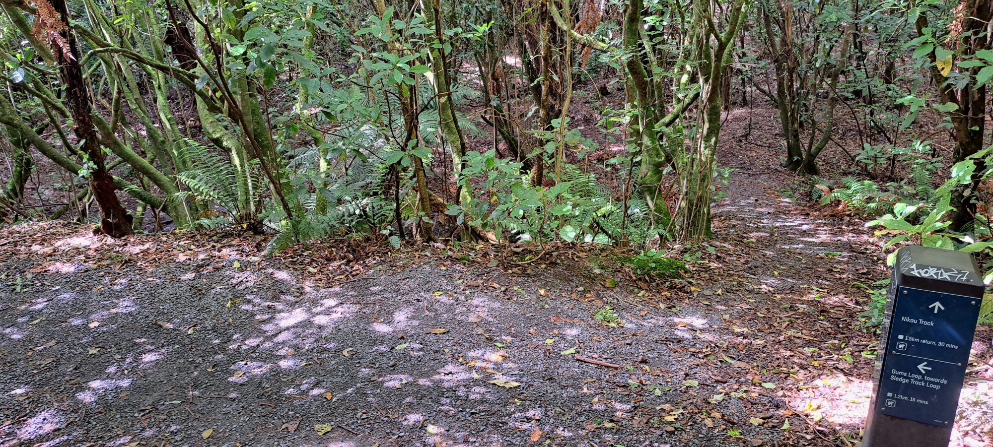
Today, my choice was to stroll along Nikau Track, an offshoot of Gums Loop Walk, tracing the path alongside Nikau Creek. The track is an easy flat walk with picturesque views of the creek and native bush. It’s a brief excursion, and chances of encountering others on the track are slim. At its conclusion, a sign indicates the end of Nikau Track, marked by two wooden seats and a sign alerting you to the end of the track. However, keen observers may notice traces of a track continuing onward. This extension was once part of the track, but the track was shortened some time ago. It was here that I started my bush bash adventure.
 Upon reaching the end of the Nikau Creek Track, and armed with a foreknowledge of the area, I observed (as I expected) the track that continued beyond the sign. I traversed the rolling terrain of this overgrown path, finding it somewhat challenging due to the slopes being slippery. Easier than a bush bash though. Someone had thoughtfully constructed steps in the clay to aid passage on the steeper portions of the track, so there were obviously people still using this part of the track. This segment of the journey brought back memories when I was a kid. I remembered this section of the walk, because it is when you first encountered substantial hilly terrain from what is mostly a flat easy walk.
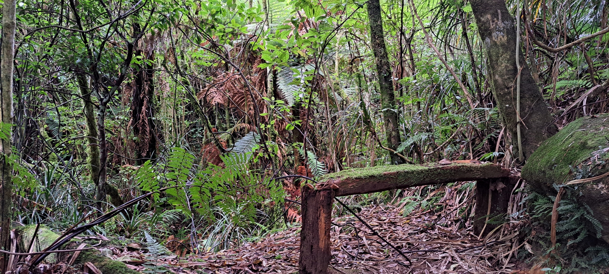 Eventually, I reached an aged wooden bench seat. I remember this seat being there some 50 or so years ago. It still looked strong enough to sit on, but was quite damp, so refused the offer. Continuing beyond this point, the surroundings transitioned into steeper terrain and vines intertwined with the bush with small sections of the track continuing. Eventually I was at the back of the valley and I contemplated extending my journey to connect with the current Whakanui Track near the ridge’s summit by following Nikau Creek up to its logical end then bush bashing beyond that. However, mindful of my evening commitments, I chose to skip the longer journey, despite my desire to undertake it.
 As I retraced my steps. I was now back at the old bench seat and my curiosity piqued when I discovered a concealed plastic lunch box. I thought the box contain poisonous bait, indicating that this stretch of the track probably serves as a route for baiting. Choosing not to open it, I retraced my steps onto Nikau Creek Track, then continued onto Gums Loop Walk before making my way to Gums Loop Meadow. This section of that walk is where the walk derives its name.
(Update: A commenter mentioned in the replies of this post that the plastic container is, in fact, a geocache.)
 I had a new aim now. It was to locate an alternate trail leading to the back of Ultimate Pool as I was close to that site and had a bit of time up my sleeve. I intended to capture some photographs. Despite my efforts, I couldn’t find the track. I wasn’t sure if I missed it or if it was farther ahead. Undeterred, but short on time, I ventured into the bush instead, directing myself towards the Wainuiomata River, hoping to ascertain Ultimate Pool’s position relative to my current location. However, the dense foliage obstructed my view. I resolved to head back home at this point, opting to traverse westward through the eucalypt forest. It proved to be a bit more challenging than I thought, as I bashed my way through a mix of native bush, first coloniser plants, and tall eucalypts.
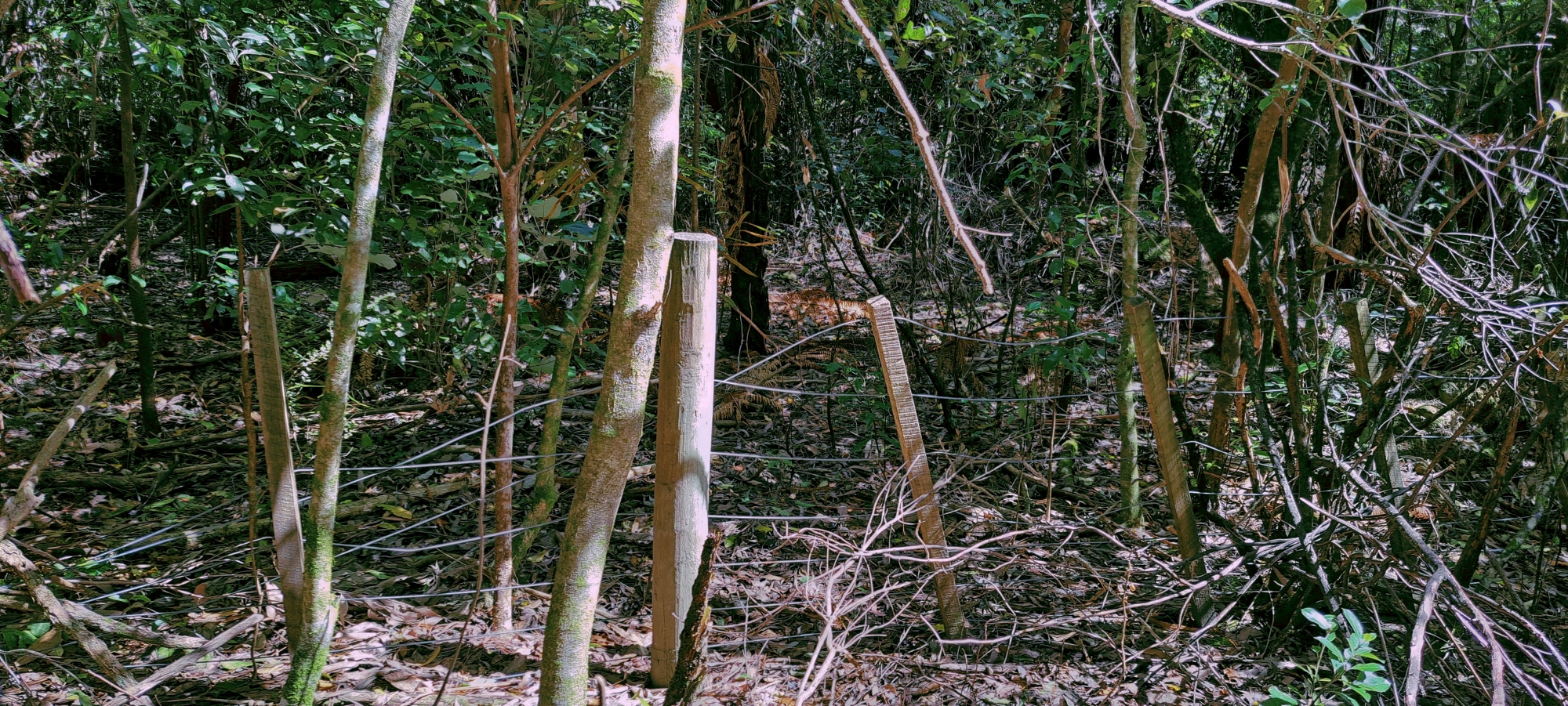 I then came to a fence and it seemed in good condition. However, the fence had to be old, dating back to a time when this was farmland. In fact, I came across three fences. One that ran along the Wainuiomata River and two adjacent to it. It basically mapped out an old farm plot, where horses once grazed back in the 1960s and 1970s from memory. Possibly even before that. As I pressed forward, the landscape transitioned, leading me out of the dense bush and back onto the meadow at its widest point. From there, I headed back on Gums Loop Walk and toward my car, intermittently pausing to capture photographs of the picturesque Wainuiomata River from an old road / track that once crossed the river over to the triangular grass area near Top Pool. I also took some photos of Top Pool and some local ducks that have made the area their home.
All up, I enjoyed the adventure. I got some exercise and came away with some nice photos. Now it was time to go back to my other life over the Wainuiomata Hill.


You might be interested to know that the plastic lunchbox you discovered is actually a geocache, and doesn’t contain bait but a logbook (probably dilapidated) for geocache searchers to record their username. There are several in the area including one near the Kittyhawk site. Adds another aspect to bush-bashing or bushwalking.
https://www.geocaching.com/
Just looking at the website it seems that the Nikau cache is not shown, but the app on my phone still shows it.
Don’t do much cache finding myself but sometimes curious to see what’s around in the areas I visit for walking/bush bashing. Fascinating to hear about your adventures as I like exploring the area too, but haven’t bush bashed much around Skerrets Creek (apart from today!)
Great thanks for the geocache information. Good to know.
Also, I was in the area of Skerretts Creek yesterday too. But came in from the top of McKerrow and down to the place where the top two arms of Skerrett converge. How far up did you go? I thought I heard someone in the bush below at one point and yelled out. But got no answer, so thought it might be a goat or a boar.
No problem on the cache information David, happy to help.
That’s interesting, I was doing an evening bush bash down to Skerrets/Whakanui from the Boy’s Brigrade track, nearer the Mt Crowther track end than Mckerrow, so if it was about 5.30-7pm it could have been me.On the other other hand I’ve seen/heard deer up there, seen pig sign and heard goats near Mckerrow so noise could be that. Kiwi can be quite noisy at night-time on the upper Whakanui too.
That that was about the time I was heading down a spur to the Whakanui near Skerretts Creek. There was a bit of thrashing around at the beginning in supplejack and other undergrowth as I tried to go down an unnamed creek bed (maybe the same one you recorded in #5), but it was so overgrown and steepening I bailed out to the spur to my left that had a good contour down to the Whakanui and followed that with relative ease.
I did hear voices at one point but it sounded more like people travelling along the Whakanui rather than calling out. There’s a link here https://drive.google.com/file/d/1QcRzzGQz_I97Mt_j2o5xpBzj0ZH6zjeo/view?usp=drive_link to the route I took, only the bottom half is GPS, the rest is sketched by hand, complete with poorly drawn arrows!