Wainuiomata news, photos, and history
Wainuiomata .Net is dedicated to preserving the suburbs rich history while documenting its present. We also highlight the natural beauty of Wainuiomata, with detailed coverage of parks, rivers, and bush walks. The site features high quality photography that vividly captures both the area’s heritage and its natural landscape. Content is organised across categories including News, History, Reserves, Walks, Rivers, Waterworks, and Tours.
WAINUIOMATA PHOTOS
A visual journey through Wainuiomata
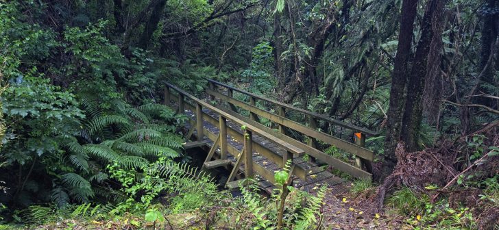
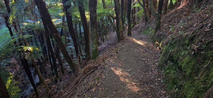
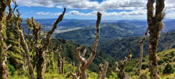
The Northern Forest is the large, bush-covered section of East Harbour Regional Park lying between Wainuiomata and Eastbourne.
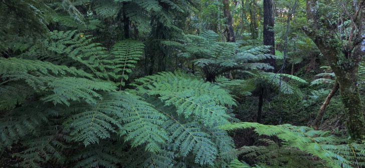
A fern-filled gully viewed from the aptly named Fern Gully Track. The well-maintained track climbs gently toward the Northern Forest.
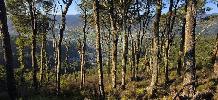
Rātā Ridge Track offers views across Wainuiomata Valley, contrasting native forest with residential streets and open land below.
WAINUIOMATA ADVENTURE
Exploring the bushlands and tracks of Wainuiomata
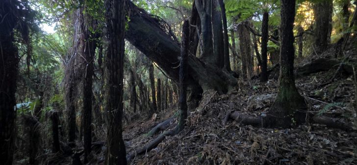
Searching for evidence of historic gold prospecting believed to have taken place in the Northern Forest of Wainuiomata.
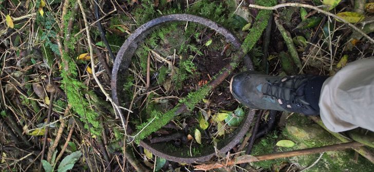
A bush treasure hunt uncovering an old bench-cut track, pipeline relics, discarded bottles, and a hidden waterfall.
A first visit to the Northern Forest section of East Harbour Regional Park in Wainuiomata where I walked the Trig Loop.
WAINUIOMATA NEWS
Latest Wainuiomata News.
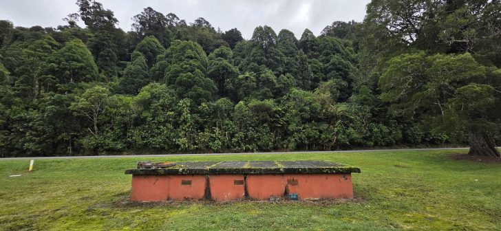
View the abandoned O-K Main Kinney Strainer Chamber in Wainuiomata Regional Park, once part of the historic O-K water pipeline.
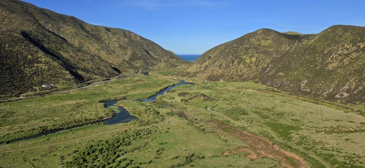
The oxbows near the Lighthouse Bridge in East Harbour Regional Park are former meanders of the Wainuiomata River.
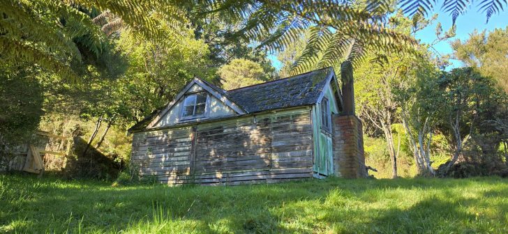
Behind Hine Road, this old building raises an interesting question. Is it simply an old bach, or could it have started life as an army hut?
WAINUIOMATA HISTORY
Wainuiomata Through the Years.


Discover Wainuiomata
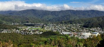 Wainuiomata is framed by the Eastern Hutt Hills, the Orongorongo Range, and a rugged coastal edge. This natural enclosure creates a distinct sense of separation from the wider Hutt Valley, giving the area a strong town identity rather than that of a typical suburb. Visitors are drawn to its exceptional natural environment, with opportunities for bush walking, mountain biking, swimming, and fishing.
The history of Wainuiomata starts with the topography of the land. The isolation, wetlands, and dense forests made it a difficult for settlement. However, an earthquake in 1855 elevated much of the swamp. The first pioneers came for logging and agriculture, then water management. Post WWII, housing swiftly reshaped the area into a working class neighbourhood.
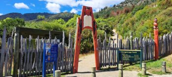
 Scenic reserves in Wainuiomata is a scenic reserves in Wainuiomata protect the distinctive podocarp forests that blanket the surrounding hills. Exploring these areas offers a genuine retreat from urban life into a tranquil natural setting. Key destinations, including Wainuiomata Regional Park and Remutaka Forest Park, along with a number of smaller local reserves, are all easily accessible to visitors.
 Wainuiomata tracks and walks showcase the extensive native forests and rivers that define the area. Routes range from easy to more challenging, typically reflecting whether the terrain is flat or steep. A number of tracks also traverse the surrounding hills to the Hutt Valley and Eastbourne, including some of the region’s most highly regarded mountain biking trails.
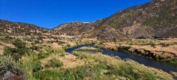 Wainuiomata rivers and creeks are plenty. Being encircled by steep hills, moisture is trapped resulting in streams and creeks that merge together to form rivers and wetlands. The Wainuiomata River is the primary waterway and is a significant water source for the Wellington region. More notable creeks include Black Creek and Wainuiomata Stream.
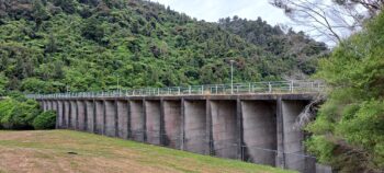 The Wainuiomata Waterworks has an interesting history. It was the area where Wellington city’s water was sourced, but has been scaled back today to supply around 15% – 20% of the region’s water requirements. Part of this area is now open to the public and is a popular riverside destination offering bushwalking, biking, and other recreational opportunities.
