
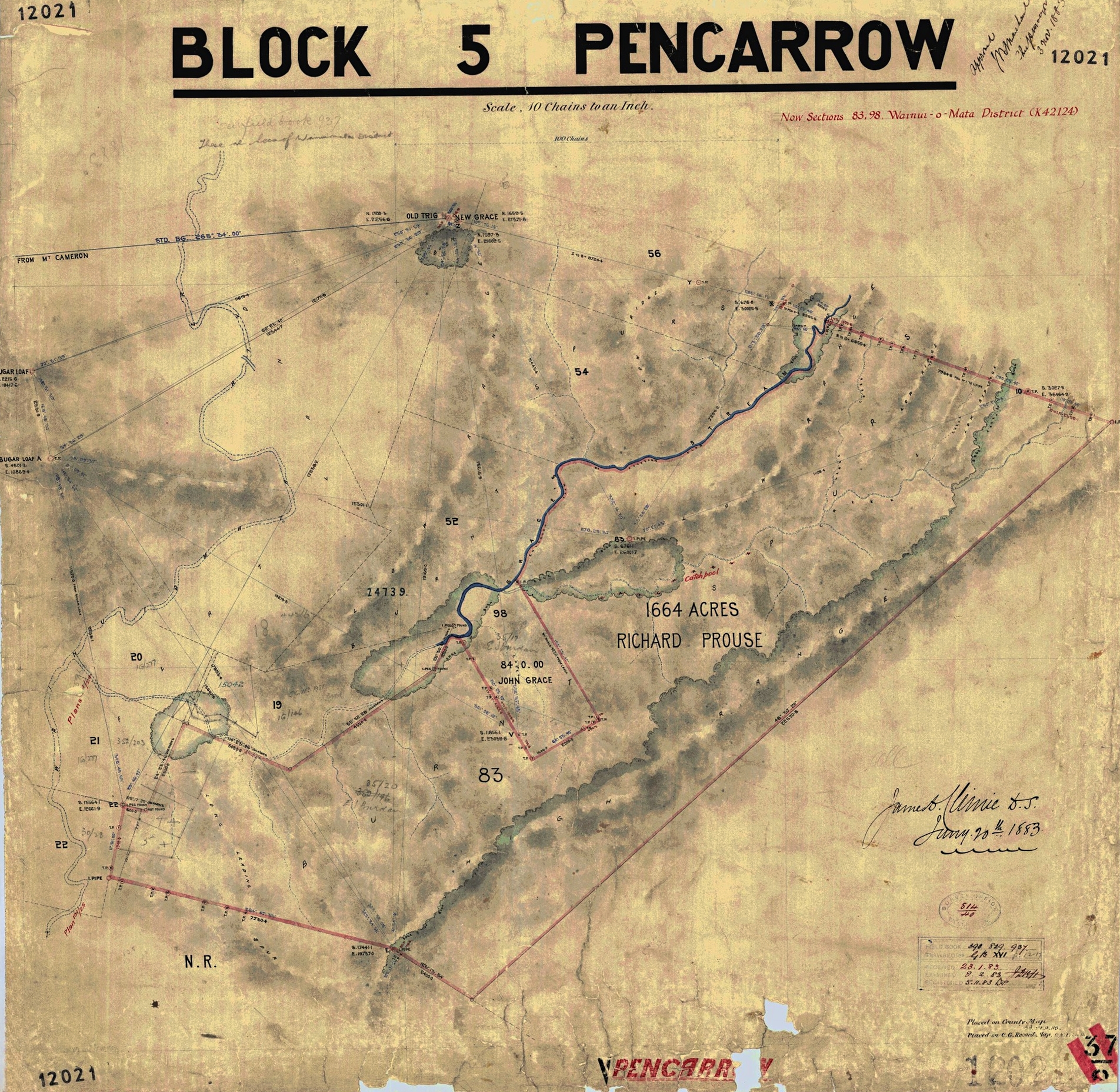
This 1883 example survey section, reconstructed from field notes, uses Mt Grace on the Coast Road as a primary trig point. It covers the southern side of the valley and the Catchpool area. Note the presence of a double Sugar Loaf, which may have served as a distance reference or checkpoint.
Ignoring bearings, distances, peg numbers and other survey measurements, the main place names and labels are:
- Block V Pencarrow
- Mt Grace
- New Grace
- Sugar Loaf
- Sugar Loaf – shown a second time
- Coast Road
- Grace’s Stream
- Catchpole Creek
- Orongorongo River
- Native Reserve
- R. Prouse / Richard Prouse
- John Grace
- Section 83
- Section 98
The associated 1882 survey field notes confirm that Section 83 was surveyed for Richard Prouse and Section 98 for John Grace, and specifically name Grace’s Stream, Catchpole Creek and the Orongorongo River.
(NZ Pictures)
The map is SO 12021, Block V Pencarrow, Sections 83 and 98, Wainuiomata, dated 20 January 1883.
(NZ Pictures)




