Where harbour, hills, bush, and wild coast meet.
East Harbour Regional Park is a diverse coastal and bush landscape on the eastern side of Wellington Harbour. Stretching from sheltered harbour bays and forested hills to the exposed south coast around Baring Head / Ōrua-pouanui, the park brings together walking tracks, native bush, river valleys, historic sites, and wide views across Cook Strait and Wellington Harbour. It is one of the region’s most varied natural areas, where city-edge recreation meets rugged coastal wilderness.
History
 The history of East Harbour Regional Park begins long before it became a public reserve. The land around Parangarahu, Ōrua-pouanui / Baring Head, the eastern harbour coast, and the hills between Eastbourne and Wainuiomata has deep significance for mana whenua, especially Taranaki Whānui and Te Āti Awa. This was a much older cultural landscape, shaped by settlement, food gathering, travel routes, and long-standing relationships with the harbour and coast.
Para Hill, also known as Mt Para, adds an important layer to this early history. The name Para is understood to be a shortened form of Parangarahu, the pā and place name associated with this coastal area near Fitzroy Bay. From its elevated position above the southern entrance to Wellington Harbour, the hill has commanding views over Cook Strait, the harbour entrance, Fitzroy Bay, and the surrounding coastline. This made it a naturally strategic site long before its later European and military use.
In more recent times, the Eastbourne hills became popular with walkers from the late 1800s, while Butterfly Creek developed into a well-known picnic and walking destination in the early 1900s. A regional park for the East Harbour area was formally proposed in 1975, and the idea later evolved into East Harbour Regional Park, focused on protecting public land for recreation, conservation, and landscape values.
The park grew over time rather than being created all at once. Greater Wellington purchased the Pencarrow Lakes area in 1991 because of the ecological importance of Lake Kohangatera, Lake Kohangapiripiri, and their wetlands. In 1995, the first management plan for East Harbour Regional Park was developed, helping bring together land that had previously been managed by different agencies into a more unified park system.
Baring Head / Ōrua-pouanui added another important layer to the park’s history. The lighthouse was first lit in 1935 and became New Zealand’s first lighthouse to begin operating on electricity. Around the same period, the high ground above the coast also became part of Wellington’s wider defence landscape. During the Second World War, Para Hill was used as a military observation post, taking advantage of the same wide views that had made the hill important in earlier times.
From Para Hill, observers could watch the entrance to Wellington Harbour, the waters of Cook Strait, and the exposed coastline around Baring Head. The observation post formed part of the wider coastal defence network that protected Wellington during wartime, when harbour approaches, shipping movements, and possible enemy activity were closely monitored. Remains of this military presence help show how the landscape was adapted for defence, surveillance, and communication during a period of national uncertainty.
The purchase and protection of Baring Head land in 2010 was a major milestone for East Harbour Regional Park. It opened more of this coastal landscape to the public and helped preserve its historic buildings, military remains, native habitats, scientific sites, farming history, and dramatic south coast scenery.
The park continues to change. In 2025, Greater Wellington took ownership of Gollan’s Valley Station, a large property sitting between the Northern Forest and Parangarahu Lakes. This purchase is significant because it helps connect major parts of East Harbour Regional Park and adds valuable wetlands, native bush, open space, and heritage features to the wider protected landscape.
Today
 Today, East Harbour Regional Park forms an extensive protected landscape stretching along the eastern side of Wellington Harbour and the exposed south coast. Its four geographical sections are managed as part of a wider network of conservation land, recreation areas, historic places and culturally significant sites. The addition of Gollans Valley Station has strengthened the physical connection between areas that were previously separated, creating new possibilities for ecological restoration and long-term park planning.
Walking and cycling are among the main ways visitors experience the park. Its track network ranges from short family-friendly outings to steep climbs, exposed coastal routes and longer day walks. Access points are spread across Eastbourne, Days Bay, Lowry Bay, Wainuiomata and the coast, allowing visitors to explore different parts of the park according to their interests and level of fitness.
East Harbour Regional Park is made up of four distinct sections, each with its own landscape, character and recreational opportunities.
Northern Forest
The Northern Forest covers the steep, forested hills between Eastbourne and Wainuiomata, forming the green backdrop to the eastern side of Wellington Harbour. It contains some of the region’s finest remaining beech and northern rātā forest, together with a network of tracks climbing from Wainuiomata to Eastbourne and Days Bay. Popular destinations include Butterfly Creek, the Main Ridge Track and several viewpoints overlooking Wellington Harbour and the Hutt Valley. Unlike the exposed landscapes farther south, the Northern Forest is largely sheltered beneath a dense native canopy and provides important habitat for native birds and other wildlife.
Gollans Valley Station
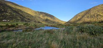
Gollans Valley Station is a 1,366-hectare property lying between the Northern Forest and Parangarahu Lakes. Purchased by Greater Wellington in 2025, it joined the last two previously separated sections of East Harbour Regional Park and created a largely continuous area of protected land extending from the Wainuiomata hills towards the coast. The property contains native bush, wetlands, open grasslands, streams and former farmland. Its protection is particularly important because Gollans Stream and its tributaries flow towards the Parangarahu Lakes.
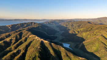
Parangarahu Lakes
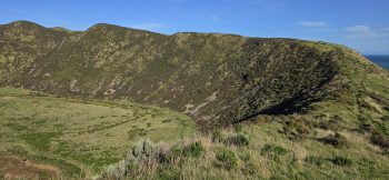
The Parangarahu Lakes area surrounds the freshwater lakes of Kōhangapiripiri and Kōhangaterā near the southern entrance to Wellington Harbour. The lakes, wetlands, coastal hills and surrounding catchments support a distinctive range of native plants and wildlife. Visitors usually reach the area on foot or by bicycle along the Pencarrow Coast Road from Burdan’s Gate. The route also provides access to the historic Pencarrow lighthouses and elevated viewpoints across the lakes, Wellington Harbour and Cook Strait.
Baring Head/Ōrua-pouanui
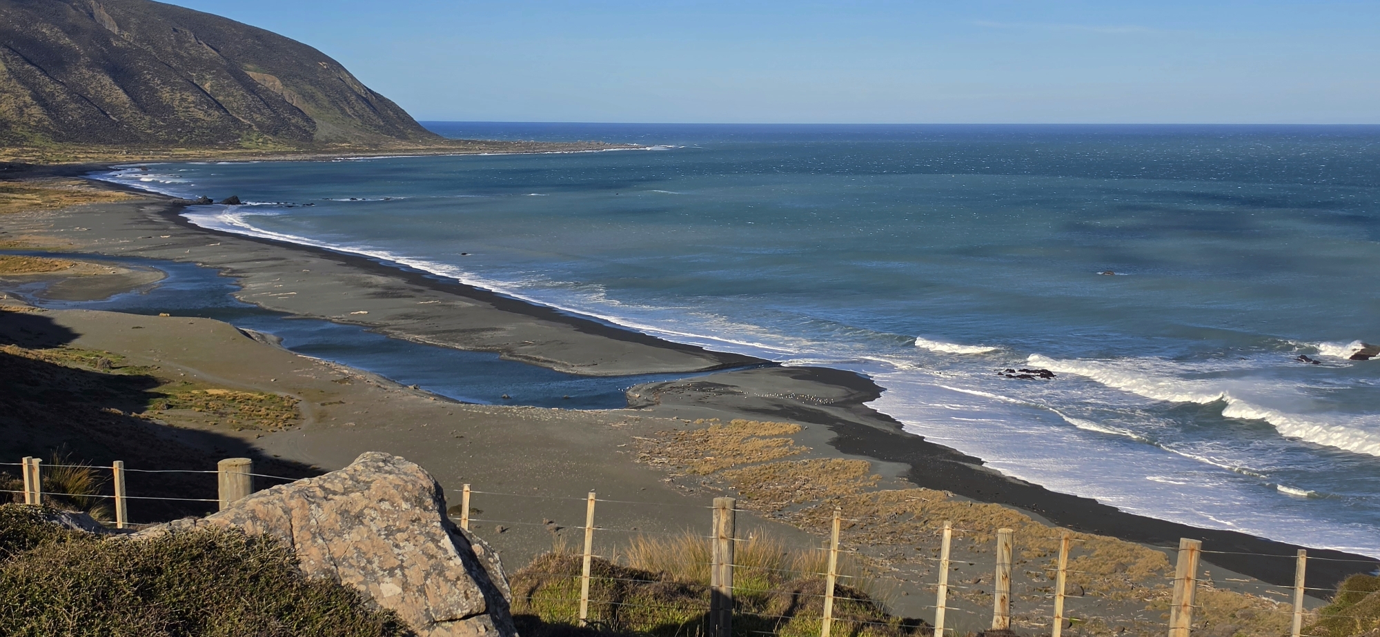
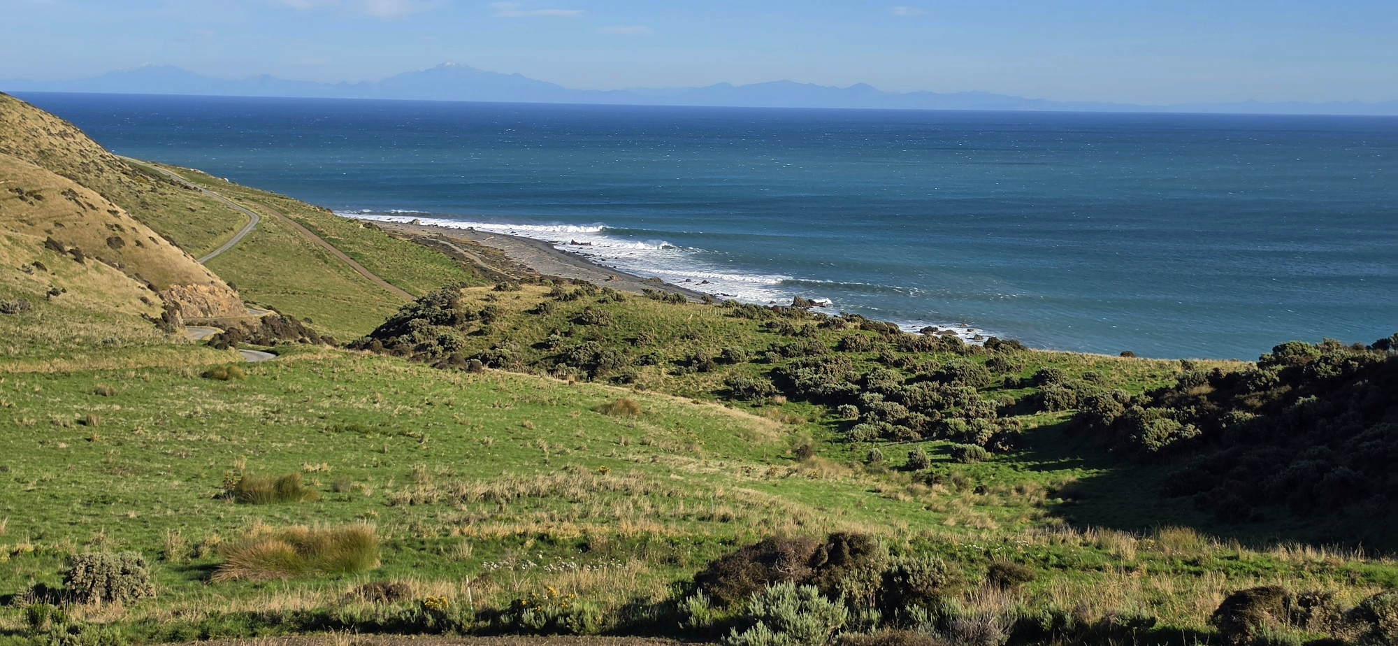
Baring Head/Ōrua-pouanui occupies the rugged coastal landscape at the southern end of Fitzroy Bay, where Wellington Harbour meets Cook Strait. The area includes river flats, windswept hills, rocky coastline and wide views across the strait. Its best-known landmark is the Baring Head lighthouse complex, which includes the lighthouse, lightkeepers’ cottages, power house and other historic structures. The wider area also contains archaeological sites, wartime remains, unusual geological features and extensive ecological restoration projects. Access is from Wainuiomata Coast Road, with walking and cycling tracks leading towards the lighthouse, river mouth and surrounding headlands.


Walks
East Harbour Regional Park offers a wide range of walks, from short coastal loops and lighthouse routes to longer forest tramps through the hills between Eastbourne and Wainuiomata. The walks vary greatly between each part of the park, with the Northern Forest offering sheltered bush tracks, Parangarahu Lakes providing open coastal and wetland scenery, and Baring Head / Ōrua-pouanui combining river valleys, rugged coast, lighthouse history, and wide Cook Strait views.
Lowry Bay Loop
The Lowry Bay Loop is a bush walk in the Northern Forest section of East Harbour Regional Park. It climbs through native forest to lookout points with views over Wellington Harbour and the Hutt Valley, making it a rewarding option for those wanting a shorter hill walk with both shelter and scenery.
Trig Loop
The Trig Loop takes walkers through native bush towards Rātā Ridge and Lowry Trig, the highest point in the Northern Forest. Parts of the route are steep, but the walk offers a strong sense of the forested hill country that separates Eastbourne from Wainuiomata.
Days Bay Loop
The Days Bay Loop starts from the Days Bay area and climbs from the harbour side into the surrounding hills. It is a good walk for combining native bush, ridge views, and the village atmosphere of Days Bay, with the option of returning to the waterfront afterwards.
Eastbourne Loop
The Eastbourne Loop begins near Muritai Park and climbs above Eastbourne, giving walkers harbour views as they rise towards the lookout. It is a compact but rewarding route, linking the coastal village with the bush-clad slopes above.
Butterfly Creek Loop
The Butterfly Creek Loop is one of the best-known walks in the Northern Forest. It leads through bush and down into the Butterfly Creek valley, a long-established picnic and walking destination with native forest, birdlife, and a more sheltered inland feel.
The Traverse
The Traverse is a longer and more demanding route across the Northern Forest. It crosses ridges and links different parts of the hill country, giving experienced walkers a fuller sense of the scale of the forest between Wainuiomata and the eastern harbour suburbs.
Rātā Ridge
Rātā Ridge follows part of the high forested ridge system in the Northern Forest. The route is known for mature bush and northern rātā, and gives walkers a more elevated journey through one of the park’s most distinctive native forest areas.
Kaitawa Loop
The Kaitawa Loop is a steeper tramping route through mature bush, climbing from the harbour side towards the ridge before returning by another track. It is better suited to walkers wanting a more challenging Northern Forest route with harbour views and varied terrain.
Burdans Gate to Lower Lighthouse
This coastal walk follows the Pencarrow Coast Road from Burdans Gate towards the lower Pencarrow Lighthouse. It is a mostly open and exposed route beside Wellington Harbour, with views across the harbour entrance and out towards the Cook Strait landscape.
Lighthouse Loop
The Lighthouse Loop climbs from the coastal route up towards the historic Pencarrow Lighthouse. The walk offers views over Parangarahu Lakes, Wellington Harbour, and the surrounding coastal hills, combining lighthouse history with open landscape and wetland scenery.
Cameron Ridge Loop
The Cameron Ridge Loop climbs onto the ridge between Lake Kohangapiripiri and Lake Kohangatera. From the higher ground, walkers gain excellent views over the lakes, wetlands, Pencarrow coast, and back towards Wellington Harbour.
Valley View Loop / Kohangatera
The Valley View Loop / Kohangatera walk takes in the Lake Kohangatera area and nearby wetland landscape. It is a good route for seeing the quieter inland side of Parangarahu Lakes, where freshwater, native vegetation, and open coastal country meet.
Oxbow Loop
 The Oxbow Loop is a short, easy walk at Baring Head / Ōrua-pouanui, starting near Lighthouse Bridge. It follows the lower Wainuiomata River valley and passes old horseshoe-shaped river bends, showing where the river once flowed before changing course.
Raukawa View Loop
The Raukawa View Loop is a short climb from the river valley up onto the escarpment at Baring Head. The reward is a wide view across Raukawa / Cook Strait, with the exposed coastal landscape giving the walk a strong sense of place.
River to Sea
River to Sea follows the Wainuiomata River valley towards the south coast. This walk connects the river landscape with the rugged coastline, leading towards Wainuiomata Beach and the open waters of Cook Strait.
Fitzroy Bay Beach via Road
The Fitzroy Bay Beach route follows the road through the Baring Head landscape before descending towards the rugged beach. It is a short but exposed walk, with views across Cook Strait and a strong connection to the wider Parangarahu and Fitzroy Bay coastal area.
Lighthouse via Road
Lighthouse via Road follows the main gravel road up through the Baring Head landscape to the lighthouse complex. Along the way, walkers cross open marine terraces and gain sweeping views before reaching the historic lighthouse, cottages, and Story Hub.
Grand Loop
 The Grand Loop is one of the main longer walks at Baring Head / Ōrua-pouanui. It links the river valley, lighthouse complex, Story Hub, coastal views, and wartime remains, making it one of the best routes for experiencing the full historic and natural character of the area.
Gollan’s Valley
 Gollan’s Valley is an important recent addition to the East Harbour Regional Park landscape, sitting between the Northern Forest and Parangarahu Lakes. Public walking access has not yet opened, but the area is significant because it helps connect bush, wetlands, open land, heritage features, and future restoration opportunities within the wider park.


DISCUSSION