
Special thanks to Carl Smith for sourcing the map.
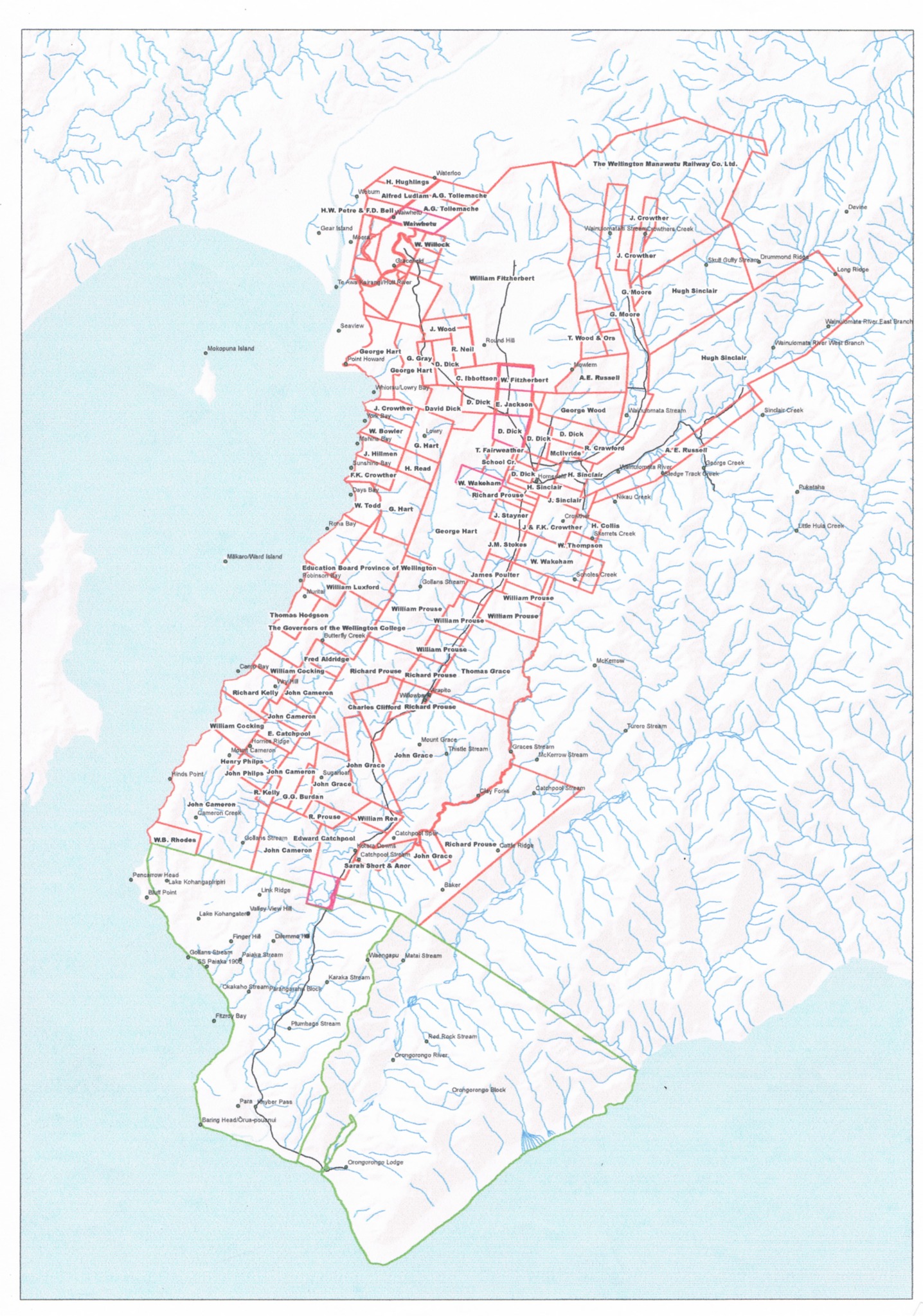
A circa 1860 Crown Grants Map showcasing the first land block purchases in Lower Hutt, Wainuiomata, and the Wellington Harbour eastern bays down around to Orongorongo Station. The blocks are marked with the names of the buyers, reflecting a period of development from wilderness to settled land. Notably, Alfred Ludlam, for whom Ludlam Crescent is named, was the first buyer of a block, though he held it for only about three years before selling it, along with another block, to Daniel Riddiford.
Landowners Shown on the Crown Grants Map
The names recorded across the various land blocks include a number of prominent early settlers and landholders, with some names appearing on several adjoining sections.
The landowners shown on the map include:
- A. G. Tollemache
- Alfred Ludlam
- Charles Clifford
- David Dick
- Edward Catchpool
- Edward Prince
- F. K. Crowther
- George Hart
- George Wood
- H. Huggins
- Hugh Sinclair
- James Potter
- J. Cameron
- J. Crowther
- J. Mowlem
- J. Stevens
- J. Wood
- John Grace
- John Prouse
- L. Crowther
- R. Neill
- Richard Kelly
- Richard Prouse
- Thomas Grace
- Thomas Hodgson
- W. B. Rhodes
- W. Catchpool
- W. Hart
- W. Wakeham
- William Cooke
- William Fitzherbert
- William Prouse
- The Governors of the Wellington College
- The Wellington and Manawatu Railway Co. Ltd.
Several names appear more than once on the map, particularly Richard Prouse, William Prouse, David Dick, members of the Crowther family and the Catchpool family, reflecting the extent of their landholdings across the area.




