The story of the kittyhawk plane crash and subsequent wreckage located in Wainuiomata
The Kittyhawk plane crash in Wainuiomata connects a wartime event with decades of local discovery and exploration. Since the 1943 impact above Skerretts Creek, scattered wreckage has remained, drawing a few hardy explorers into this remote and beautiful landscape.
Kittyhawk plane serial number 3031
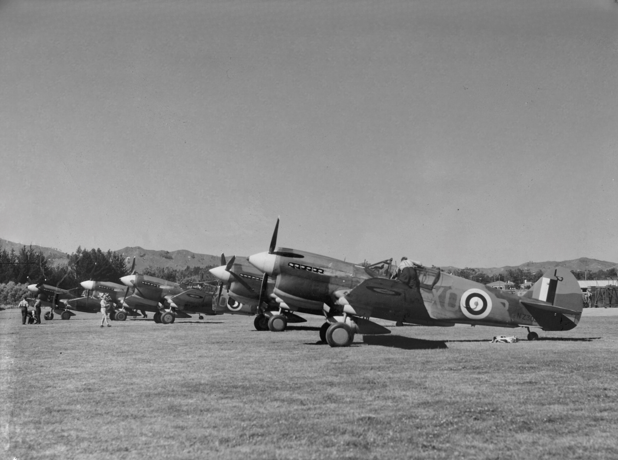 The Kittyhawk, also known as the Curtiss P-40 Warhawk, was manufactured by Curtiss-Wright Corporation in Buffalo, New York. The aircraft, identified by Constructors Number 19957, underwent several assignments: initially, it belonged to the U.S. Army as serial number 41-36124, then as RAF serial number ET770, and was later reassigned to the Royal New Zealand Air Force (RNZAF) as Kittyhawk serial number NZ3031 for 16 Squadron, coded XO-R, stationed at Fairhall, the satellite airfield of Woodbourne.
Kittyhawk plane crash
 On 1 May 1943, twenty three year old Sergeant Thomas Victor Marchant (Tom), service number 421076, RNZAF, piloted his Curtiss P-40E Kittyhawk during a training flight heading beyond Baring Head where a military observation post was located. The plane crashed into a hillside in Wainuiomata.
Tom’s final radio transmission was received at 2:12 pm, suggesting the crash occurred only minutes later. Reports indicate the aircraft encountered a downdraft, pancaked, then clipped a tree before striking near a rock face and erupting into flames. The impact scattered wreckage across a large area, with the engine breaking free and later being rolled down the gully by at least two people in the 1960s. The aircraft is believed to have needed only about 100 feet of additional altitude to clear the ridge.
At the time of impact, the aircraft was fully armed, and the resulting explosion scattered ammunition across the site. It was destroyed beyond repair, officially written off, and left where it came to rest high on the hillside. The surrounding area was severely burned by the explosion and subsequent fire, preventing vegetation from regenerating for many decades. Today, the site is once again covered in native bush.
Marchant, who had won his wings only eight months prior, was killed instantly with his remains recovered two days later, by a party of police and airmen. He now rests in peace at Aramoho Cemetery in Wanganui.
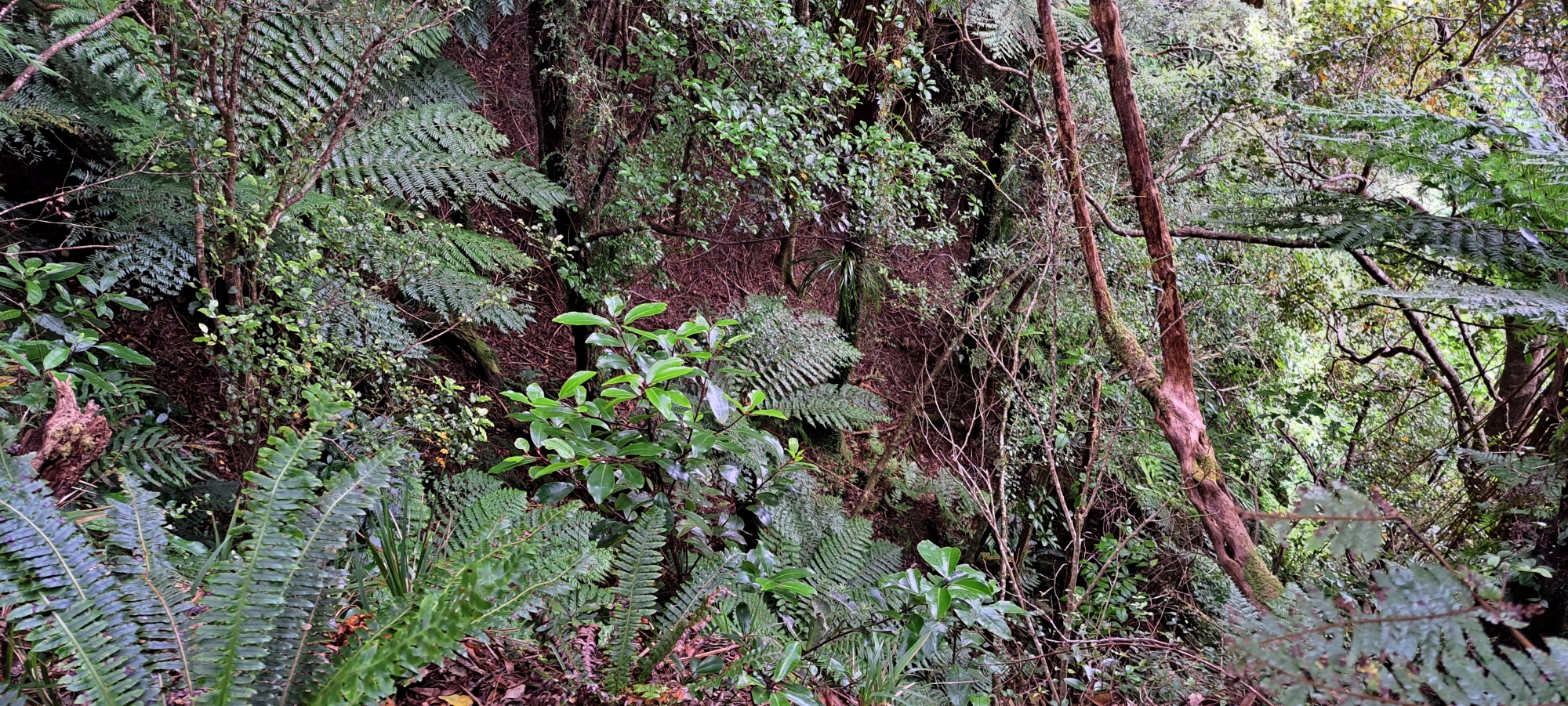
Location of the Kittyhawk crash site
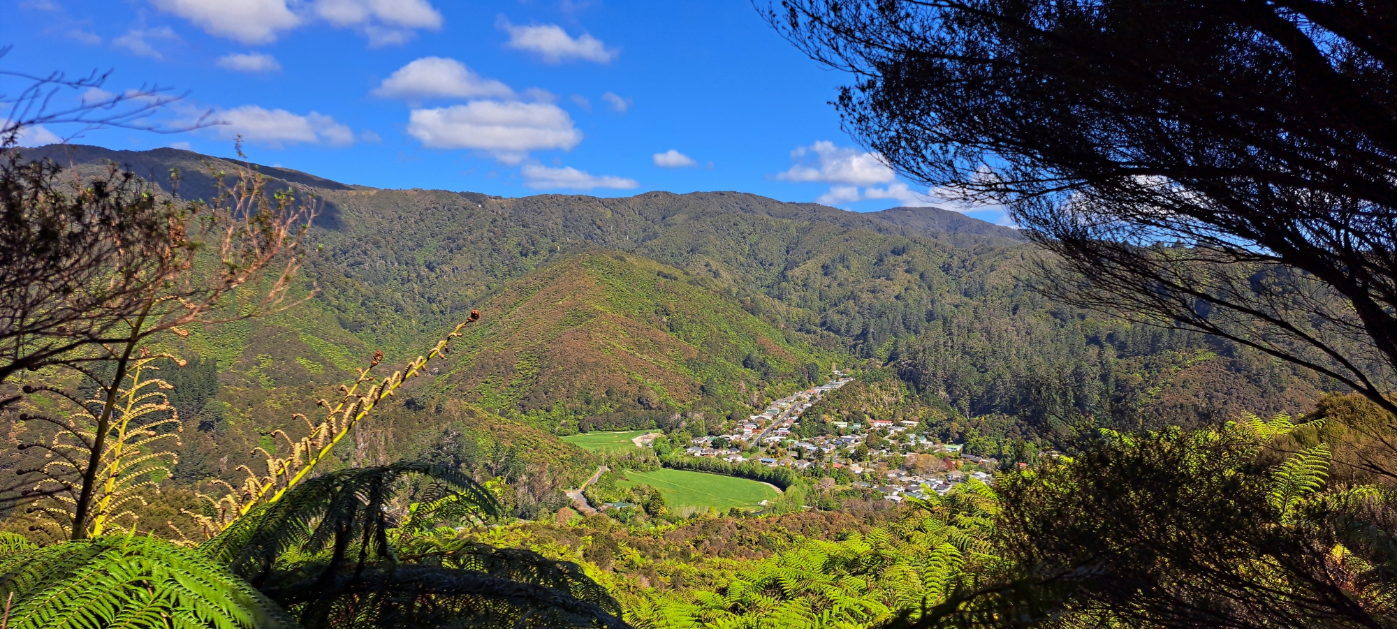
 Today, the precise crash site has likely been identified. Located below the McKerrow Ridge above Sunny Grove, specifically within the valley where Skerretts Creek descends, just below a section of low vegetation on the hillside. It is believed that the aircraft struck and topped at least one tree before impacting the slope, where it caught fire and subsequently exploded.
On 4 April 2026, the impact site was relocated with the assistance of an eyewitness to the plane wreckage. This identification was confirmed by the presence of multiple aircraft fragments scattered across the ground, along with the nearby topped tree marking the supposed point of initial impact.
The exact location of the crash site was not much of a secret in times passed though. In fact the site was visible for many years as the ensuing fire marked the hillside after the crash, and could be seen from Wainuiomata Road and even as far as the other side of Wellington Harbour. In time however, nature reclaimed the site and it is now deeply hidden in dense vegetation making it very difficult to find.
Known Kittyhawk wreckage and parts
 Over the decades, a significant portion of the wreckage scattered across the hillside and creek has been taken away by people seeking a piece of history or memorabilia. This included guns, the console panel, ammo, and basically anything that could be carried out.
In 1958, an apple box full of ammunition was handed in to the police and two groups of school boys took .5 inch machine guns out. Also, Selwyn Torrence took a gun and cleaned off the rust. The Gembitsky brothers also salvaged a gun and a quantity of ammunition. These items were later confiscated and apparently cut up. A month later, RNZAF’s former Director of Works, WG Cmdr J.M. Carr, trekked to the site and recovered more ammunition that had been uncovered by rain.
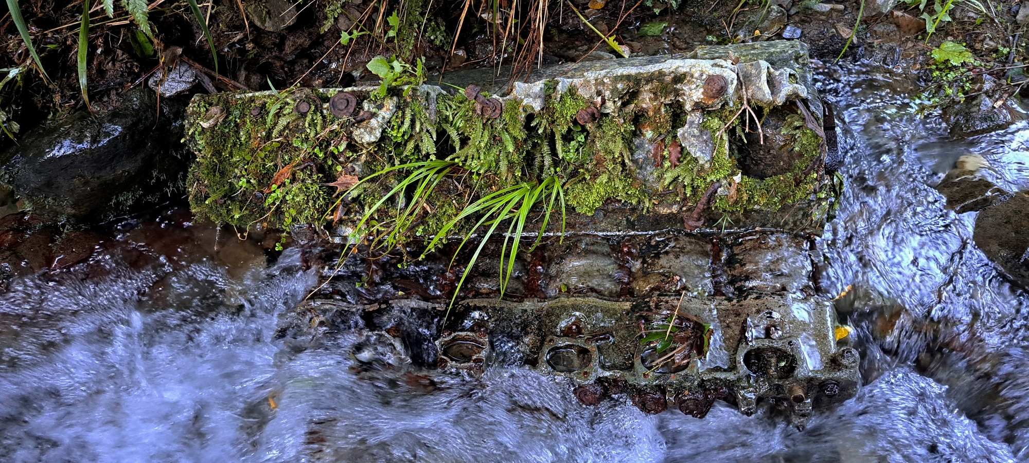
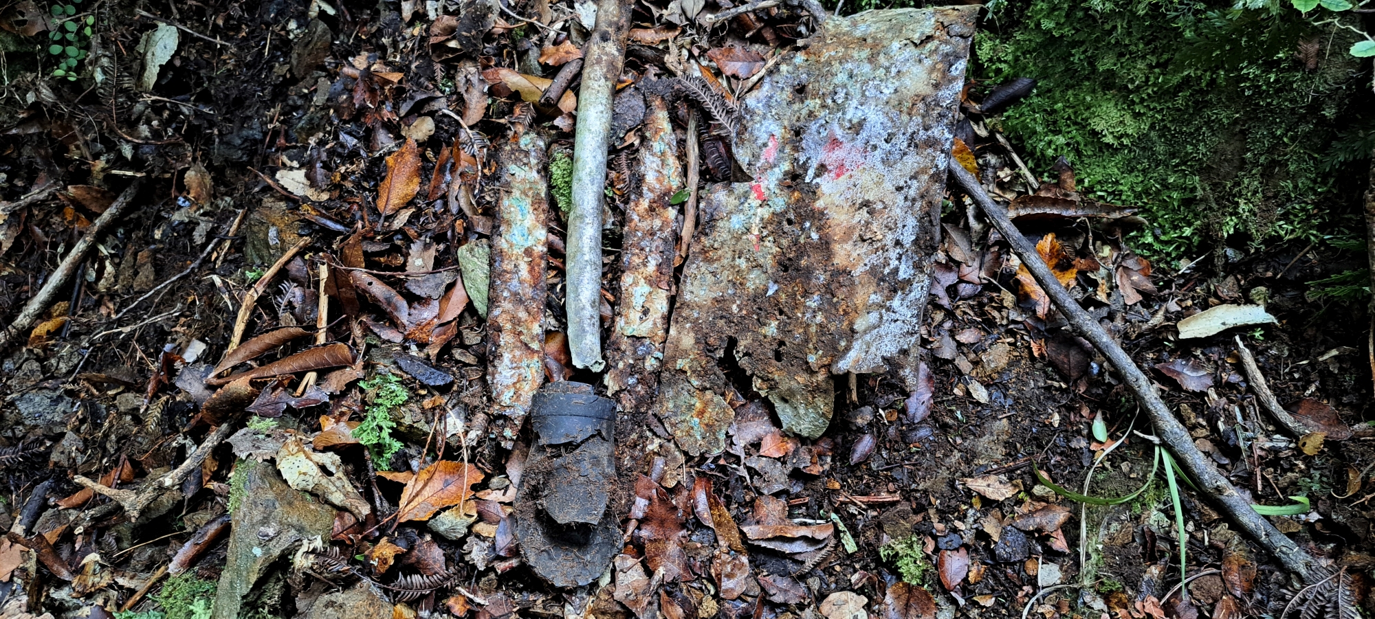
Despite these documented recoveries, and likely many others that went unrecorded, remnants of the aircraft still remain. These typically consist of components that were too large or cumbersome to remove at the time. Today, a number of sites continue to contain scattered wreckage.
Known surviving pieces include the V12 Allison engine, landing gear, sections of the fuselage, the propeller hub, wing components, and parts of the engine bearers. In addition, numerous smaller fragments are dispersed across the hillside, often difficult to detect and of limited collectible significance.
Undoubtedly, some parts remain undiscovered, likely buried by landslides. Other fragments may have been swept far downstream during floods, possibly ending up in backyards along Sunny Grove, or even carried further into the Wainuiomata River, where they would blend in with other debris.
Known locations of remaining Kittyhawk wreckage
 Over the years, the wreckage has been dispersed across multiple locations due to river flow, floods, and slips. Despite numerous attempts by individuals to locate the wreckage, finding even a single piece of the plane can prove difficult. Even if you are given instructions on the locations, it is still difficult to find. This is further compounded by the constant movement of parts down the valley. One could stumble upon a fragment of the wreckage, only to return the following year and find it displaced once again. The latest whereabouts of most sites are known to only a few.
While venturing into the valley in search of wreckage often leads to disappointment, as demonstrated in this video, the valley lacks a designated track, making the journey somewhat arduous. It traverses treacherous terrain in some sections, requiring climbing up or down ravine walls, to ascend or descend numerous waterfalls. There is even a cliff face to negotiate. At the crash site, the steep slope has caused large trees to slide down the hillside, highlighting the instability of the terrain. In summary, although some wreckage sites are more accessible than others, the absence of a proper walking trail can be challenging even under the best conditions.
Removing the wreckage
The Department of Conservation (DOC) upholds a policy of preserving plane wrecks to honour their historical significance and out of respect for those who perished. Unauthorized removal of historic artifacts, including plane wreckage, from public lands is prohibited, with DOC issuing stern warnings for such actions. Further, the New Zealand Defence Force asserts ownership of the Wainuiomata wreckage and prohibits the removal of any parts.
Special thanks to Lance Stewart for some of the detail in this article.
Special thanks to Tony Weir for his help in locating the main wreckage sites.
Special thanks to Martin Gembitsky (eye witness of the plane crash site) for confirming the crash site location.


