
A history of early settlers and their landholdings
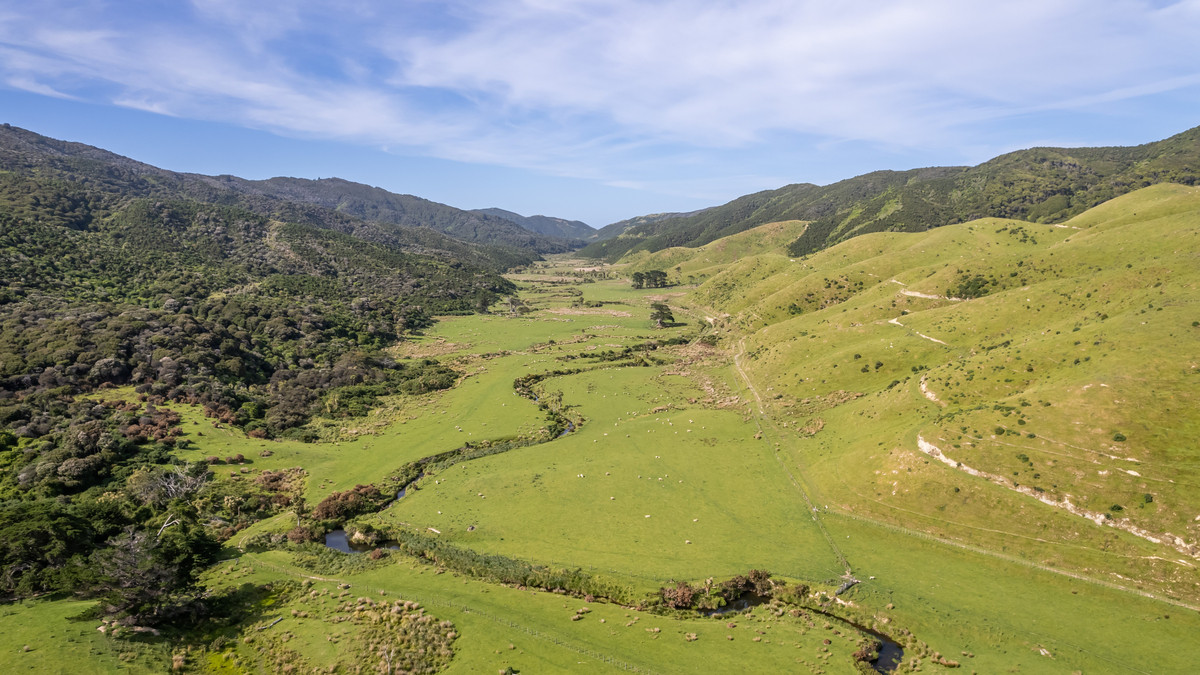
Long before Wainuiomata became a residential suburb on the edge of Wellington, it was a rugged, isolated large series of valleys, thick with native bush and crossed only by muddy tracks and rough streams. In the mid-19th century, a handful of pioneering families laid claim to this landscape, carving out farms, establishing sawmills, and shaping the early infrastructure in the area. These settlers included the Jacksons, Graces, Sinclairs, Prouses, Burdans, Crowthers, Woods and others. Their holdings were vast, stretching across ridgelines, creeks, gullys, and larger valleys.
Burrow Family Land
Below is a summary of the Burrow family’s land dealings in Wainuiomata between 1894 and 1920. It traces how James “Pardy” Burrow and his son, James Burrow junior, known as Jim, bought, leased, developed and sold several important properties. These included Ivy Cottage on Section 1, the McIlvride holding containing the post office, and the former Wakeham farm. It also covers Jim’s later 65-acre farm, which extended across parts of present-day Homedale, Hine Road and Poole Crescent. The timeline concludes with his 1920 sale of this farm and his father’s former Section 1 property to the Frederickson brothers.
Timeline
- 14 December 1894: James “Pardy” Burrow purchased 20 acres of Part Section 1, Wainuiomata, from William Burdan for £220. The property included a one-and-a-half-storey house known as Ivy Cottage. On the same day, Burrow borrowed £225 from Wellington civil engineer William Ferguson. (Gene’s Family Tree)
- 4 May 1900: James Burrow entered into an agreement with John McIlvride to lease Section 79 and Part Section 2 for ten years, with the lease taking effect from 1 April 1900 at an annual rent of £30. The McIlvride homestead was also being used as the Wainuiomata Post Office. (Gene’s Family Tree)
- 26 August 1902: James Burrow junior, known as Jim, purchased the former Wakeham property from Elizabeth Collier for £650. He financed the purchase with £50 of his own money and a £600 loan from Collier. The property comprised 209 acres and nine perches within Parts Sections 3, 42, 40 and 4, excluding the Coast Road Church land and a portion of Section 4 previously sold to Thomas Scholes. (Gene’s Family Tree)
- 30 September 1905: James “Pardy” Burrow purchased Section 79 and Part Section 2 outright from John McIlvride for £475. The property, including the homestead from which the post office operated, remained home to the Burrow family for many years. (Gene’s Family Tree)
- 19 August 1908: Jim Burrow arranged to sell the former Wakeham farm through John Thomas Hawthorn to Peter Hatton Miller. Burrow was to convey the property to Hawthorn for £1,254, after which Hawthorn would sell it to Miller for £1,880. Elizabeth Collier acknowledged receiving all money owed to her on 22 August 1908. (Gene’s Family Tree)
- After August 1908: Jim Burrow appears to have acquired a 65-acre portion of Part Section 2. The land extended from the Wainuiomata River across the area now occupied by parts of Homedale, Hine Road and Poole Crescent, and into the hills behind lower Hine Road. Jim built the house now known as 8 Poole Crescent and farmed the property with his wife, Mary. The exact purchase date is uncertain because the relevant deeds have not been located. (Gene’s Family Tree)
- 14 February 1919: Jim Burrow purchased his father’s original 20 acres of Part Section 1 for £250. His father had bought the same property from William Burdan for £220 in 1894. (Gene’s Family Tree)
- August 1920: Jim Burrow sold the house at 8 Poole Crescent, the adjoining 65 acres of Part Section 2 and the 20 acres of Part Section 1 to brothers Charles and James Frederickson for £1,700. Jim financed £1,000 of the purchase price, to be repaid by 1 June 1927 at an annual interest rate of £7 10s per cent, equivalent to 7½%. (Gene’s Family Tree)
Jackson Family Land
Three apparently separate Jackson family lines were associated with land in Wainuiomata at different times, although only Charles Welby Jackson’s family appears to have been firmly established on the Coast Road property bearing the Jackson name.
James and Emma Jackson lived at Lowry Bay, not Wainuiomata. They held and cleared Wainuiomata sections from 1841, but James died in 1846, Emma offered land for sale in the 1850s, and she returned to England by 1859. Hutt City Libraries specifically states that they were not related to Edwin Jackson. (Heritage at Hutt City Libraries)
Edwin Jackson arrived in 1857 and lived mainly in Petone, where he owned land and operated a brickworks. His son Joseph Enoch later became associated with Wainuiomata and Fairview. Therefore, Edwin’s family was not another pioneering household living in the valley during the early 1840s. (Heritage at Hutt City Libraries)
Charles Welby Jackson belonged to yet another English family and became associated with Wainuiomata through his 1866 marriage to Elizabeth Grace. The Grace family already held Coast Road land, so Charles’s connection arose considerably later than James and Emma’s early sections. (thepeerage.com)
Timlines
James and Emma Jackson of Lowry Bay
- 1841: While living at Lowry Bay, James and Emma Jackson employed workers to clear and burn off two sections they held on the Wainuiomata side of the eastern hills. The work was intended to prepare the land for farming. (Heritage at Hutt City Libraries)
- February 1853: Emma Jackson received a Crown Grant that included Section 3 in Wainuiomata, comprising about 110 acres. She later granted her sister-in-law, Eliza Wood, a 99-year peppercorn lease over the property. (Heritage at Hutt City Libraries)
- January 1855: Emma advertised Section 5 in Wainuiomata for sale. This was another of the Jackson family’s early landholdings on the eastern side of the hills. (Heritage at Hutt City Libraries)
James and Emma’s properties should not be confused with the later Jackson’s Farm on Coast Road. Their Wainuiomata holdings were connected with their settlement at Lowry Bay and access across the eastern hills.
Charles Welby Jackson and the Grace family
- 1850s: John Charles Grace and his family developed land on the western side of the Wainuiomata River along Coast Road. Their homestead was known as Hermitage, and the surrounding property later became closely associated with the Jackson family through marriage. (Tracks from the Eastern Hills to Wainuiomata)
- December 1866: Charles Welby Jackson married Elizabeth Grace, daughter of John Charles Grace. This marriage connected Charles with the Grace family’s Coast Road property. (Early Hutt Marriages)
- 1880s: Charles Welby Jackson became associated with the farm later known as Jacksons Farm, situated around 726–728 Coast Road. The property occupied land on the western side of the river and included the northern end of the route known first as Graces Track and later as Jacksons Track. (Wainuiomata Place Name Origins)
- By 1947: Wainuiomata Historical Museum records identify old barns at a place called Pukers or Puka on Jackson’s Farm. The catalogue confirms that the property and name were still recognised at this time, although it does not establish who built the house or exactly when it was constructed. (Wainuiomata Historical Museum Photo Catalogue)
Edwin and Joseph Enoch Jackson
- 1857: Edwin Jackson arrived in New Zealand with his wife, Harriet, and their children, including Joseph Enoch Jackson. The family settled in Petone, where Edwin became a landowner, brickmaker and local public figure. (Edwin Jackson’s Life and Street)
- Later nineteenth century: According to local historian Vicky Alexander’s research notes, Edwin Jackson later acquired land in Wainuiomata from William Wakeham. The surviving account does not give a precise purchase date or clearly define the original boundaries of the property. (Vicky Alexander’s 1985 research letter)
- Early 1890s: Edwin’s son, Joseph Enoch Jackson, built a farmhouse known as Fairview on part of the family’s Wainuiomata land. Fairview is associated with 421 Coast Road and was later sold to William Burdan. (Vicky Alexander’s 1985 research letter) and (Wainuiomata Central Place Name Origins)
Although all three families carried the Jackson surname and were associated with land in Wainuiomata, no close relationship between the three family lines has been established. James and Emma Jackson’s land was connected with Lowry Bay, Charles Welby Jackson became associated with Coast Road through the Grace family, and Edwin and Joseph Enoch Jackson held a separate property that included Fairview.
Grace Family Land
John Charles Grace (1807–1886) held extensive land along Coast Road, particularly across the high ridges now known as Graces Hill and Graces Stream. The Grace estate shared a boundary with the Jacksons, and their adjoining ridge track created an important corridor for travel and stock movement between properties.
Timeline
- 1851 to 1854: John Charles Grace acquires multiple Wainuiomata sections from Charles Mouncey Penny’s agents Bethune and Hunter. Claims are recorded for Sections 14, 15 and 16, with Crown Grant references and a dated claim on 17 February 1854. (nzpictures.co.nz)
- 21 April 1855: John Grace writes from Wainui o Mata Swamp on behalf of the local Road Board about land lists and road making, showing his active management of holdings. (nzpictures.co.nz)
- 29 November 1858: John Grace reports that access from the beach to the Wainuiomata Valley has been fenced off and asks the Crown Lands office to stake out the legal road. (nzpictures.co.nz)
- 17 December 1860: As a Board of Wardens representative, John Grace supports compensation for land taken to form a public road through the valley, confirming his role in local road and boundary matters affecting adjoining sections. (nzpictures.co.nz)
- By the 1850s: A ridge route across the Grace and Jackson properties is in use. It becomes known as Graces Track and later Jacksons Track, linking the Coast Road with Gollans Valley. (nzpictures.co.nz)
- 1886: Death of John Charles Grace, Justice of the Peace, marking the end of his direct tenure. (National Library of New Zealand, Find A Grave)
Pedersen Family Land
The Pedersen family’s landholdings in Wainuiomata between 1883 and 1920 began with Halvor Pedersen’s purchase of Lot 1 in 1883 and Lot 28 in 1887. Together, these properties comprised approximately 192 acres. In June 1909, he sold both lots to the Hansen brothers for £1,900.
Nine days later, Halvor purchased another property of approximately 150 acres near Coast Road. This land included the site of the present Boys’ Brigade Camp at 202 Coast Road, as well as land extending across the road towards and adjoining the present sewage treatment plant. He sold the property to William Richard Scholes in July 1920.
Timeline
- 30 October 1883: Halvor Pedersen purchased Lot 1 of the Wainuiomata Small Farm Settlement from Henry Fitzherbert for £438 10s, having borrowed £270. The property comprised 87 acres, 2 roods and 30 perches. (Gene’s Family Tree)
- 6 May 1887: Halvor purchased Lot 28 of the same settlement from Henry Fitzherbert for £358. The property comprised 104 acres, 2 roods and 23 perches. Together, Lots 1 and 28 covered 192 acres, 1 rood and 13 perches. (Gene’s Family Tree)
- 8 June 1909: Halvor arranged to sell Lots 1 and 28 to the Hansen brothers—George, Arthur and Albert—for £1,900. (Gene’s Family Tree)
- 17 June 1909: Halvor arranged to purchase approximately 150 acres from John Elliott. The property comprised Section 63 and parts of Sections 5, 6 and 64. It included the present Boys’ Brigade Camp at 202 Coast Road, together with land across Coast Road extending towards and adjoining the present sewage treatment plant. The old Collis Cottage became the Pedersen family home. (Gene’s Family Tree)
- 16 July 1920: Halvor arranged to sell the Coast Road property to William Richard Scholes. Halvor died within the following twelve months. (Gene’s Family Tree)
Prouse Family Land
Richard Prouse (1792–1875) was among the early settlers along Coast Road. He logged the land on the valley floor and somewhat up the slopes. In 1866, he donated a section of his property for the construction of the first Methodist church in the valley.
Timeline
- 1844: Prouse family relocates timber operations from Johnsonville to the Wainuiomata valley floor, beginning major sawmilling activity. (wainuiomata.net)
- 29 January 1853: Richard Prouse purchases land along Coast Road, Wainuiomata, which later becomes the church site. (Coast Road Church)
- 1866: Donates land for the first Methodist church in Wainuiomata; services begin February 1866. (Coast Road Church)
- Late nineteenth century: Prouse family timber interests extend to Whitemans Valley and later Levin, while Coast Road property remains part of Wainuiomata’s early European heritage fabric. (Horowhenua Historical Society)
Sinclair Family Land
Hugh Sinclair (sometimes recorded as Ewen Sinclair, 1810–1871) acquired a large holding around Hine Road, Moores Valley, and Sinclair Valley now known as Reservoir Valley. He and his family established a sawmill along the Wainuiomata Stream some of their old logging routes are now walking tracks inside Wainuiomata Regional Park and their tramway is now the only access road into this park.
Timeline
Here is the timeline again with links to sources beside each bullet point:
- c. 1848: First landholding established on the north side of what is now Hine Road, Wainuiomata. Two early homesteads built: Glenhill and Moness. (wainuiomata.net)
- Early to mid-1850s: Substantial freehold accumulation in Wainuiomata begins, including frontage along the Wainuiomata Stream and valley flats leading toward Moores Valley. (wainuiomata.net)
- Late 1850s – early 1860s: Sawmilling operations established by the Sinclair family on the Wainuiomata Stream. Logging tracks and a tramway are formed; parts later become today’s walking tracks and the sole vehicle access into what is now Wainuiomata Regional Park. (Wikipedia)
- 2 May 1868: Crown Grant No. 2681 issued to John Sinclair (Hugh’s son) for 105 acres in Wainuiomata. (nzpictures.co.nz)
- 1869–1870: Northbrook constructed for Hugh’s daughter Agnes and her husband Captain John Mowlem on land gifted by Hugh. Later transferred to sons John and Duncan Sinclair. (digitalnz.org)
- 8 November 1867: Hugh publicly advertises a “valuable freehold farm at Wainui-o-mata” for inspection, confirming legal tenure and active management of his holdings. (wainuiomata.net)
- 27 March 1871: Hugh Sinclair dies; estate administration leads to transfer of major holdings and milling interests to his sons. (nzpictures.co.nz)
- 1872: John and Duncan Sinclair formalise the Wainuiomata Steam Saw Mill partnership and continue milling operations. (nzpictures.co.nz)
- 1875–1876: Electoral roll entry for Section 74, 100 acres, Wainuiomata, held by John Sinclair, tying the family to formally recorded land parcels.
Burdan Family Land
George and William Burdan began acquiring farmland in the valley around 1872. Their holdings included a sizeable block near what became known as the St Albans property, built in the 1920s. The Burdan brothers were active in community affairs, particularly in the local school committee, and their land spanned into what is now part of Remutaka Forest Park.
Timeline
- 1902 and 1904: Annual Parliamentary returns list William Burdan under Wainuiomata localities, which corroborates occupation and stockholding on the Burdan farm during this period. (paperspast.natlib.govt.nz)
- 1913 to 1915: Burdan Bros listed as Wainuiomata sheep owners. Multiple AJHR stock returns show Burdan Bros at Wainuiomata with tallies, reinforcing active farming and tenure continuity before World War One. (paperspast.natlib.govt.nz)
- 22 December 1920: John William Burdan named in a Māori Land Court transaction for Wainuiomata No 22 Subdivision 1. Gazette notice records a transaction involving Wainuiomata 22 Sub 1 between Ani Tiria and another and John William Burdan. This is a specific, citable land record linking a Burdan to a titled parcel in Wainuiomata by number. (paperspast.natlib.govt.nz)
- 1920s: St Albans homestead constructed for Maurice James Burdan on Coast Road. The homestead’s creation date and association with the Burdan block are supported by local history work and photographic catalogue records. (wainuiomata.net)
- 1922 to 1927: Individual Burdan farmers recorded for Wainuiomata and Eastbourne. AJHR lists C O Burdan, J W Burdan, M J Burdan and G G Burdan, showing named operators and reinforcing holdings through the 1920s. (paperspast.natlib.govt.nz)
Crowther Family Land
John Eric Crowther (1831–1911) farmed in Moores Valley, centred around an area now known as Crowthers Creek. His brother, Frederick Kershaw Crowther (1833–1907), held land closer to Homedale and the ridgelines above Coast Road. These elevated areas came to be known as Crowther Ridge and Mt Crowther, preserving the family’s name in the landscape.
Timeline
- 1864: John Eric Crowther purchases approximately 355 acres at Moores Valley, naming the farm Brookfield. Title created by Crown Grant, Wellington Land District, with boundaries along the Moores Valley stream system later known as Crowthers Creek. (brookfield.scouts.nz)
- 1867: Crowther appears in wardens and Crown Lands notices for Upper Wainui-o-mata, which aligns with freehold tenure being formalised in this period. Exact Grant number retrievable from the Crown Grants index. (nzpictures.co.nz)
- Later 19th to mid 20th century: Brookfield remains a Crowther residence, with photographs and references to Miss Crowther’s house at Brookfield captured in 1961. (National Library of New Zealand)
Wood Family Land
John Wood, born in 1830, emigrated to New Zealand with his wife, Maria, and their two children in 1855, arriving at Port Nicholson aboard the Sea Snake in early May. Soon after his arrival, he took up land in the Moores Valley area of Wainuiomata. Although only 25, he soon became prominent in local affairs and was among the settlers appointed as road wardens and jurors between 1855 and 1862. In 1857, he joined Robert Neill, Richard Prouse, William Prouse, William Wakeham and David Dick in signing a request to the Wellington Provincial Council for the establishment of a local school, which opened later that year.
Timeline
- Woodlands homestead context: The Wood family property name Woodlands appears in local place-name work as a Wood family farm or house located toward the lower part of Wainuiomata Hill Road and Waiū Street. (nzpictures.co.nz)
- Northbrook and Wood family connection: Photographic records and local notes connect the Wood family to Northbrook in the late nineteenth and early twentieth century, which helps correlate family residence against land titles in the same period. (digitalnz.org)
- c. late 1850s to early 1860s :The Wood family establish the homestead known as Woodlands near the lower Wainuiomata Hill Road and Waiū Street locality. Published booklet and place-name research confirm the name and siting. (National Library of New Zealand)
- Late nineteenth to early twentieth century
Wood family members appear in local photographic and narrative records associated with Northbrook and other homesteads, helping triangulate residence against titles for that period. (digitalnz.org)
Wainui‑o‑Mata Development Limited
In 1928, a group of Wellington businessmen formed Wainui-o-Mata Development Limited, acquiring around 1,600 hectares of farmland in the valley with the goal of creating a new residential township. To support this, they launched the ambitious Wainuiomata Tunnel project in 1932 to link the valley with the Hutt by road and, potentially, rail. Funded by land-and-profit bonds sold to investors, the plan stalled during the Great Depression, and the company went into suspension by 1934.
By 1939, bondholders took over, and in 1945 they were granted 135 acres in trust. Real growth came after World War II, when demand for housing surged. Wainuiomata quickly developed into an affordable family suburb, earning the nickname “Nappy Valley” during the 1950s. The company oversaw subdivisions in areas such as Homedale and Hair Street, helping shape the suburban layout still recognisable today.
Although the tunnel was never finished as a transport route, it was later used during WWII by the military and eventually repurposed in 1975 by the Wellington Regional Water Board for water infrastructure.




DISCUSSION