Grand Loop, Baring Head / Ōrua-pouanui
The Grand Loop is the main circuit walk at Baring Head / Ōrua-pouanui and one of the best ways to experience the Wainuiomata south coast. At 7 km and about 3 hours, it is long enough to feel like a proper coastal tramp but short enough to be done as a half-day walk. It does not include every track in the Baring Head area, but it does include the major highlights: the river valley, lighthouse complex, Story Hub, wide coastal views, and World War II remnants. For walkers wanting the strongest overall introduction to Baring Head, this is the route to choose.
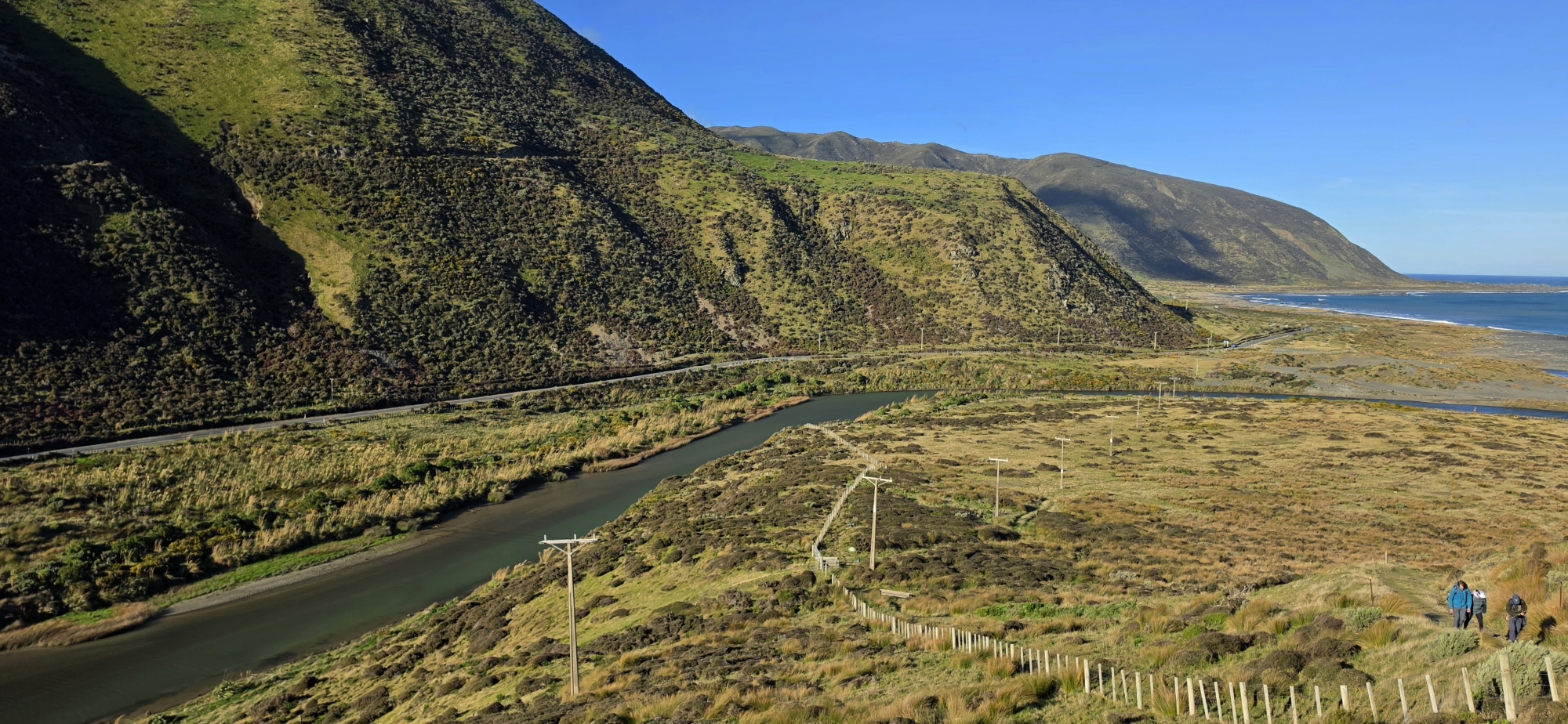
The main Baring Head circuit
The walk starts from the Baring Head car park near the end of Wainuiomata Coast Road. From there, the route heads into the open coastal landscape around the Wainuiomata River and climbs towards the higher ground around the lighthouse. This is not a sheltered bush walk. It is exposed, open, and very much shaped by the south coast: wind, sea views, grassland, river terraces, and big sky.
What the Grand Loop includes
The Grand Loop is the best single walk if you want a broad experience of Baring Head without simply walking up and back by the same road. It includes or passes close to the key features that make this area special: the Wainuiomata River valley, marine terraces, the lighthouse area, the Story Hub, Para Trig, coastal viewpoints, and World War II remnants.
However, the Grand Loop does not take in every named track in the Baring Head section. It is a named circuit of its own. Other walks shown on the park map include Oxbow Loop, Raukawa View Loop, River to Sea, Fitzroy Bay Beach via Road, and Lighthouse via Road. These are separate routes or side options, although parts of them may overlap with or sit near the Grand Loop.
For example, Oxbow Loop is a short flat 2.2 km walk in the river valley, while Raukawa View Loop is a shorter 2.3 km walk climbing the river escarpment for Cook Strait / Raukawa views. The River to Sea route continues down the river valley to Wainuiomata Beach and the climbing rocks, while Fitzroy Bay Beach via Road is a separate route to the rugged beach.
Why it is worth doing
The strength of the Grand Loop is that it combines several different layers of the Baring Head landscape in one walk. There is the natural landscape of river, coast, terraces, and exposed headland. There is the maritime history of the lighthouse. There is the human history of the lightkeepers’ cottages, service roads, and wartime remains. There is also the simple drama of the location: one of the most exposed and atmospheric pieces of coastline near Wellington.
The lighthouse complex is the major landmark. From the higher ground, the views open across Cook Strait / Raukawa, back towards the harbour entrance, and along the southern coast. On a clear day, the walk feels expansive; on a windy day, it can feel wild and severe.
Walking conditions
The Grand Loop is not especially long, but the Hard grading should be taken seriously. The terrain is exposed, the weather can change quickly, and the south coast is known for strong wind. Greater Wellington advises visitors to check the forecast, carry warm and waterproof clothing, take enough food and drink, use sun protection, plan the route, and tell someone their intentions. The map also notes that many parts of the park do not have cellphone coverage.
Because of the exposure, this is a walk best saved for a settled day. In poor weather, strong wind, or heavy rain, the shorter river-valley walks may be a better choice.


DISCUSSION