
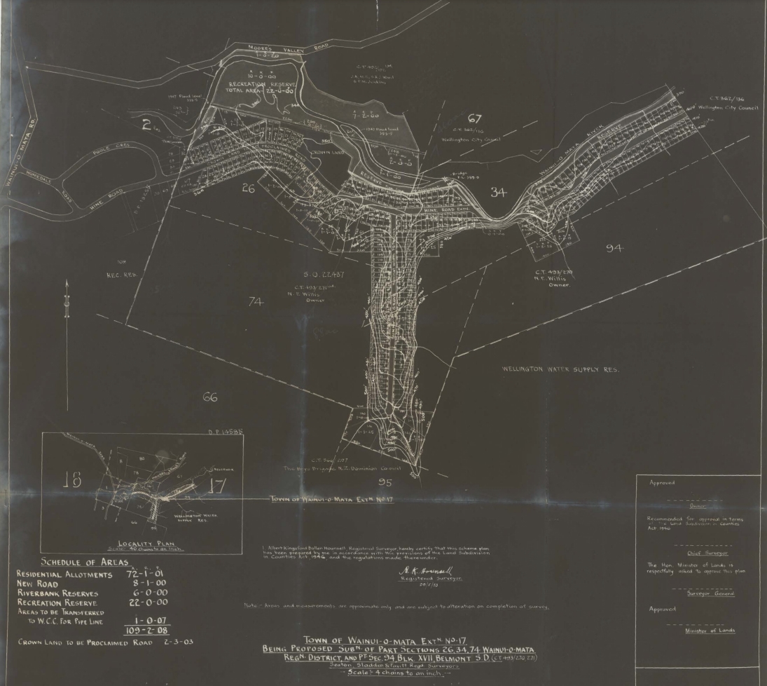
According to a 1948 plan, Hine Road was originally intended to extend beyond the Hine Road Recreation Area (pictured) and further into Reservoir Valley.
A plan showing the layout of Hine Road has the street extend into the location where Gums Loop Track is located. Perhaps in an alternative universe, Greater Hine Road exists. What do you think of this alternative plan? Was it better or is the current layout of Hine Road coupled with Hine Road Recreational Area adjoining Wainuiomata Regional Park a better plan? I would love to hear your thoughts. Leave a comment below.
Top of plan
MOORE’S VALLEY ROAD
WAINUI-O-MATA ROAD
RECREATION RESERVE
TOTAL AREA [figure indistinct]
There are also several ownership/title annotations around the upper edge, including references to the Wellington City Council, but some of the smaller wording is too faint to transcribe reliably from this copy.
Bottom left
LOCALITY PLAN
40 Chains to 1 Inch
[The scale wording is faint, but appears to be this.]
SCHEDULE OF AREAS
RESIDENTIAL ALLOTMENTS 72-1-01
NEW ROAD 8-1-00
RIVERBANK RESERVES 6-0-00
RECREATION RESERVE 22-0-00
AREAS TO BE TRANSFERRED
TO W.C.C. FOR PIPE LINE 1-0-07
109-2-08
CROWN LAND TO BE PROCLAIMED ROAD 2-3-03
The figures are in the old acres-roods-perches format.
Surveyor’s declaration
The central wording at the bottom is a surveyor’s certification. Much of the smaller text is faint, but the clearly readable parts include:
Registered Surveyor
and:
Note – Areas and measurements are approximate only and are subject to alteration on completion of survey.
That last sentence is independently confirmed in the National Library catalogue description of this exact plan.
TOWN OF WAINUI-O-MATA EXTN. No. 17
BEING PROPOSED SUB’N OF PART SECTIONS 26, 34, 74, 94 WAINUI-O-MATA REG’N DISTRICT
BLOCK XVII BELMONT S.D.
The title references are:
C.Ts 492/191, 493/210, 493/271
The National Library catalogue confirms those certificate-of-title numbers and identifies the plan as Wainuiomata Extension 17. (National Library of New Zealand)
SEATON & SLADDEN
Surveyors
Scale: 5 chains to an inch
Approval box at bottom right
Approved
[signature / date]
Recommended for approval
[remainder faint]
Chief Surveyor
The Hon. Minister of Lands is respectfully asked to approve this plan
Surveyor-General
Approved
Minister of Lands




