
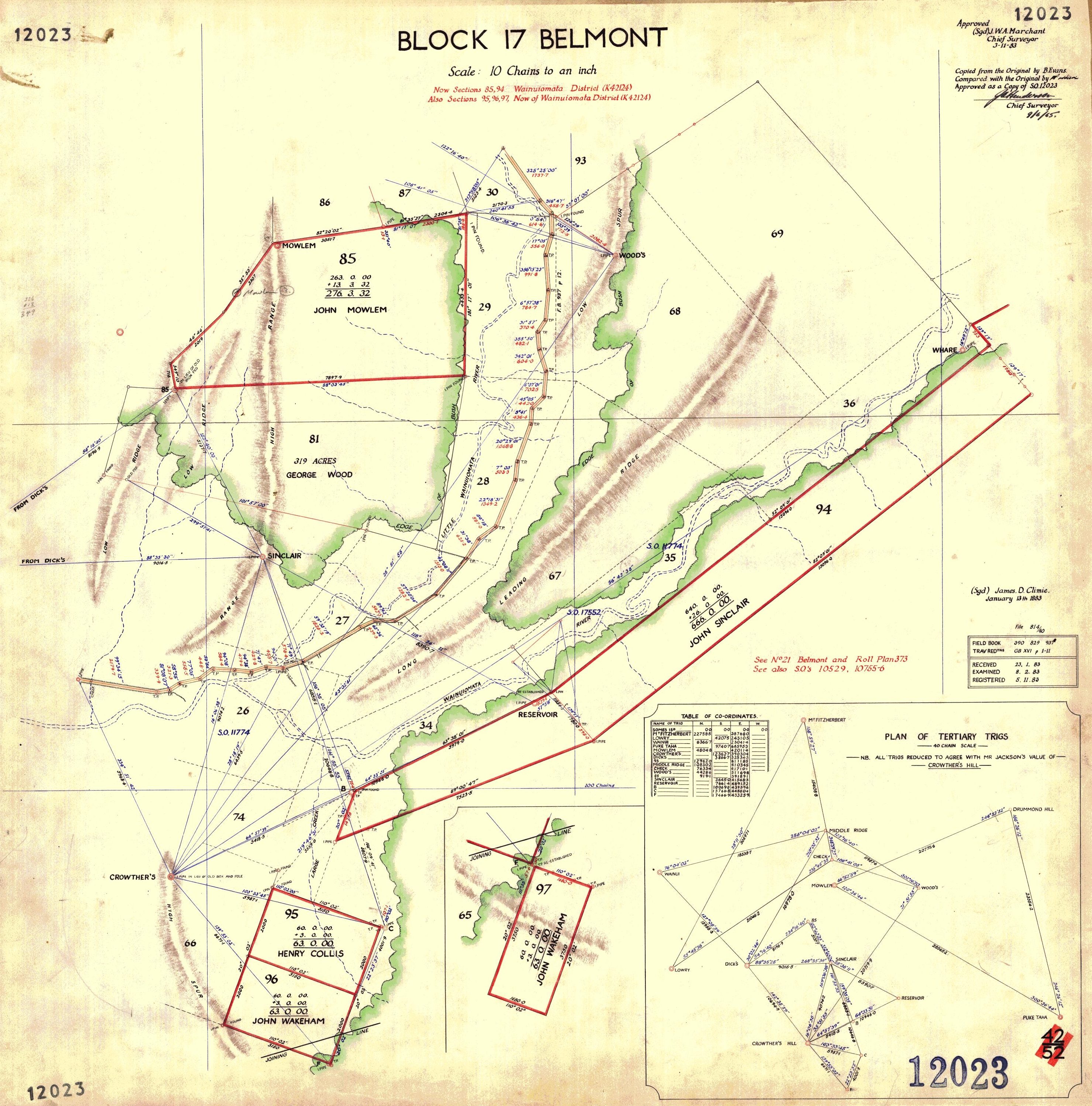
1883 Mowlem and Sinclair Map showing Moores Valley and Reservoir Valley
This map (Block 17 Belmont) made on the 9th of June, 1963 is an approved copy of a map by chief surveyor (Sgd) J.W.A Marchant and (Sgd) James.D.Clime. It shows sections in the Homedale area, Moores Valley, and Sinclair Valley (Reservoir Valley).
Special thanks to Jeremy Foster for sourcing this document.
BLOCK 17 BELMONT
Scale: 10 Chains to an Inch
The survey plan is numbered:
12023
The original survey plan is recorded as SO 12023, Block XVII Belmont, and dates from January 1883. It covers Moore’s Valley and Sinclair/Reservoir Valley and shows the sawmill/tramway area. (NZ Pictures)
Main names and labels on the map
MOWLEM
JOHN MOWLEM
WOODS
GEORGE WOOD
SINCLAIR
JOHN SINCLAIR
CROWTHER’S
HENRY COLLIS
JOHN WAKEHAM
WHARE
RESERVOIR
WHITEMAN’S
There is also a label on the western side which appears to read:
PROUSE DICK’S
The surviving survey field-book index confirms that the work associated with this map included John Mowlem, George Wood, John Sinclair, H. Collis, John Wakeham and Crowther, as well as Whiteman’s Saddle Road. (NZ Pictures)
Bottom-right survey information
(Sgd) James D. Climie
The small box below contains administrative entries headed approximately:
FIELD BOOK
TRAVERSE
RECORD
EXAMINED
REGISTERED
The individual numbers and initials are too small for me to transcribe confidently.
PLAN OF TERTIARY TRIGS
SCALE
There is a note beneath this which appears to say that the trig stations have been reduced to Crowther’s Hill, but the smaller wording is not sharp enough for me to guarantee the exact transcription.
Top-right approval
The original approval appears to read:
Approved
(Sgd) J. W. A. Marchant
Chief Surveyor
Below that is later wording indicating that this is a copy of the original survey plan, followed by:
Approved as a Copy of S.O. 12023
Chief Surveyor
The later copy appears to be dated 9/6/63, which matches the information here.




)