
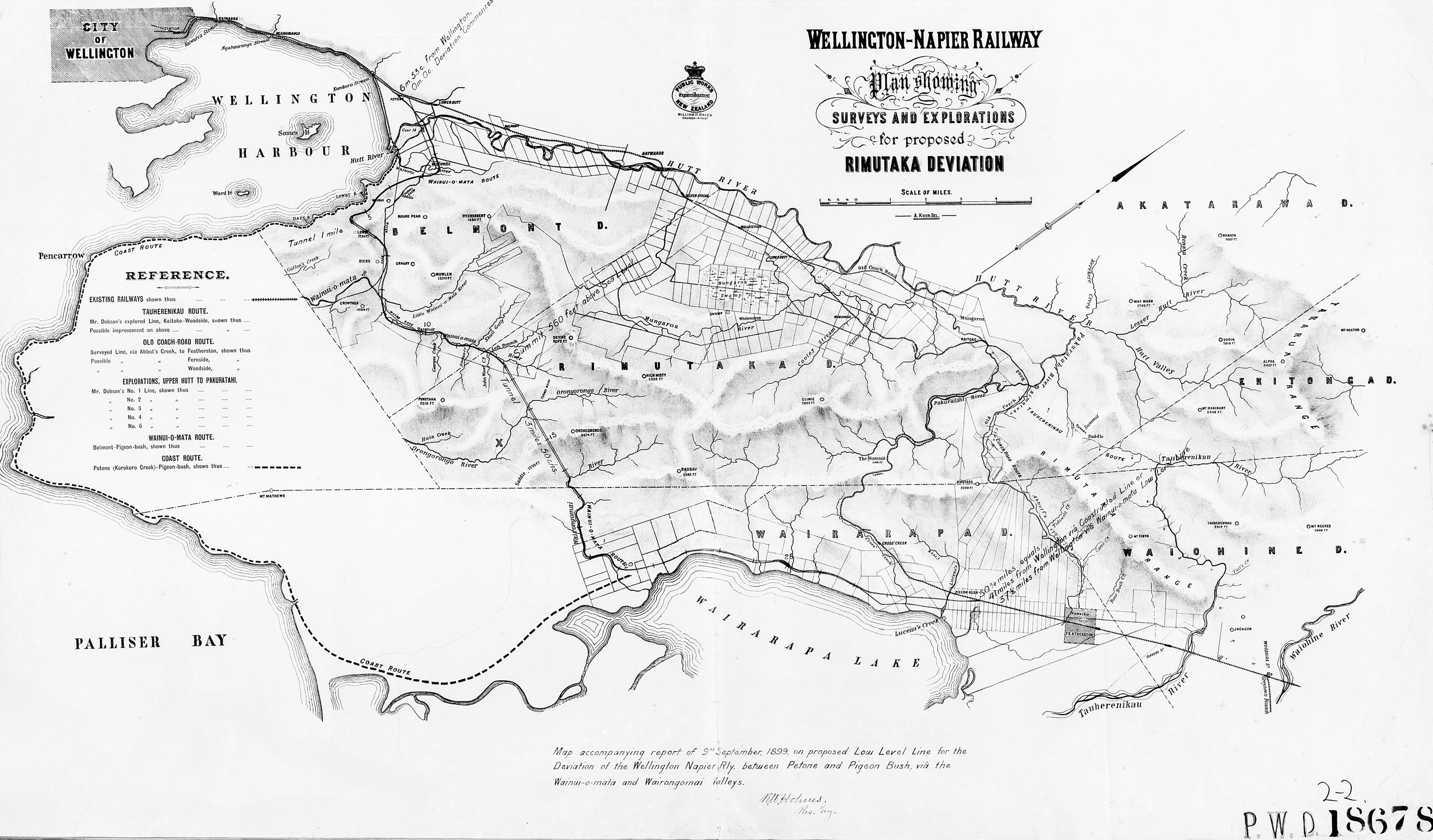
Map (9th September 1899) showing the deviation of the Wellington Napier Railway via Wainuiomata and Wairongomai Valley. This deviation never materialised and instead the route went over the Rimutaka Incline.
WELLINGTON – NAPIER RAILWAY
PLAN SHOWING SURVEYS AND EXPLORATIONS
FOR PROPOSED RIMUTAKA DEVIATION
The main place and feature names shown include:
Petone
Lower Hutt
Belmont
Lowry Bay
Wainui-o-mata
Wainui-o-mata River
Orongorongo River
Wairongomai River
Lake Wairarapa
Pigeon Bush
Featherston
Woodside
Cross Creek
Rimutaka Range
The map relates to the route described in the accompanying 1899 Public Works report as:
WELLINGTON-NAPIER RAILWAY
PROPOSED DEVIATION BETWEEN PETONE AND PIGEON BUSH VIA WAINUI-O-MATA – LOW-LEVEL LINE
Public Works Department, Wellington, 9th September, 1899. (Papers Past)




