
East of Nikau Creek, I met a special guest whose presence added a touch of enchantment.
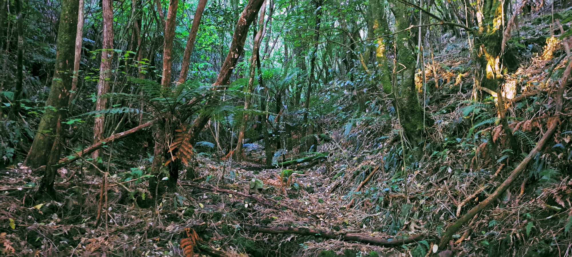
With one and a half hours up my sleeve, I headed to Hine Road Recreation Area to finish exploring Nikau Valley and surrounds. I headed for Nikau Creek Track then crossed over Nikau Creek to explore a plateau that runs along the creek’s eastern bank. Part of this area was supposedly a firebreak decades ago, so the vegetation here should be in a state of regeneration, making for a nice walk among the younger trees and plants.
 Walking through the forest here was pleasant. Isolated enough to feel like you were the only person on the planet, but close enough to the main track to be back in civilisation and within 20 minutes of KFC (joke – laugh now). This was perfect as I had limited time and it meant I could head out and be back in my car fairly quickly.
The flat plateau with forest and old firebreak eventually ended when Nikau Creek crossed over and ran along the flank of the eastern hill of the valley. The creek however meandered through the valley, so it flowed a little more to the western side at times, opening up the eastern plateau again and again.
 I eventually came to a feeder stream that flowed down a steep ravine, that split the eastern slope, and I ventured up the dry stream bed for a little and decided to head back when the going got a bit tough. In fact, I was sure that I had on another occasion seen this ravine from the top of the hillside, but I didn’t walk down on that occasion. So I had seen the top and the bottom of this small ravine and stream, but the middle was a mystery. I’ll make a prediction though. More bush and a stream flowing down a steep gradient.
Returning to the plateau, I opted to cross Nikau Creek and proceed along Nikau Creek Track. Once there, I chose to go off track and veer up the western valley flank near the head of the track and descended down the slope that connects with Gums Loop Walk, before the track passes Top Pool. During this time, a peculiar bird swooped past my head, then repeated the action minutes later. Subsequently, it perched on a distant branch, revealing its substantial size and plump build, yet defying easy identification from a distance. It appeared larger than a tui or blackbird, but smaller than a kererū. Emerging onto Gums Loop Walk, I found the bird calmly seated on a branch beside the track, affording me the opportunity to approach closely for photographs. While sparrows typically accompany me on these bush bash excursions, encountering this bird was a surprise departure from the norm.
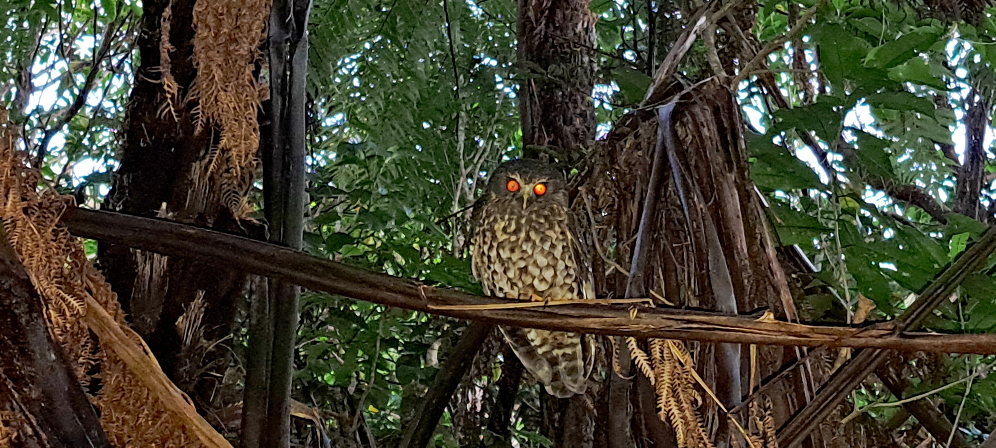 Close enough for identification, I could see it was an owl. A morepork (ruru) to be precise. This chilled critter of the forest had no qualms about me using the flash, as daylight was dwindling into dusk. I had only ever seen a morepork in the wild once before and that was a whopping 50 years ago or so, when as a kid I would explore the pine forest behind Sunny Grove.
 Afterward, I departed, then hopped into the car, and pulled into the car park at the peak of Wainuiomata Road to snap some last minute aerial photos to conclude another enjoyable adventure. While it might have been a bit more ordinary on the adventure scale, considering I was traversing familiar terrain from past hikes, with no traces of ancient civilizations or the like, the encounter with the morepork rendered it memorable. Naturally, I felt appreciative of the stunning natural surroundings and the physical activity it afforded as well.


