
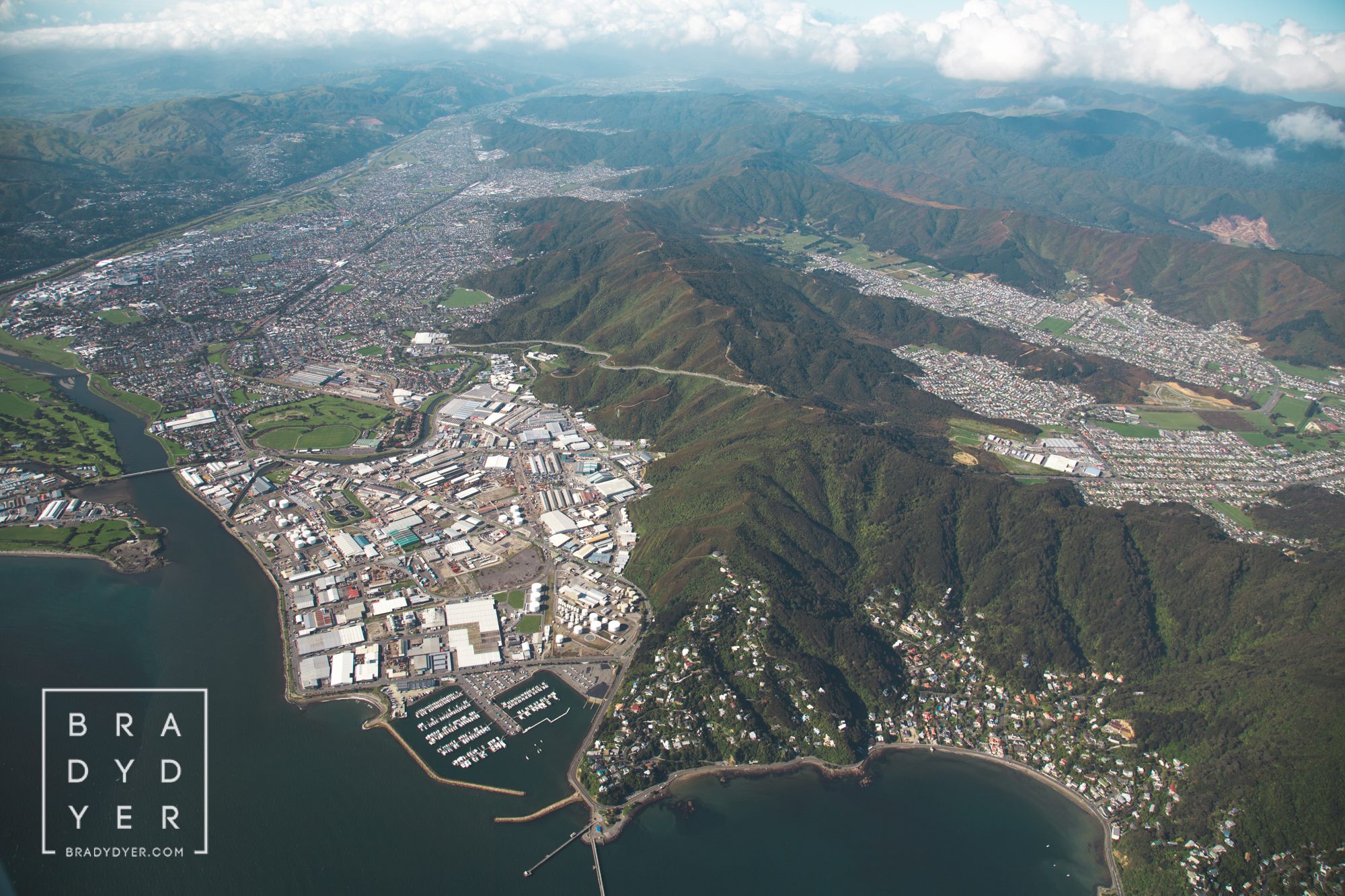
The Pukeatua Range, also known as the Wainuiomata Hill Road, runs through the centre of the image, revealing the full stretch of the Hutt side of Wainuiomata Road. This range forms the natural divide between Wainuiomata and the Hutt Valley, with Wainuiomata visible to the right. Much of Wainuiomata lies close to 100 metres above sea level; the flat land that now forms the township was once a wet, boggy swamp about 150 years ago.
SEARCH
TIMELINE
WAINUIOMATA TOURS
Step into the wilderness of Wainuiomata and experience it for yourself. Learn more →.
WAINUIOMATA MUSEUM
Located in Wainuiomata Primary School, it is open 2pm-4pm every Sunday. Learn more →.
DISCUSSION
- David Johnson on Ōrongorongo Bridge
- Richard Witheford-Smith on Ōrongorongo Bridge
- David Johnson on Glenhill in Wainuiomata
- Barbara Caudwell on Glenhill in Wainuiomata
- David Johnson on Wainuiomata Sewerage Plant Decommissioning
BUY ME A COFFEE
Pages
- Wainuiomata
- History
- General History
- Historic Sites
- Hidden Sites
- Kittyhawk Plane Wreckage
- Skerretts Creek Water Catchment
- Water Race
- Colemans Tunnel
- Waiwhetu Tunnel
- Wainuiomata Tunnel
- Sinclair’s Tunnel
- Black Creek Tunnel
- Old O-K Venturi Meter House
- Scour Pipe
- Earth Bridge
- Earth Bridge Drainage Pipe
- Power Generator
- Horse Powered Log Arch Cart
- Scout / Pearson Hut
- Workers Huts or Camp
- The Black House
- Infrastructure
- Roads
- Buildings
- Industries
- Notable People
- Land Holdings
- Reserves
- Walks
- Rivers
- Waterworks
- About
- Contact
Recent Articles
Subjects
Artefacts
Bridges
Buildings
Bush
Bush Bashing
Cars
Coastline
Coleman's Tunnel
Dams
Deaths
Farming
Floods
Homes
Housing
Huts
Kittyhawk
Land
Logging
Lower Dam
Morton Dam
Mountains
Newspaper
Oakes
Orongorongo Catchment
Orongorongo Pipeline
Orongorongo Tunnel
People
Pipeline
Prospecting
Reserves & Parks
Rivers
Roads
Semple’s Camp
Shops
Sinclair
Streets
Tracks
Tramways
Trees
Tunnels
Venturi Meter
Walks
Waterfalls
Water Race
Waterworks



