The day had come to uncover the remains of the Kittyhawk, an aircraft that crashed in 1943.
This expedition had been my most anticipated trip, yet various obstacles continually impeded my plans. Initially, it was the absence of suitable footwear, then an injured foot hindered my progress. Subsequent engagements like football in the weekends, or weekends with some rain in the forecast, further delayed my endeavour. However, after persevering through these challenges, the moment finally arrived when everything fell into place. I had a green light to proceed.
On a positive note, the delay gave me time to do more research. I’d already received information on various locations containing wreckage remnants from a knowledgeable source. This would significantly help me locate the wreckage sites. It was merely a matter of adhering to the instructions provided to discover the wreckage. However, I often like to approach things from a different angle, as sticking to the beaten path often yields nothing new. My unconventional approach involved not only visiting the known sites I had been informed about, in order to see the known wreckage sites for myself, but to also venture off to areas less traversed, to see if I could discover anything new.
 Now it was just a matter of choosing to whether to ascend from the valley floor or come down from the ridgeline above. Opting for the latter, I had two compelling reasons for this decision. Firstly, during a prior bush expedition (referred to as “bush bash 3“), I had already ventured halfway up the creek and located the Kittyhawk’s engine and I didn’t really want to repeat that.
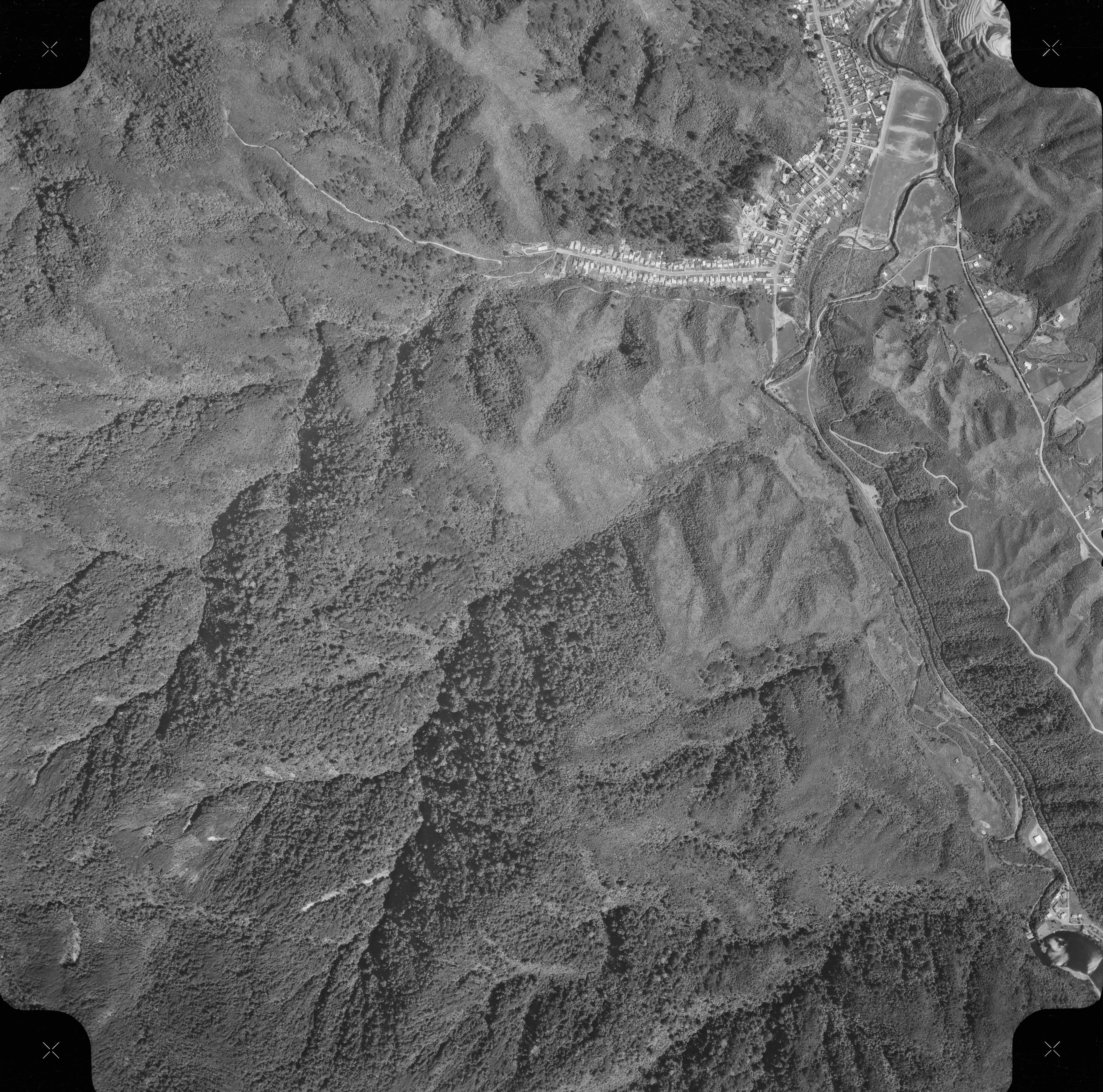 The other reason for coming down from the top, had to do with an 1969 aerial photograph. Over the last few months, I had delved into old aerial photographs in hopes of uncovering inadvertent captures of the crash site. One photo caught my attention, seemingly depicting an aircraft shaped object. Yet, I grappled with the likelihood of pareidolia, where the mind perceives patterns that aren’t truly present, akin to spotting faces in clouds. Despite initial skepticism, upon closer inspection, the object bore more semblance to an aircraft the more I looked at it, with circular shapes resembling wheels being placed atop the wreck, and with the direction of the outline of the plane aligning with the presumed trajectory of a plane ascending the hill. Admittedly, it still required a significant leap of imagination to draw such a conclusion, one that would most likely be dismiss in a court of law. Nonetheless, I felt compelled to investigate this location given that there was not much else to go on, even if it contradicted the conventional narrative established by previous researchers regarding the crash site. Hence, I opted for the top-down approach, as it offered a quicker route to the site and facilitated easier navigation, given its proximity to the ridgeline’s summit.
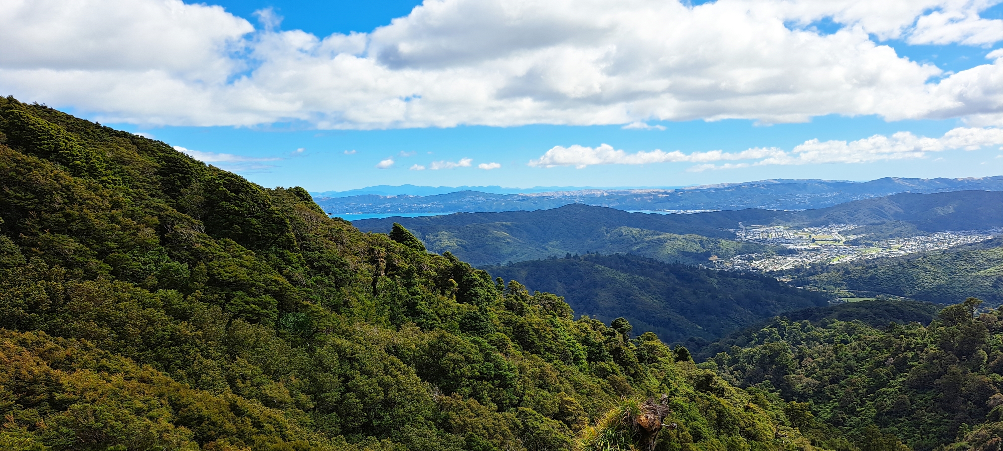
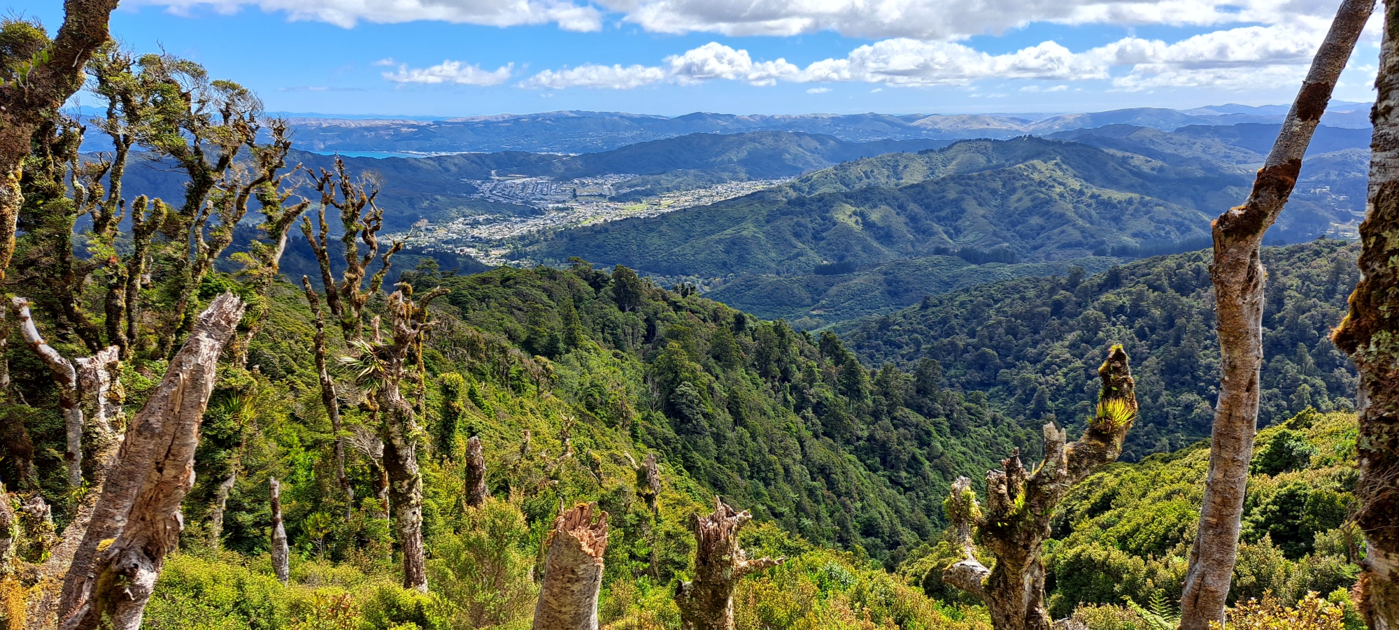 So I took off to Wainuiomata, driving towards the untamed wilderness behind Sunny Grove. I parked the car and then began my ascent up the hill to the ridgeline, following well-trodden walking tracks. Despite the estimated 1.5-hour hike to the top, the allure of picturesque views and the enchanting lush forest compelled me to pause numerous times for captivating photographic moments, with radiant sunlight at my back and under a blue sky. Upon capturing the views, it was time to begin my descent down the ridgeline, where the real adventure lay before me.
 I initially descended down an area of low scrub that could indicate the crash site and ensuing fire. The vegetation here was obviously not as lush and as old as the surrounding area for a reason. However, another reason for this vegetation type could be that the area is exposed and gets hit with strong winds, but that also backs up the accounts where the plane hit a downdraft. There was one potential problem with this area being the site though. There are other areas like this, one being above Nikau Valley for example. It’s probably true that exposed steep areas near the ridgeline do not favour the growth of large trees and might not have anything to do with an airplane crash and fire. Regardless, this low growth area above Skerretts Creek is where most people descend, given that you also have a view. So that was my cue to take a different path in order to find something new. I decided to turn around and go back to the ridgeline, then descend down through the forest instead. This was also closer to the site that I wanted to investigate and it was indeed easier to walk through the lush forest than it was to make one’s way through thick low bushes that scratch you as you pass through.
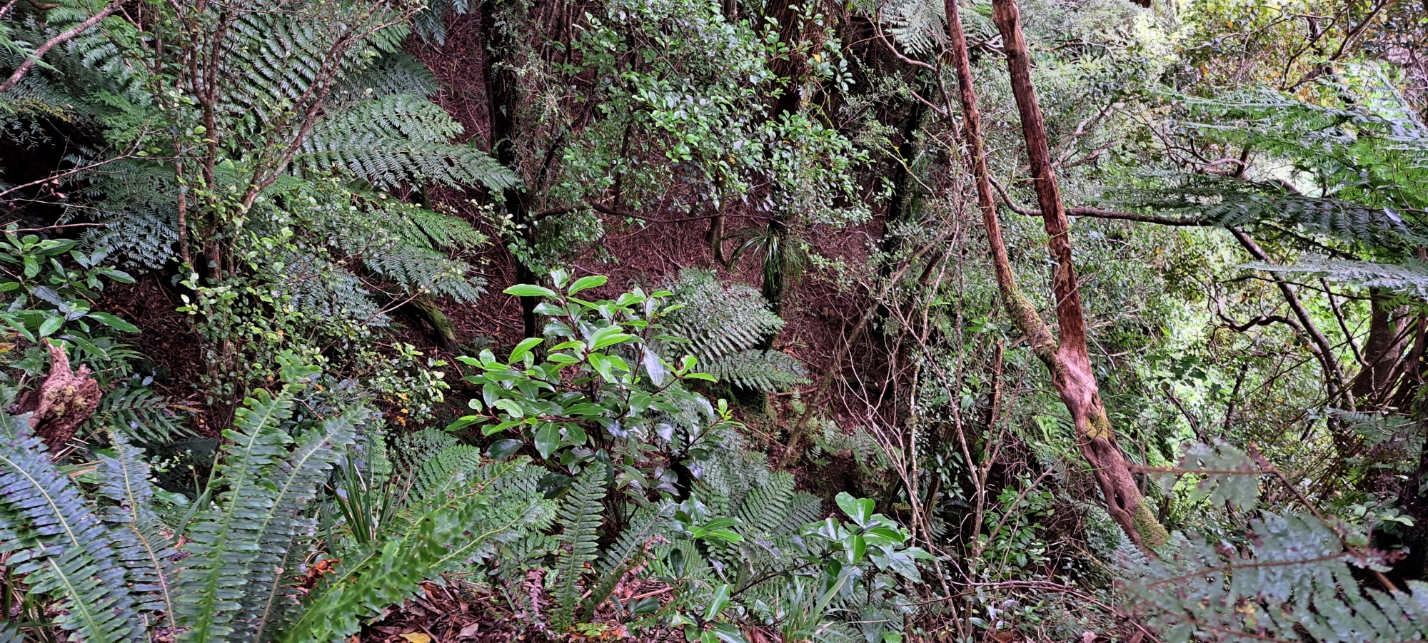
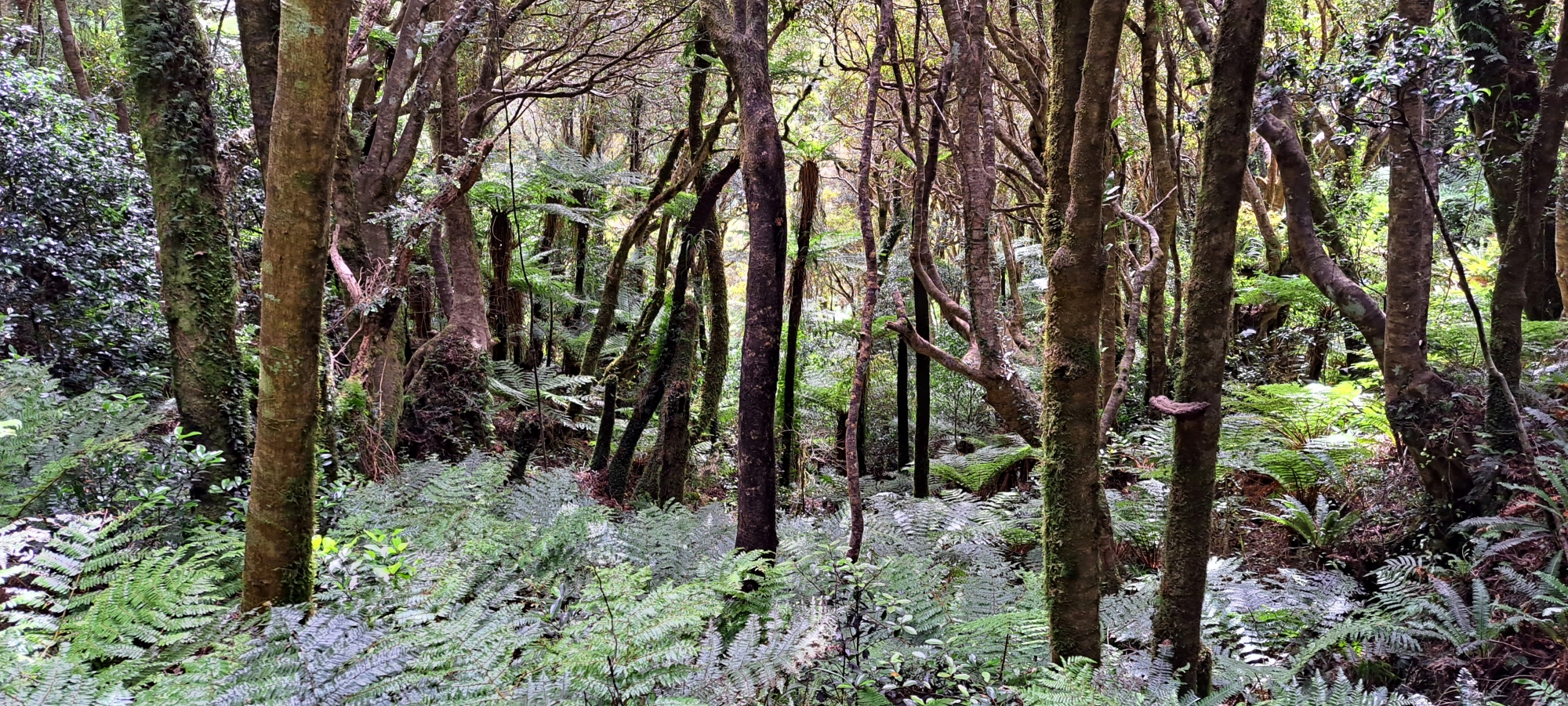 The forest was beautiful, and I had to take some photos here too, but the ease of passage was too good to be true. I came across my first stumbling block, a steep cliff face that was impossible to descend without ropes and climbing experience. So I had no option but to walk along the cliff as it couldn’t go on forever. But which way? I chose the direction that took me the closest to the site of course, despite seeing a way down in the distance in the other direction. Eventually the cliff angle reduced its gradient, allowing me to climb down a little bit where trees had clearly slipped down the cliff face. Obviously there was the worry that the area could slip again, but the fallen trees were still living and had dug their roots into the soil from their new positions, which was a good sign. I then headed toward the site.
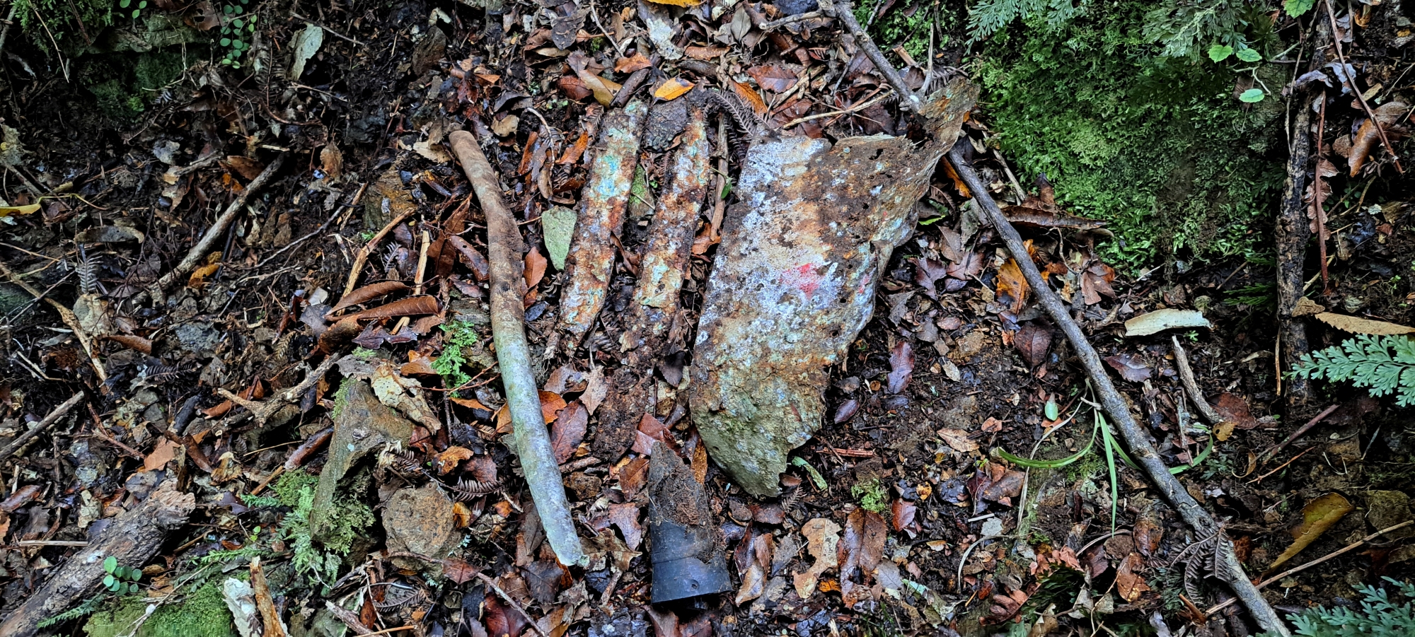
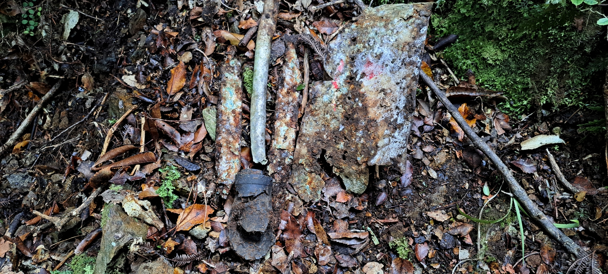 As I approached the site, a short distance away and further up from my earlier position, my attention was drawn to what seemed to be a small rubber or plastic pipe or perhaps a small black cylinder-shaped cap of some kind. Clearly man-made, its origin remained uncertain. Was it a component of the plane or had it tumbled down from a walking track above the ridgeline? Determining this proved challenging at this stage. Nevertheless, I decided to investigate further, by approaching the object then picking it up. I then proceeded to scrape loose leaves, sticks, and small rocks around that area. Before long, I uncovered an aluminum rod, followed by two long and flat pieces of metal with blotches of blue colouring. Continuing on, I found a metal sheet adorned with small blotches of red coloring and featuring uniformly punched holes down its middle. There was no mistaking it. This had to be part of the plane wreckage, and it was precisely where I suspected it might be, aligning perfectly with the location depicted in the old 1969 aerial photograph.
 I didn’t conduct an exhaustive search of this small area due to the numerous tasks required to reach other sites and with the afternoon advancing, I couldn’t afford to delay any longer. After about 10 minutes of finding nothing else, I opted to depart and proceed down the valley, confident that I could revisit to explore the area more thoroughly at a later time. Nonetheless, I felt content with the find, as it confirmed the presence of the plane at this location at some point. Now, the crucial question remained: was it the crash site, had the plane slid down to this spot from a crash site further up, or was this the impact site with the possibility of the plane carving a path up the hill from there? This intriguing puzzle would undoubtedly necessitate further investigation on another occasion.
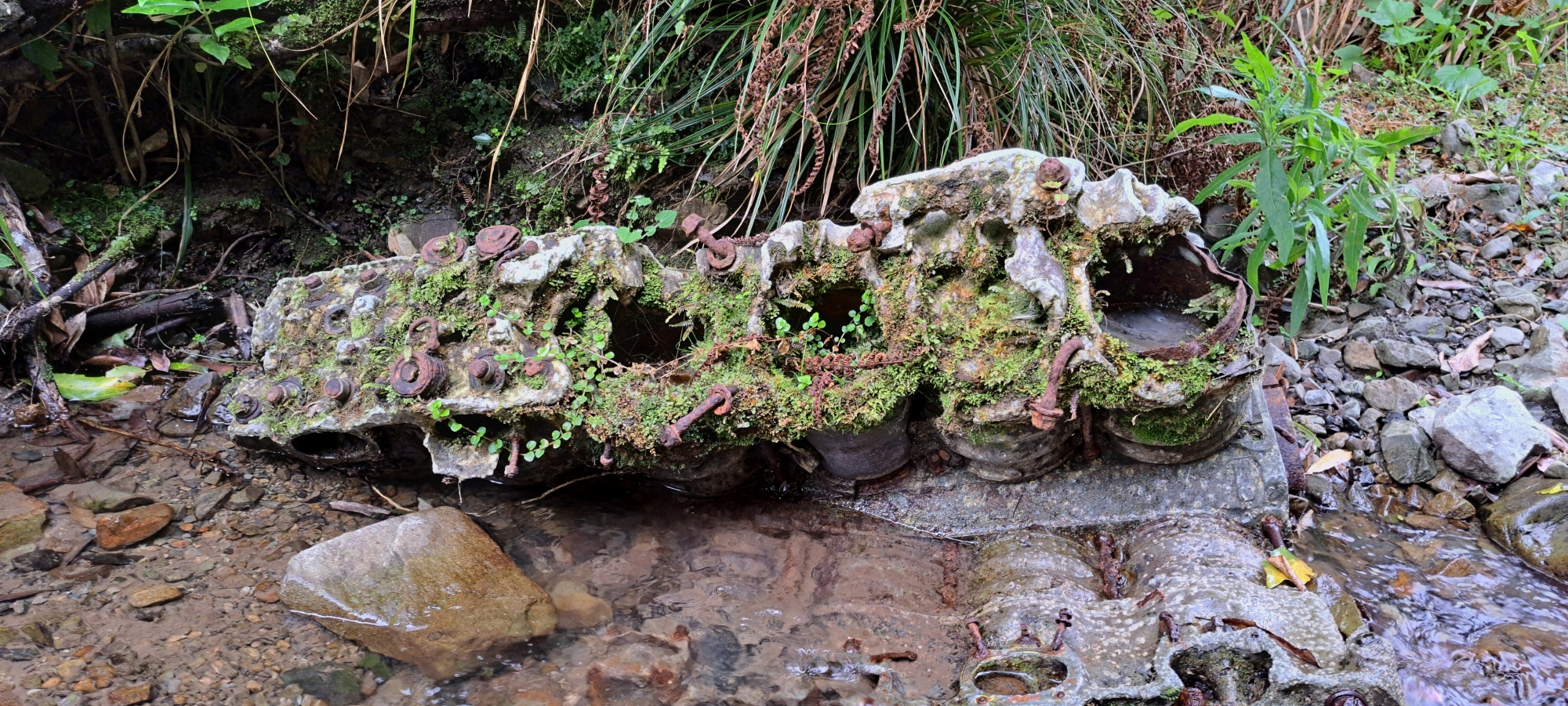
 As I descended down the hill before me the rest of the way, I was able to locate the other wreckage sites, including the fuselage, mounts, landing gear, tank, propellor, and of course the engine. But it was no walk in the park. I had to descend three waterfalls with the first one being IMO classified as dangerous. I had to scale the wall of a ravine at one point with nothing to hold onto. If I slipped at that small section, I would have slid into the river below. I don’t like taking these kinds of risk as it is really a numbers game and I don’t like gambling with my life, even if the odds are in my favour. But it was either scale down the waterfall or go all the way back up the mountainside. I can tell you that I will probably not do this part again. Either I will find a safer way around this obstacle or go down as far as the top of this waterfall and return, or ascend up to the bottom of this waterfall from below and return.
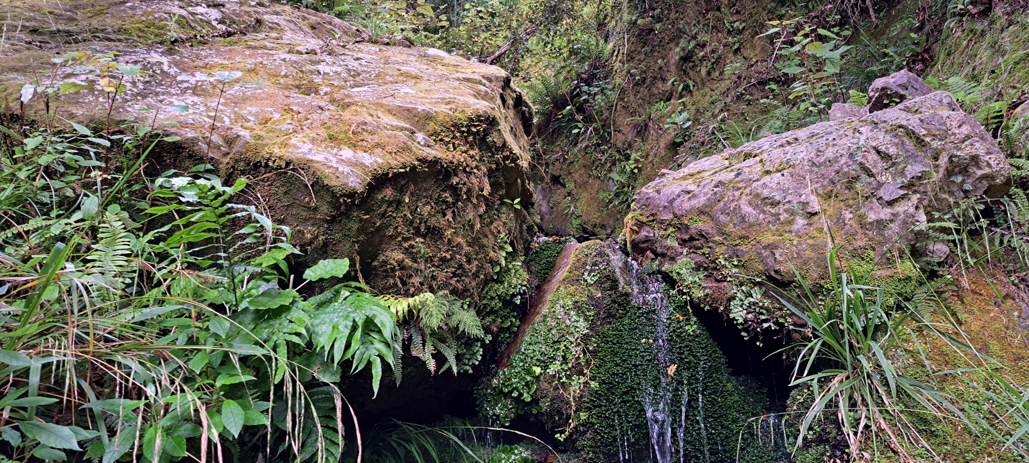 After that, there was a second waterfall that was also slippery and could end in injury, but there was vegetation around the ravine wall that you could anchor yourself onto. Finally a third waterfall that was easy, but I had slipped down this on my first trip (bush bash 3) when going up the creek, so I still needed to be careful. At last I was at the bottom of the valley and the creek passed through more open country. I could relax a bit more, but then it happened. I stepped onto a boulder and slipped on my arse. Ouch! Got a bruise now. Lesson learned. Always keep your focus.
Eventually I hit the walking track and was back out at Sunny Grove no later than 6pm. All up, I was happy with the day’s venture. I got some reasonable exercise, some good photographs, and a bruise on my butt. What more could you wish for? Maybe a cold beer.
Special thanks to Tony Weir and Lance Stewart for information on the wreckage sites.


