A short bush bash today led to the discovery of a small piece of local history.
Today was never going to be a big adventure, as I only had few hours and needed to stay in phone contact. That significantly limited my options, so I decided to revisit a site that I felt could hold more discoveries, as I had never fully explored the terrain there. The site in question is the scour pipe area.
At this site, several features have been identified. There is an earth bridge designed to protect the old water pipe from the old dam which use to allow vehicles to pass above. Nearby, a scour pipe branches off the old Ōrongorongo pipeline, accompanied by a set of large cogs that likely controlled a valve for that pipe. There is also the track that leads to these locations. Additionally, the site features a dug-out trench with no definitive explanation.
Anyway, I began my exploration at the old track leading to the scour pipe. From this point forward, for clarity, I will refer to this track as Scour Pipe Track. Before reaching the top, where the scour pipe is located, I noticed a much smaller track branching off back down the hill, one I had not noticed before. I only spotted it because I was scanning for new ground to cover. Curious, I decided to follow it.
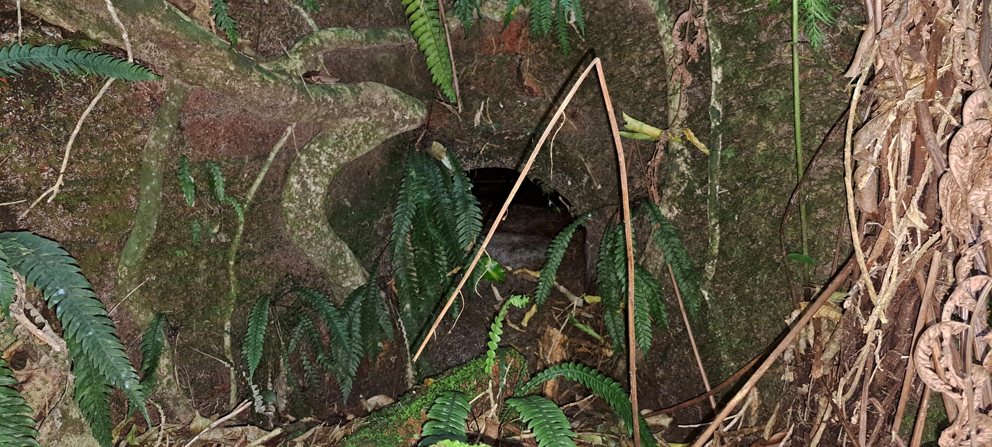
As I descended, I chose to walk in a straight line through the bush near the bottom of the slope to see if anything lay hidden. It wasn’t long before I reached a small stream. Nearby, I spotted a pipe emerging from the same slope I had just descended. On closer inspection, I discovered a collapsed brick facade in front of the pipe.
It took little imagination to connect this pipe to the earth bridge, which I assumed lay directly above but out of sight. It seems logical to infer that a drainage pipe was once installed to channel creek water down the hillside toward the earth bridge, preventing it from accumulating behind the wall like a dam. In fact, the area behind the bridge resembles a large pond or small natural pool, as silt has built up and the drainage pipe likely blocked.
I then decided to walk uphill from the pipe to confirm that the earth bridge was directly above it, as I had assumed. However, based on my rough calculations, the pipe’s entrance seemed to be positioned slightly to the left, within the pond area, rather than in the centre, where one would expect if it had originally carried the creek flow under the earth bridge. But back at the pipe’s exit, I noticed that it was placed at an angle, which likely explained the misalignment in my original estimation.
To be certain that the pipe I had found was indeed connected to the bridge, I trekked up and over the western hillside of the pond behind the earth bridge, searching for any other possible connections. As expected, I didn’t come across anything particularly noteworthy. However, I did take a few photos of trees that had fallen down the steep slope yet still had their roots in the ground, causing them to grow outward at unusual angles.
With that out of the way, I followed Scour Pipe Track as far as possible, noticing it extended further than I had previously realised. Some sections were overgrown with supplejack, but it became clear that the track runs below and alongside the abandoned section of Maintenance Road, which I refer to as Maintenance Track. Just before merging with the road track above, it appears to split into two paths before joining again. Perhaps this loop was originally designed to allow wheelbarrows to pass each other while moving up and down the hillside. Along this overgrown track, I also came across several concrete blocks, one of which had a groove carved into it.
So the overall track layout may have served as an access route to not only the scour pipe, but as an entrance to Maintenance Road, where the old pipeline and an old meter hut are located.
It is also important to remember that this entire area was once logged. Workers constructing the early dam pipeline would likely have had a much clearer line of sight, making it easier to plot the pipeline’s route by following the natural contours of the land. Today, however, the dense regenerating bush conceals much of what was once plainly visible.
On my way out of the site, I spotted a bottle mostly buried in the ground, protruding from the roots of a tree. Given how rarely people must pass through this area, coupled with the fact that a tree had grown over it, I assumed it could be quite old. I carefully dug it out and, after wiping off some dirt with my hands, I wasn’t entirely sure of its age as it appeared more modern than other bottles I have found on my adventures. However, I did notice some numbers on the glass that might help with identification.
I plan to give it a proper clean later and share it in a vintage bottle group on Facebook that I recently joined. The group’s knowledgeable members help identify and provide historical insights on old bottles found in New Zealand. I previously posted photos of another bottle I discovered and received some great information, so I’m looking forward to seeing what I can learn about this one, but at this stage, I suspect it is not that old, maybe the 1960s to 80s?
Anyway, it was time to head back to the car. Although this adventure was not an in-depth exploration of an ancient podocarp rainforest or an ascent of a mighty peak, it was rewarding to uncover a small piece of local history.


