Today, I hiked a steep bush-covered slope tangled with supplejack, to discover more sections of the 1880s water race.
Today was never going to be a walk in the park. The terrain I had planned to explore was steep, strewn with loose rocks, and tangled in thick bush, especially the ever-present supplejack vines. I was heading into an area I hadn’t covered before, not far from where, during Bush Bash 41, I discovered a manhole leading into the 1882 water race system. This race once carried water from the old dam to Coleman’s Tunnel nearly 2 km away. The most fascinating part is that hardly anyone even knows this tunnel / pipe / culvert exists as it is buried underground and was abandoned in the year 1902, 123 years ago.
Until today, I knew of four places where this old water race could still be glimpsed, all hidden deep within the forest. But what would I find in this new area?
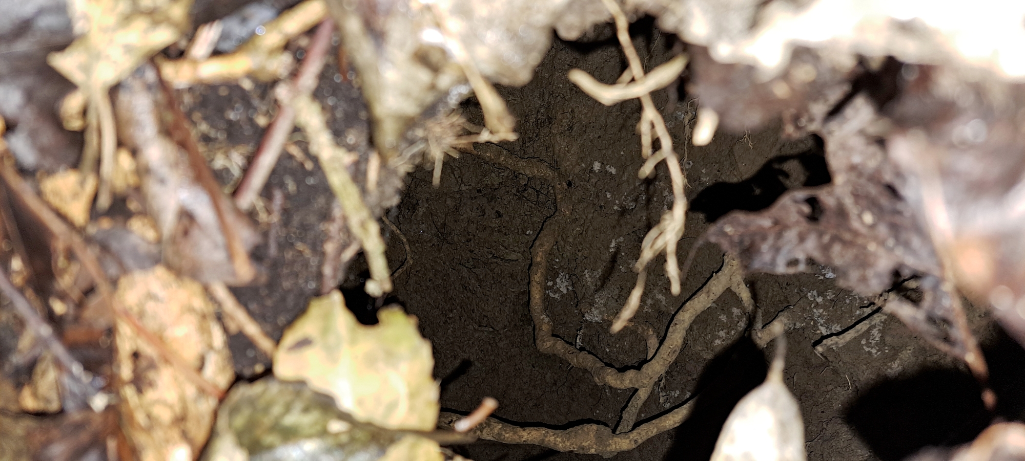
I headed toward a steep slope that levelled out into a small plateau in places, likely the remains of a maintenance track once used to service the water race. As I moved through the area, I spotted something man-made nestled among the low native plants. At first, it looked like a pipe, but as I got closer, I realised it was a curled sheet of iron. I nearly walked straight past it, until I noticed some small gaps next to it, indicating that there was a small opening below. Just beside it was a slightly larger gap, though still too small to fit my hand and phone in to take a photo.
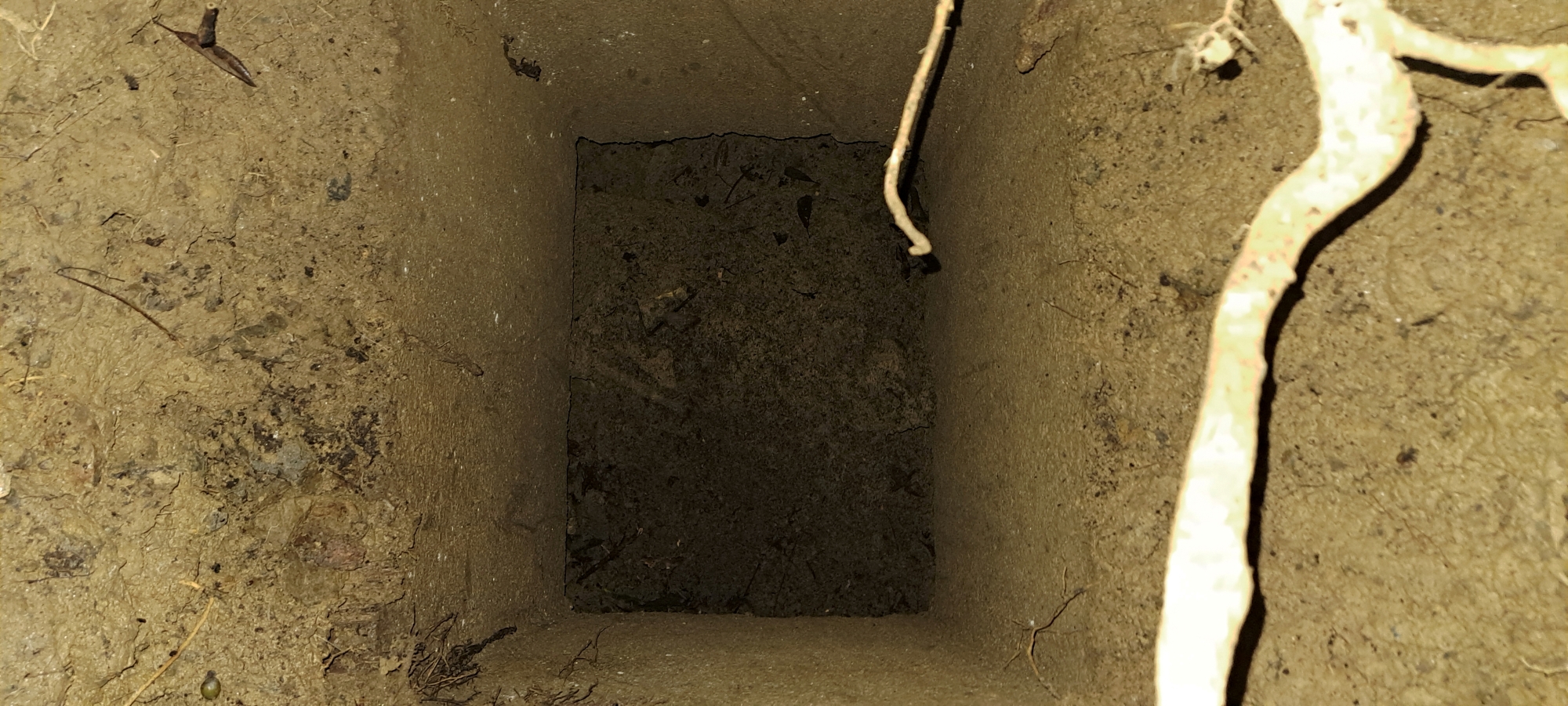 I cleared away some ground vegetation that had spread out like a mat over this small hole to get my phone inside . It was pitch dark inside, so I snapped a photo with the flash on and expected to see nothing but dirt. Instead, what I saw in the phone was another manhole leading directly down to the water race. There was some fallen earth at roof level of the race, but the manhole itself was clear of debri. I removed more ground vegetation around the hole with my hands and then took numerous photos and moved on.
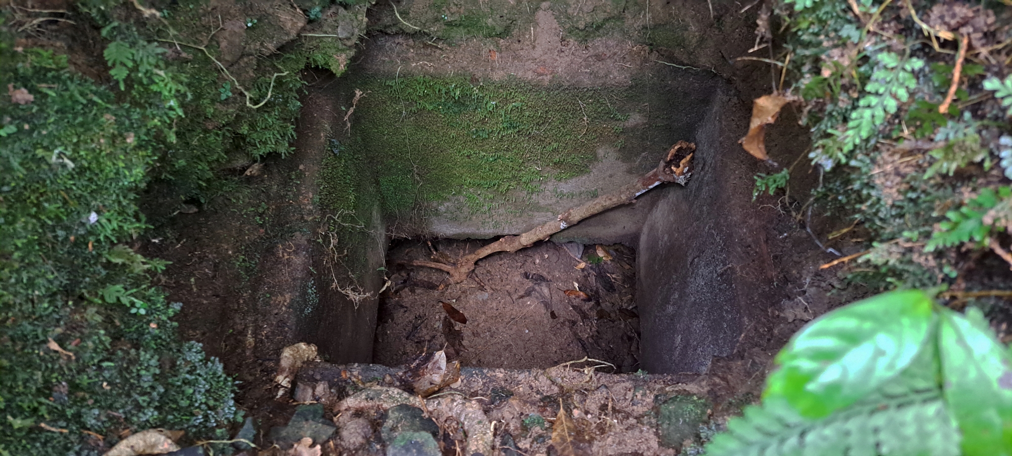
About a hundred strides further on, I came across a larger hole in the ground, which turned out to be another manhole after I again cleared some ground vegetation by hand. Although this one was more accessible, there was a bank of dirt and rocks behind it that looked unstable. It seemed likely that, before long, the bank would collapse into the hole, filling it with debris and burying it for good. I took some photos, then continued on to the edge of the area I had planned to explore today, but found nothing else of particular interest.
I then made my way back to the second manhole and then retracing and counting my steps 100 or so times to arrive at the first manhole, but oddly couldn’t find that one again, despite the piece of iron that had alerted me to that location in the first place. No matter, I’d photographed it, so I had proof. However, I’m sure I’ll be able to find it again if and when I return. There were only two options as to where it would be and it was probably more west as I headed east. But it was getting a bit late by this stage to check out the other direction.
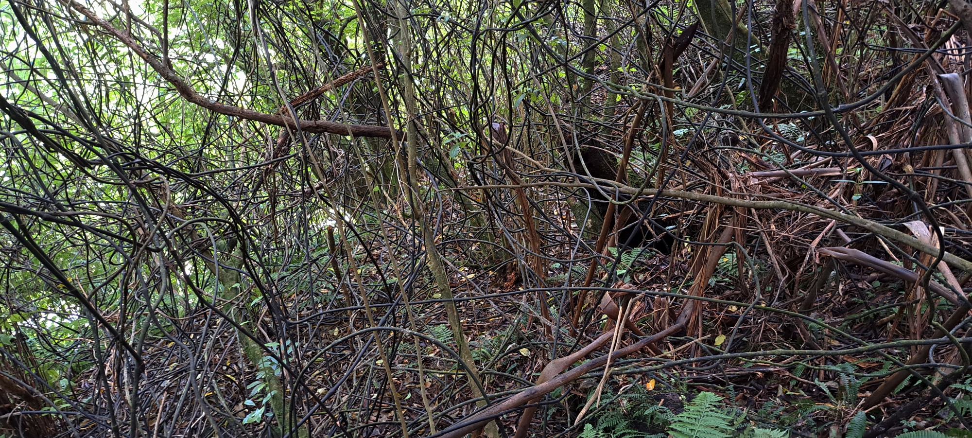 As I headed back to my car, I mentally marked a few more spots I haven’t explored in this general area, ones to check out in the next visit of this area. By the time I reached the car, I was feeling a bit sore and worn out. The vegetation in this area I walked through today was relentless in places, the supplejack vines were everywhere, and the slope was covered in loose rocks. It was a harder trek than I had anticipated.
I returned home now knowing of six locations where this 140-year-old water race is still visible. Despite being buried underground and hidden beneath thick regenerating bush, I had managed to uncover a long-lost relic of early engineering that has been forgotten by time.


