Final Discoveries Along the Water Race and a Bushwalk Behind the Chlorine Plant
Today was about checking out the final area where the water race may have run. A friend had mentioned that part of the water race is visible from Reservoir Road, so I planned to investigate that and decide whether any further exploration of the remaining hillside was needed.
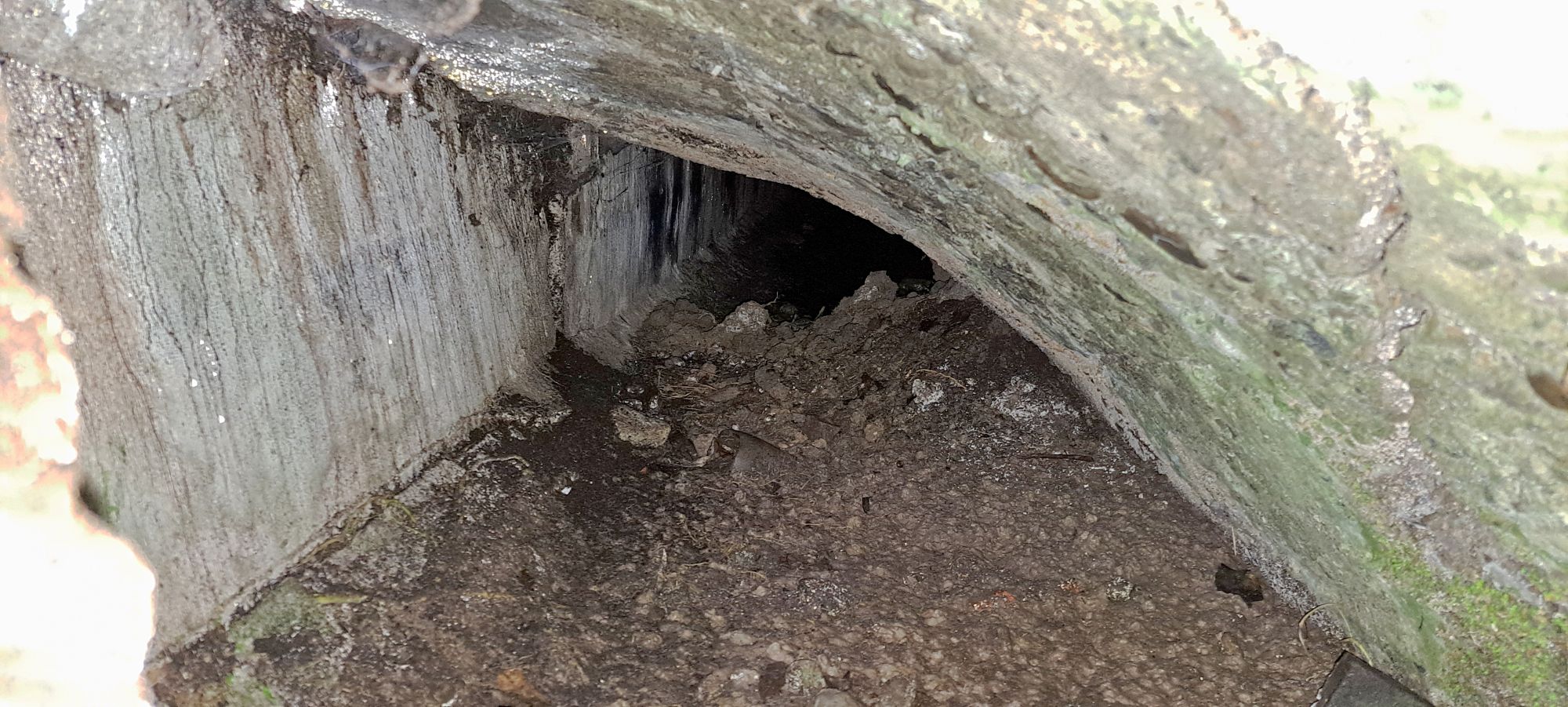
 I parked at the Hine Road Recreation Area car park and decided to get a photo of the Skerretts Creek culvert before heading for Reservoir Road, which is part of the Gums Loop Walk. Onroute, I stopped at Ultimate Pool. But I was heading for the Wainuiomata Chlorine Plant where across the road, you can see the water race running next to the road. A section had collapsed at some stage due to subsidence of the hillside, exposing the interior. I arrived, then photographed the damage and held my phone inside the opening for a few shots. I was also curious about the concrete wall next to it.
I then started to wonder where the race continued. Did it run beneath the road near here, follow alongside it, or take another route entirely? In fact, I suspect this might be the site of a major leak mentioned in a news article dated 28 February 1887, which stated:
“It was apparent that the leak had been caused by a subsidence of the race, under which the outflow of a gully in the hill above finds its way to the riverbed.
A concrete wall had been built at the base of the gully by the contractor, but was apparently inefficient for the purpose.”
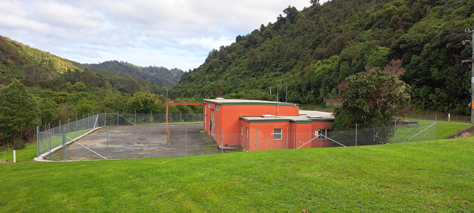
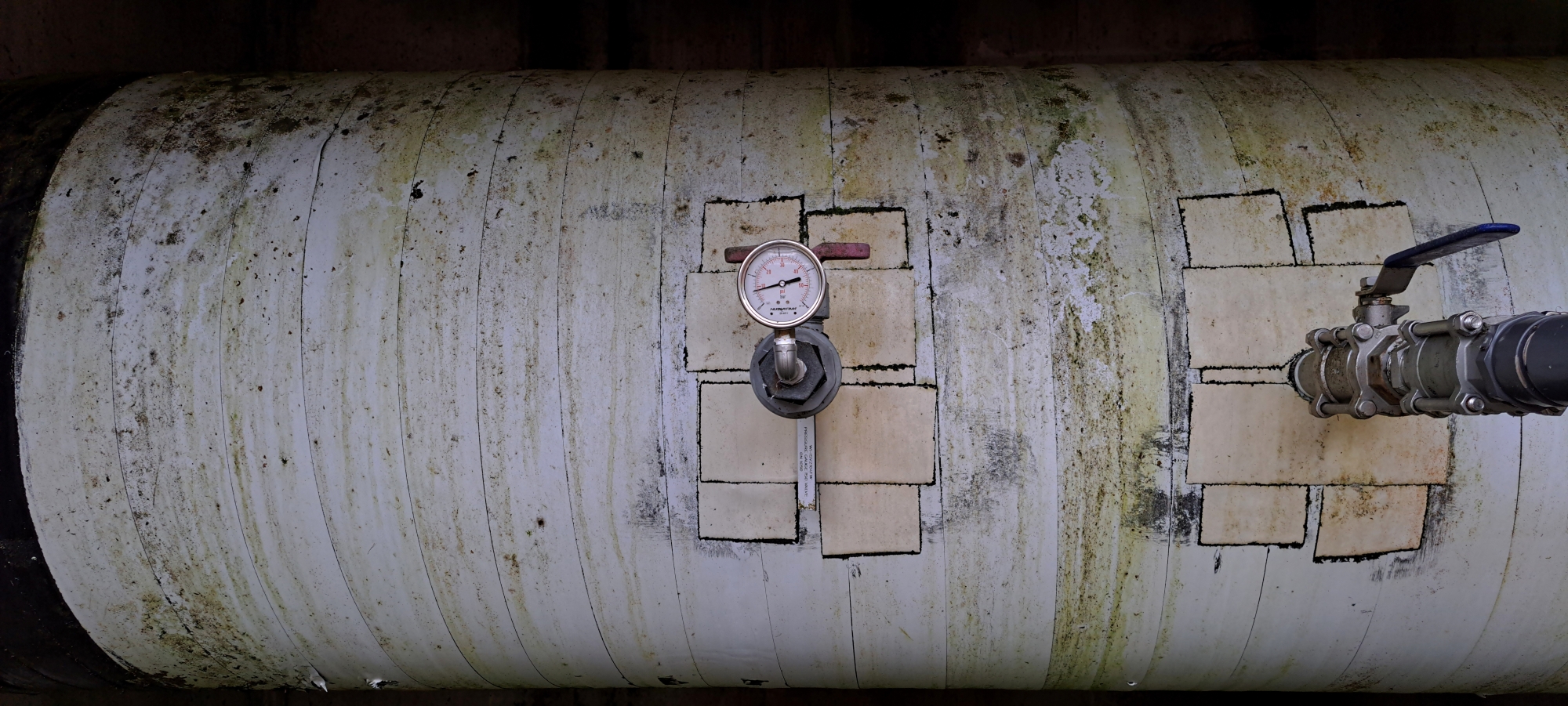 Moving on. I still had most of the day to do more exploration. There was still a small section of hillside I hadn’t explored yet, which might also contain visible remnants of the water race, but I decided to check that out later on my way back. For now, I thought it would be worth venturing into the bush behind the Chlorine Plant. Before doing so, I took a few photos of the plant itself, which now has a security fence. I captured some shots of the main pipe at this site, visible from the outside of two small underground rooms with gates prohibiting access.
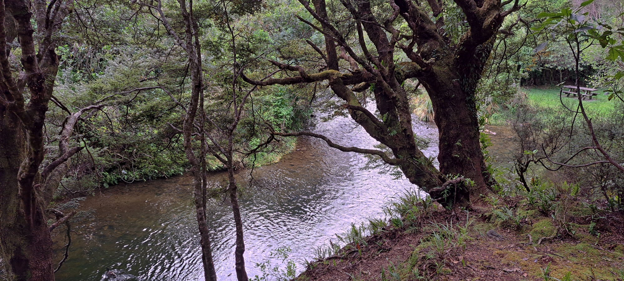
 Now it was time to go bush. Although I’d explored parts of the forest below in the past, I wanted to do a more thorough search. I descended a steep bank to a plateau near the Wainuiomata River. The bush was easy enough to navigate and offered some scenic river views. As I continued, the landscape widened and I spotted several discarded items on the hillside to my left, possibly dating back to around 1964. This was the construction date of the building above and the date is clearly engraved on the building.
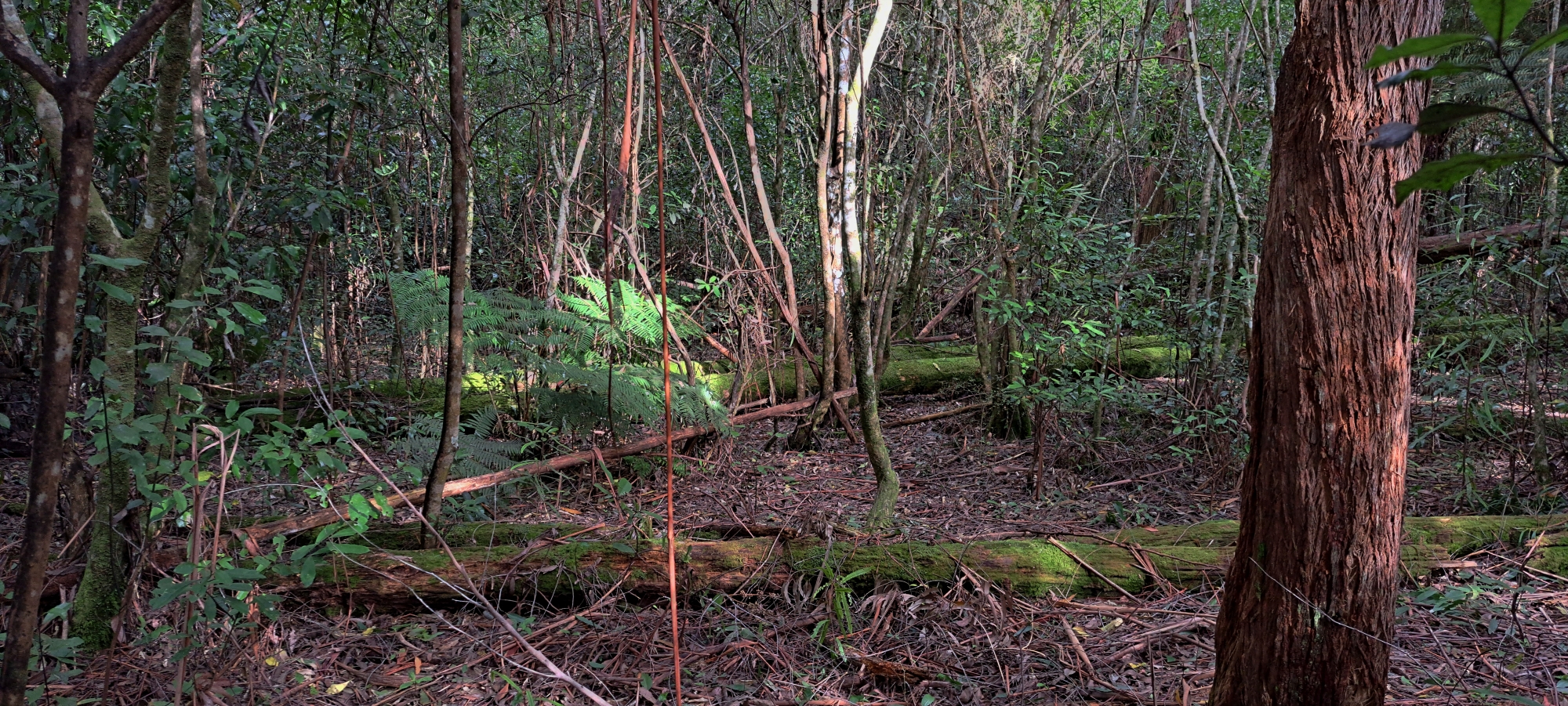
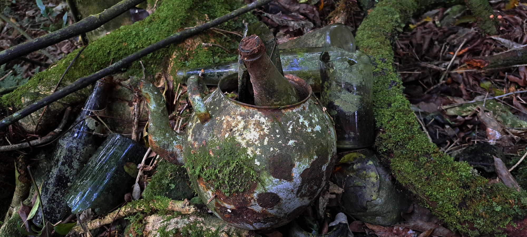 Among the remnants were pieces of cladding, a metal plate with rivet holes, and nearby I found an old teapot, and several bottles. These items could date back further than the 1960s, as the remains of fencing in the area suggest it may once have been used as pastureland before construction of the building. In fact, during an earlier exploration of what appeared to be two old huts on the eastern side of Sledge Track Creek which is closeby, I noticed terraces below that site which resembled old forestry tracks leading down to the Wainuiomata River. On the opposite bank (which is where I was now), I saw low vegetation and patches of grass, very close to the bush area. I had reasoned at the time that this could once have been a route used to haul logs out of Sledge Track Valley and up towards what is now Reservoir Road, which, of course, didn’t exist as a road yet. If that’s the case, the bottles, teapot, and curved metal sheet I found could be even older than first assumed. Interestingly, the metal sheet on the hillside looked very similar to one I had seen near the two old hut sites. When visiting that site with a few people last year, one person suggested that this metal sheet may have been part of a boiler, possibly used to power steam-driven machinery for logging operations.
 Anyway, I eventually made my way back on Reservoir Road and then trekked along the remaining unexplored hillside where the water race was buried. I found nothing but I was happy to have explored this hillside fully. I then went back onto the road and continued toward the swing bridge, deciding to complete the Gums Loop Walk in order to head back to the car. Along the way, I got sidetracked by a small trail leading above Swing Bridge Pool. From there, I bush-bashed through the gum forest and photographed a small stone wall on the riverbank. I then moved away from the river and came across an old forestry track I’d been to before. It’s surprisingly well-preserved for something that’s been abandoned for over a decade.
 Heading deeper into the gum forest, I reached a creek, the largest between Sledge Track Creek and Nikau Valley Creek. As far as I know, it’s unnamed, but it’s a beautiful spot, flowing through a deep, narrow ravine surrounded by native bush. After crossing to the opposite bank, I re-entered the gum forest and emerged at Gums Loop Meadow.
 From there, I followed Gums Loop Walk and took the newly built extension, eventually joining a now abandoned section of the Whakanui Track which has been renamed Sunny Grove Track by some. I walked the section running at the top of the reserve and in my view, this may have once been part of an original forestry route I call Sinclair Track. Along this track is a small path leading down to Sinclair Cemetery which I visited. From there, I returned to the car park and headed home.
All in all, it was a satisfying walk with several smaller objectives completed, and the water race area now thoroughly explored. While it’s possible I’ve missed a few spots where the race may still be visible, I’ve documented six locations where the old 1880s water race can be clearly seen. This historic structure once carried water from the old dam and fed it into the main pipeline supplying Wellington, around 2 kilometres away.
With the water race exploration now complete, it’s time to come up with a new objective.


