A short suburban bush bash offering a light adventure on the fringes of Wainuiomata, blending residential edges with pockets of greenery.
 Today I headed to Wainuiomata to explore some of its wilderness, accompanied by a friend. We began by parking behind the Louise Bilderbeck Hall to check out a new housing development where excavation work had been carried out for the foundations. The site is located just below Dick’s Hill, which sits between Hair Street and the Main Road. This area is home to the main underground water pipe and was once the location of Dick’s Tunnel, built in the early 1880s. The tunnel was decommissioned when the Morton Dam came online and was later sealed and buried. I was curious to see whether the development work might have uncovered any trace of the tunnel. While that seemed unlikely, I hoped at the very least to confirm where the tunnel wasn’t.
After parking near the back of the site, we followed a grassy strip that climbs the hill toward The Village, once home to the old Palliser Hotel. At the top, I spotted a patch of bush I’d been meaning to check out, and this seemed like the ideal moment. My friend, already familiar with the area, was keen to show me an old gate hidden in the bush along a ridge running parallel with Hair Street.
It wasn’t much of a bush bash, more like walking an overgrown track. As we moved along the ridge, glimpses of Hair Street appeared through the trees. We came across old fences, weathered posts, and poles that had likely once held aerials, now partly swallowed by the bush. Further along, we found a rope swing hanging from a beech tree. The properties on this side of Hair Street extend right up the hill, offering kids the perfect space to build forts and swings. We even saw wooden steps nailed into trees, evidence of the kind of outdoor adventures my generation used to enjoy, before Xbox and PlayStation took over.
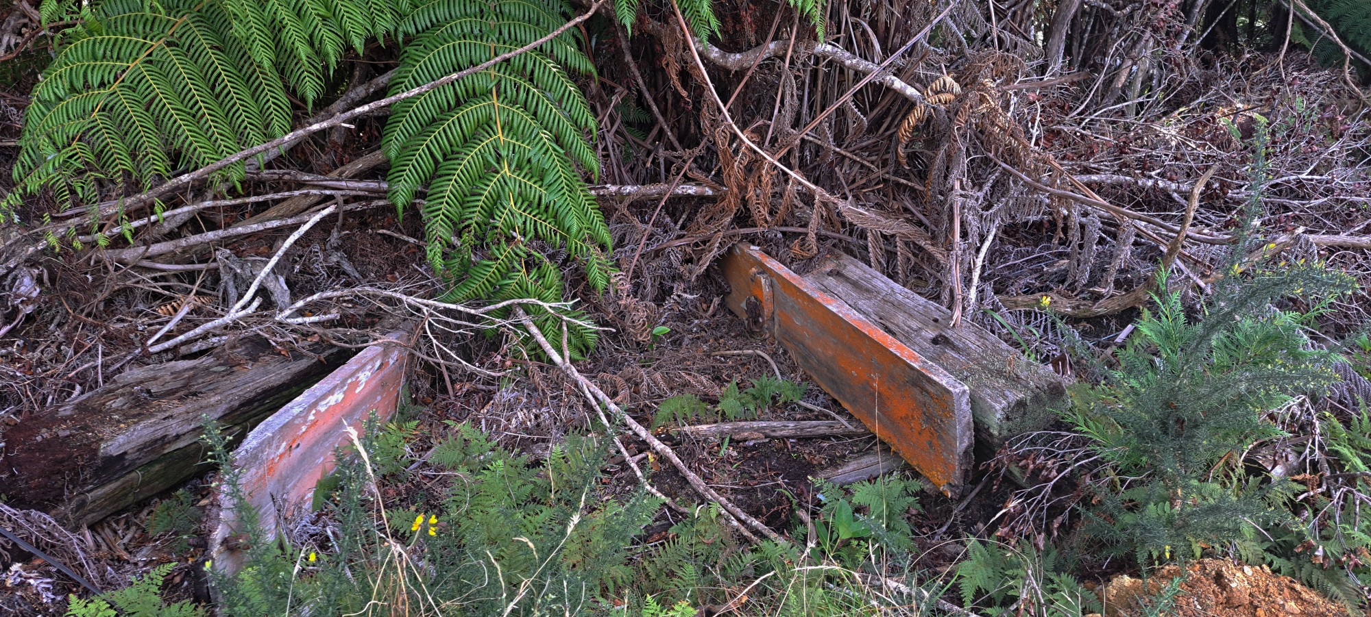 Eventually, we reached a spot overlooking what we thought was the end of Hair Street, only to realise we’d missed the gate. On our way back, we found it. The area had been bulldozed by a landowner, and the gate’s wooden frame now lay discarded in the undergrowth. Further on, we stopped at a few vantage points looking west, and noticed what appeared to be a school nestled below the next ridge. (We later drove by and confirmed it was a school.)
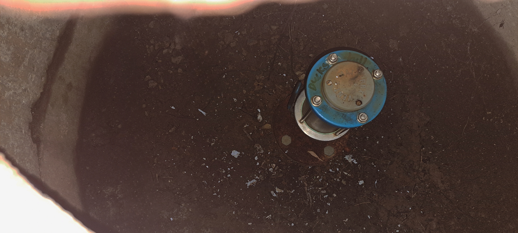 Back on the grassy strip, we crossed over to take a closer look at the progress made on the Pakura Place housing development. Near the end of our walk, we came across a manhole cover that was slightly ajar. I snapped a photo of the air vent inside. Written on it were the words “Duck’s Hill,” which I assume was a mislabelled reference to Dick’s Hill.
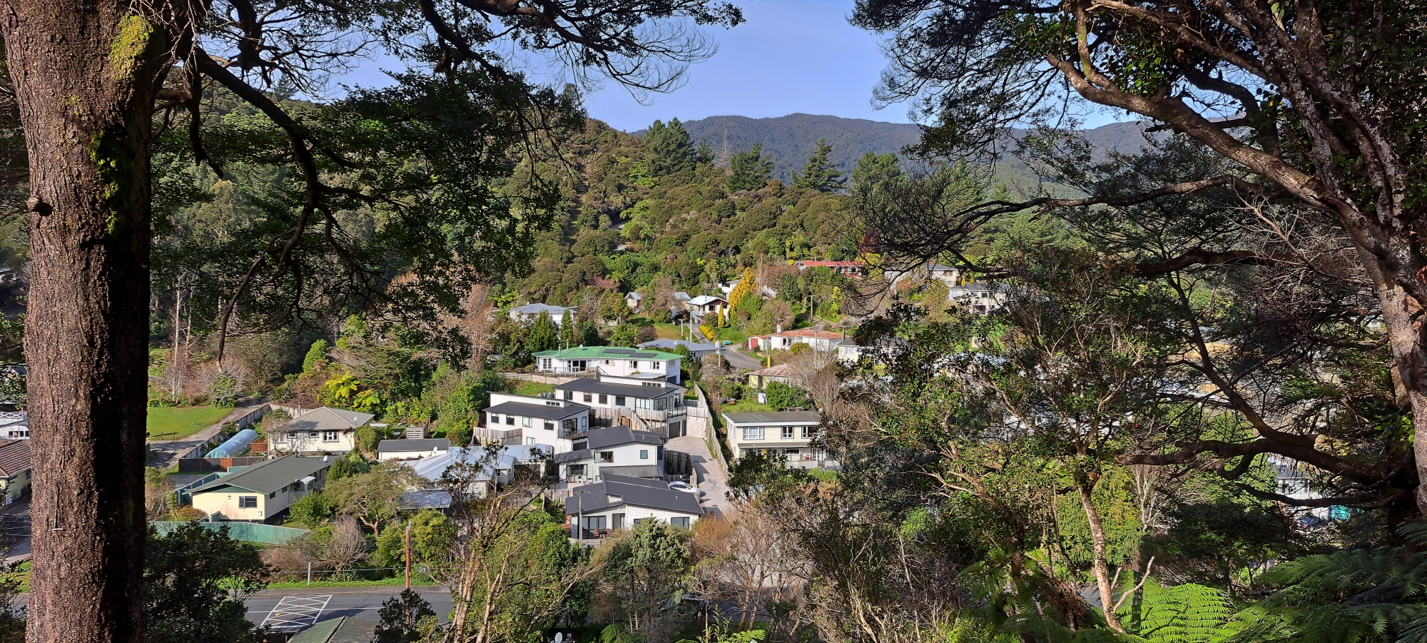
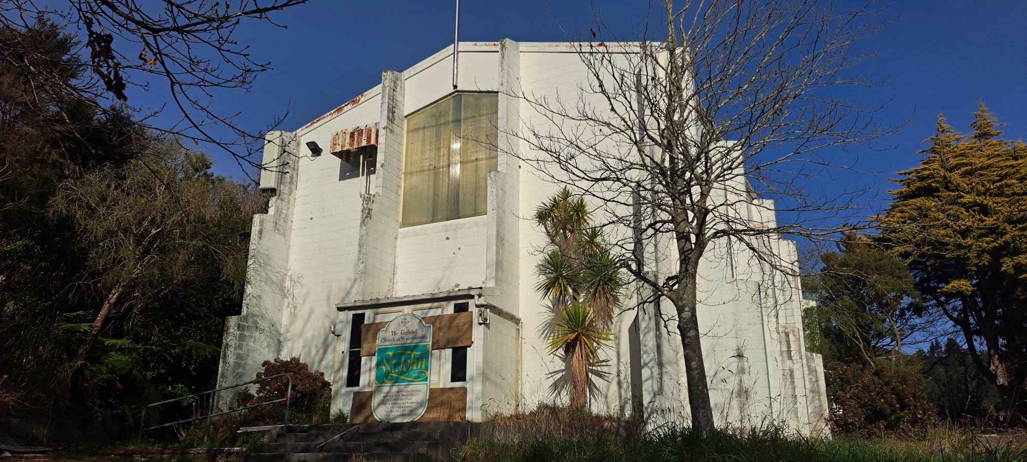 Nearby, a narrow strip of bush led off to the left as we made our way back toward Louise Bilderbeck Hall. We followed it and soon emerged behind St John’s, an old, abandoned Anglican church. The building sits elevated above The Village, and from there I took a few photos looking south down the Coast Road Valley.
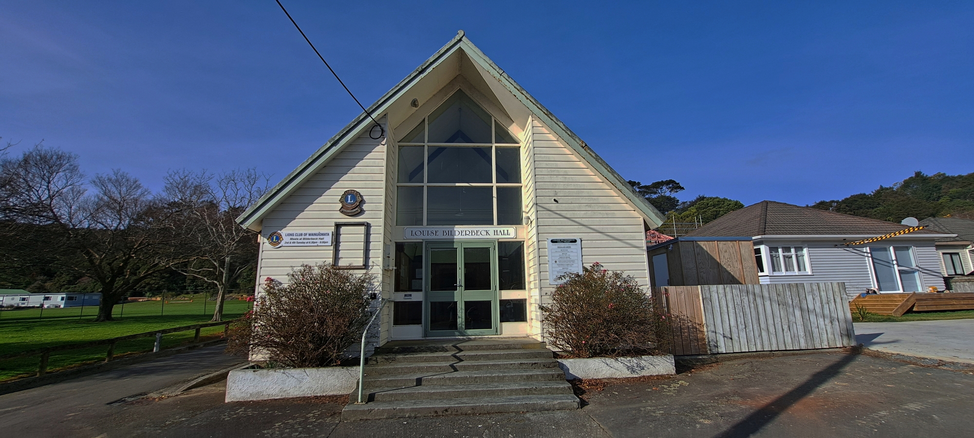 We then walked down the driveway, passed the Louise Bilderbeck Hall, and returned to the car. It hadn’t been a long walk, but it gave us a fresh perspective on this part of Wainuiomata and a clearer sense of how everything fits together in the landscape. The outing took longer than expected, so we wrapped up the bush bash here instead of continuing with the more extensive exploration we had originally planned.


