I explored a network of hidden tracks on the hillside of Reservoir Valley
My original plan today was to revisit a bench track I’d found during Bush Bash 56, though I wasn’t sure I’d have enough time. That track branched off another bench track I had already completed, but the branch continued further uphill and I hadn’t been able to follow it at the time. I planned to climb the hillside above Tana Umaga Track to gain height quickly, then head east in the hope of intersecting this upper bench track, which I suspected might continue to the top of the hill and connect with Solomon Track.
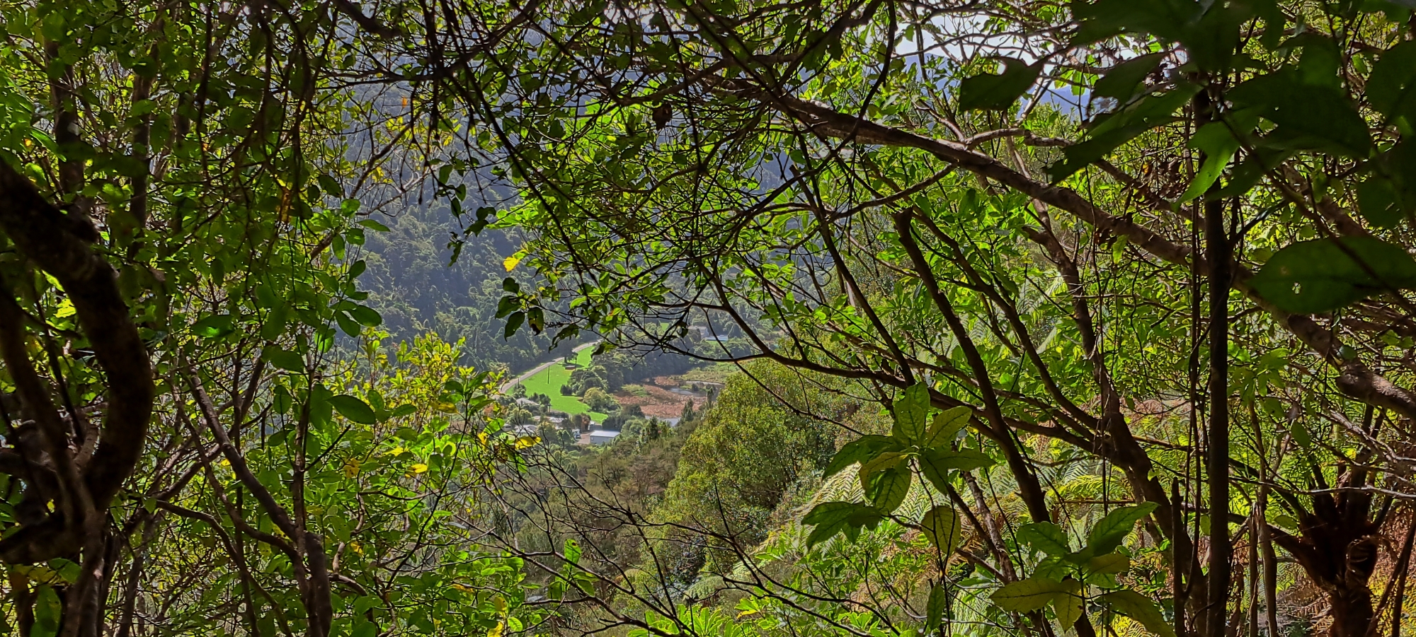
I entered Tana Umaga Track and walked to its highest point, where a creek runs down a gully. From there, I climbed up the hillside. The slope was steep but open enough to move through, and I even got partially obscured views of Reservoir Valley far below. Further up, I came across a horizontal bench track running along the hillside. It initially looked very similar to the one I’d discovered in Bush Bash 54, but it was located in a completely different area, further west and much higher up the hill. I wondered whether it might be an old forestry track, and if it could even connect to the Mystery Bench Track I found in Bush Bash 54.
At this point, I had a choice: go east or west. I chose east, since I didn’t want to head back toward the car as my adventure had only just begun. The track was open in some sections but overgrown with regenerating bush in others. Eventually, I reached a connecting track that climbed straight up the hill and since the track I was on seemed to lead to a dead end, I began ascending. I was fairly sure I’d seen this same vertical track during Bush Bash 56, though at the time I hadn’t followed it, thinking it might just have been a small creek line. But now, higher up the hill, it was clearly a formed track.
I followed it upward until I reached what looked like untouched beech forest with some old growth trees. The forest was beautiful, and I continued along a narrow ridge that kept rising. When the bush became thick and I couldn’t tell how much higher I could go, I decided to bush-bash down the western side of the ridge from where I’d ascended.
As I dropped lower, I found myself entering a deep gully thick with supplejack, the kind of terrain I know from experience is slow and difficult. I decided instead to climb back up the hill, re-entering the beech forest but at a different spot. Descending again, I found yet another gully full of supplejack and once again climbed out. Eventually, I reconnected with a track I’d used earlier and discovered another that branched off. This one descended the eastern side of the ridge and eventually reconnected with the bench track I’d found earlier, which I thought had ended further west, but clearly it hadn’t. So I decided to follow it further east.
Not long after, I came across another vertical firebreak climbing back up the hill. For a moment I doubted my direction, but I knew I was further east now, so it had to be a different track. In fact, I think it was the same vertical firebreak I’d noticed in Bush Bash 56 but hadn’t explored and the track I had seen earlier in the day was another vertical track entirely. I followed it uphill until it connected with another overgrown firebreak that ran down the opposite side of the ridge. I had a choice again, climb higher or follow this new track down. I chose to descend, hoping to relocate the bench track further east and see if it connected with the one from Bush Bash 54, confirming whether it was all part of one long system.
As I descended, I couldn’t find the bench track again, but I did reach Tana Umaga Track near its junction with Sledge Track. From there, I turned west along Tana Umaga to return to the high point where I’d first entered the bush bash. By this stage, my legs were aching and I almost called it a day, but I still wanted to know how far west the rough bench track went. So I climbed back up the hillside, rejoined the track, and headed west. It seemed to end almost immediately until I realised part of the hillside had subsided. Once I crossed the slip, the track continued briefly before fading out.
At the western end, I left the track and descended the hill, eventually hearing a creek below, one I recognised from Bush Bash 2. The terrain was as steep as I remembered, but too dangerous to descend directly, so I climbed back to the ridge and followed it down toward the creek further north. I’d done this route too in Bush Bash 2, so this time I shifted slightly east, reconnecting with the first corner of Tana Umaga Track before heading out.
It was a tough, demanding walk, and my legs were shot. I limped back to the car and drove home, completely worn out but satisfied with the day’s discoveries.
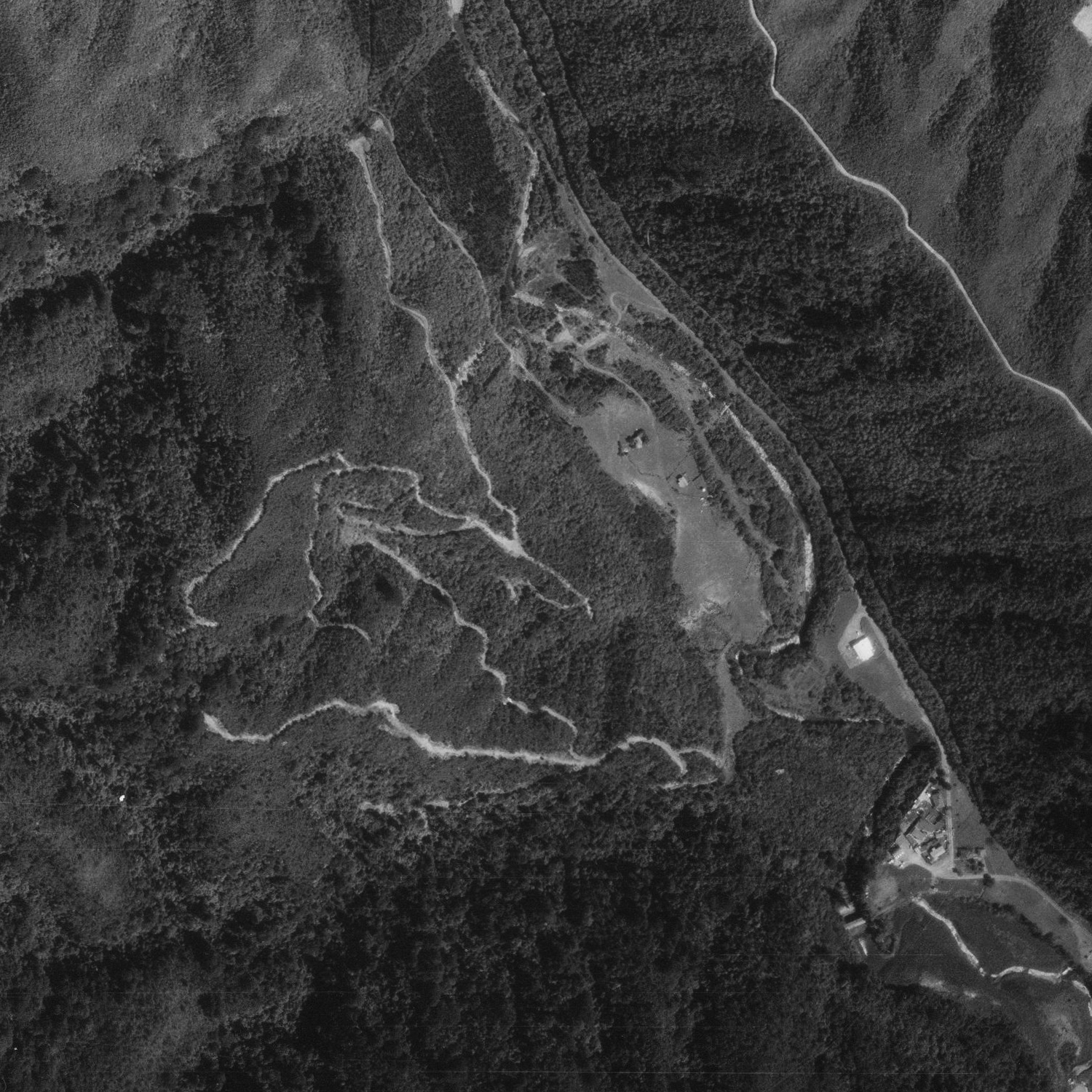 So what were these tracks? They were part of a series of geological-survey routes laid out in the 1980s to assess the hillside above the Wainuiomata Valley for its rock composition and suitability as a future reservoir site. From 1974 onwards, survey crews cut and used what are now overgrown firebreaks and tracks in the valley’s catchments to test underlying strata, fault zones and stability for a proposed dam that was never built.


