Source: Whites Aviation Collection, Alexander Turnbull Library
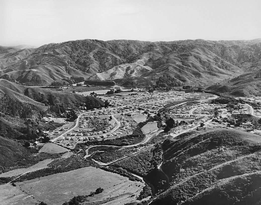
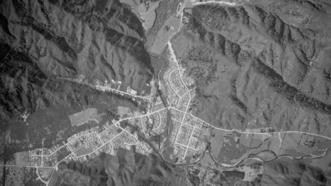
Aerial view of Homedale (circa 1953) showing some interesting features. They are as follows:
- Hine Road finishes at the intersection with Poole Crescent.
- There is a downhill track connecting what is now Hine Road and Richard Prouse Park.
- Richard Prouse Park is farmland.
- You can see the old pipes crossing the Wainuiomata River.
- Poole Crescent Reserve is visible. It was called ‘Bottom Field’ by the school children in those days.
- Wainuiomata Primary School is in view and doesn’t appear to have the swimming pool or the classroom block for the primers.
- The old Main Road Bridge, The Village, and part of Moores Valley Road can be seen.

