(Click the image to go full screen and click again to zoom in. Then use your device to zoom in further and pan.)
Image sourced from LINZ Data Service and is licensed for reuse under the CC BY 4.0 licence.
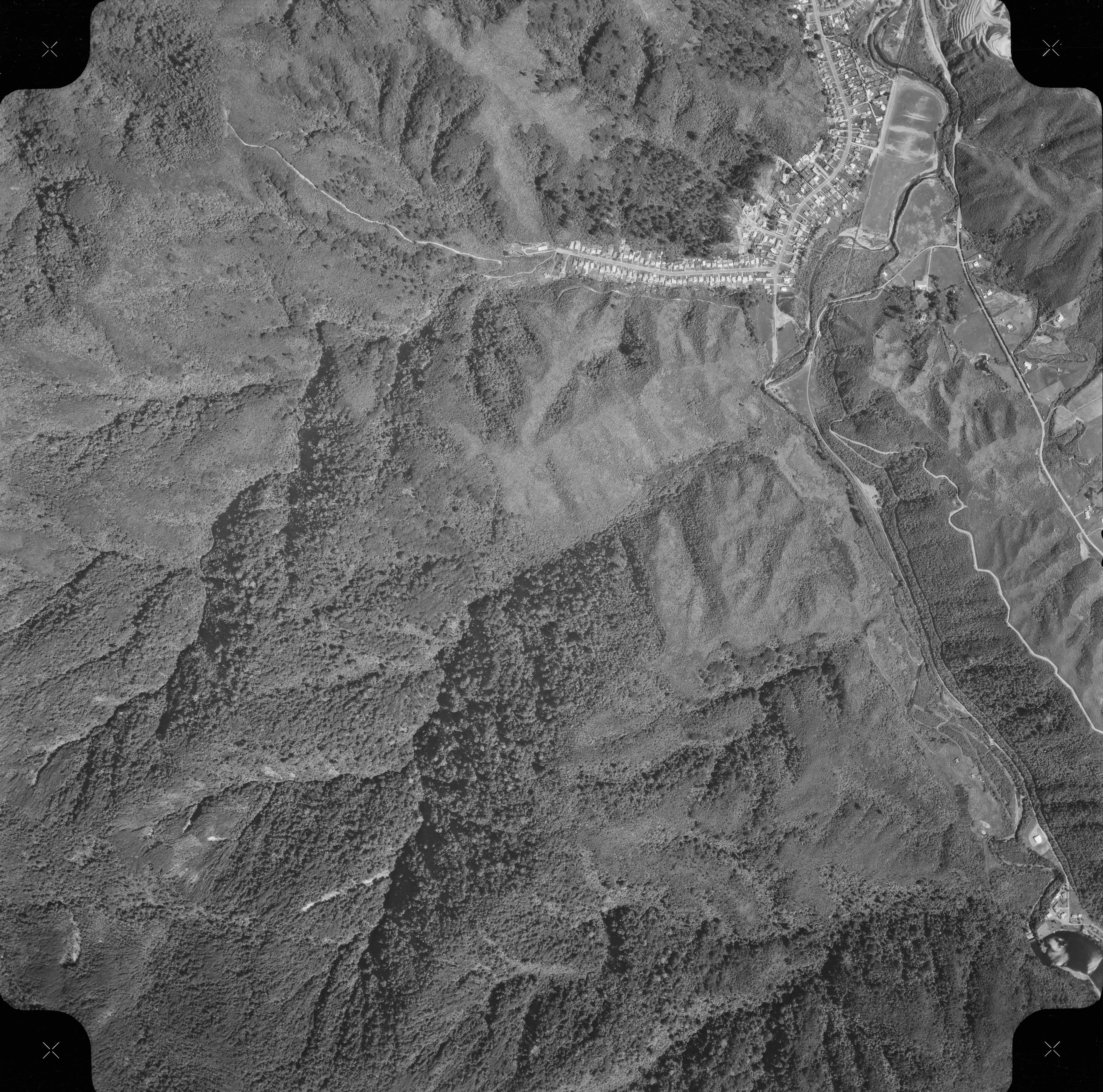
Features in this 1969 aerial photo of the eastern part of Homedale in Wainuiomata
In this image, you can see Hine Road, Sunny Grove, Moores Valley, and Reservoir Valley. For comparison, you will also be able to navigate to a similar aerial photo in the year 2023. The 1969 photo reveals some interesting features which are listed below.
- There are some major earthworks behind Moores Valley Road.
- Beyond the top of Sunny Grove within the old Skerretts Creek Catchment Area (on the Whakanui Track), you can see 4 or 5 water tanks. Today, only 2 remain.
- The Black House is also visible at the top of Sunny Grove as are two additional tanks on the Mary Crowther Trig Track that are still there today.
- The Whakanui Track, which serves both as a track and firebreak located behind Sunny Grove, is visible. Off this main track, a smaller path diverges, leading to the final two houses at the top of Sunny Grove. Kids used this path to test out their trolleys in the early 1970s as it was a little steep. If continue on the main Whakanui Track however, it eventually links up with the main track at the top of Sunny Grove heading toward the old Skerretts Creek Catchment area where the four or five water tanks are located.
- In what is today the Hine Road Recreation Area, you can see remnants of Cullens Road and Cullens Bridge which looks more like a pedestrian bridge. There are no remnants left today. Cephas John (Jack) Cullen (1891 – 1981) used this road and a previous bridge for vehicular access to his home. He leased a home nearby that was the original home of the Sinclair family, however, lacking vehicular access to the house, he arranged for the construction of a road leading to it.
- The western portion of the upper road or maintenance track marks is very visible and still in use. Presently, this segment of the maintenance road has been overtaken by surrounding vegetation but the maintenance road to the west still connects to the track that ascends the hill and follows along the ridge.
- The meadow on the Gums Loop Track had the gum trees planted around this time period. It is hard to see if they are there or not in the photo. But there is certainly no gum tree forest like there is today.
- The ford and 4 wheel drive track that led to Mackays Cottage is there and appears to be the same location today near the current swing bridge. Nearby the track to the swimming hole can be seen. That track still exists today.
- Mackays Cottage cannot be seen in the photo due to lack of quality, but the 4 wheel drive track goes passed the site and links to other homes or cottages further back in the Reservoir Valley where the old swing bridge was located some 100 metres east from the current swing bridge and Mackay Cottage site.
- Behind these cottages or homes you can see a track that provided access to the southern side of the lower dam spillway. I walked that track myself once.
- There are more homes in the waterworks area next to the lower dam than there are in 2023.
Click on the image to activate a full-screen slideshow for enhanced detail and also see the identical location in the year 2023 by navigating to the next slide.
Homedale East Aerial View 2023
Click photo to launch fullscreen slideshow for comparison with the 1969 image.

Map data: Google, Maxar Technologies


