(Click the image to go full screen and click again to zoom in. Then use your device to zoom in further and pan.)
Image sourced from LINZ Data Service and is licensed for reuse under the CC BY 4.0 licence.
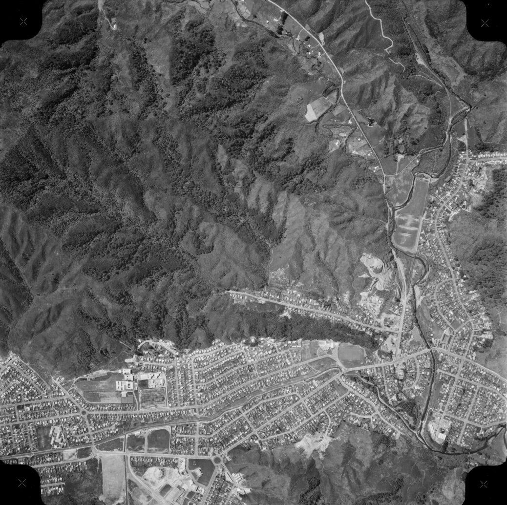
Aerial photo taken in 1969 of Homedale and Moohan Street area in Wainuiomata
- Gums Loop Meadow looks like farmland. The gum trees were planted around 1969, so if they are there, they would be young plantings.
- Cullens Bridge and road is visible near the Hine Road Recreation Reserve.
- The Maintenance Road near Reservoir Road can be clearly seen. The entrance is visible at Whitcher Grove.
- House Northbrook, an old mansion on Whitcher Grove is visible.
- Two water pipes running above ground from Whitcher Grove run above ground through the eastern part of Richard Prouse Park. Today, the pipes run underground except when they cross the Wainuiomata River.
- On Moores Valley Road before Whitcher Grove to the east is a road / track leading to the Wainuiomata River where a ford to Richard Prouse Park is visible. It could be connected to a huge quarry closeby.
- The two water pipes at the western end of Richard Prouse Park can be seen across Wainuiomata River, but they extend above ground a lot further than today.
- Above Hair Street, you can see three water tanks where there was once five or six. They belonged to a water catchment area that existed here in the 1940s to 1960s. The tanks were all gone by the 1970s.
- The main pool in the Wainuiomata Baths is smaller than it is today. There is also one less pool in total and no slide.

