Starting in 1974, geological surveys were conducted to see if a new dam could be built in Reservoir Valley
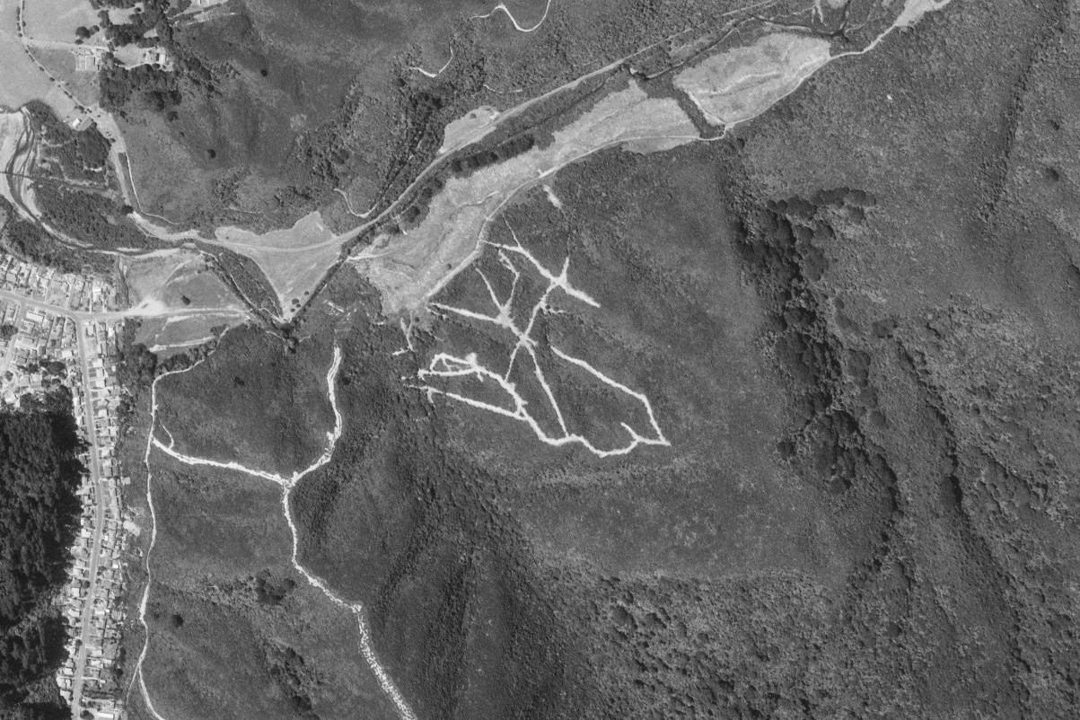
As early as 1925, the Morton programme proposed building a third dam, planned to be located about a mile downstream from the Wainui dam. This dam would have flooded the valley below the caretaker’s house, including the existing road. Although this project never came to fruition, geological surveys were carried out over the following years to assess the feasibility of a third dam. Remnants of these surveys are visible in the older firebreak networks that were once visible on the hillsides in Reservoir Valley. Today, these tracks are largely overgrown, but old aerial photographs show these old firebreaks. But not all these firebreak routes were abandoned. The Tana Umaga Track for instance was originally created in the 1970s as one of these routes.
These routes were used to examine rock formations, and the project was likely abandoned due to factors such as the stability of the valley’s rock, earthquake risks, and the proximity of the nearby Homedale population to the proposed dam sites. Below is a summary of survey reports evaluating the feasibility of four potential dam locations.
Wainuiomata Dam: Environmental Impact Assessment
This report prepared by the firm Mandeno, Chitty & Bell for the Wellington Regional Water Board dates back to 1978. The report primarily assessed the potential environmental impacts of constructing a new earth-rock dam to replace the older Morton Dam in the Wainuiomata region.
Key aspects of the report included:
- Environmental Concerns: The assessment analysed the effect the new dam would have on the surrounding environment, particularly on local flora and fauna, as well as the changes to water flow in the Wainuiomata River and adjacent ecosystems.
- Sediment and Water Quality: Consideration was given to sedimentation patterns and potential water quality issues that could arise from both the dam’s construction and ongoing operation.
- Structural and Geological Analysis: The geological makeup of the area was critical for understanding how the dam would interact with the landscape, including the stability of surrounding soil and rock layers.
This assessment investigated whether the proposed project complied with environmental standards and minimised negative impacts.
Wainuiomata water reserve seismic refraction surveys of damsites 2, 3 and 4
This report by SR Hicks was published in 1982 by the Geophysics Division of the New Zealand Department of Scientific and Industrial Research. The report details seismic refraction surveys conducted at proposed dam sites in the Wainuiomata water reserve. These surveys were aimed at understanding the subsurface geological conditions to inform the design and construction of dams. The seismic refraction method was used to analyse subsurface layers, which is critical for assessing the suitability of the sites for dam construction. The report also includes a bibliography, providing references to other related research in the field, and comprises 41 pages of technical findings and maps.
A paleoenvironmental study of subsurface Quaternary sediments at Wainuiomata
In 1993, a geological survey was conducted in the Wainuiomata Valley using a stratigraphic drillhole to examine the underlying rock layers. The survey uncovered significant geological insights into the valley’s composition. Below the surface, the drill reached deep into the valley’s foundation, revealing ancient greywacke and argillite rocks, which form part of the bedrock in the region. However, what was particularly notable is that these older rocks were found to be overlaid by more than 60 meters of much younger, softer Quaternary sediments. These sediments, which date back to the Pleistocene epoch (the geological period spanning from about 2.6 million to 11,700 years ago), consist primarily of materials like sand, silt, and gravel that were deposited during a time of fluctuating climates and advancing glaciers.
The Pleistocene sediments reflect a time when the landscape was shaped by glacial movements and changes in sea levels. These layers are much less consolidated than the ancient greywacke and argillite below, indicating significant geological activity and environmental changes over millions of years.
This combination of ancient bedrock and younger surface sediments is common in areas like the Wainuiomata Valley, which has experienced both tectonic uplift and periods of glaciation and erosion during the Quaternary period.


