Image sourced from LINZ Data Service and is licensed for reuse under the CC BY 4.0 licence.
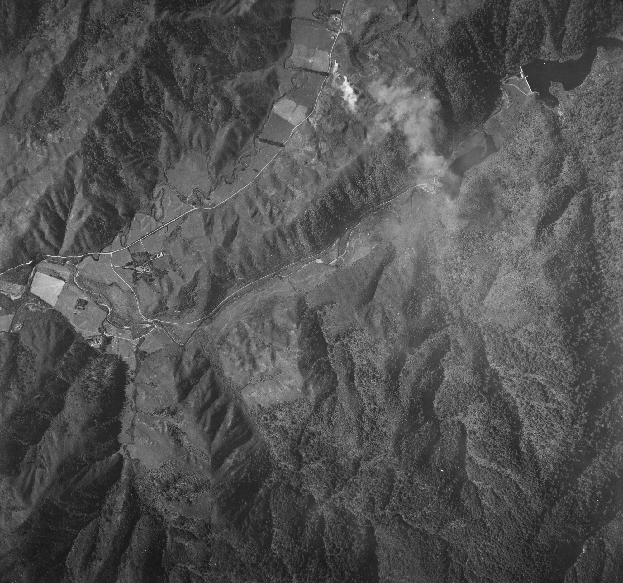
A 1941 aerial photo above Reservoir Valley depicting a time before Hine Road and Sunny Grove existed. It also shows The Terrace and huts that were located here.
Interesting observations from this 1941 aerial photograph of Reservoir Valley and surrounds include:
- The original path of Skerretts Creek is visible.
- Richard Prouse Park was farmland.
- A view Moness, an original home owned by the Sinclair family.
- The large home (Glenhill – later called Riverlea) surrounded by trees was leased in the 1940s by Cephas John (Jack) Cullen (1891 – 1981). Access from Reservoir Road to this home was over Cullens Bridge located at the bottom of what is Hine Road today.
- Hine Road Recreation Area was a farming plot.
- House Northbrook and property with circular hedging is clearly visible on Whitcher Grove.
- Land burnoff is taking place in Moores Valley.
- The old maintenance road / track for the waterworks raceway is visible above Reservoir Road.
- There appears to be a track between Top Pool and Secret Pool. Alternatively, the Wainuiomata River has momentarily split into two streams.
- Numerous tracks can be seen through The Meadow and The Terrace, the grass areas in Reservoir Valley that runs alongside the Wainuiomata River.
- Old huts that no longer exist can be seen in The Terrace area with the old swing bridge visible between two of these huts.
- Numerous houses next to Lower Dam can be seen. Most of these buildings are gone now.
- Lower Dam Spillway is visible.
- Morton Dam and its spillway is clearly visible.


)