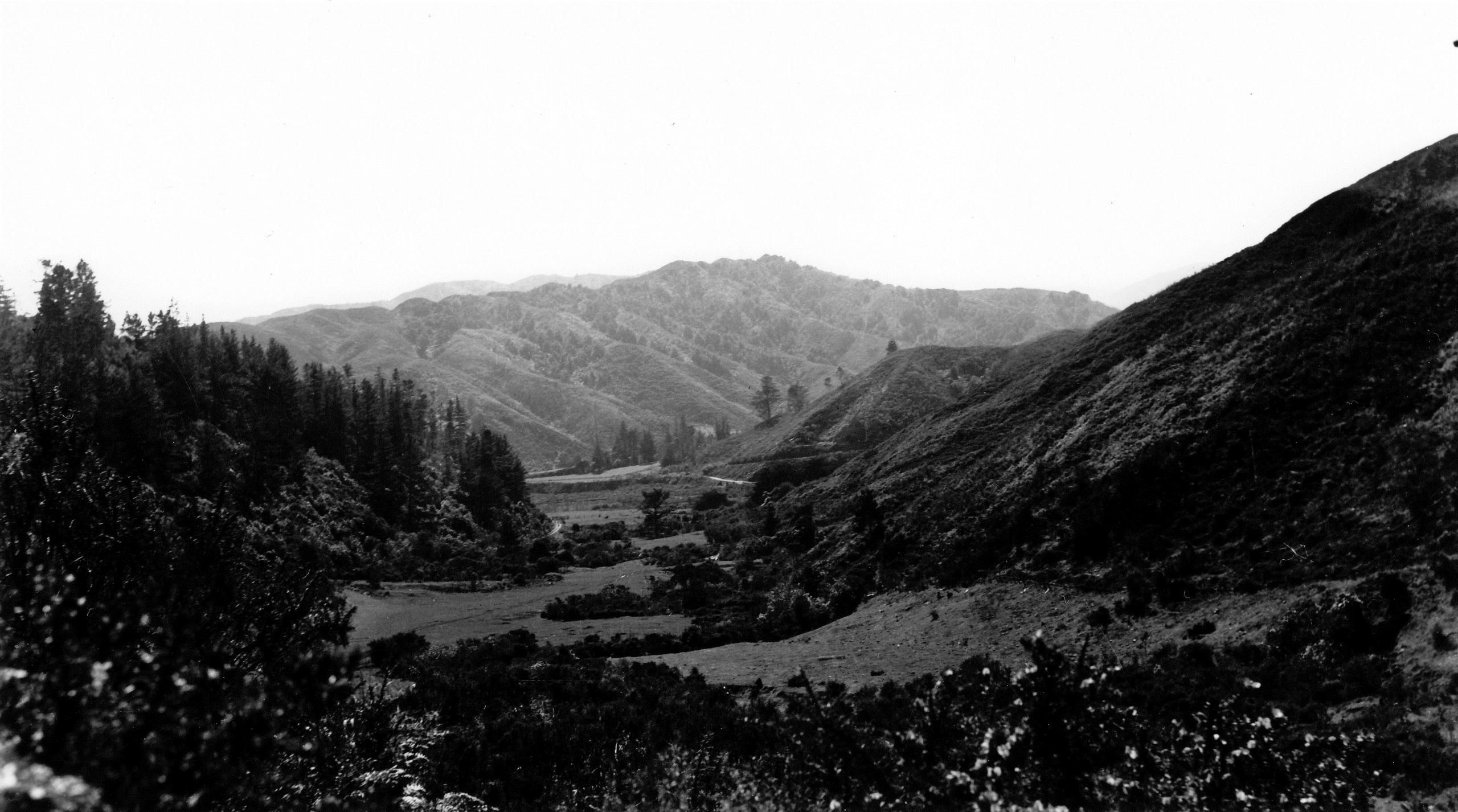
Looking at Sunny Grove when it was farmland in the 1940s.
In view is farmland surrounded by hills and a track through the centre. A noticeable contrast is evident between the eastern and western hills: the former appears to have undergone more recent deforestation, with the western side being replaced by pine trees that have since grown to great height, as seen in the photo. This was likely a reforestation effort. The Sinclair family ran a sawmill at the foot of the hills you can see in the background, near the intersection of Whitcher Grove and Moores Valley Road today.
Skerretts Creek doesn’t appear to be visible. Pre-housing, the creek meandered down the valley from one side to the other. For housing development purposes, the creek was entirely redirected to the eastern side of the valley. Since the 1960s, the creek flows through the rear of the properties on the odd numbered side of the street.


