The Rugged and Remote Wainuiomata Coastline
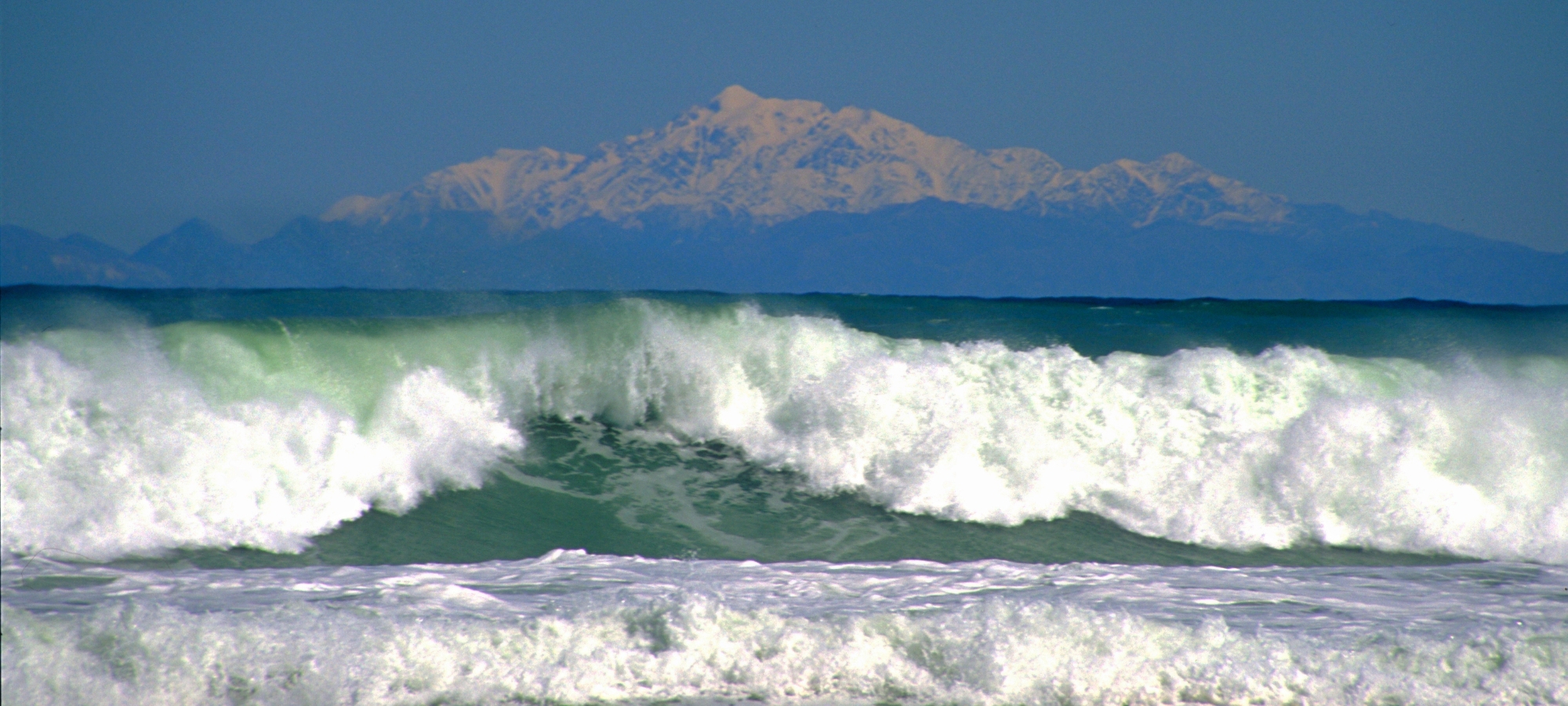
The Wainuiomata coastline forms the eastern edge of the Wainuiomata Valley and faces the Cook Strait. It is a rugged, largely undeveloped stretch of coast known for its exposed conditions, sweeping shingle beaches, and dramatic views across to the Kaikōura Ranges on clear days.
Wainuiomata is best known for its forested hills, yet it is equally blessed with a spectacular and secluded stretch of coastline. Along the short western section, the coast runs from Parangarahu to Baring Head and forms part of East Harbour Regional Park. From Baring Head southwards, the coastline continues to the mouth of the Wainuiomata River and onward toward Palliser Bay. Although much of the land behind this southern section is privately owned, an unsealed road provides access, followed by a coastal walking route that leads past seal colonies and a scenic scientific reserve.
The weather here is shaped by exposure to southerly systems sweeping up the strait, often bringing strong winds, heavy swells, and rapidly shifting conditions. Northerlies can be equally fierce. As a result, the sea is frequently rough, making this stretch of coast far more popular with walkers, anglers, and photographers than with swimmers, for whom the conditions are generally unsuitable.
Baring Head is a defining feature of the coastline. The headland rises steeply above the sea and is home to the Baring Head Lighthouse, commissioned in 1935 to replace Pencarrow Lighthouse as the main coastal navigational aid for this entrance to Wellington Harbour. The lighthouse precinct still contains several heritage buildings once used for lighthouse staff and operations. The surrounding land includes rolling farmland undergoing active restoration and river flats used by native birds such as banded dotterel and black fronted tern.
On the south coast, the Wainuiomata River meets the sea at a broad gravel bar and estuary. This area has long been influenced by natural processes such as changing river mouths, floods, and tidal movement. It also has a deeper cultural history connected to early Māori use of the coastline for fishing and seasonal travel routes.
Turakirae Head Scientific Reserve at the south-east end of the Wainuiomata coastline and protects a diverse and nationally significant coastal environment. The reserve is renowned for its striking series of uplifted marine terraces, formed by repeated earthquakes along the Wellington Fault, providing a clear geological record of tectonic activity over thousands of years. It is also home to one of New Zealand’s largest fur seal colonies outside the South Island, offering an important breeding and resting habitat. The landscape shifts between shingle beach, rocky platforms, and exposed coastal scrub, supporting hardy native plants and birdlife adapted to the harsh winds and salt spray from the Cook Strait. Access is open via the Wild Coast Track.
Overall, the Wainuiomata coastline is valued not only for its rugged natural character and sweeping South Coast vistas, but also as an ecological and recreational landscape.


DISCUSSION