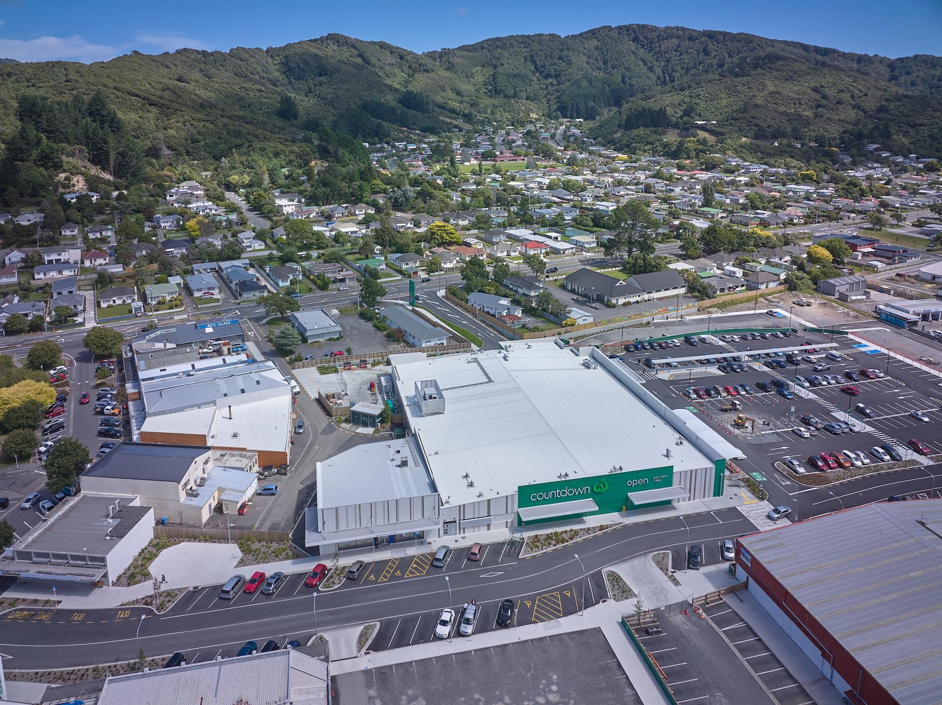
Looking at Woolworths from above in the year 2022. It shows the 3,600 square meters of supermarket space, and other retail outlets, childcare facilities, and medical centers. The first part of Queen Street can be seen as can the newly formed ‘The Strand’, a road that traverses the former location of the Wainuiomata Mall. This transformation brought a significant revitalization for Wainuiomata and minimised the necessity for residents to commute over the hill to Central Lower Hutt or Petone.
Tags: Aerial ShopsAerial View of Woolworths in 2022
-
Wainuiomata Valley Circa 1990
/ / Photos / 0
Looking down upon Wainuiomata in approximately the year 1990 as seen from the top of the Wainuiomata Hill.
-
Photos and Memories of the Waterworks in 1969
/ / History, Photos / 0
Images and memories capturing the essence of the Wainuiomata Waterworks as shared by the Reidy Family, and conveyed by...
-
McDonalds in Wainuiomata
/ / News, Photos / 0
McDonald’s opened its restaurant in Wainuiomata, on April 13, 1999. Located on The Strand, it is across the...
-
Ranger’s Office
/ / Photos / 0
The ranger's office in Wainuiomata Regional Park was originally constructed to accommodate waterworks staff.
-
Burger King in Wainuiomata
/ / News, Photos / 0
Burger King in Wainuiomata opened in 2023. It consists of a typical drive through and also has a lobby...
-
Catchpool Stream View
/ / Photos / 0
Looking at Catchpool Stream located in Catchpool Valley. The stream is located at the entrance to a number of...
-
Concrete Artefact
/ / Photos / 0
This discovered concrete artefact features a small metal door engraved with the letters W W, which may stand for...
-
Concrete Well in 2023
/ / Photos / 0
Image depicting the concrete well captured in 2023. Initially built during 1881-1882, the well now remains concealed.
SEARCH
RANDOM POST
TIMELINE
PAGES
- Wainuiomata
- History
- General History
- Historic Sites
- Hidden Sites
- Kittyhawk Plane Wreckage
- Wainuiomata Tunnel
- Waiwhetu Tunnel
- Black Creek Tunnel
- Colemans Tunnel
- Sinclair Tunnel
- Meter House
- Scour Pipe
- Water Race
- Earth Bridge
- Forgotten Power Generator Site
- Horse Powered Log Arch Cart
- Skerretts Creek Water Catchment
- Concrete Water Tanks
- Mount Crowther Track Water Tanks
- Scout / Pearson Hut
- Workers Huts
- The Black House
- Infrastructure
- Buildings
- Industries
- Notable People
- Waterworks
- Rivers
- Walks
- Reserves
- All Reserves & Parks
- Remutaka Forest Park
- Catchpool Valley
- Wainuiomata Regional Park
- Hine Road Recreation Area
- Harry Todd Recreation Area
- Richard Prouse Park
- Poole Crescent Reserve
- Rotary Park
- Wainuiomata Scenic Reserve
- Queen Street Reserve
- Bryan Heath Park
- Ngaturi Park
- Brookfield
- Camp Wainui
- Turakirae Head Scientific Reserve
- Puketahā Wildlife Sanctuary
- Wainuiomata Trees
- All Reserves & Parks
- About Us
M | T | W | T | F | S | S |
---|---|---|---|---|---|---|
1 | 2 | |||||
3 | 4 | 5 | 6 | 7 | 8 | 9 |
10 | 11 | 12 | 13 | 14 | 15 | 16 |
17 | 18 | 19 | 20 | 21 | 22 | 23 |
24 | 25 | 26 | 27 | 28 | 29 | 30 |
31 |
WAINUIOMATA MUSEUM
