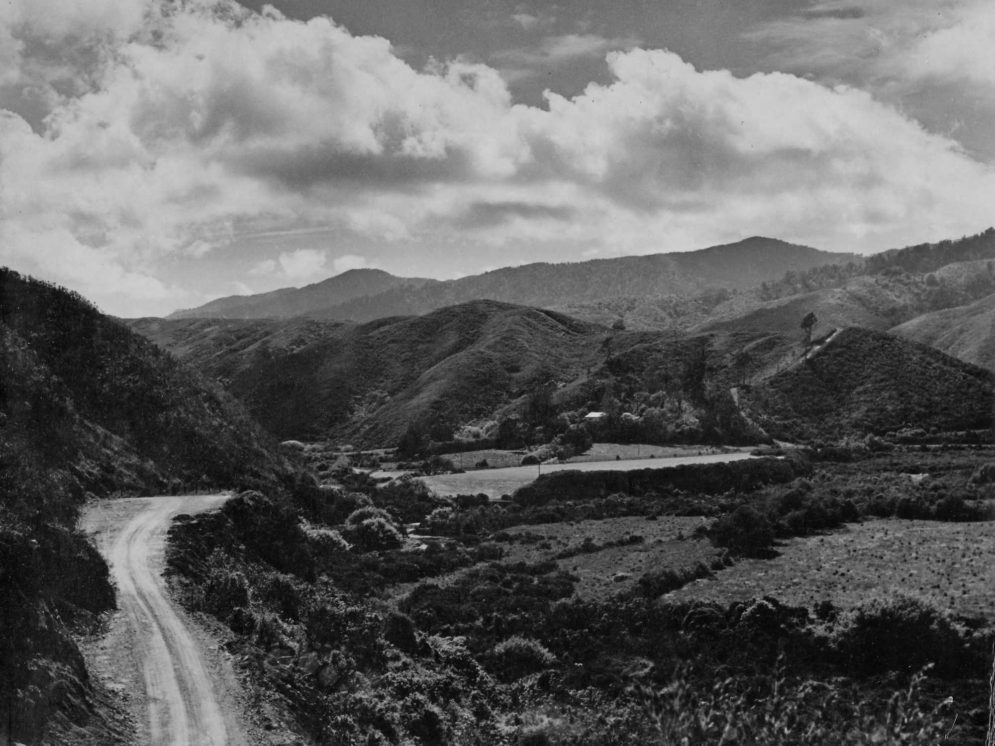
Photo of Moores Valley Road, Wainuiomata, in the late 1950s. The road is still unsealed, and the area below is now Richard Prouse Park. In the centre of the image is a flat grass plateau, with Witcher Grove situated behind it, adjoining Waterworks Road. A firebreak can be seen climbing the hillside, now completely overgrown.


