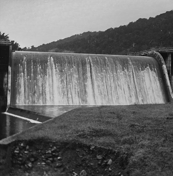
Looking at the Morton Dam spillway in action in the year 1924. Morton Dam was once the main source for Wellington’s water, but the dam was decommissioned in 1988.
Wellington City Council Archives, 00125-17: CC-BY.
Looking at the Morton Dam spillway in action in the year 1924. Morton Dam was once the main source for Wellington’s water, but the dam was decommissioned in 1988.
Wellington City Council Archives, 00125-17: CC-BY.


Support Wainuiomata.Net with a donation and help us continue to uncover local history, capture photos, drink coffee, and promote Wainuiomata.

| M | T | W | T | F | S | S |
|---|---|---|---|---|---|---|
| 1 | ||||||
| 2 | 3 | 4 | 5 | 6 | 7 | 8 |
| 9 | 10 | 11 | 12 | 13 | 14 | 15 |
| 16 | 17 | 18 | 19 | 20 | 21 | 22 |
| 23 | 24 | 25 | 26 | 27 | 28 | 29 |
| 30 | 31 | |||||
Support Wainuiomata.Net with a donation and help us continue to uncover local history, capture photos, drink coffee, and promote Wainuiomata.
© 2026 virtualtopia.com
