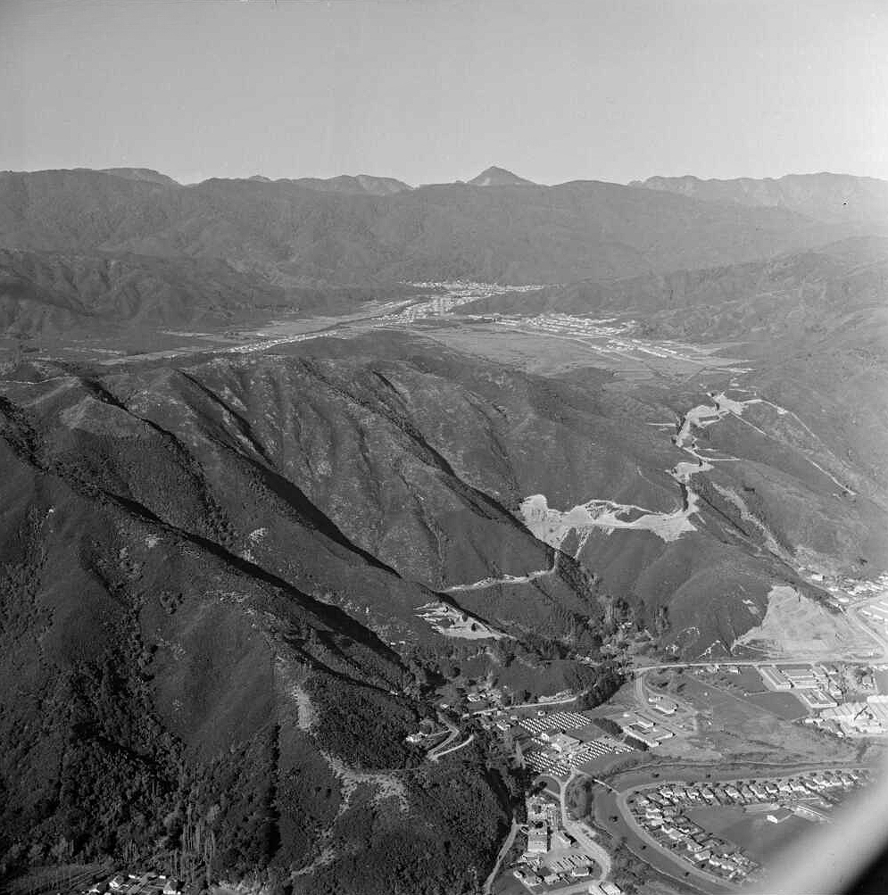
Roading authorities were required to improve access into the valley after it held the title of the region’s fastest-growing suburb for several years. This photo shows a major road upgrade on the Lower Hutt side of the hill. It also highlights the elevation difference, with Wainuiomata sitting noticeably higher than the Hutt Valley below.
Tags: Aerial StreetsWainuiomata Hill in 1958
-
The History of Sunny Grove
/ / History, Photos / 0
About the history of Sunny Grove in Wainuiomata. The name of Sunny Grove took place on a rainy day...
-
Wainuiomata Road in 1964
/ / Photos / 0
Aerial image of Wainuiomata Road in 1964, showing Wainuiomata Road over the Wainuiomata Hill summit and into the valley.
-
The Village in 1989
/ / Photos / 0
In 1989, numerous shops thrived within The Village, creating a lively hub of activity. Today, The Village stands at...
-
Burger King Opens in Wainuiomata
/ / News, Photos / 0
Burger King in Wainuiomata opened in 2023. It consists of a typical drive through and also has a lobby...
-
The History of Fitzherbert Road
/ / History, Photos / 0
Fitzherbert Road, originally known as Swamp Road before 1959, extended to the base of the hills leading to Naenae...
-
Wainuiomata Historical Museum Preserves the Past
/ / News, Photos / 0
The Wainuiomata Historical Museum proudly houses a diverse collection of historical exhibits that vividly depict its rich heritage.
-
View of Bryan Heath Park
/ / Photos / 0
Trees cast their shadows across the bank of a waterway next to Bryan Heath Park in Wainuiomata. This waterway...
-
View of Sunny Grove & Hine Road
/ / Photos / 0
View of Sunny Grove, Hine Road, and Hine Road Recreation Area as seen from a ridge in Wainuiomata Scenic...
SEARCH
TIMELINE
PAGES
- Wainuiomata
- History
- General History
- Historic Sites
- Hidden Sites
- Kittyhawk Plane Wreckage
- Wainuiomata Tunnel
- Waiwhetu Tunnel
- Black Creek Tunnel
- Sinclair Tunnel
- Colemans Tunnel
- Meter House
- Water Race
- Scour Pipe
- Earth Bridge
- Power Generator
- Horse Powered Log Arch Cart
- Skerretts Creek Water Catchment
- Concrete Water Tanks
- Mount Crowther Track Water Tanks
- Scout / Pearson Hut
- Workers Huts
- The Black House
- Infrastructure
- Buildings
- Industries
- Notable People
- Waterworks
- Rivers
- Walks
- Official Tracks
- Unofficial Tracks
- Bivy Track
- ECNZ Power Pylon Track
- Gawler Reservoir Track
- Hine Road Track
- Maintenance Track
- McKerrow Ridge Track
- Mill to Moness Track
- Mount Crowther Track
- Old Nikau Creek Track
- Old Whakanui Track
- Scholes Creek Track
- Scour Pipe Track
- Sinclair Track
- Solomon Track
- Spear Cut Track
- Sunny Grove Track
- Water Race Track
- Reserves
- All Reserves & Parks
- Remutaka Forest Park
- Catchpool Valley
- Wainuiomata Regional Park
- Hine Road Recreation Area
- Harry Todd Recreation Reserve
- Richard Prouse Park
- Poole Crescent Reserve
- Rotary Park
- Wainuiomata Scenic Reserve
- Queen Street Reserve
- Bryan Heath Park
- Ngaturi Park
- Brookfield
- Camp Wainui
- Turakirae Head Scientific Reserve
- Puketahā Wildlife Sanctuary
- Wainuiomata Trees
- All Reserves & Parks
- About Us
M | T | W | T | F | S | S |
---|---|---|---|---|---|---|
1 | ||||||
2 | 3 | 4 | 5 | 6 | 7 | 8 |
9 | 10 | 11 | 12 | 13 | 14 | 15 |
16 | 17 | 18 | 19 | 20 | 21 | 22 |
23 | 24 | 25 | 26 | 27 | 28 | 29 |
30 |
WAINUIOMATA MUSEUM
