Photographer: Derek Simpson
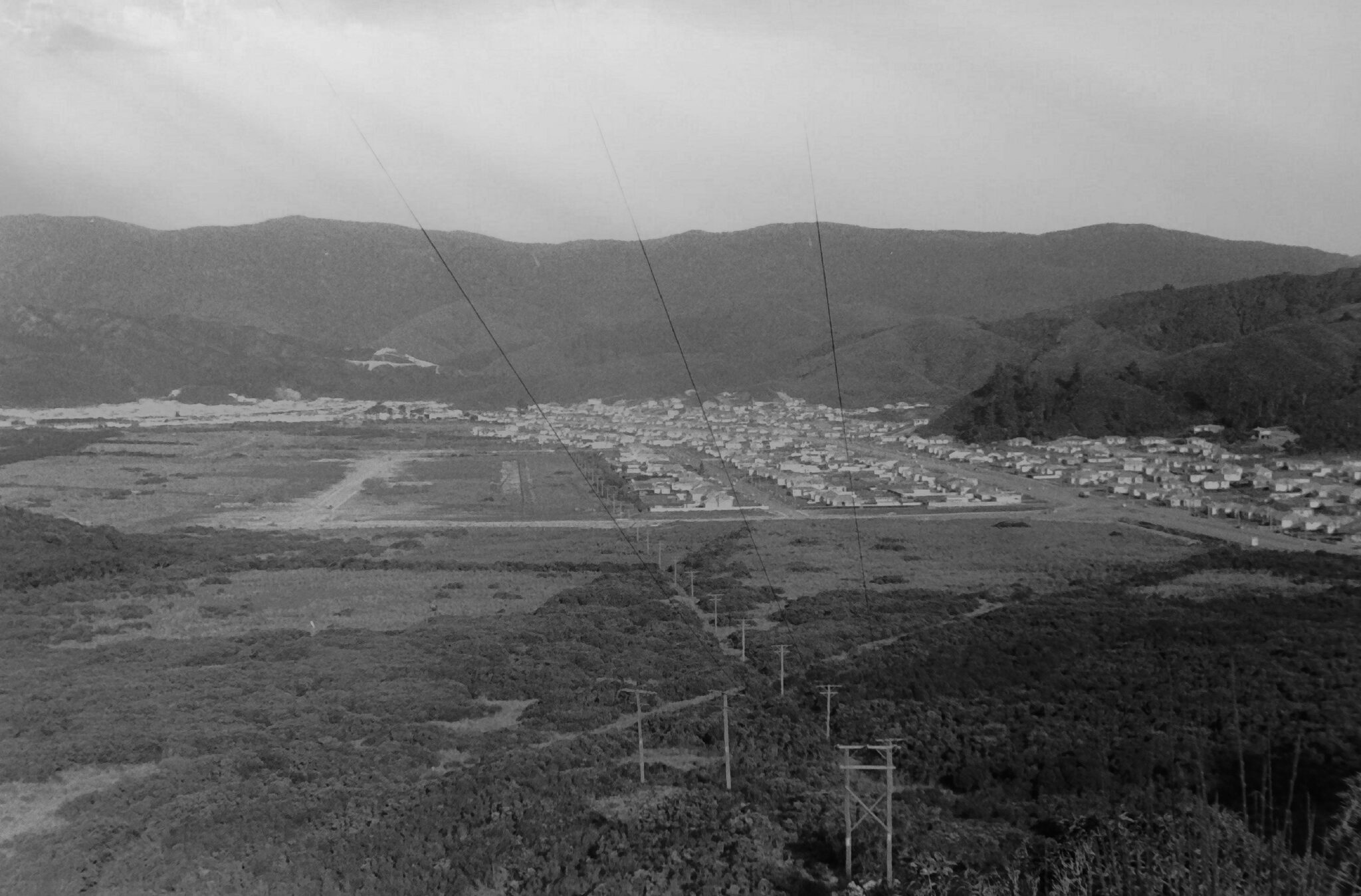
View of Wainuiomata Valley as seen from the summit of Wainuiomata Hill circa 1960. The suburb of Parkway and Parkway College are yet to be established.
Photographer: Derek Simpson
View of Wainuiomata Valley as seen from the summit of Wainuiomata Hill circa 1960. The suburb of Parkway and Parkway College are yet to be established.


Support Wainuiomata.Net with a donation and help us continue to uncover local history, capture photos, drink coffee, and promote Wainuiomata.

| M | T | W | T | F | S | S |
|---|---|---|---|---|---|---|
| 1 | ||||||
| 2 | 3 | 4 | 5 | 6 | 7 | 8 |
| 9 | 10 | 11 | 12 | 13 | 14 | 15 |
| 16 | 17 | 18 | 19 | 20 | 21 | 22 |
| 23 | 24 | 25 | 26 | 27 | 28 | 29 |
| 30 | 31 | |||||
Support Wainuiomata.Net with a donation and help us continue to uncover local history, capture photos, drink coffee, and promote Wainuiomata.
© 2026 virtualtopia.com
