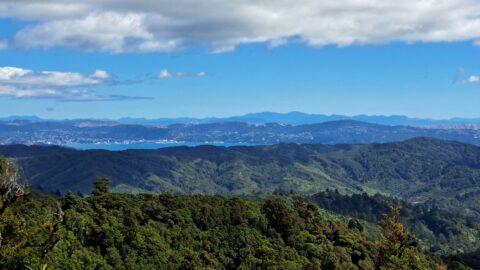
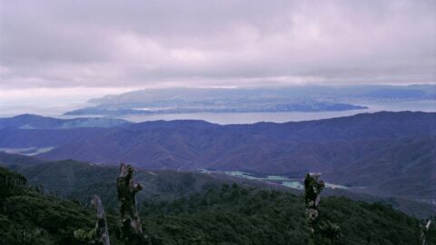
From the Whakanui Track, you can enjoy a distant view of Wellington and Wellington Harbour, with the South Island...
Wainuiomata: Mountains
Wainuiomata is nestled in a basin surrounded by hills, mountains, and a coastline. The mountainous areas offer excellent opportunities for bush walks and tramping. Numerous streams and creeks flow from these hills and mountains, eventually emptying into the Wainuiomata River.
A timeline taken from the same lookout near the car park at the top of the Wainuiomata Hill. Click...
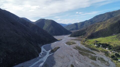
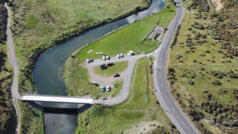
This photo shows the Wainuiomata River dividing the Wainuiomata Regional Park to the left and Hine Road Recreation Area...
Drone footage looking at the Wainuiomata coastline and Baring Head. This coast is part of the southern coastline of...
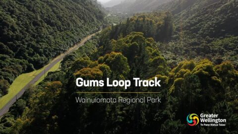
The Gums Loop track at Wainuiomata Regional Park is an easy track walk at any time of the year...
Drone footage looking at the Wainuiomata coastline and Baring Head. This coast is part of the southern coastline of...
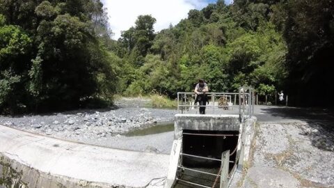
Drone footage taken at Lower Dam in the Wainuiomata Water Collection Area. The footage provides a great view of...
This is typically off-limits to the general public with restricted access. The excursion served for drivers to become familiar...
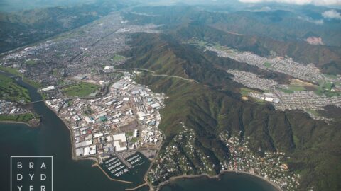
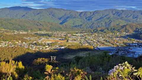
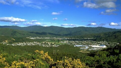
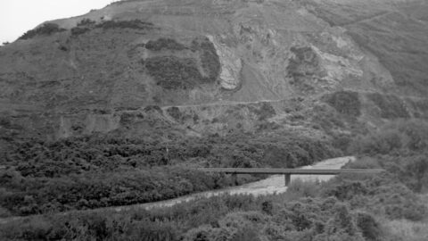
The Pukeatua Range, also known as the Wainuiomata Hill Road, runs through the centre of the image with Wainuiomata...
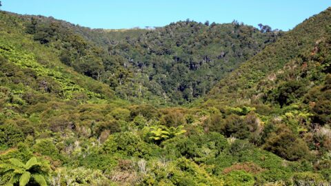
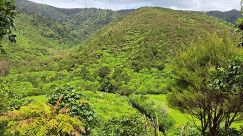
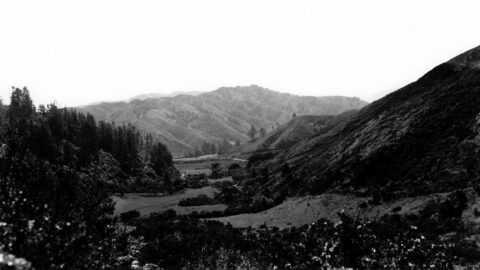
Looking at the valley that contains Nikau Creek and the Nikau Creek Track, (circa 2009). This is where the...
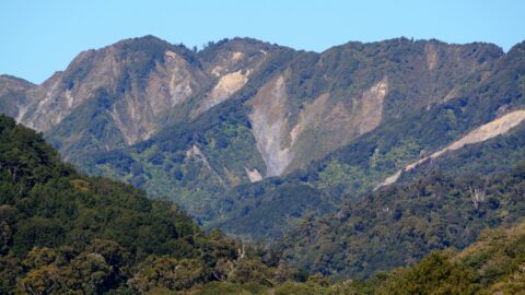
View of Clay Ridge in Remutaka Forest Park. Clay Ridge can be reached by taking the Clay Ridge Track....
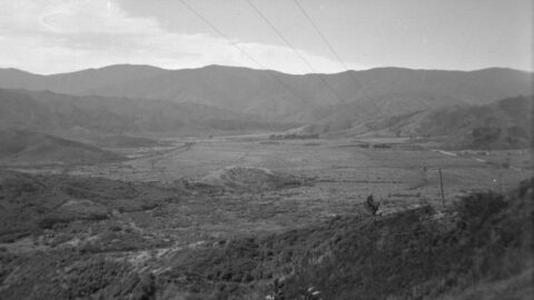
Wainuiomata Valley as seen from the summit of Wainuiomata Hill in the year 2009. This is prior to the ...
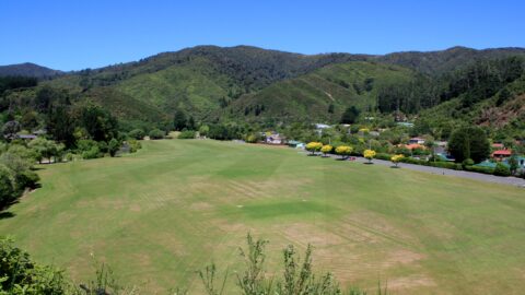
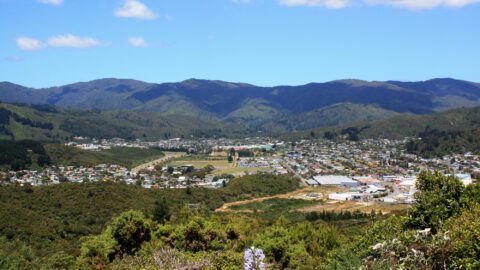
View of Richard Prouse Park in Wainuiomata. Photo was taken from Moores Valley Road above the Wainuiomata River in...
Looking down upon Wainuiomata in approximately the year 1990 as seen from the top of the Wainuiomata Hill.
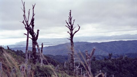
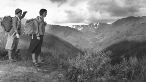
Pictured is a view that opens up from the McKerrow Track, circa 1989. Looking out toward Wellington with the...
Pictured is a view toward Wellington from the Whakanui Track in 1989. In view is the valley where Coast...
Looking at Wainuiomata Valley from atop Wainuiomata Hill circa 1949 reveals the absence of suburbs. The valley contains mostly...
Looking at Sunny Grove when it was farmland in the 1940s. In view is farmland surrounded by hills and...
View from the Five Mile Track at the top of Gut Buster in the year 1933. In the distance,...
WAINUIOMATA TOURS

Step into the wilderness of Wainuiomata and experience it for yourself. Learn more →.
WAINUIOMATA MUSEUM

Located in Wainuiomata Primary School, it is open 2pm-4pm every Sunday. Learn more →.
BUY ME A COFFEE
Support Wainuiomata.Net with a donation and help us continue to uncover local history, capture photos, drink coffee, and promote Wainuiomata.


DISCUSSION