I checked out the Old Whakanui Track and then crossed over Nikau Creek and bush bashed behind a swamp, near Gums Loop Walk.
 Today, I went with a friend who showed me the entrance to the Old Whakanui Track which branches off Nikau Creek Track. When I was a kid growing up in Wainuiomata, I walked up this track numerous times and even went right up onto the ridge above. But the track was eventually moved to the bottom of Sunny Grove or Hine Road Recreation Area in 1982, then later to above Sunny Grove. That said, these old Whakanui tracks and entrances still exist, mostly used as baiting tracks and useful link tracks for hardy trampers.
The former Whakanui Track located at the base of Sunny Grove remains accessible today and connects to the main Whakanui Track, which commences at the summit of Sunny Grove. However, the pre-1982 version of the old Whakanui Track where Nikau Creek Track is located today, was an entirely distinct path that led directly to the ridge. This historic route traces its roots back to an ancient Maori track. The decision to relocate the track was prompted by the area’s role as a water catchment supplying Wellington. Consequently, the relocation aimed to deter human activity in the vicinity. Today, the area is not part of the water catchment, so it is fully open to the public.
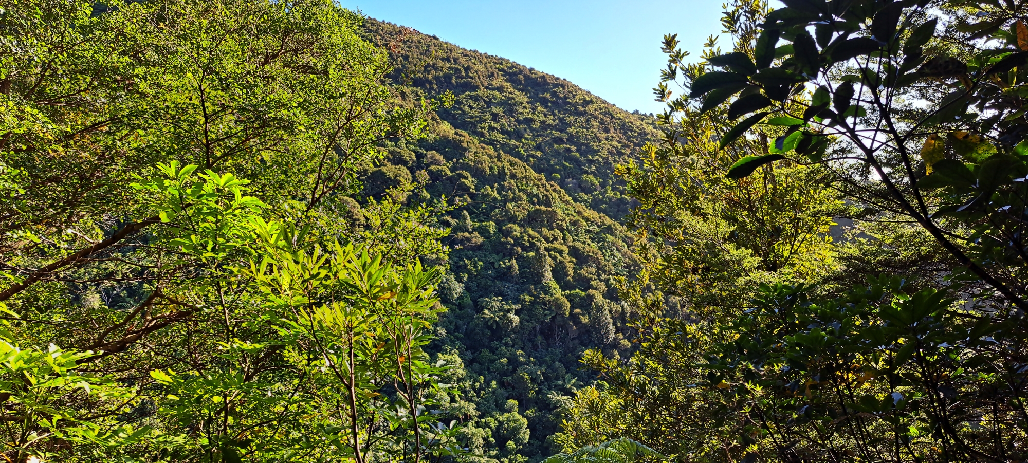 My trek started at Hine Road Recreation Area where I connected to Gums Loop and then headed up the Nikau Creek Track for half a kilometre before arriving at a pile of stones marking the turn off. From there it was a quick jump across Nikau Creek and then a moment’s pause while figuring out where the rest of the track was located. The thing about these old tracks is you can easily lose your way. Upon locating it, I then ascended quickly and steeply up the hill but only went part the way up in order to capture some photos of the valley below. I wasn’t interested in doing the whole track at this stage, due to time constraints. There weren’t many photo ops as the bush hid most of the views below, but a couple of spots gave some nice views through the trees. All up, it was a steep and narrow walk which I am interesting in completing at a latter date. It’s not well maintained and is almost a bush bash IMO. Totally understandable though, as it is not an official public track.
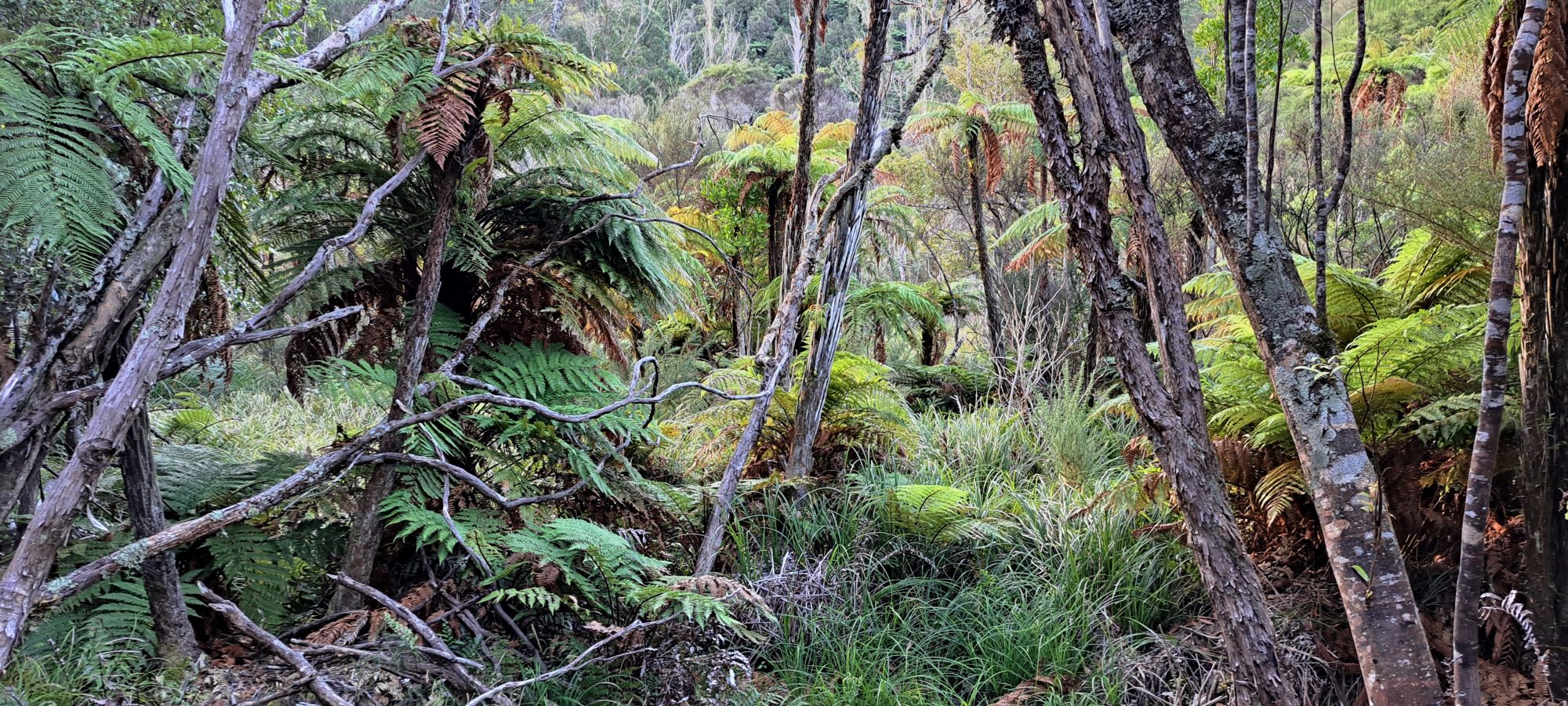
 Once I had some photos and couldn’t see any possible lookout points further up, I headed back down. However, instead of heading out to Gums Loop Walk via the Nikau Creek Track, I opted for a bush bash to the east of Nikau Track as it looked inviting. I left the track when I saw a steep river bank in the distance where Nikau Creek has been doing its best to erode the bank away. I then saw a way up that bank and found myself on a nice plateau, hosting a mānuka and kānuka forest that was easy to walk through. Further in the forest, the vegetation became more dense and I saw numerous fences showcasing the areas past as farmland, as late as the 1970s but also much earlier.
 Through the forest, I circled the hill to the south where I encountered a wetland area where the hillside offered a more solid footing. Skirting along the base of that hill, but above the swamp, I came across what appeared to be an old road or farm track. But it led to nowhere and then seemed to pick up again. Initially unsure if it was even a road or track, my uncertainty faded when later on, I eventually stumbled upon a fence line and eventually, the entrance to the track. Later confirmation came when I examined old aerial photographs, revealing the presence of a farm track / road in the same location.
While I was in this forest, I also ascended the hillside in three distinct spots. Twice, following creeks up two different gullies, and once up a ridge that divided the two unnamed creeks. The ridge appeared to have been a firebreak at some point, judging by the vegetation type which consisted mainly of early coloniser plants like gorse, but with some young mānuka and kānuka trees trying to reclaim the area. The gorse proved challenging and required some crawling underneath to get through.
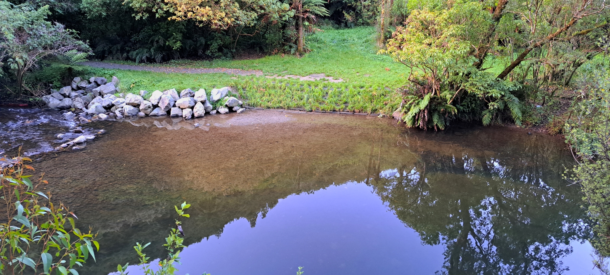 Once I was out of the forest and back on the Gums Loop Walk, I located the track to Ultimate Pool. There, I took some nice evening shots of this natural swimming area. I tried to locate this track on Bush Bash 11 where I explored the opposite area from Gums Loop Walk, where there were also fences and remnants of old paddocks that had since been reclaimed by the eucalypt forest of Gums Loop.
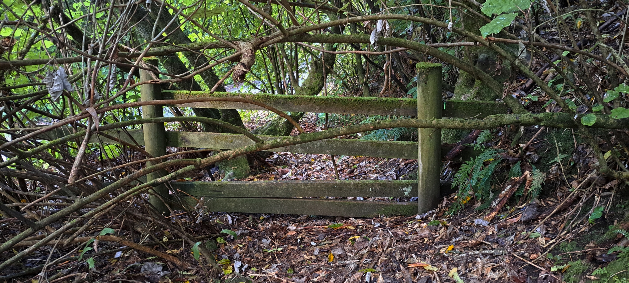 This adventure was more fun than I have anticipated, owing to the discovery of an old farm road / track and fences associated with the farmland that existed here decades ago. I had a hunch that this area might hold a little bit of history as it is nicely tucked away behind a vast swamp, likely deterring most explorers. The remnants of the old farm track hinted at a history of agricultural activity, with fences dividing the land into paddocks along the hillside. And since it is not a place people venture into, who knows what the area might be hiding. Nonetheless, with darkness approaching, it was time to head back to the comfort of my car.


