Today, I explored Reservoir Valley / Sinclair Valley by deviating from Gums Loop Walk to follow the old track.
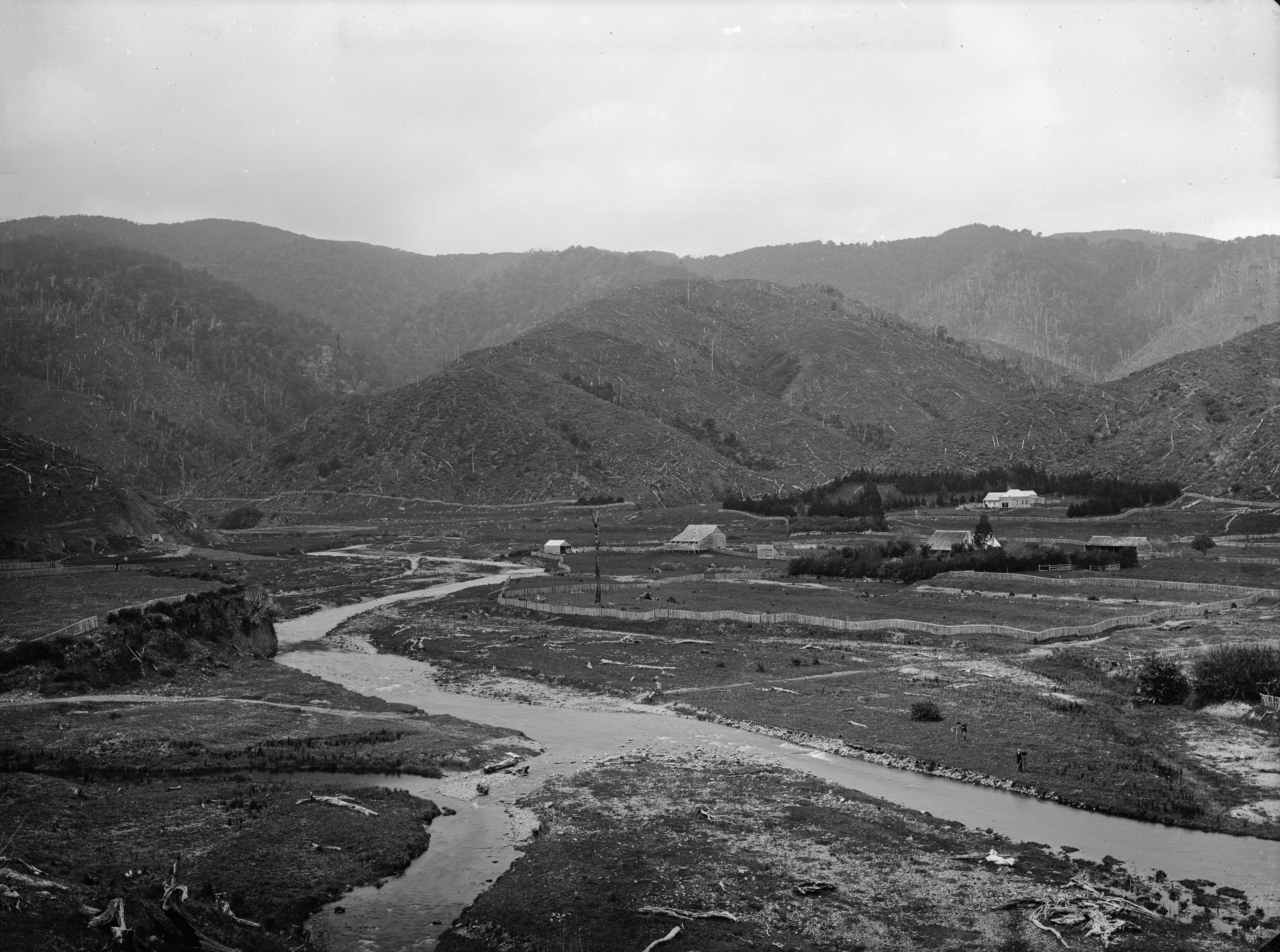 According to a photo from the 1880s, a track once ran along the hillside and through Reservoir Valley or Sinclair Valley as it was called back then. This old track, where Gums Loop Walk is mostly located, traversed the valley, but remnants of the old track are still visible nearby, where Gums Loop takes a different route.
A few days prior, a friend recently pointed out a spot on Sledge Track, where the old track branches off, and which might still be intact. My mission was to explore this area and follow this section of the old track, while also walking any other sections of the old track onroute.
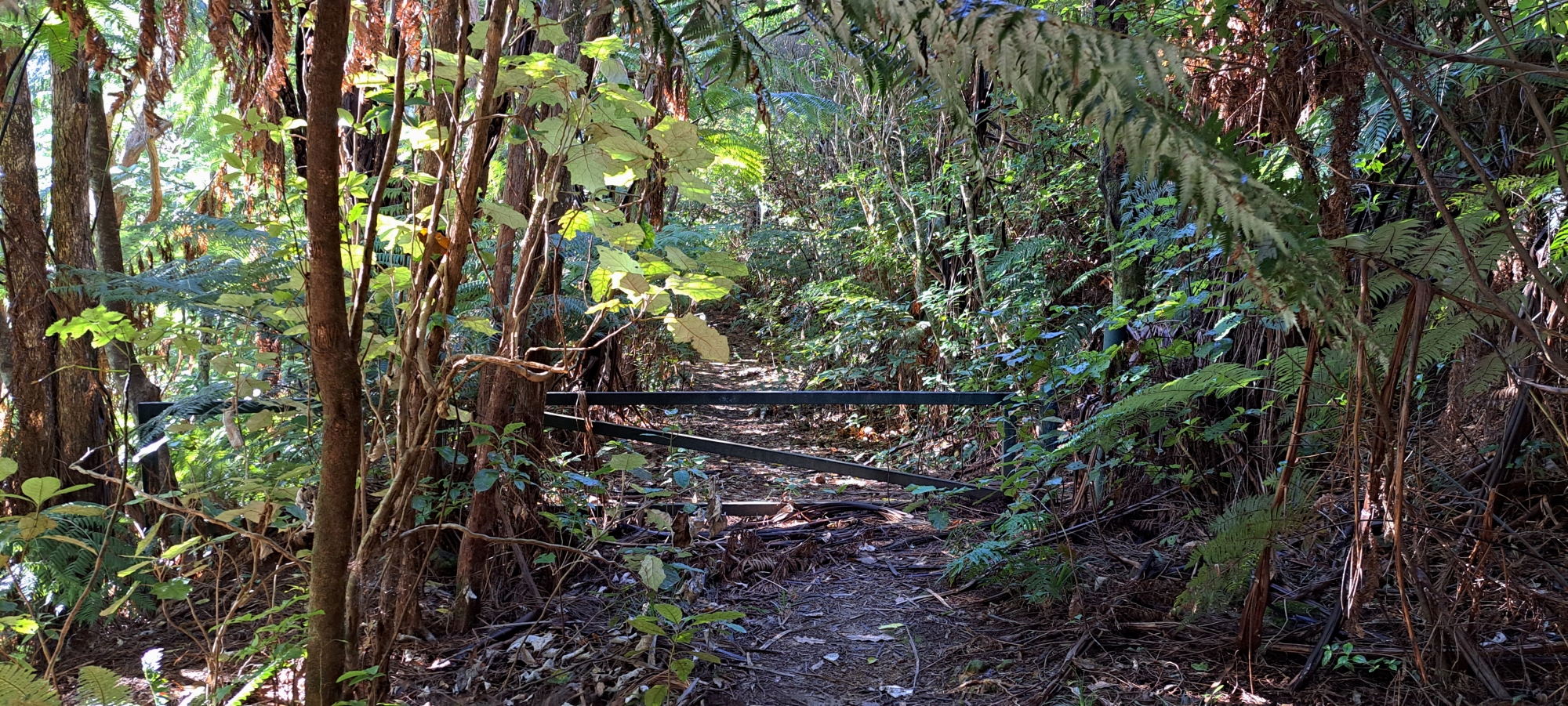 I began my journey at Hine Road Recreation Area, where I traced the old track through the bush starting near Sinclair Cemetery. This path was also part of the Whakanui Track many decades later before the Whakanui entrance was moved to the top of Sunny Grove. While walking this section of the old track, I came into contact with workers converting part of the track into a wheelchair-accessible loop, so I took some photos to capture this area before it changed forever.
At the end of this section of the old track, it comes out into the meadow and near the bridge that crosses over to Top Pool. However, I could see that the old track actually continued on with the entrance into the meadow being a newer pathway. So I bush bashed through this part of the old track till I came out just behind Top Pool. The 1880s photo shows this track hugging the hillside, which is exactly where I traversed and despite being covered in trees, the track was still visible due to the landscape being unnaturally flat and carved into the hillside . Once behind Top Pool, it seemed likely that the Gums Loop track in this section pretty much follows the old track because the land below and above is too steep.
Continuing on Gums Loop, when I got near the bridge over Nikau Creek, I could see the old track running parallel and then crossing the creek slightly further downstream than the bridge. Once I crossed the creek, to my right I could see what looked like the old track continuing behind the Gums Loop Meadow and a wetlands area. But I ignored that section as I had found this trail and documented it in Bush Bash 15. Once I walked far enough along Gums Loop Walk to the end of this section that I had already covered previously, I photographed a hidden wooden fence that borders the old track and Gums Loop. I then continued on Gums Loop Walk once again assuming the old track likely took this path as it hugs the hillside.
 I then reached the turnoff for Tana Umaga Track and chose to follow it, planning to link up with Sledge Track from there. The previous week, during Bush Bash 19, I had already walked and documented Sledge Track from the side near Mckays Cottage which was likely part of the old track. Hence, there was no need to cover that section again.
 Once at the end of Tana Umaga Track, I connected onto Sledge Track and headed in the direction of Sledge Track Creek. This track got its name from its history as an old forestry route, where the Sinclair family logged the area and transported the logs out by sledge. I continued on till I came to a sign indicating that the track turns sharply in order to stop people from walking straight ahead and getting lost. However, I was a bit suspicious. A similar sign exists at the end of Nikau Creek Track and that sign hides an older track behind. Similarly, at the other end of Sledge Track, a sign pointing the way also hides an older track that went further up the valley toward the lower dam. Knowing this, I walked behind this particular sign before me and indeed there was an old track located behind But was it part of the old track through Reservoir Valley? Probably not, as it headed further into the valley toward the source of Nikau Creek. It was probably an old forestry track and might be used as a baiting track today.
I followed this track till I could see it no more. There was one section above where the track might have continued, but rather than climb up, I decided to return because this was not my main mission today. I’ll save that possibility for another day. I headed back to Sledge Track via the old track instead. Except, I decided to bush bash back to the track on the eastern side of the creek and I ended up crossing a smaller ravine and feeder creek before arriving back at the Sledge Track. I then went to the location that was pointed out to me days before where the old track supposedly continued on. But I searched that area high and low, but could see no remnants of an old track. Perhaps there was never a track here, or maybe it was too old and was now fully overtaken by the bush.
Using Sledge Track to head home, I took the southerly portion of the lower loop section whereby I seemed to locate the old track in the bush nearer the hillside. I followed what appeared to be an old track, but I did doubt that is was a track at all, then I would see features that would convince me it was. It was flat and a track seemed to appear then disappear. While walking this section, toward Mackay Cottage, it bypassed the cottage to the south by hugging the hillside. While in there, I saw an old artefact or object if you will, that could have been anything from an old possum trap, a planting box, or a rotting piece of furniture of some kind.
 I eventually arrived back onto Gums Loop Walk where that track hugs the hillside and I headed back toward Hine Road Reserve. However, instead of going all the way out, with a bit of extra time up my sleeve, I decided to bush bash north from Gums Loop Meadow toward a concrete wall that lines part of Wainuiomata River. This wall was pointed out to me a few days earlier while I was walking along Reservoir Road. From this new vantage point, I was able to get photos of the whole wall in one shot. However, this little venture was a bit dangerous as I descended down a bank and when I climbed back up a different route, I climbed a steep rock face that proved more difficult than anticipated, which was a silly risk to take. Nevertheless, I got to the top and walked out of the valley and jumped in the car and headed for home.
All up, a nice adventure with both nature and history on offer and with some extra little detours on the side.


