In this episode, I explore called The Terrace in hopes of finding two undocumented huts.
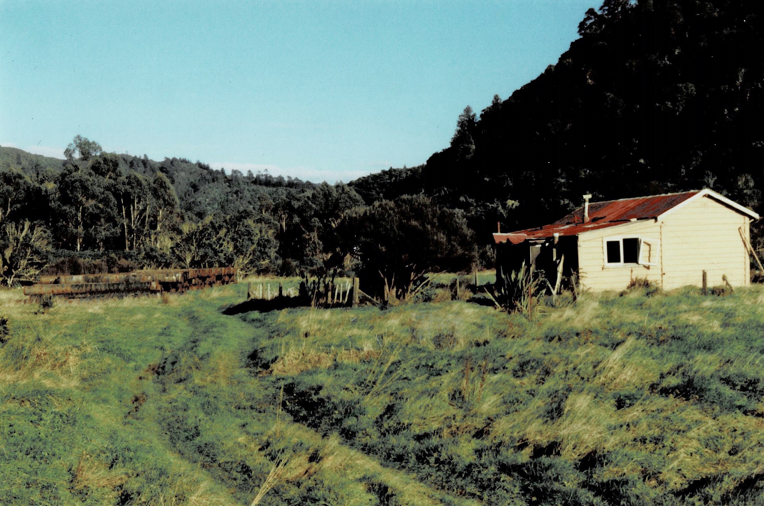
After my exploration recorded in Bush Bash 22, it was time to fulfill my main objective for the day. That is, to go to The Terrace and visit the sites of two known huts and additionally, find evidence of two undocumented huts. The known huts are first: Mackay Cottage which is signposted and marked out by a stone fence with remnants of the chimney within the perimeter. The other hut is Pearsons Hut / Scout Hut. This hut isn’t signposted, but a boundary fence still stands, helping me identify its original location. Additionally, several photographs taken before it burned down in 1995 also provide clues to its location.
 Now to the existence of the two undocumented huts. These are only known from oral recollections, and they were apparently gone by the 1930s. This predates detailed topographical maps that began to be made in the 1940s due to WWII. Consequently, these old maps show only the two known huts. The lack of hard evidence for these two undocumented huts necessitated a search of the area, and I was up for the task. Additionally, locating the exact site of Pearson Hut was also on my agenda today. I just needed to find a chimney or any other part of the building that might still remain in order to learn of its exact location.
The undocumented huts were deeper in Reservoir Valley than Mackays Cottage and Pearson Hut, putting them closer to the site of the old dam which was constructed in 1884. Obviously, this raises questions about the function of these huts and their location to the building of the dam. The workers needed accommodation, toilets, and had meal requirements etc. Could these huts be connected in some way with the workers tasked with building the dam? Another possibility which would date these huts even earlier would be the area’s proximity to Sledge Track. Could these huts have been used by the Sinclair family and workers who logged this area. Nearby, Sledge Track was where logs were hauled out to be placed on the tramway where they were taken to the mill in Moores Valley. I can only speculate about the exact function of these huts. Perhaps they were just recreational, or maybe they were part of the historical enterprises in the area. Either way, on with the expedition.
…Bush Bash 22 which took place earlier on the same day, left me near one of the known huts, that is Mackay Cottage. I have been to this site dozens of time before, so I decided to skirt around that site and trek through the bush to the south whereupon I came to an old possum trap or artefact of some kind that I had located before in Bush Bash 20. Knowing that I had explored the bush further east from there, I came out of the bush and walked through the swampy area till I connected with Sledge Track. From there, I took the track and then departed the track to cross Sledge Track Creek and then bush bash deeper into the valley from there.
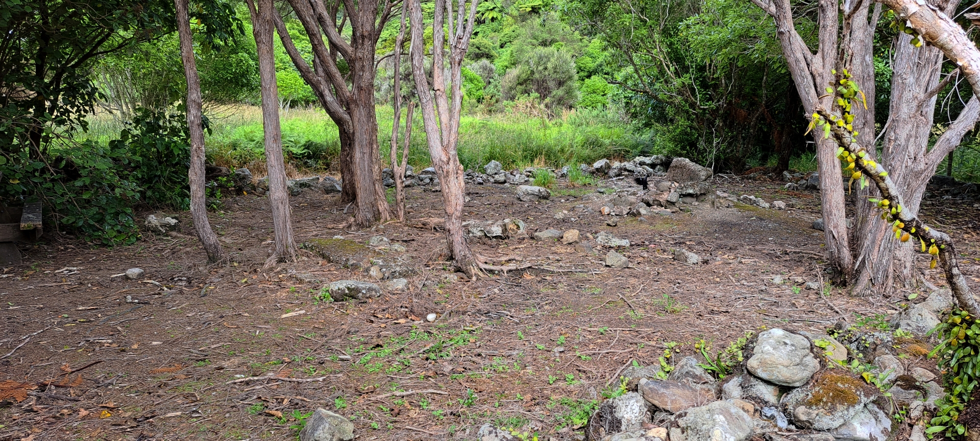
I arrived at a site where I had found remnants of what I think is a chimney discovered in Bush Bash 19 but I hadn’t really looked at the site properly to know for sure. This, however, was the best evidence yet for the location of one of the two undocumented huts. I took some photos and examined the chimney base and pipe extending into the ground. It was solid, leading me to believe there was a good chance that this was a remnant of an old hut. So, I chalked this up as a location for a hut, meaning two sites were located: Mackay Cottage and this site.
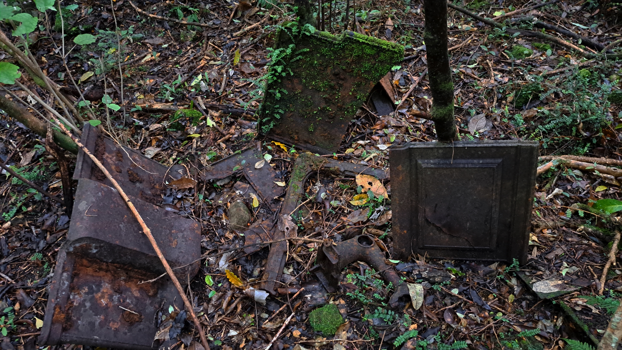
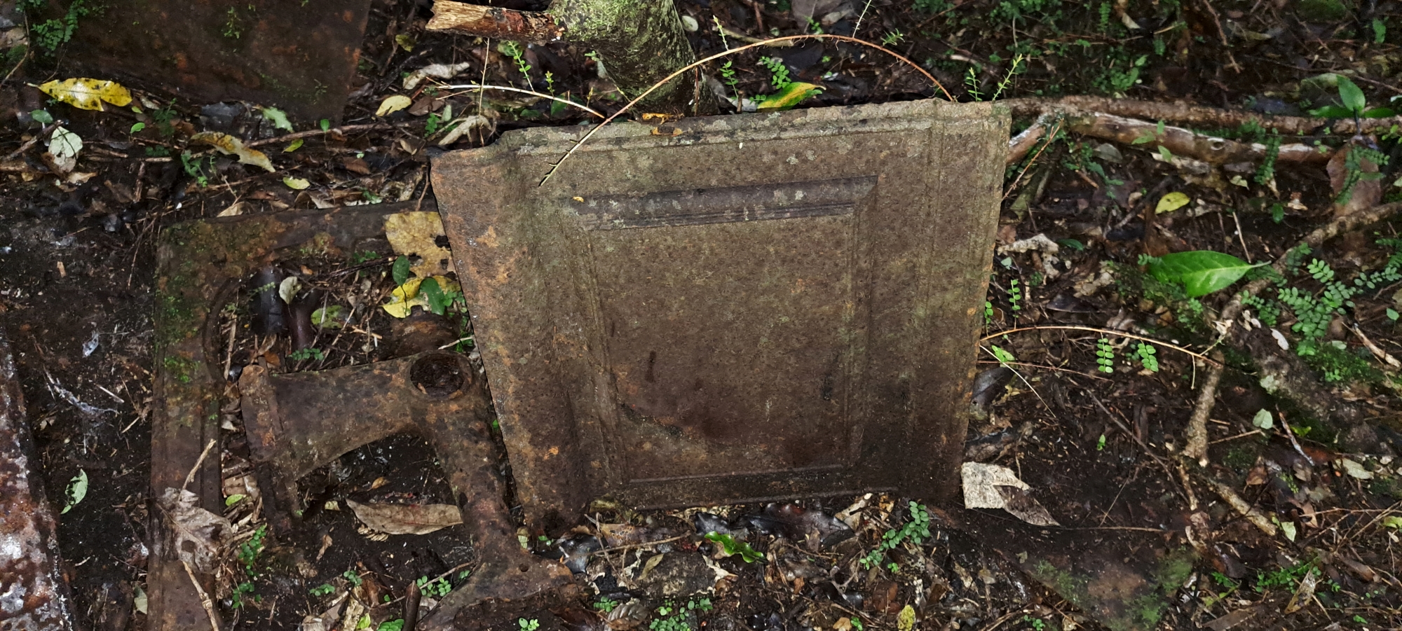
I began searching for the other site where a hut might have existed. After trekking around the area for some time, I eventually noticed something in the distance that appeared man-made. I figured it was probably a fallen fern frond or a nikau palm leaf, as these often have large bulbs that can look like flat surfaces in poor lighting and from afar. However, as I got closer, I realized I was in luck. It was a site with metal debris, likely from an older time period.
Up close, I saw what appeared to be a dismantled and rusting cast-iron stove. There was also an artifact that was shaped like a sewing machine, with a gear at one end, which could have been a piece of plumbing. Upon closer inspection, I thought it might also be a meat grinder. Another object appeared to be a metal tabletop, and there were several other pieces lying about, some partially covered in dirt and debris. This suggests that more artifacts may lie buried at the site, which I will undoubtedly examine again at a later date.
After taking some photos, I decided to leave, satisfied that if a hut existed in this area, it was likely here. So, this brings the hypothetical count to three out of four, which isn’t bad. One hut to go.
The remaining hut to locate was Pearson Hut, which should be relatively easy since there are still fences outlining the property’s boundary and photos of the hut exist. Additionally, some Wainuiomata residents recall this hut as it was present as late as 1995. However, unlike Mackay Cottage, the location of this hut is not signposted or marked at the site. So, I only needed to find the chimney or some other solid part of the structure, like a foundation, to confirm the hut’s exact location. Before focusing on Pearson Hut though, there was the small matter of thoroughly searching the area I was currently in, before leaving.
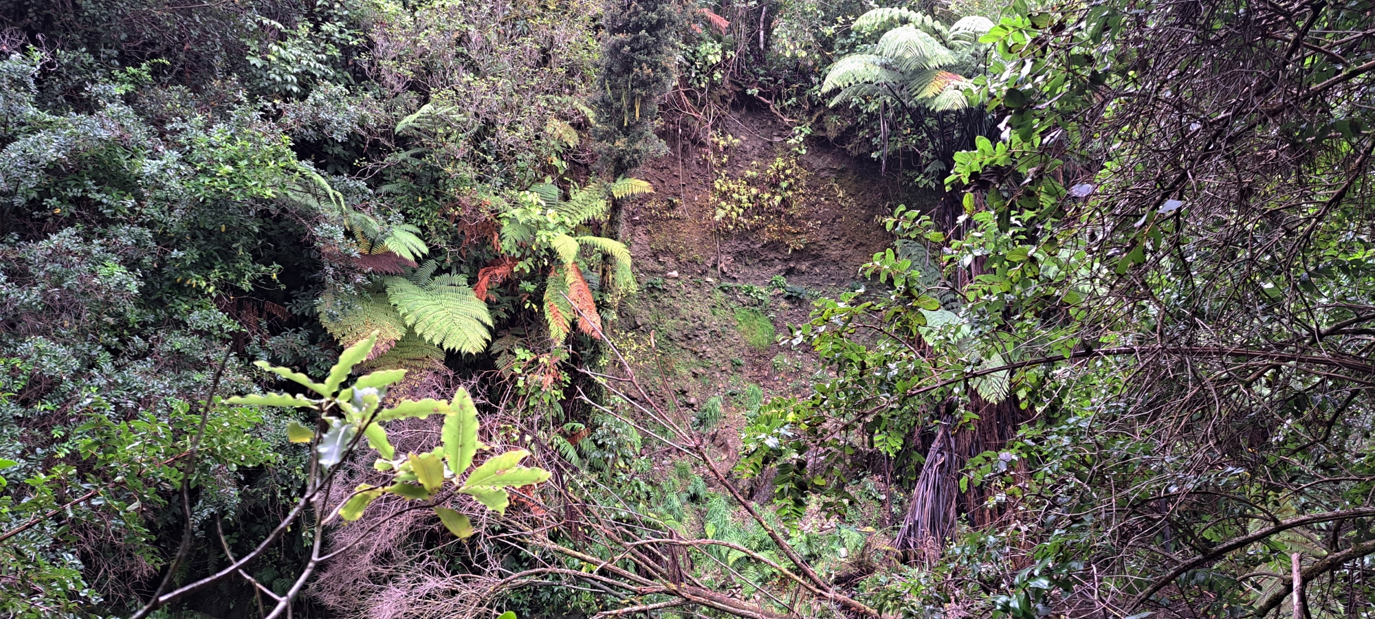 From the location of the site containing the metal debris, I decided to head for the Wainuiomata River where I saw evidence of a large slip that seemed recent, as debris from the slip were still in the river. I followed the riverbank for some distance upstream until I eventually could hear the rushing water of the lower dam. However, I couldn’t get a clear view of it due to a small but steep spur that stuck out of the river bank and dense bush. So I went around the spur from above, but it just got steeper and higher making it hard and dangerous to descend down to the riverbank for a photo. So, I backtracked and followed the river’s edge from the low point, but the spur was impossible to get around. I found out the hard way, but the grade was way too steep for a person to cling onto and the vegetation was perhaps the thickest I had ever encountered. I gave up and headed back up to the high point after the spur and tried to drop down, but that was just as difficult and dangerous, so I just gave up trying to get a photo from there.
 What to do now? I headed back to the area where I had identified the two sites and scoured it thoroughly until I was satisfied there was nothing else to see. However, I couldn;t find the second site, where remnants of the oven and other artefacts were located. I just wanted to make sure that I hadn’t missed anything there so wanted to return. I persisted looking for it and eventually stumbled across it again. I took more photos, but had to use my flash at this point, as the sun was nearer the horizon and the thick forest hindered light coming in from the lower angle.
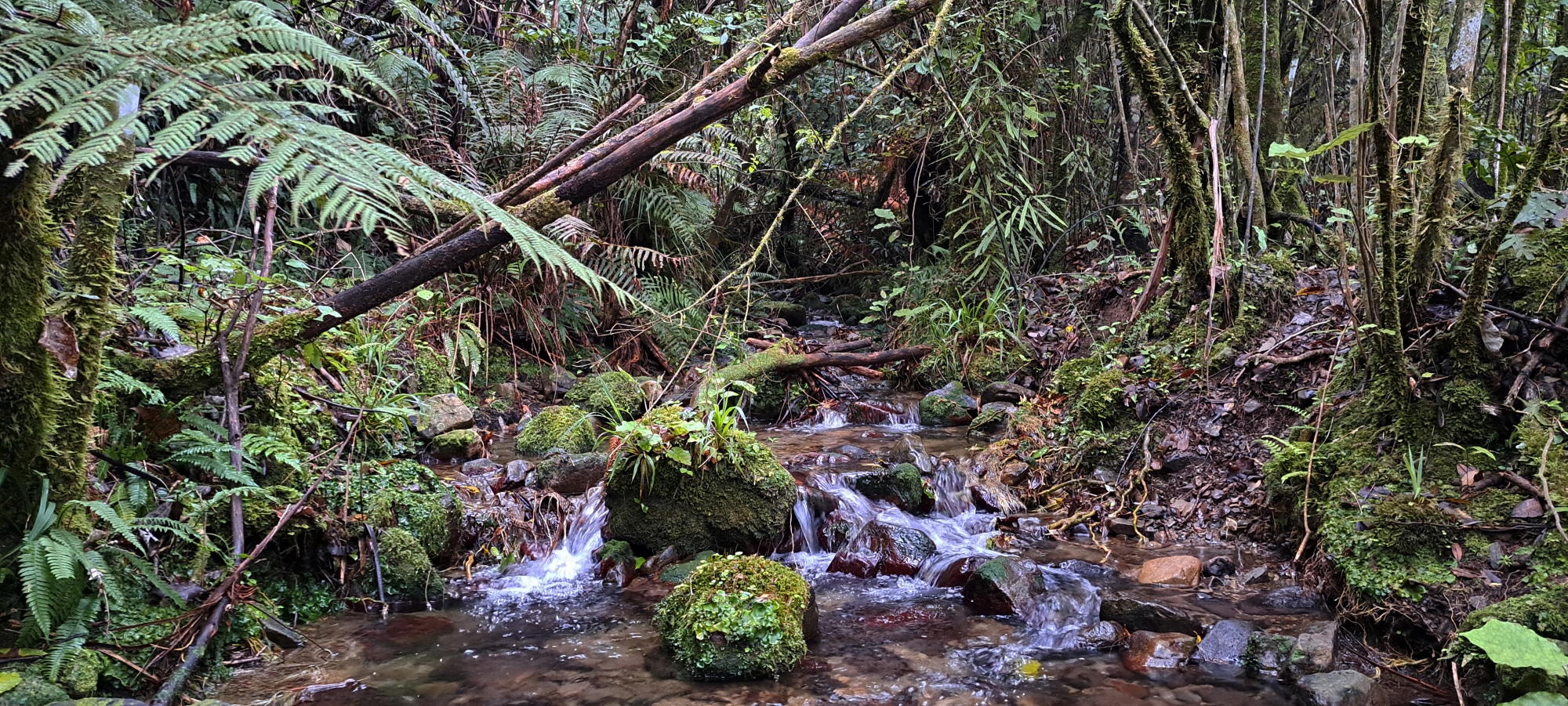
I then returned to the river and considered following it west (downstream), to see if there was anything else of interest on my way out. Indeed, I found what appeared to be a track, possibly a path leading to the two huts from the river’s edge. I followed the track away from the hut locations, eventually crossing over Sledge Creek. The track continued on the other side of the creek until it reached the Wainuiomata River, and I could see it also resumed on the other side of the river too.
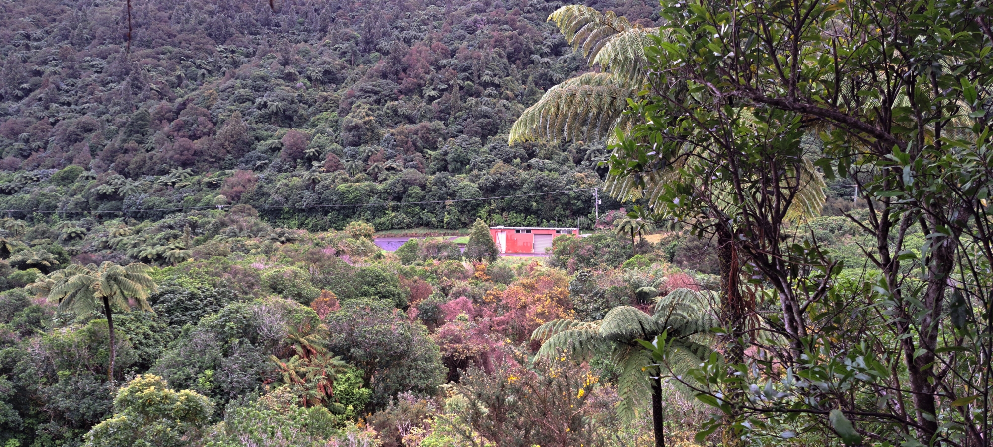
Perplexed by this track, I climbed higher up the bank behind the riverbank to get a better view of the area and lay of the land. From here, I could see I was some distance behind the old chlorine building, and the old track went right up next to that building. Of course, that building didn’t exist until 1964, so the track probably predated it.
 Here is my theory regarding this track: it might have been part of the original Sledge Track, where logs were transported to the Wainuiomata River, then moved to the tramway on the other side, and finally taken to the mill. If this is correct, the chlorine building marks the spot where logs were loaded onto the tramway from Sledge Track. This opens up another possibility: perhaps the huts in this location were used by the Sinclair family for their forestry enterprise, given the proximity to Sledge Track. This is pure speculation, of course, but if the huts existed when Sledge Track was being used to extract logs, then the old track and huts could date back to the mid-1880s.
After walking for some time along this old track, I arrived back at today’s version of Sledge Track in the wetlands area. Here I took some photos of Sledge Track Pool from above, and now it was onto Pearson Hut, to see if I could find exactly where that was located. If I could do that, then my mission to located all four huts in one day would be fulfilled.
Did I find the necessary evidence to locate Pearson Hut? Find out in Bush Bush 24…


