In this episode, I discover the exact location of Pearson / Scout Hut (1912-1995).
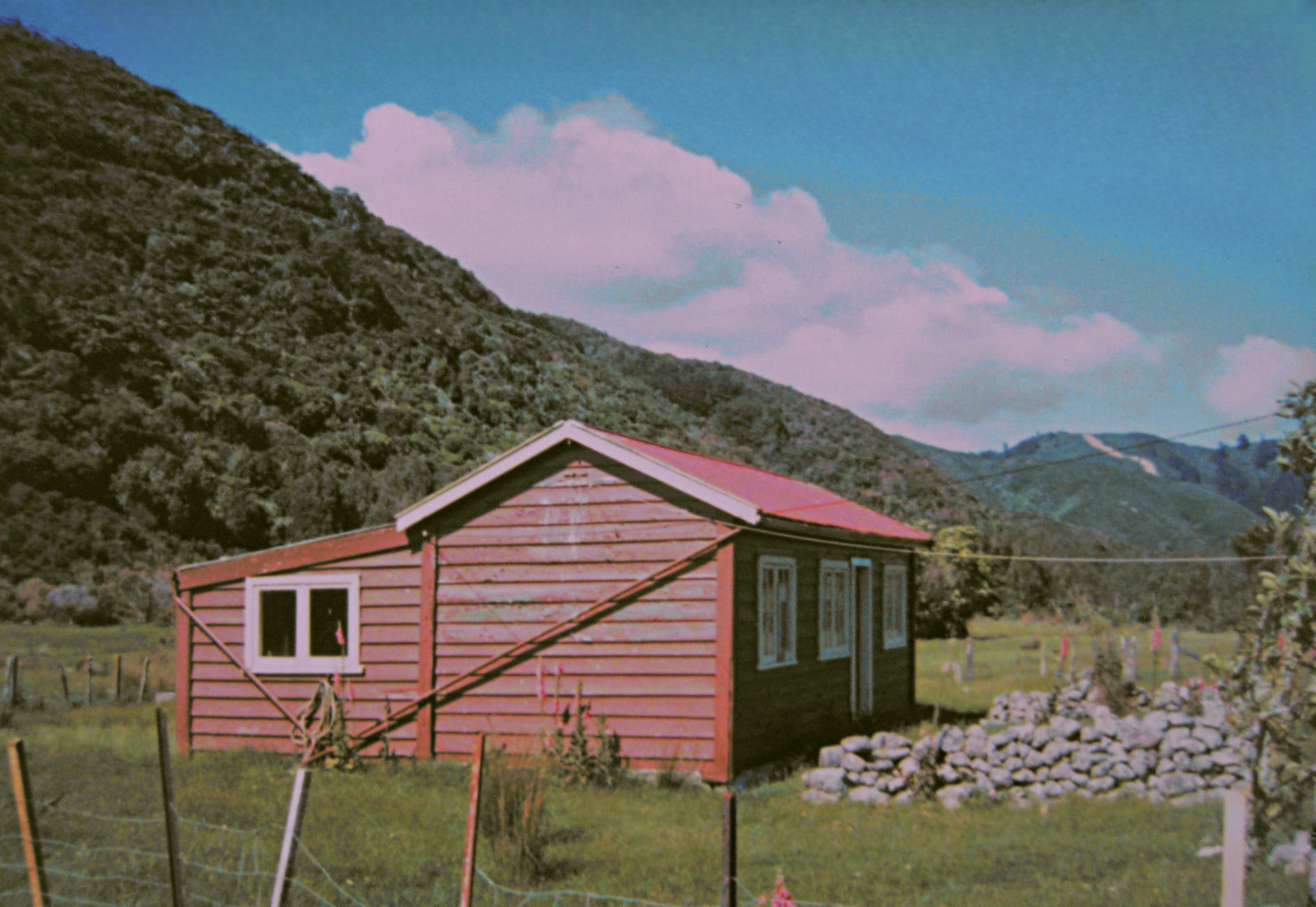 In Bush Bash 23, I discovered what could be two huts that once existed in the area called The Terrace. Returning from that mission, I had enough time to take a look at the Pearson Hut site to see if there was any remnants that locate the hut such as a chimney or foundation. This hut stood from 1912 until it burned down in 1995.
…Walking back out of Reservoir Valley via Sledge Track, I followed the boardwalk through the swamp area and noticed a grass-covered track. Curious, I stepped off the boardwalk and explored the small but wide grass track and the cluster of trees between this track and the boardwalk. Finding nothing special there, I crossed the track and headed into the bush towards the Wainuiomata River. This is the area the hut was located in and I walked along a steep bank that I had descended and explored previously in Bush Bash 19. In that expedition, I descended down the bank and discovered corrugated iron sheets and other materials that belonged to the hut. This time, I walked along the bank in a westerly direction toward Gums Loop Bridge.
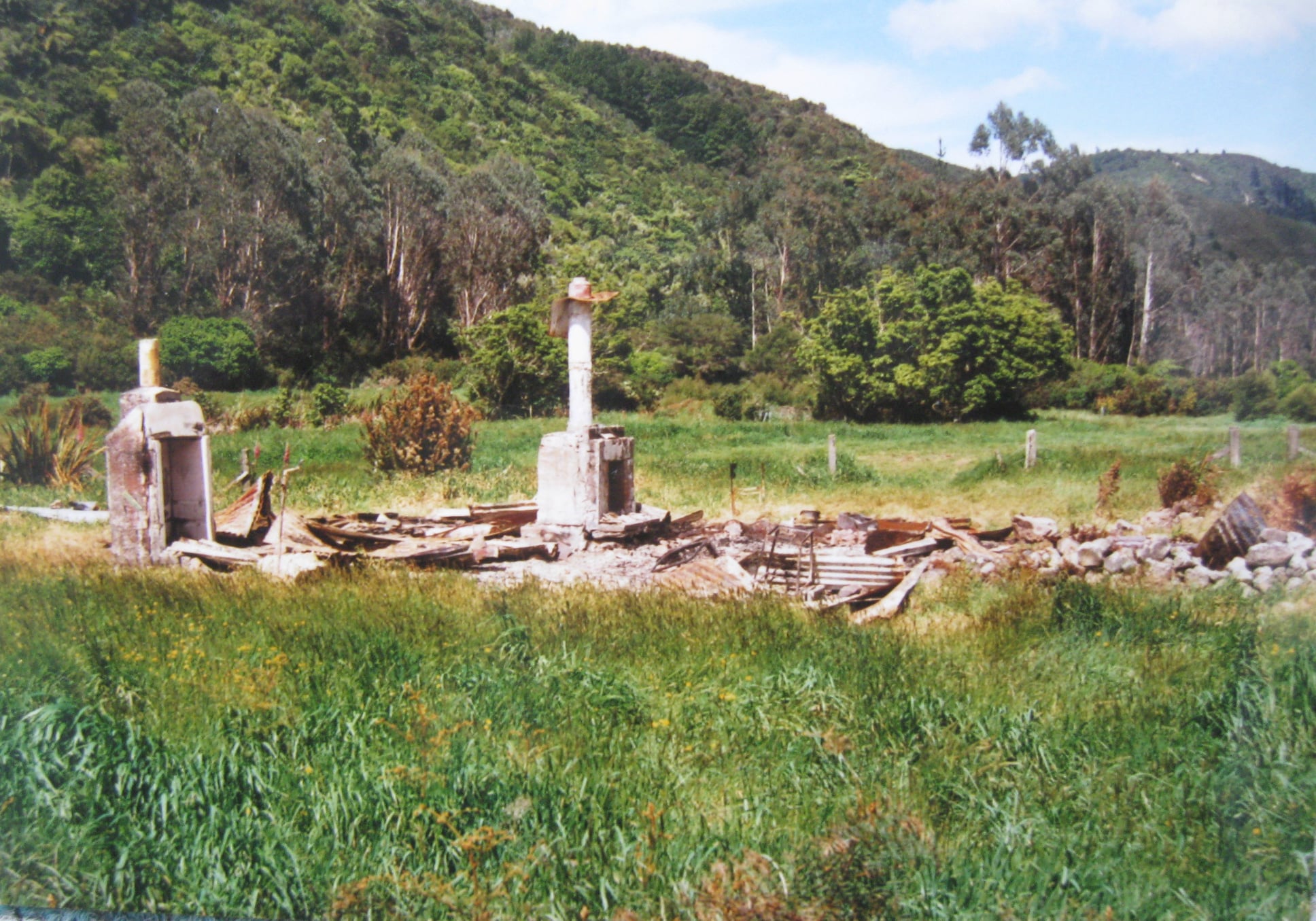 I saw sheets of corrugated iron here too that obviously came from the roof according to photos of the hut. It had a corrugated iron roof and wooden weatherboards for cladding. I also saw two piles of about 30 tyres that all appeared to have the same diameter. These piles had small plants growing atop, somewhat disguising their presence. What I was looking for, however, was the chimney or a foundation that might still exist. Here is a 1995 photo of the chimney and possibly the stove after the fire that year. You can also see scattered corrugated iron at the site.
I went further in the bush, and saw about 20 bottles mostly beer bottles, but also a couple of wine bottles and even a jar. The hut must have been a location for parties back in the 80s or early 90s. I guess you could make as much noise as you wanted.
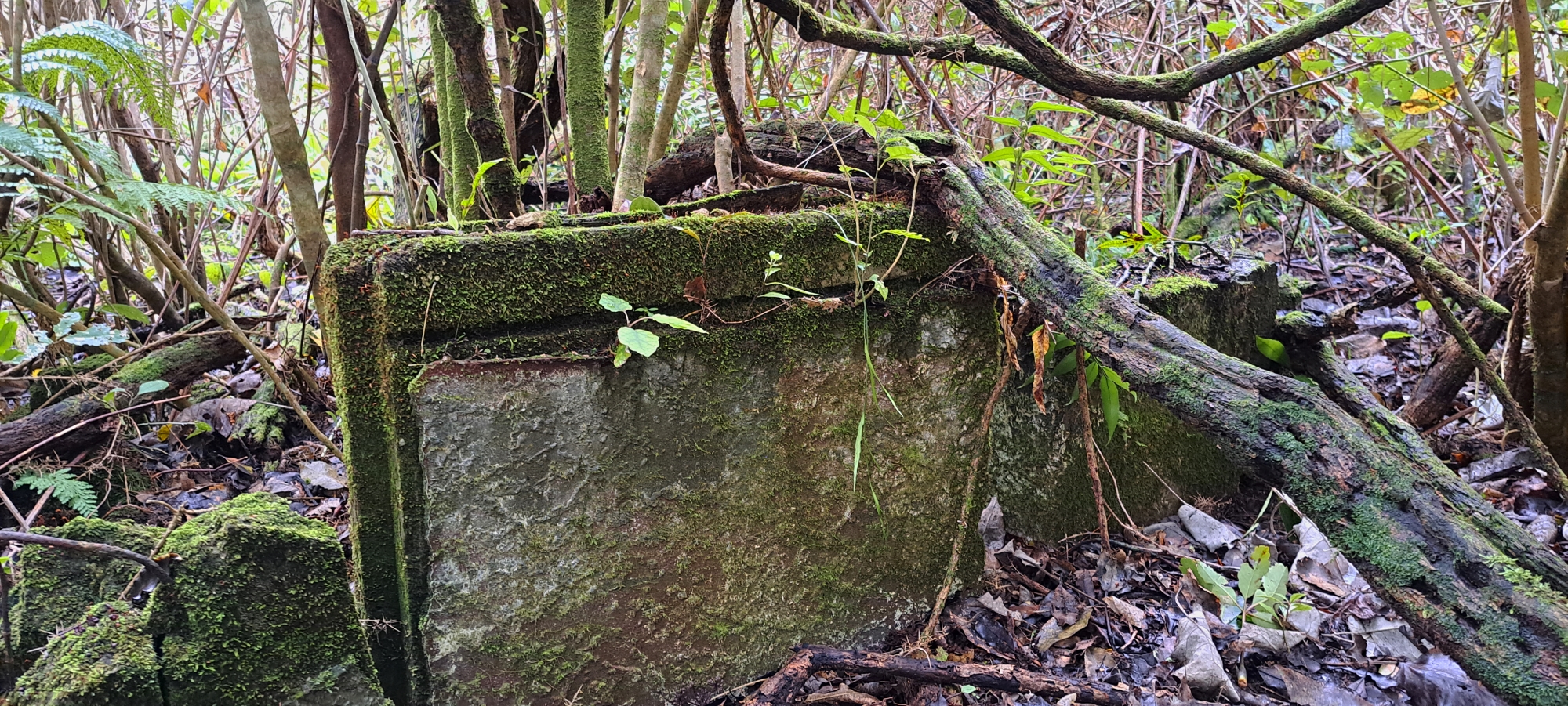 I also saw a section of the fence that was still intact and in good condition. Then I came across a concrete fence posts, (which are visible in the photo showing the debris after the fire). On one of the fence posts, there is a latch where a gate likely existed. Closeby in a small area of thick, low-lying colonising plants, including gorse and blackberry, I spotted what looked like the remnants of the chimney. I carefully walked into the area to take some photos, but a blackberry vine grabbed hold of my arm, and then I got stung by some stinging nettle or similar plant. It wasn’t really painful, but now my arm feels like it’s been scraped on the road. Oh well, it’s a small price to pay when delving into the history of Wainuiomata. Got to take the good with the bad. Anyhow, I took multiple photos of what appeared to be the chimney and fireplace. Regardless, this was solid proof that I had confirmed the location of Pearson Hut.
So, along with Bush Bash 22 and 23, I now had good evidence for the exact location of four huts that once existed in an area that was once called, The Terrace. Of course I am fully aware that evidence and proof are not the same thing. Nonetheless, I doubt I will find stronger evidence than what I found today, and I am content to leave this area behind for now and to consider exploring a new area in the near future. However, I will keep an eye out for any new historical references, information, or photos of this area, to further enrich my understanding of its history.
 Anyway, I continued leaving the valley along what appeared to be a track running alongside the Wainuiomata River. This track might have been the old path leading to an old swing bridge that once stood nearby and connected to the hut via a track. As I pressed onward, I noticed something large through the thick foliage ahead. Drawing nearer, I discovered it was the new bridge that had replaced the last swing bridge, which was recently removed. I was back in the year 2024 and what a bridge it is. I walked beneath the bridge, capturing some photos, before continuing along the grassy track further until I reached the ford.
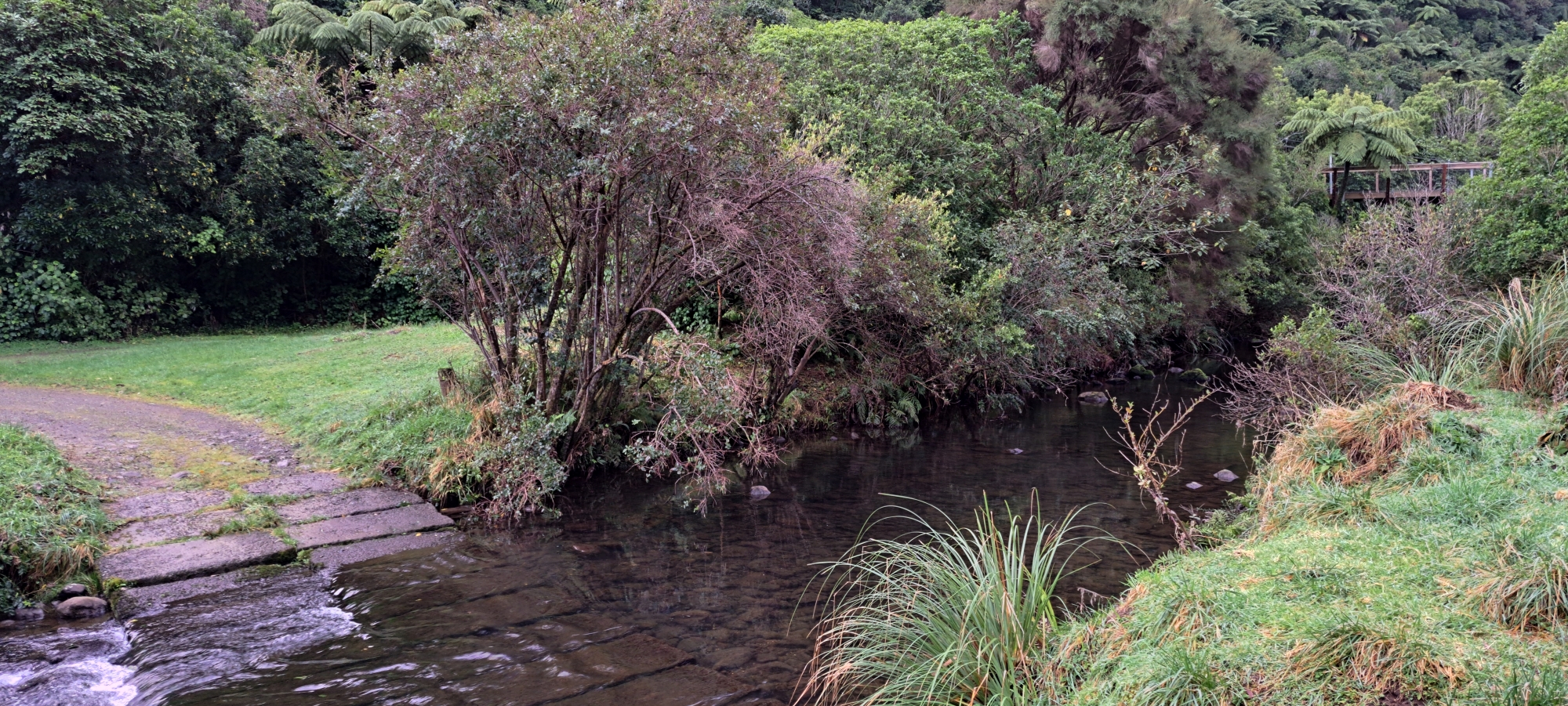 I walked across the ford to clean my boots and test their waterproofing capabilities. Impressively, no water entered my boots until I waded through a section of the river that was deeper than the opening in my boots. As expected, no boot could stay dry after that test. Ahh, the sensation of cool water on my tired hot feet.
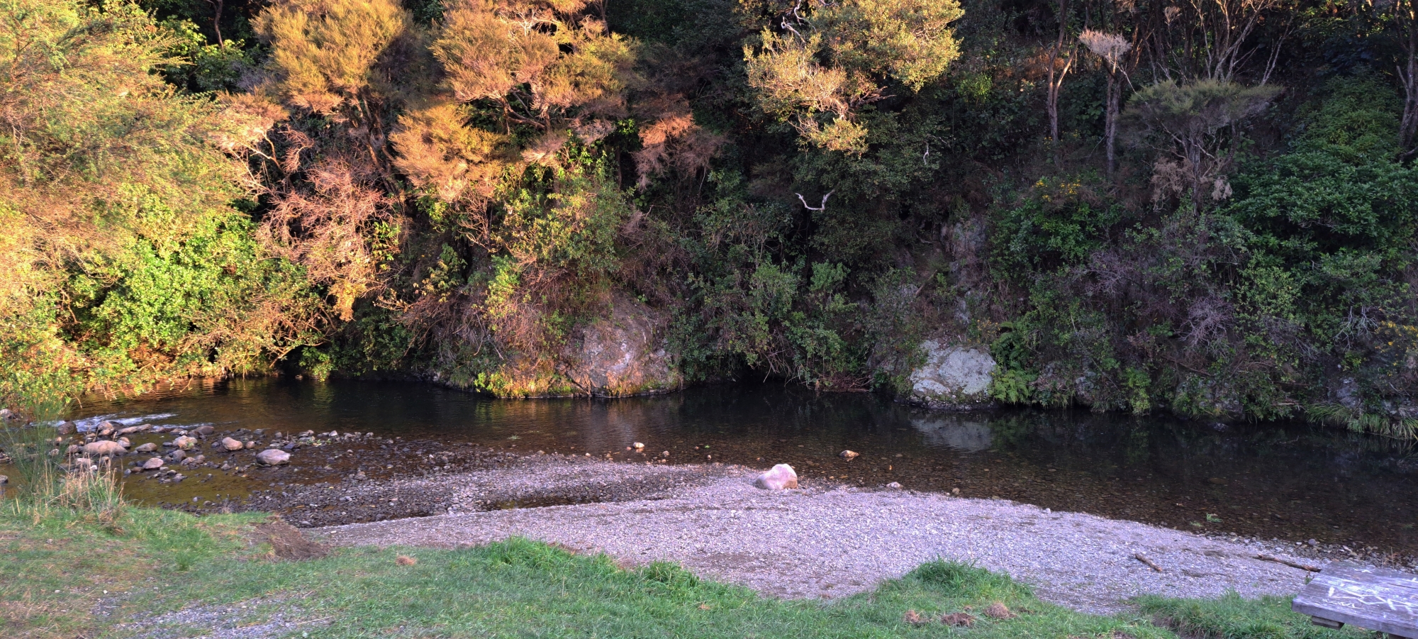 From there, I ascended to Reservoir Road, then headed to Top Pool. Crossing the bridge there, I followed the new track at Gums Loop towards Sinclair Cemetery. Finally, I returned to my car, changed into dry clothes and footwear, and prepared to head back over the hill towards home. Another successful day at the office. What to do next, I wondered.


