Today’s adventure involved searching for evidence of an old tramway in Reservoir Valley.
Today’s mission was ambitious, delving into the history of a small railway (known as Sinclair Tramway) from the mid to late 1800s, once located where Reservoir Road stands today. Originally used for transporting logs to a mill near the Moores Valley Road and Whitcher Grove intersection, the tramway later served as transport to the dam. No physical remnants, tracks, sleepers, or parts of the locomotive, are known to exist today, as far as I know. The locomotive itself eventually found its way to the West Coast in the South Island and after that, who knows.
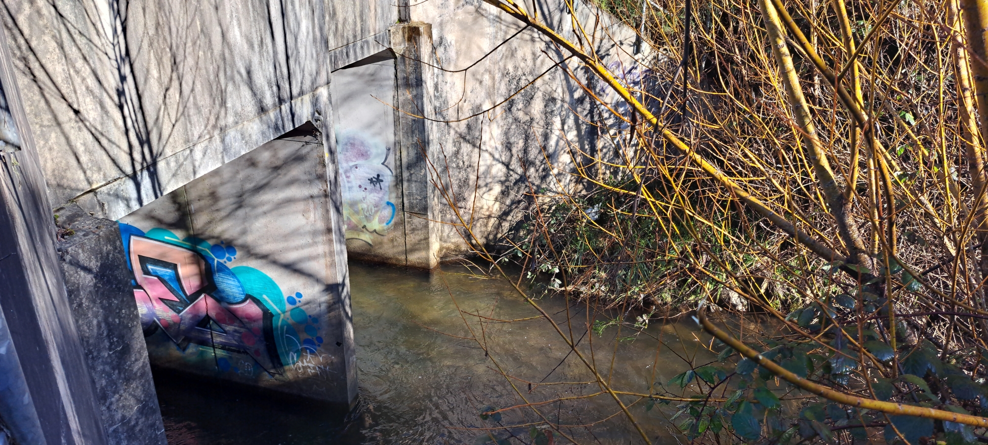 Before embarking on the main trek, I captured some photos of the Wainuiomata Stream and the culvert beneath Moores Valley Road, taking advantage of the clear skies and full rivers after recent rains. I then walked along Whitcher Grove, and counted up to four Kererū at the same time, likely attracted by food-bearing trees on that road.
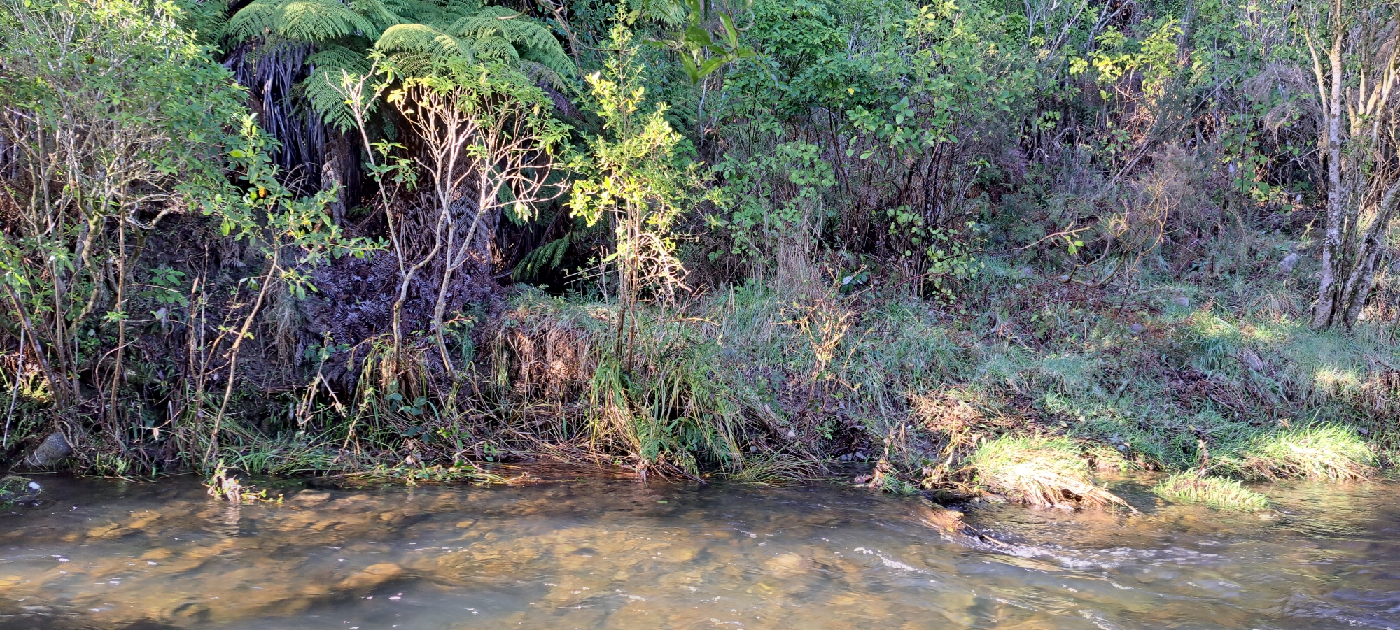 My main mission began in the most promising spot for potential tramway evidence. Aware of a likely failed outcome however, I embraced the journey more for its outdoor exercise and adventure. From the Reservoir Road carpark, I followed an overgrown old track, which once provided vehicular access across the Wainuiomata River from what is called The Triangle to Gums Loop Meadow. The path, slightly less vegetated, was a subtle reminder of its past. Once I reached the river, I simply followed alongside the riverbank which is located below the road, where the tramway once existed. I speculated that parts might have been discarded down there over the years as the road was built atop the old tramway.
The area I trekked through was surprisingly flat and easy, leading me to a familiar concrete wall, that didn’t allow passage beyond. I photographed the wall from new angles and ascended up to the road. 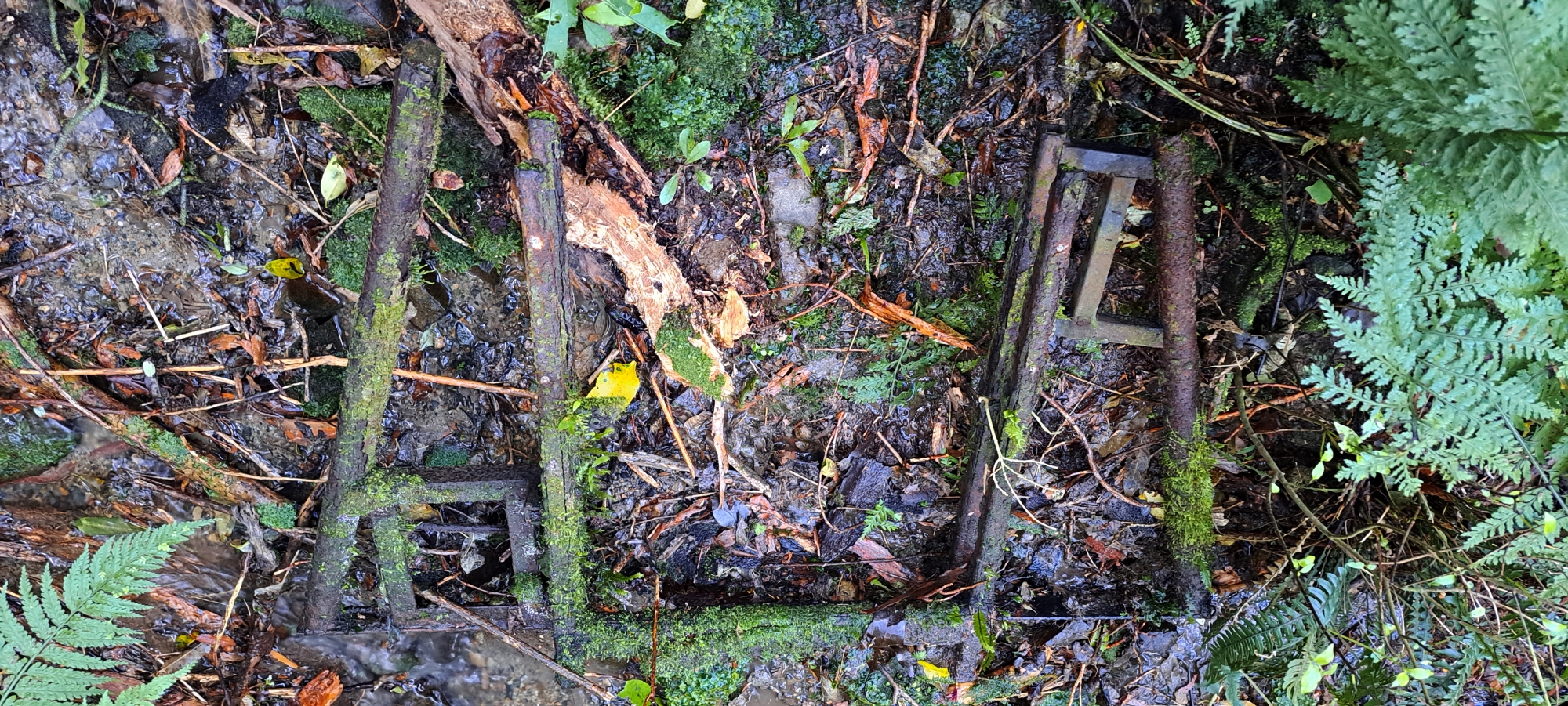 Once the land below flattened out again, I descended and continued along the riverbank and passing three locations each containing a pipe that runs under the road.
Besides pipes, I also found a rusty, heavy artefact that seemed old and weathered. I wondered if it could be part of a frame belonging to an old locomotive. But this was likely wishful thinking, as it would have matched my mission perfectly. The artefact did appear to have an electric plug attached to it, so it might be part of an old trailer perhaps. Nearby, a large hole next to the road opened by recent floods might have exposed this item, potentially linking it to later construction on this road. As for the tramway, one would assume that the tracks were recycled. Regardless, I documented the artefact and continued.
Once again, the path was obstructed by a steep bank, followed by Ultimate Pool. I didn’t bother searching the area beyond that pool, as I had already explored it during a previous bush-bashing adventure. Instead, I ascended back to the road and descended again past the area I had previously visited, this time to a new spot where I had also been when looking for a low stone wall. I knew the wall existed, as I had seen it from the other side of the river a few weeks back. However, once again, I failed to locate the wall, making it a 2-0 score in favour of the wall. Nevertheless, I did find mounds of rocks further inland from the river. In fact this area is littered with rocks that appear to have been placed in their locations, so it is logical that the wall is there somewhere too.
 Coming out of the bush, I approached the swing bridge, where I conversed with a person who grew up in Wainuiomata, but now lives in the States. I offered him directions before I crossed the swing bridge. I photographed Mackay Cottage site and Pearson Hut, finding an old gate entrance that is visible in old photos. Further up the valley, I ventured into the bush toward what I consider, two undocumented huts, gone since the 1930s.
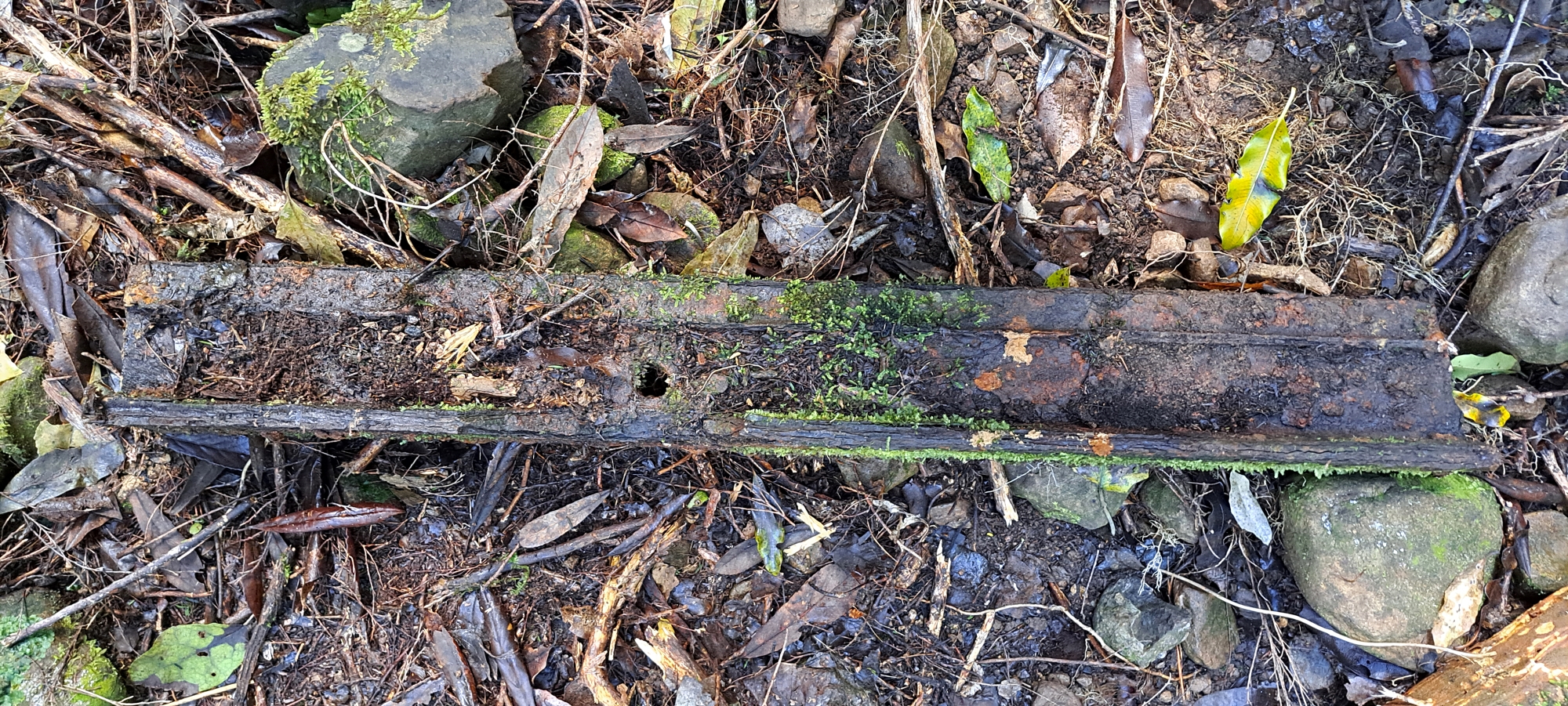 In the general area of these hut sites, I rediscovered familiar items like a metal grill, bricks, tiles, a concrete platform, and stove parts, along with new objects like an old possum trap and some wire netting. But the big find today was a one-meter or so single rail track, strangely fitting my mission, or was that wishful thinking once again. Perhaps it was a steel column or girder. If the latter, then the nearby hut could have been quite large and significant if it had metal girders. But if it is a rail track, then it was located away from the tramways’ known path, but close to Sledge Track where logging operations took place. I guess it could also have been a rail track that doubled as a column or girder as there was probably an abundance of rail tracks compared to other building materials back when the tramway was under construction and when it was operational.
Maybe the drilled holes in the side of the track / column / girder might help answer the question as to its exact function? I did notice however, that this wasn’t the typical H-shaped girder or column. Instead, it had a broader, flat base with a smaller upper surface, fitting the shape of a track. Additionally, I observed that the entire site contained numerous iron or steel artifacts which I guess can stand decades of erosion compared with wooden artefacts.
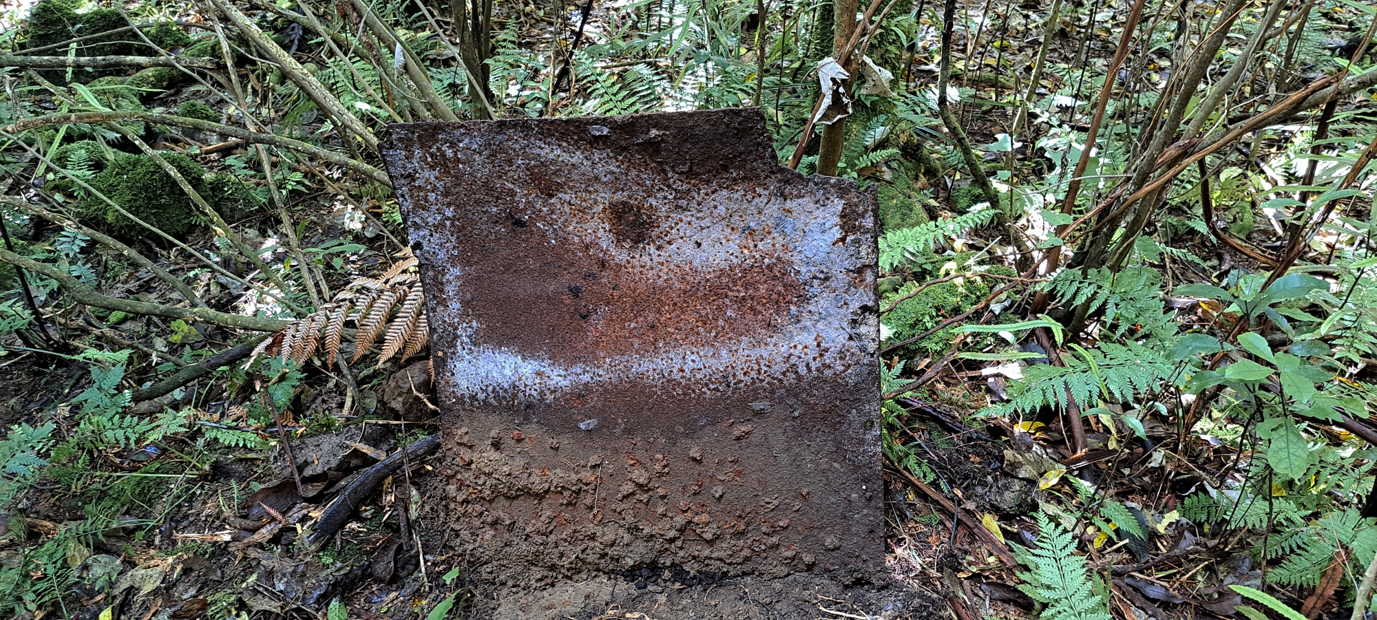
Shifting to a different location, I came across debris that appeared to be a discarded section of an old chimney. After confirming it was man-made by photographing underneath and inside the blocks / bricks, I then realised that the chimney base I had discovered weeks earlier was very close by, indicating it was part of the same structure. Also nearby, I noticed a metal sheet buried in dirt and tangled with roots. After struggling to lift it, I finally managed to flip it upright, revealing its shape and visible bolt holes. It was quite heavy and it was curved at one end.
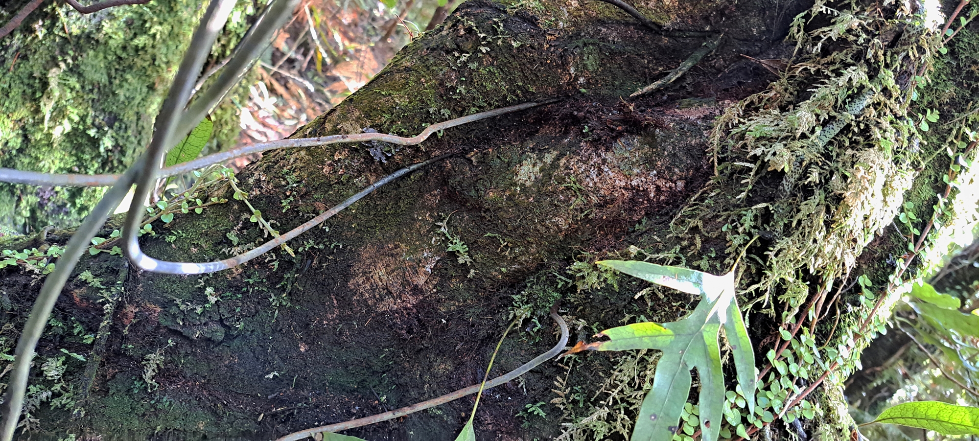 I then returned to photograph a length of wire embedded in a tree trunk that I had discovered a few weeks earlier. Observing how the tree had grown around the wire, I took a series of close-up photos to help estimate when the wire was originally wrapped around the trunk while the tree was younger. If the fence and the huts were in use at the same time, this could provide a useful clue for dating the huts.
Back in the hut area, I found another chimney base, suggesting a third hut or a connection to the hut with the concrete floor and iron debris which was the closest hut site. If connected, then this hut was a larger structure than previously thought.
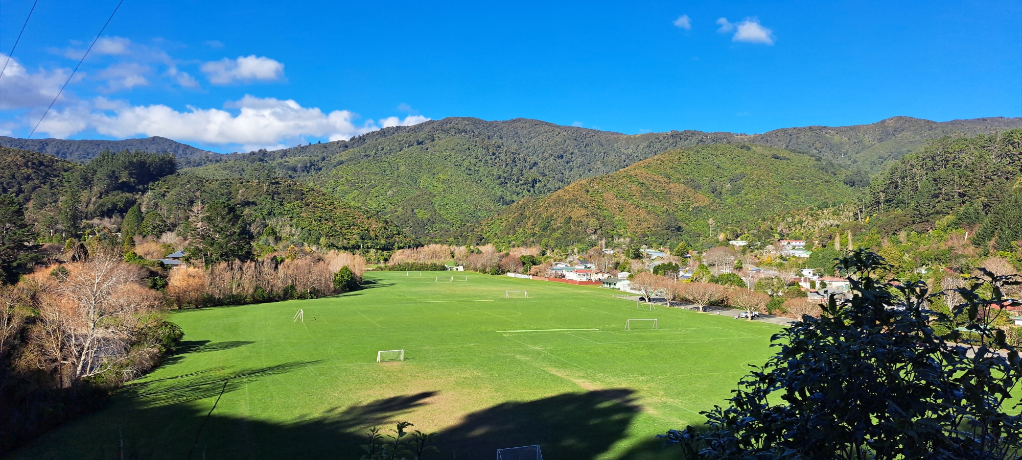 Satisfied with the day’s findings, I exited and arrived at Sledge Track, then crossing the ford by the swing bridge, dubbed by me as the “boot cleaner”. The swift water from recent rains meant I had to be careful with foot placement, but that extra work was paid back when I didn’t have to move my feet back and forth in the water to clean the boots. My mission ended with a pleasant walk along Reservoir Road, and drying my boots by walking on the road in a manner to not collect any new dirt. As I drove out, I couldn’t help but capture another photo of Richard Prouse Park a lookout at The Rock, as it was a truly stunning day.


