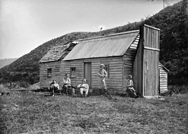
Smith’s Whare
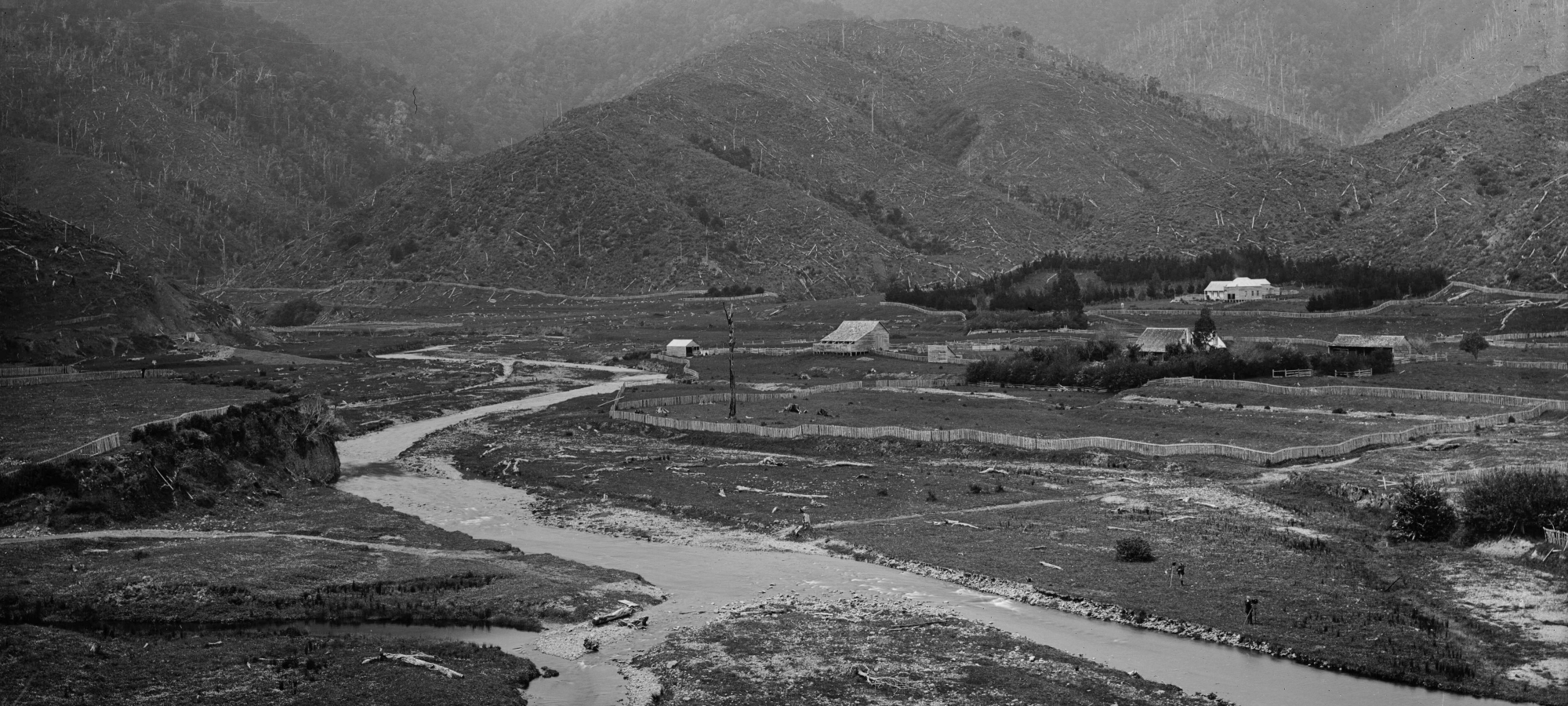
Today, I set out with a specific goal: to locate the site of Smiths Whare, an old fishing hut near the confluence of Wainuiomata Stream and Wainuiomata River. A photo of this hut was taken in March 1888 by Frederick James Halse of Wellington. The photo includes five men in front of the hut. But where was this hut located exactly and is there any evidence of its location today? Furthermore, in another old photo, there seemed to be a track nearby, so I decided to investigate whether the track still existed despite the regenerating bush in the area. Despite seeking these answers, there was the added benefit of getting some decent exercise in the process.
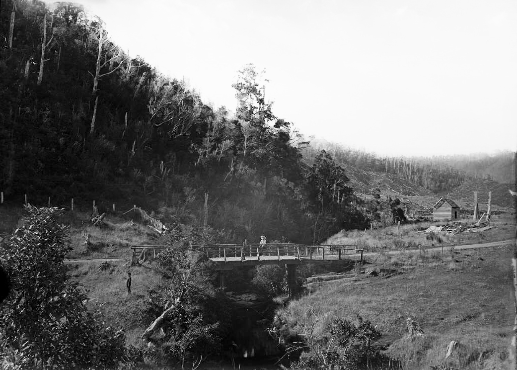 Upon looking for any clues from old photos or records for the location of Smith’s Whare, my curiosity was sparked by a further photograph that provided a key clue to its exact location. On April 1, 1888, Frederick James Halsea took a photo of a bridge crossing over Wainuiomata Stream with the Sinclair Sawmill Hut in the background. According to the Alexander Turnbull Library, the photo was taken from “Stock’s Whare”, which was another name for Smith’s Whare. By studying the photo and knowing a bit about the topography here, I realised that the Wainuiomata Stream flows toward Smiths Whare, but rather than the water flowing into the hut, it was sufficiently elevated above the stream atop a bluff. With this in mind, I decided I would follow the stream myself until it encountered the bluff, where the stream was forced to change direction. Another pertinent detail in that photo is the bridge, as it aligns perfectly with the location of a culvert under Moores Valley Road today.
With this information, I set off for Wainuiomata. I drove to a small turn-off on Moores Valley Road, where I could access both the Wainuiomata Stream and interestingly, another spot that I had been meaning to explore for some time, a small creek flowing down the hillside on what was once called The Rock. I would do this second adventure if I had any reasonable time left, once I had fulfilled my main objective.
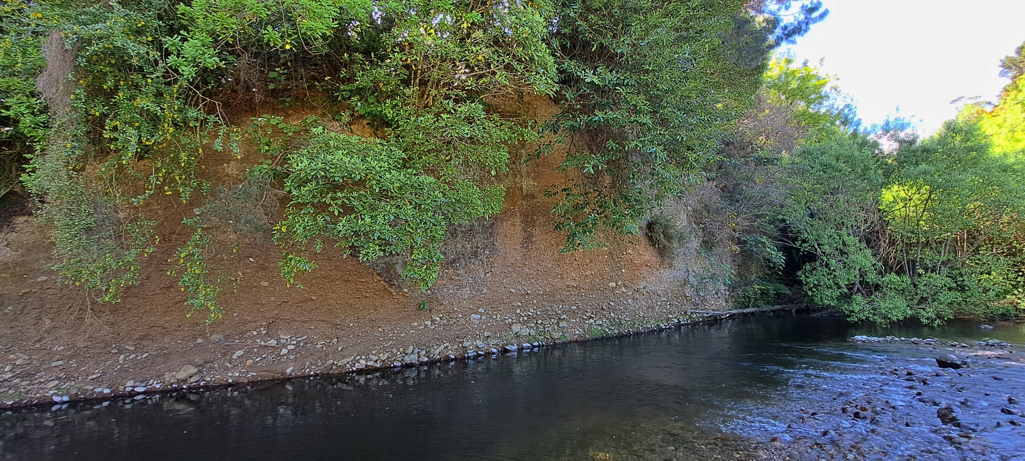
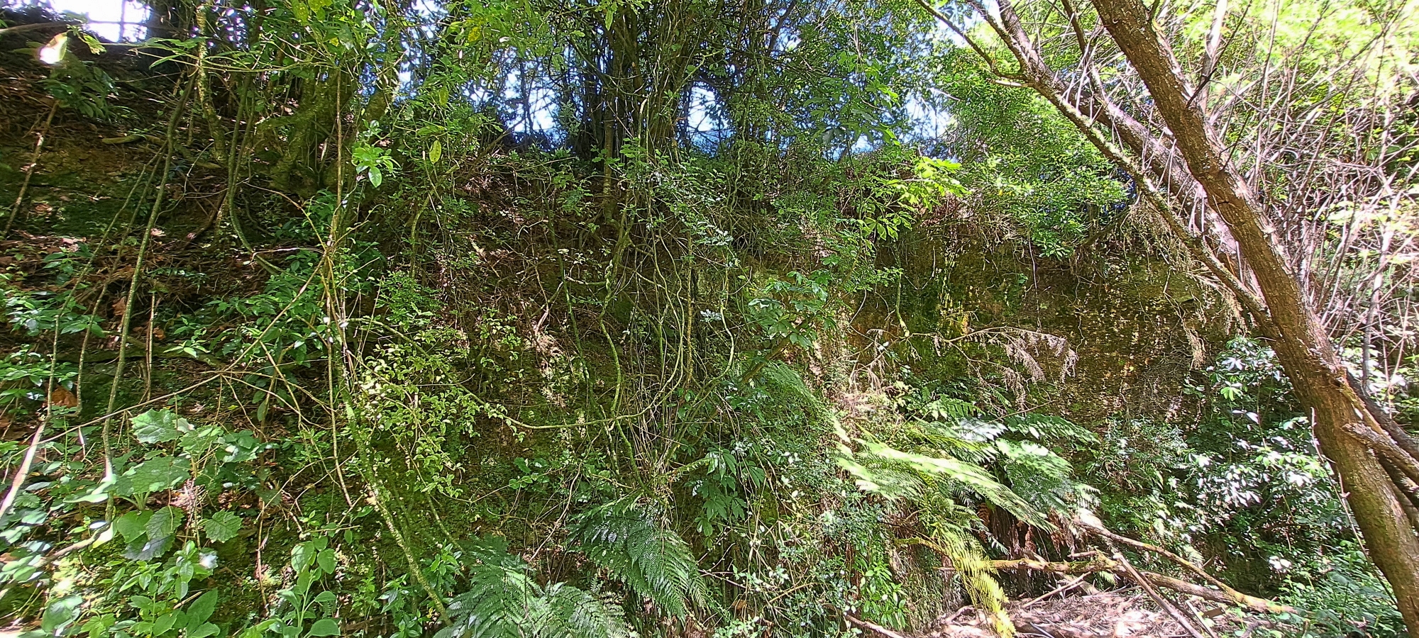 After reaching the turnoff on Moores Valley Road, I prepared my gear, packing essentials like a drink, jacket, and other useful items, and set off toward the culvert. Once I descended to the Wainuiomata Stream, I followed its path until it turned sharply at a bluff, perfectly matching the location in the photo that was said to be taken from Smiths Whare, which would place the hut above the bluff at this precise location. Although I had found the spot, the bluff seemed nearly impossible to climb. The area below was wet and muddy too, with flood debris and pools of stagnant water everywhere, making the terrain tricky to walk along.
I considered abandoning the route altogether and instead ask permission from the private landowners above, if I could explore the area above the bluff. But I decided that scaling the bluff was less of a hassle. Problem was the stream ended up flowing against the bluff, so there was only one place I could climb where the stream was not too close and the gradient of the bluff was less than 90 degrees. Fortunately, there happened to be a few decent trees growing there, I guess because the lesser gradient allowed it. I scaled up the bluff wall using these trees as anchors to hold onto. Once at the top, I could see farmland and some buildings across a fence. I was then forced to walk a fine line between the bluff edge and the fence that looked electrified. Eventually I was able to descend back down to the stream as it flowed away from the bluff.
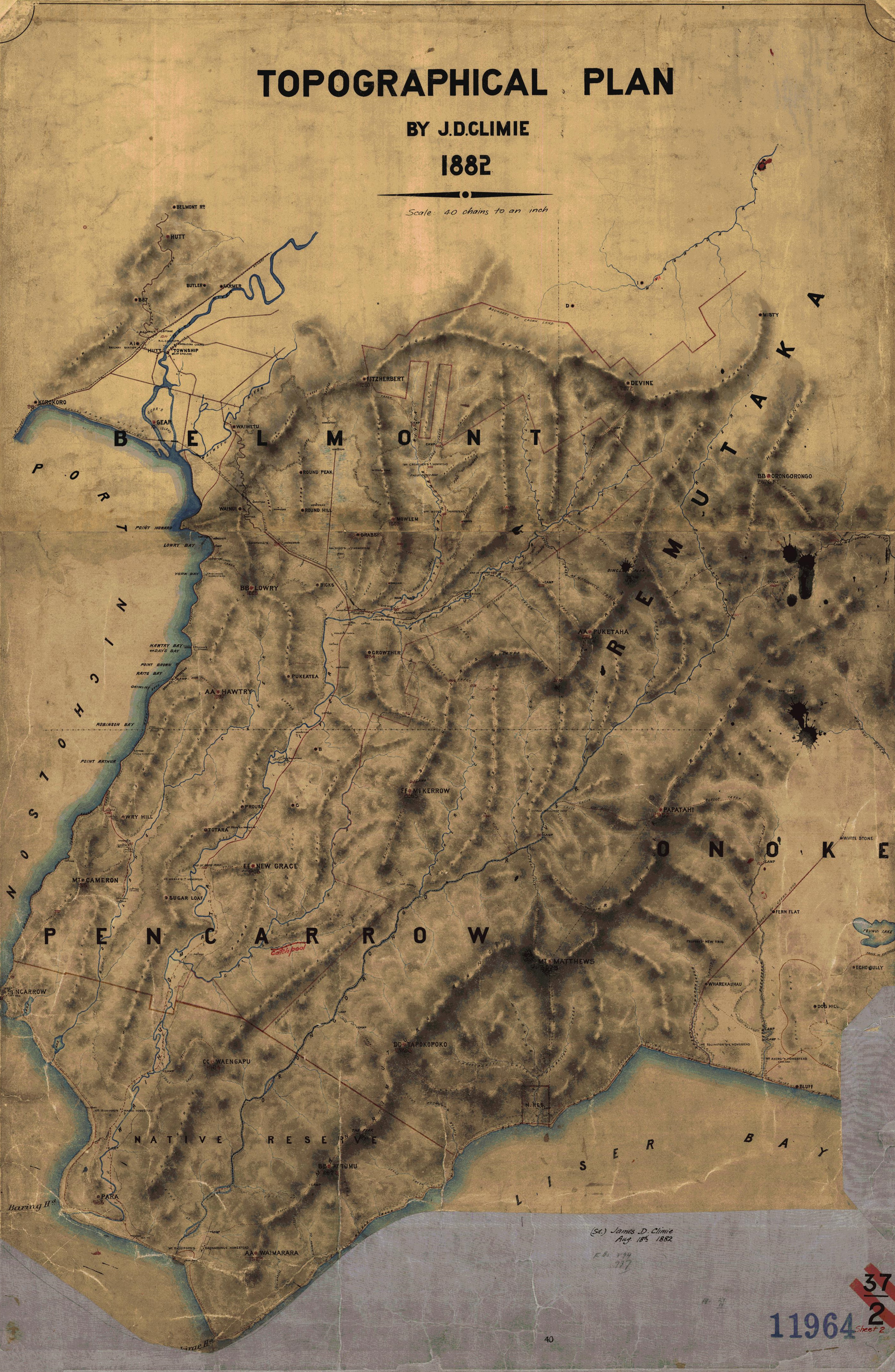
Note: Later on while examining an old map from the 1880s, I noticed three dots in the area where I believe Smith’s Whare once stood, with each dot seemingly representing a separate building. It’s possible that Smith’s Whare was constructed from three earlier workmen’s huts. In the old black-and-white photograph of the hut, you can clearly see that the building is formed from at least two huts being joined together.
Mill to Moness Track
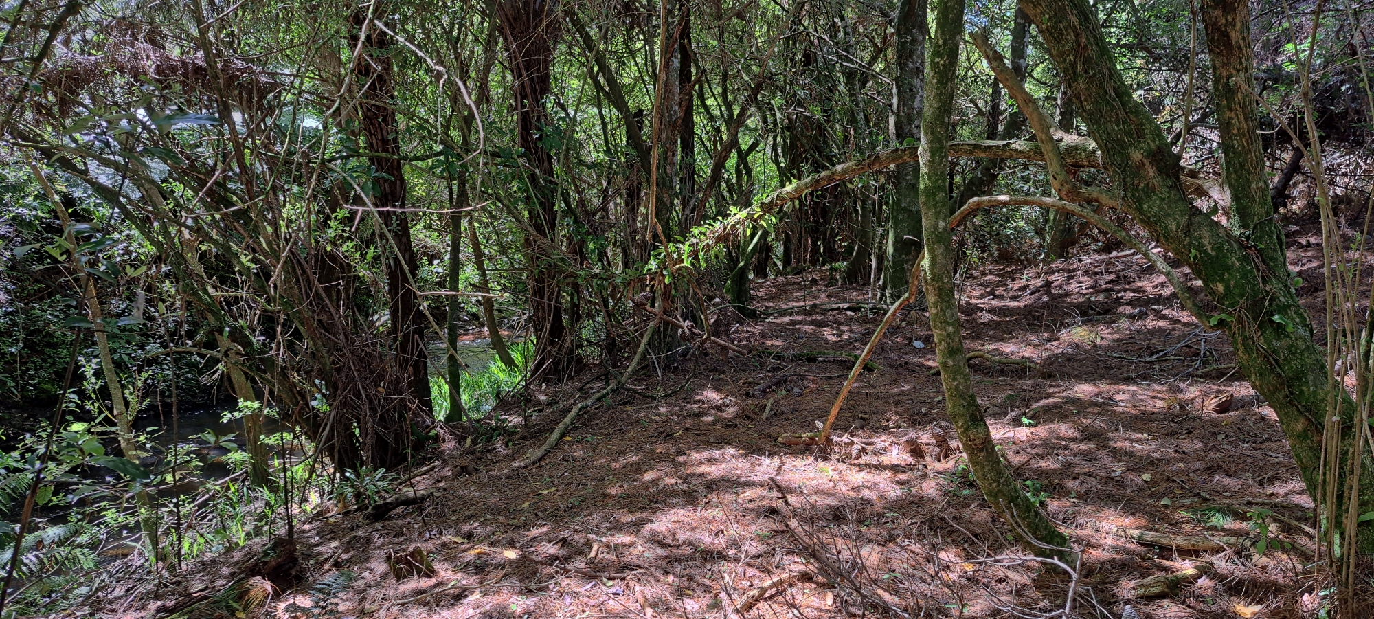
 Although I didn’t find any remnants of Smiths Whare above or below, I was now standing on what I believe to be an old track visible in an 1880s photo near the confluence of the stream and river. Initially, I thought the stream had three branches or that there were three streams flowing into the river next to each other. Upon further investigation however, it turned out that one of those branches was actually a track as it clearly crosses the river and continues on toward Moness, a Sinclair property. Already knowing this, I could see the land I was standing on did indeed resemble an old track, albeit overgrown with blackberry bushes that by the way, left my legs a bit scratched up. After crawling under numerous bushes, the terrain then opened up, making it easier to walk toward the river. Just before the confluence, I saw a boulder bank that is not visible in this photo. I wasn’t sure if it was natural or man-made, but I suspect the latter and later realised how it may have been constructed.
Wainuiomata River
 Finally, upon reaching the Wainuiomata River, I realised that although I had identified the locations depicted in old photographs and descriptions, there were no actual physical remnants of the whare on the ground. These were likely washed away by floods decades ago, built over, or reused. What I did uncover was based on deductions from the land’s topography for both the hut and the track. However, I stumbled upon the skeleton of a sheep or goat – for whatever that’s worth.
 Now what? Instead of retracing my steps back over the challenging bluff and push my luck, I decided to cross the Wainuiomata River and head toward Richard Prouse Park. Before doing so, I explored along the bottom of the bluff as far as I could, aiming to cross just before Cliff Pool where the river runs directly along the cliff face. However, the terrain became difficult before Cliff Pool, so I opted to cross the river early and head along Richard Prouse Park to get to the pool from the other side, where I managed to take some photos.
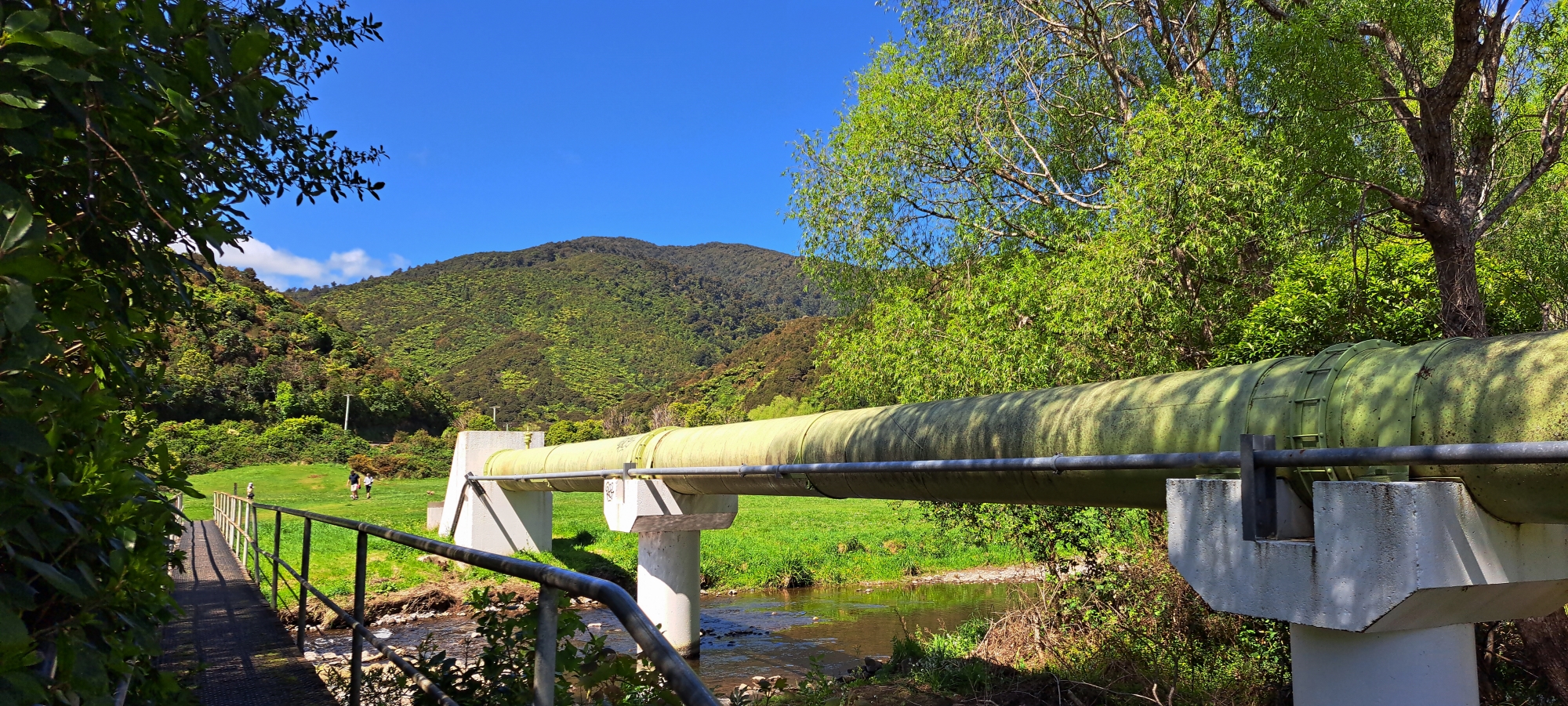 From there, I made my way to the bridge across the river and continued toward the eastern end of the park, capturing photos of the large pipe that spans the river. On the eastern side of the park, I headed for the bluff again and tried to follow it till I got to Reservoir Road, however I was stopped by dense blackberry bushes and gorse. My alternate route took me across a buried pipe near Colemans Tunnel, whose entrance has been entirely bricked up and buried.
Whitcher Grove
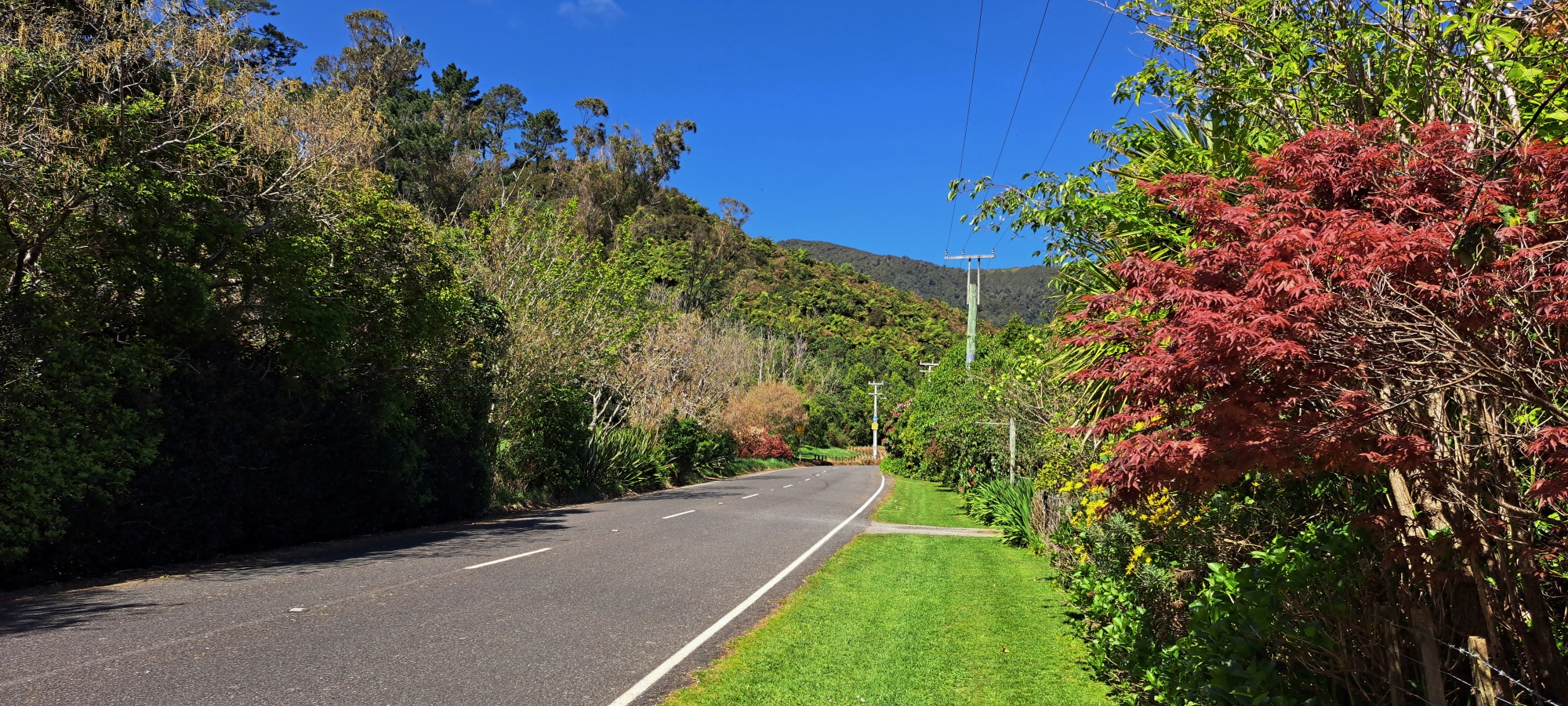
I continued along Reservoir Road and Whitcher Grove, passing numerous holly trees and the site where House Northbrook once stood. Holly trees in this part of Wainuiomata always intrigue me, as they seem to mark areas of significance. For instance, Sinclair Cemetery has holly trees outlining its boundary, as did an old farm that once occupied part of what is now the Hine Road Recreational Area, with holly trees marking its entrance and along its southern boundary. Around Northbrook, holly trees grow in a distinct line. Nearby stands a magnificent giant redwood, likely planted at the same time as the three still present on Hine Road today. It seems probable that a former owner of this land invested in a significant number of holly saplings or seeds and managed to acquire a few young redwood trees as well.
As I walked, I mustered the courage to visit the house on the property where Smith’s Whare was once located, intending to ask if they had any knowledge of the old fishing hut. If they didn’t, I hoped they might at least allow me to photograph the site. However, as I approached their driveway, I noticed a large gathering where dozens of cars were parked, and vehicles were passing me along the drive. It seemed that an event of some kid was taking place on the property, so I thought it best to leave these guys to party.
I did however manage to get some photos of the area that included a shed that I believed marked the spot where Smiths Whare once stood. The shed sat on elevated ground perpendicular to Wainuiomata Stream, and positioned far enough back from the bluff to be considered safe.
Reflecting on the photograph description I had used to locate Smith’s Whare, I realised that the “exact” location might require a more flexible interpretation. It’s possible the photo was taken a few metres away from the hut, yet still referred to as being from the hut itself. Regardless, the location and its immediate surroundings would have been ideal for a fishing hut in the 1880s. With the area being recently deforested at the time, the plateau would have offered clear views of both the Wainuiomata Stream and the Wainuiomata River, n ideal retreat for a fisherman, maybe even heaven.
Satisfied with my exploration, I headed back to the road and my car. Mission accomplished. The experience gave me a deeper understanding of the terrain here and some interesting photographic opportunities, even if it meant navigating around a few obstacles and coming away with numerous blackberry vine cuts. Now, it was time to explore the creek flowing down the hillside, next to where I had parked my car…


