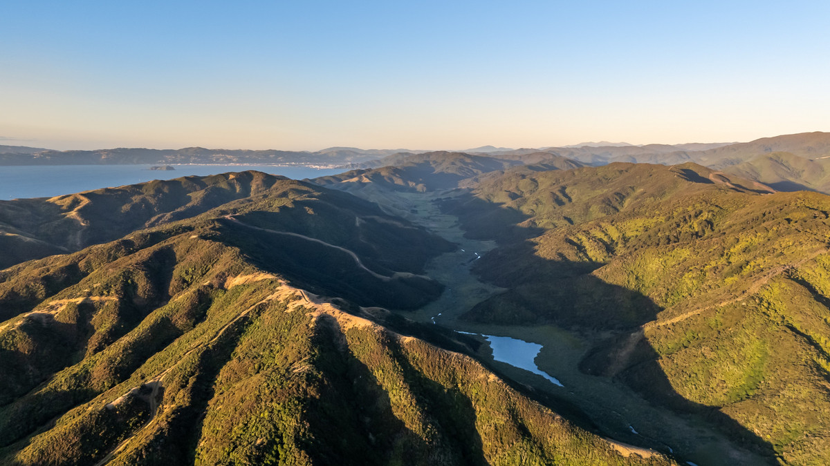
Long before Wainuiomata became a residential suburb on the edge of Wellington, it was a rugged, isolated large series of valleys, thick with native bush and crossed only by muddy tracks and rough streams. In the mid-19th century, a handful of pioneering families laid claim to this landscape, carving out farms, establishing sawmills, and shaping the early infrastructure in the area. These settlers included the Jacksons, Graces, Sinclairs, Prouses, Burdans, Crowthers, Woods and others. Their holdings were vast, stretching across ridgelines, creeks, gullys, and larger valleys.
Jackson Family Land
Charles Welby Jackson (1840–1926) inherited and farmed land along the coastal road slopes of Wainuiomata. He married Elizabeth Grace, whose family’s property bordered his own. Their estate included ridgelines and access routes that became known as Graces Track and later Jacksons Track, connecting the Coast Road with Gollan’s Valley and beyond. These routes played a vital role in the 1880s for movement across the region.
Grace Family Land
John Charles Grace (1807–1886) held extensive land along Coast Road, particularly across the high ridges now known as Graces Hill and Graces Stream. The Grace estate shared a boundary with the Jacksons, and their adjoining ridge track created an important corridor for travel and stock movement between properties.
Prouse Family Land
Richard Prouse (1792–1875) was among the early settlers along Coast Road. His land, known as “Prouse Brow” or Mount Prouse, became a recognisable landmark. In 1866, he donated a section of his property for the construction of the first Methodist church in the valley, anchoring a growing sense of community.
Sinclair Family Land
Hugh Sinclair (sometimes recorded as Ewen Sinclair, 1810–1871) acquired a large holding around Hine Road, Moores Valley, and Sinclair Valley now known as Reservoir Valley. He and his family established a sawmill along the Wainuiomata Stream some of their old logging routes are now walking tracks inside Wainuiomata Regional Park and their tramway is now the only access road into this park.
Burdan Family Land
George and William Burdan began acquiring farmland in the valley around 1872. Their holdings included a sizeable block near what became known as the St Albans property, built in the 1920s. The Burdan brothers were active in community affairs, particularly in the local school committee, and their land spanned into what is now part of Remutaka Forest Park.
Crowther Family Land
John Eric Crowther (1831–1911) farmed in Moores Valley, centred around an area now known as Crowthers Creek. His brother, Frederick Kershaw Crowther (1833–1907), held land closer to Homedale and the ridgelines above Coast Road. These elevated areas came to be known as Crowther Ridge and Mt Crowther, preserving the family’s name in the landscape.
Wood Family Land
John Wood acquired land in the Moores Valley area of Wainuiomata shortly after arriving in New Zealand in 1855. Despite being only 25 at the time, he quickly became influential within the local community, serving as a road warden and juror between 1855 and his death in 1866. In 1857, he was one of the key petitioners advocating for the establishment of a local school and was appointed to its founding committee.
Summary
| Family | Location / Area | Notable Features / Activities |
|---|---|---|
| Jackson | Western ridges near Coast Road | Charles Welby Jackson farmed high ridgelines adjoining Grace land; helped form Jacksons Track over to Gollans Valley. |
| Grace | Coast Road ridgelines | John Charles Grace owned elevated land at Graces Hill; connected to Jacksons via marriage and adjoining properties. |
| Prouse | Coast Road, near early town centre | Richard Prouse owned land at Mount Prouse; gifted land for the Methodist Church (1866). |
| Sinclair | Hine Road and upper Moores Valley | Hugh Sinclair established a sawmill near Sinclair Creek; land later used for tramways and dam access. |
| Burdan | Gollans Valley and Rimutaka foothills | George and William Burdan farmed land stretching to the East Harbour hills; site of St Albans homestead (1920s). |
| Crowther | Moores Valley and Coast Road ridge | John and Frederick Crowther owned land around Crowther Ridge; associated with Crowthers Creek area. |
| Wood | Georges Creek (off Reservoir Valley) | George Wood owned “Woodlands,” a 400–500-acre farm; creek and access track later used in Orongorongo water scheme. |
Wainui‑o‑Mata Development Limited
In 1928, a group of Wellington businessmen formed Wainui-o-Mata Development Limited, acquiring around 1,600 hectares of farmland in the valley with the goal of creating a new residential township. To support this, they launched the ambitious Wainuiomata Tunnel project in 1932 to link the valley with the Hutt by road and, potentially, rail. Funded by land-and-profit bonds sold to investors, the plan stalled during the Great Depression, and the company went into suspension by 1934.
By 1939, bondholders took over, and in 1945 they were granted 135 acres in trust. Real growth came after World War II, when demand for housing surged. Wainuiomata quickly developed into an affordable family suburb, earning the nickname “Nappy Valley” during the 1950s. The company oversaw subdivisions in areas such as Homedale and Hair Street, helping shape the suburban layout still recognisable today.
Although the tunnel was never finished as a transport route, it was later used during WWII by the military and eventually repurposed in 1975 by the Wellington Regional Water Board for water infrastructure.


