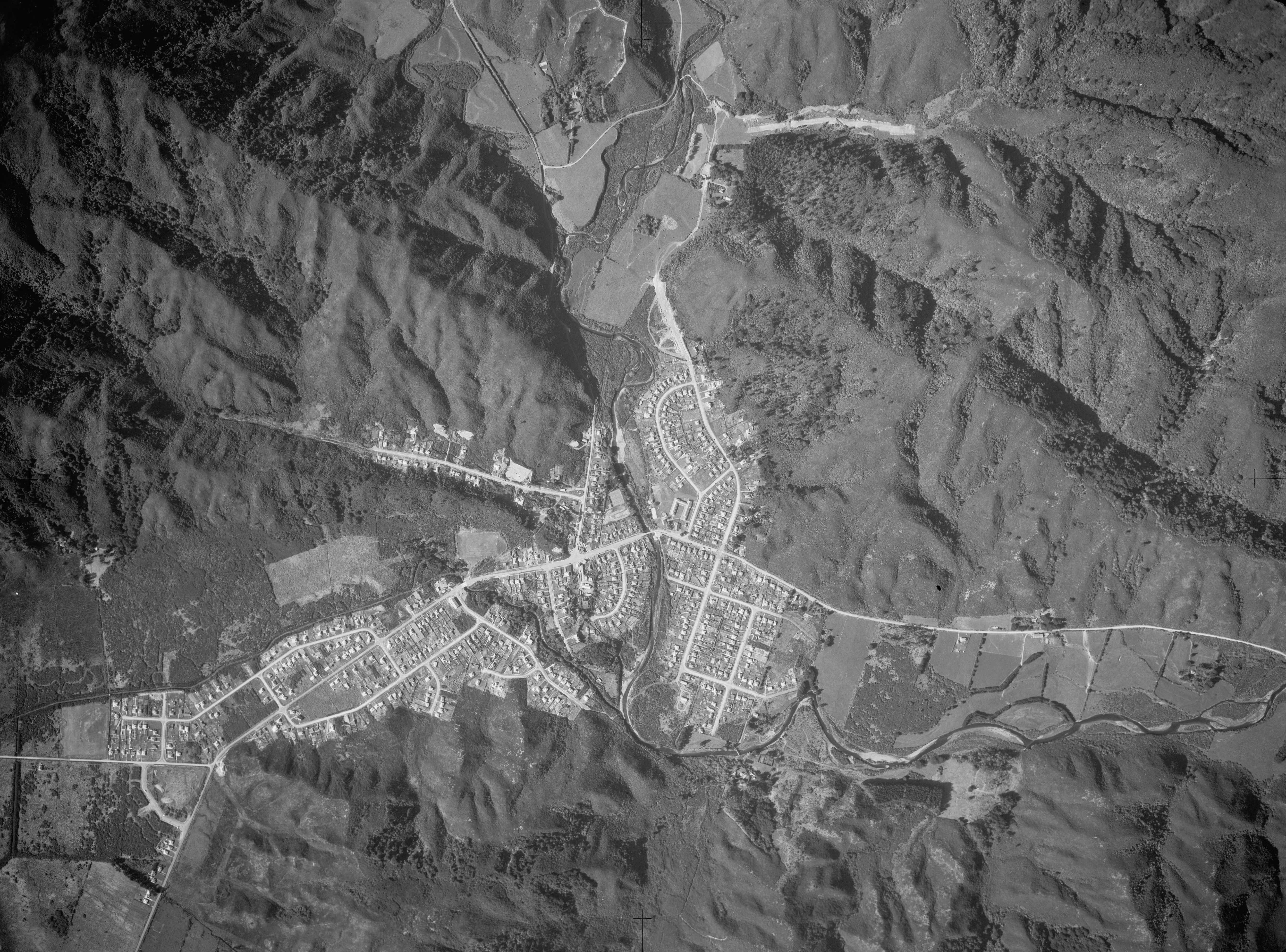
The image of Wainuiomata from 1954 offers a fascinating glimpse into the area’s history, as it predates suburbs like much of Arakura and Parkway. At this time, both Sunny Grove and the eastern section of Hine Road appear largely undeveloped. Interestingly, the terrain in Sunny Grove seems to be undergoing significant alteration, possibly indicating the period when Skerretts Creek was rerouted.
Sourced from the LINZ Data Service and licensed for reuse under the CC BY 4.0 licence.


