Image sourced from LINZ Data Service and is licensed for reuse under the CC BY 4.0 licence.
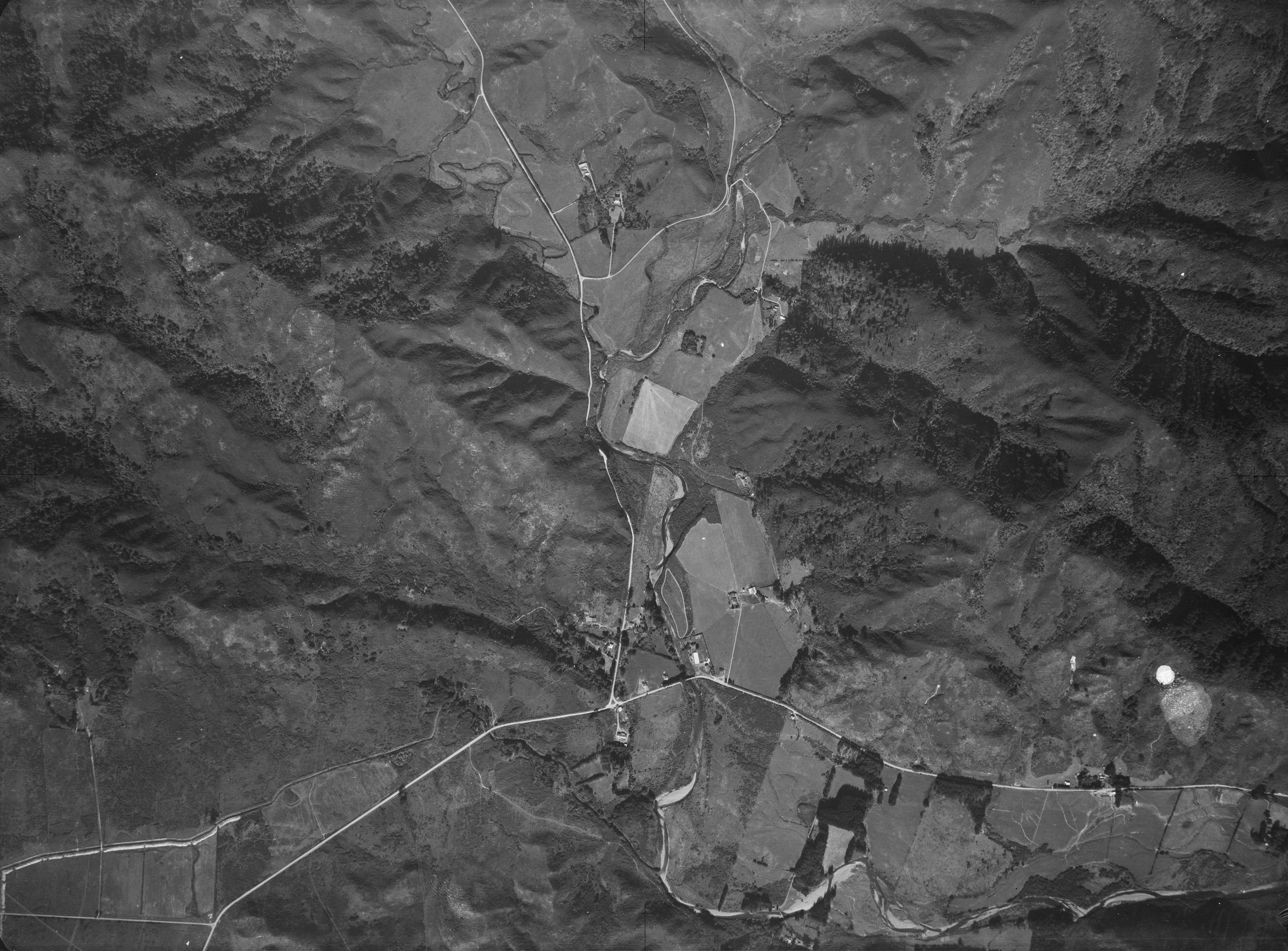
This aerial photograph of Homedale taken on 16 of January 1941 shows a number of interesting features.
When you examine this photo closely (click the photo, select fullscreen, and zoom in by holding the Control key while scrolling with your mouse), you’ll notice several intriguing details.
- The Village has a single store and a petrol station located at the roundabout.
- Wainuiomata School, as it was known, consisted of one classroom, a hall, and a residence for the principal.
- The property and buildings of a former farmstead can be clearly seen between what is now Hine Road and Poole Crescent.
- Below the farmstead is a field where horses were once run. This was calle ‘Bottom Field’ when the school used the land.
- Multiple Sinclair-owned properties are visible, but in 1941, they had different owners. These include Dyers Whare (formerly Sinclair House), Moness, Riverlea (formerly Glenhill), and House Northbrook.
- A longer section of the pipeline can be seen above ground as it approaches Moness.
- Cullen’s Bridge and the road leading toward Glenhill are clearly visible.
- The original path of Skerretts Creek, which runs behind Sunny Grove, can be seen before it was altered for housing development.
- A track (or possibly two) appears to connect Top Pool and Secret.
- The track that extends behind today’s Gums Loop Meadow may have been an old forestry track referred to here as Sinclair Track.
- Where Hair Street is today, a track once meandered through what was called Sulky Valley.
- Further up at the end of Hair Street Sulky Valley, possible scars of an old quarry can be seen on the hillside. It might also be damage to the photograph or fingerprints.


