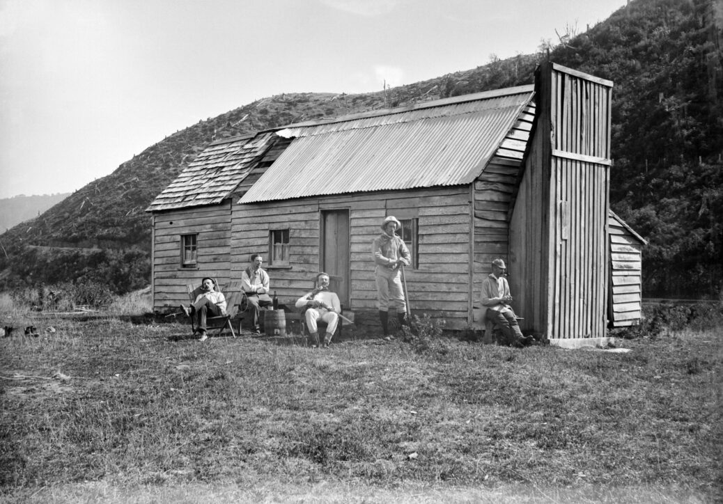
Trout fishing party at Smith’s Whare in the Waterworks Valley, Wainuiomata taken in March 1888. Halse, Frederick James, 1863-1936 : Collection of negatives. Ref: 1/2-004086-G. Alexander Turnbull Library, Wellington, New Zealand. /records/22822206
History
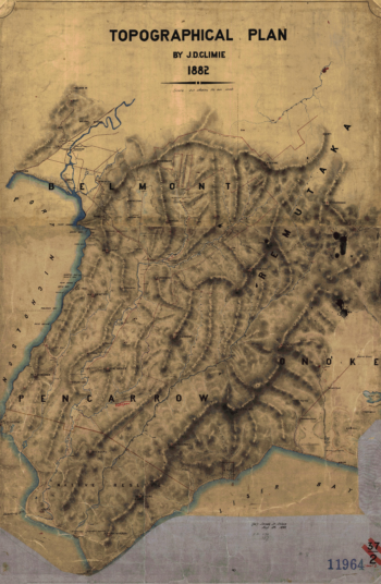
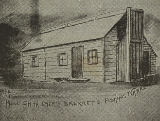 Smith’s Whare, a fishing hut near Moores Valley Road and Whitcher Grove, was likely once a worker’s hut used by those logging in Sinclair Valley, now known as Waterworks Valley. At least one written account places workers’ huts in this general area (above the bluff), and these huts appear to be marked on an 1882 map.
Smith’s Whare was named after James Eman Smith (1862–1916), a keen amateur fisherman. Before serving as Resident Commissioner of the Cook Islands and later as Commissioner of Pensions, Smith worked with the Treasury Department. For fishing, he often stayed in the hut overlooking both the Wainuiomata Stream and Wainuiomata River. This fishing hut was also known as Stocks Whare. The sketch to the right labels it as: Mess Smith Dyer & Skerret’s (Skerretts) Fishing Whare.
In the photograph of Smith’s Whare, the people shown are listed below in no particular order:
- Arthur Henry Stock (1854 – 1930) worked in a bank. (The hut was also known as Stocks Whare).
- Ernest Loughman Burnes (1864–1930) worked for the New Zealand Shipping Company in Wellington. He was born in Victoria, Australia, where he also passed away.
- James Eman Smith (1862 – 1916) worked for the Treasury Department and later became Resident Commissioner of the Cook Islands and Commissioner of Pensions.
- John Matthew King (1863-1930) was a Commissioner of Taxes and a 1880s Rugby player.
- Robert John Steward Todd (1861-1894) was an Accountant at the Government Insurance Department.
Location of Smith’s Whare
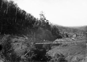
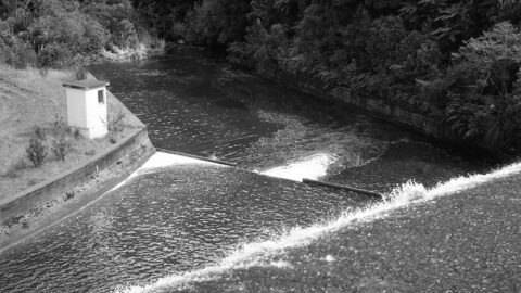
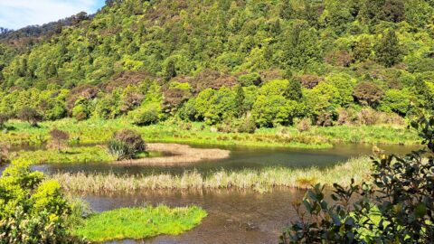
With Smith’s Whare no longer standing, pinpointing its former location requires some detective work. A key clue comes from a photograph said to be taken from Smith’s Whare, showing the Wainuiomata Stream, a bridge, and a sawmill hut in the background to the right. Today, a culvert lies underneath Moores Valley Road where the bridge once stood. From there, the stream flows straight before reaching a bluff, which, according to the photograph, is likely where Smith’s Whare was located above. However, descriptions like these aren’t always precise; the photographer may have referred to Smith’s Whare because it was the nearest known landmark, and could have been standing some metres away.
A second piece of evidence suggests the same location, just above the straight stretch of the stream after the old bridge / modern culvert where there is a bluff and where the stream is forced by the bluff to turn about 90 degrees. This evidence is an 1882 map showing three dots (each representing a building) in precisely the same spot where the old black and white photo of the bridge and sawmill hut was supposedly taken. The course of the steam on this map is still accurate to this day as it basically flows into the bluff and then is forced to flow around the bluff for a section.
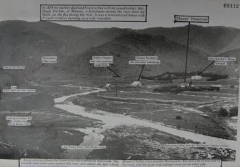 A third piece of evidence is found in a written account noting that worker huts and a store near the confluence of the Wainuiomata River and Wainuiomata Stream were located across the road from the mill. This suggests that, once logging operations ended, the three huts, or possibly two huts and a store, could have been combined into a single structure and repurposed as a fishing hut, given the convenient proximity to these two key waterways.
The photograph of Smith’s Whare, showing five men standing outside clearly indicates that the hut was constructed from what appears to be at least two joined buildings. The main section of the hut likely originated as one of the original worker’s huts or the store, with an additional hut attached to its western side . Thus, the primary part of Smith’s Whare may well have been a worker hut or store and the addition perhaps part of another hut.
Accident near Smith’s Whare?
On 23rd September 1893, Mr Muter of the Government Insurance Department fell 22 feet from a cliff into the river. Cecil Adams managed to pull him out and revived him using Sylvester’s method of artificial respiration. Muter was then carried to a nearby whare, thought to be Smith’s Whare.
The Demise of Smith’s Whare
According to a news article in 1888, a hut that was likely Smith’s Whare was being used by a group of telegraph linemen, when it was destroyed by fire at around 1 o’clock on the 13 March 1888. None of the linesmen were present at the time, and it was believed that embers from a fire left smouldering by the group’s cook were carried by the wind onto the hut’s walls.
Being a lightly built structure, it caught alight quickly. Inside were various items of clothing and a dog, which sadly perished in the blaze. The hut was not insured, and the damage was estimated at £40 by its owner, Mr J. Wakeham.
Directly across the road from Smith’s Whare stood House Northbrook, the residence of Mr and Mrs Wakeman at the time. If this article is referencing Smith’s Whare, then it burnt down in the same year that the main photo in this article was taken.

