Hutt Valley NZ war sites map, URL: https://nzhistory.govt.nz/media/photo/hutt-valley-nz-war-sites-map, (Manatū Taonga — Ministry for Culture and Heritage), updated 2-Apr-2019
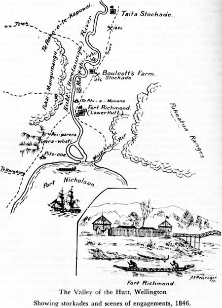
Sketched map shows Wainuiomata as Pukeatua Ranges
This 1846 map showing stockades and scenes of engagement in a time of conflict including Fort Richmond and Boulcott’s Farm. The interesting feature in the map on the subject of Wainuiomata is the name the hills in that location are given which is Pukeatua Ranges.
The name “Pukeatua” is of Māori origin, “Puke” means “hill” or “mountain,” and “atua” means “god” or “spirit.” Therefore, “Pukeatua” can be translated to “Hill of the gods” or “Sacred hill.” In these hills today is a bridge called Pukeatua Bridge.
Another map from 1882 refers to the region where these mountains are situated as Remutaka, which is the current name. The name was changed relatively recently from Rimutaka to Remutaka.


