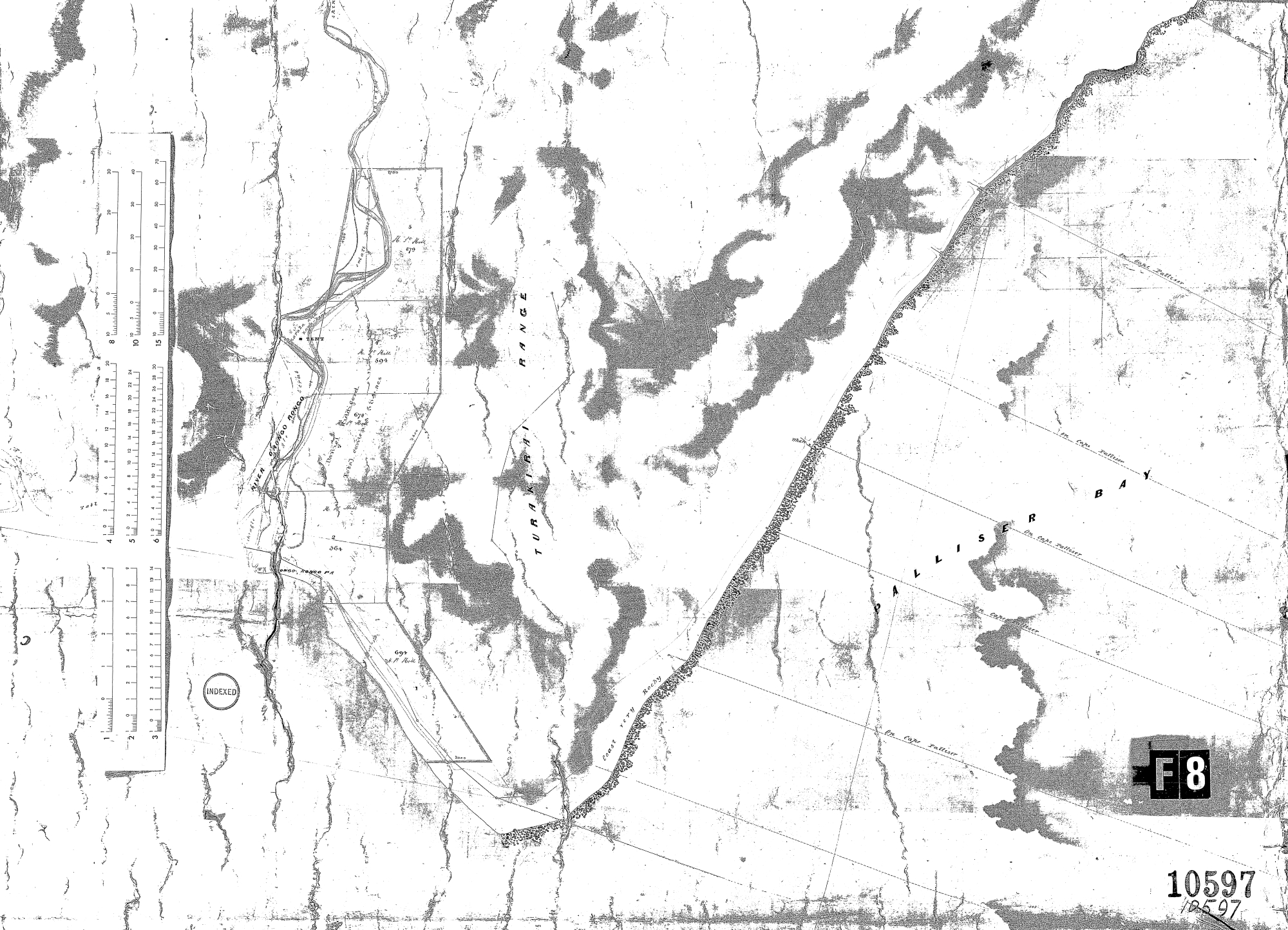
Plan of part of the Harbour Wai-nui-o-mata and O-Rongo-Rongo Districts – 31 Oct 1860
Below is a list of interesting observations:
- Turakirai Range is now just part of the Remutaka Range.
- The spelling Turakirai is slightly different to the spelling of the reserve that is located on the coast today called Turakirae Head Scientific Reserve.
- Orongorongo is referred to as two words: Orongo rongo or it could be O Rongo Rongo.
- On the map, there is a pa named ‘ongo rongo pa’, but it is actually Orongo rongo Pa as the first two letters have blended into the shading on the map.
- This pā helps explain why the original European settler family in the area, the Riddifords, had more interactions with Māori than with other Pākehā.
- Outlined is 584 acres of land being leased by Daniel Riddiford.
- Other plots appear to be leased or owned by Mr Hill.
- It’s interesting to note that the coastline in Palliser Bay is referred to as very rocky as rocks were taken from this general area to help build the Wellington Urban Motorway.
- The area surrounding the river is referred to as “Shingle Land” which could be a name or a descriptive.
- Some way up the Orongorongo River, where the map surveyors tent was perched, there was karaka and kawakawa trees. Karaka can be found near coastlines while kawakawa is often found on the edges of dense forest. Kawakawa leaves were used by Māori for medicinal purposes.
Special thanks to Lance Stewart for sourcing this map.


