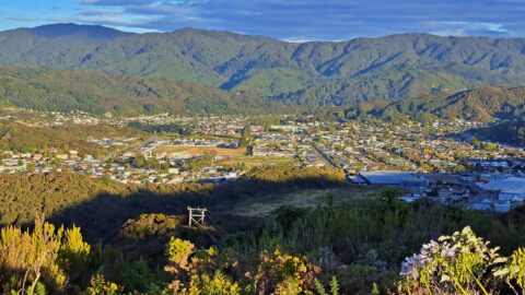
This view from the Harry Todd Track in the Harry Todd Recreation Reserve shows Hine Road in the foreground.
Wainuiomata: Aerial
Take a photographic journey from the skies or from other elevated locations to witness the transformation of Wainuiomata over the decades. This growing collection of aerial photography provides a captivating visual story of the suburb’s growth and metamorphosis.
Articles here include photos taken from high up vantage points on hillsides, drone footage, as well as photography from aircraft. Among these images, selections from the LINZ Data Service are available for reuse under the CC BY 4.0 licence. These particular photographs will be clearly marked for recognition.
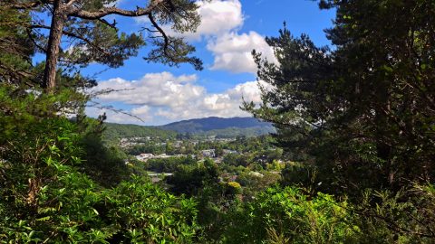
Looking from Mount Crowther on the Mount Crowther Track near the transmission station in the Harry Todd Recreation Reserve.
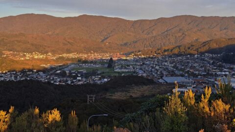
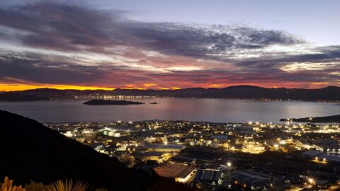
A warm, reddish light spills across the Wainuiomata Valley, casting long, drifting shadows that stretch over the landscape
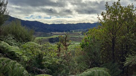
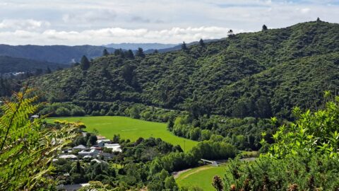
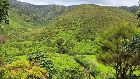
View of the valley through which Coast Road winds its way. Once dominated by early timber milling, the valley...
Each day, motorists travelling on Wainuiomata Road over the Wainuiomata Hill can pull over at the lookout to take...
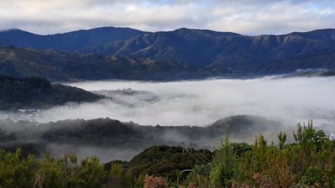
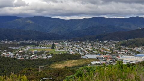
Given the topography of the land in Wainuiomata, its surrounding hills often trap mist, creating a still, atmospheric landscape.
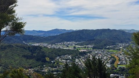
Looking down upon Richard Prouse Park from the top of a ridge, behind Sunny Grove. You can see both...
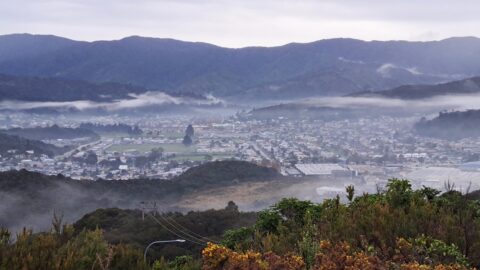
The valley’s topography and lack of wind can cause low clouds and mist to become trapped by the surrounding...
'Wainuiomata Lookout' presents panoramas of Wellington Harbour, Wellington city, The South Island, and Lower Hutt including Petone & Seaview.
Typical overcast day in Autumn as seen from the Wainuiomata Hill Lookout. The view here is always good, no...
As dusk falls over Wainuiomata, the setting sun bathes the landscape in its warm, reddish hues, casting shadows across...
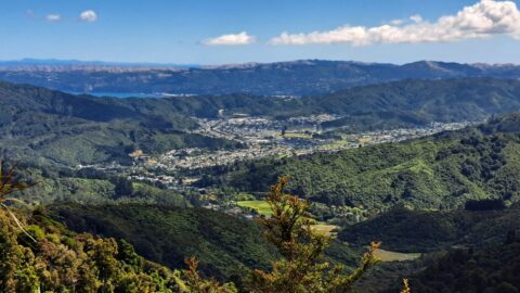
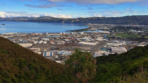
This view from the Whakanui Track gives an expansive look at Wainuiomata. Immediately below is Nikau Valley and Moores...
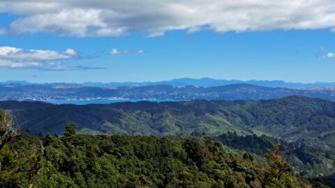
From the Whakanui Track, you can enjoy a distant view of Wellington and Wellington Harbour, with the South Island...
A timeline taken from the same lookout near the car park at the top of the Wainuiomata Hill. Click...
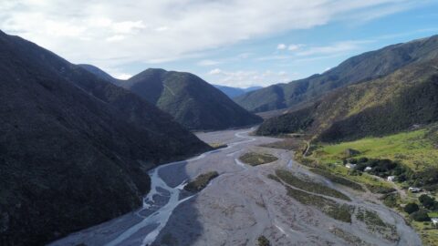
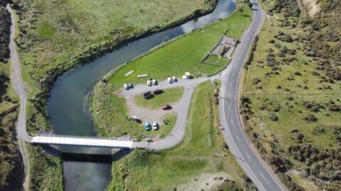
This photo shows the Wainuiomata River dividing the Wainuiomata Regional Park to the left and Hine Road Recreation Area...
Drone footage looking at the Wainuiomata coastline and Baring Head. This coast is part of the southern coastline of...
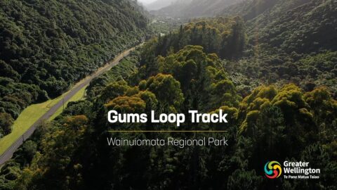
The Gums Loop track at Wainuiomata Regional Park is an easy track walk at any time of the year...
Drone footage looking at the Wainuiomata coastline and Baring Head. This coast is part of the southern coastline of...
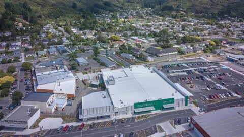
Looking at Woolworths from above in the year 2022. It shows the 3,600 square meters of supermarket space, and...
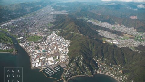
The Pukeatua Range, also known as the Wainuiomata Hill Road, runs through the centre of the image with Wainuiomata...
WAINUIOMATA TOURS

Step into the wilderness of Wainuiomata and experience it for yourself. Learn more →.
WAINUIOMATA MUSEUM

Located in Wainuiomata Primary School, it is open 2pm-4pm every Sunday. Learn more →.
BUY ME A COFFEE
Support Wainuiomata.Net with a donation and help us continue to uncover local history, capture photos, drink coffee, and promote Wainuiomata.


DISCUSSION