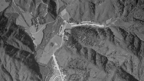
Aerial photos from 1941, 1942, and 1954 reveal up to four Sinclair family homes, including Glenhill, Northbrook, Moness, and...
Wainuiomata: Aerial
Take a photographic journey from the skies or from other elevated locations to witness the transformation of Wainuiomata over the decades. This growing collection of aerial photography provides a captivating visual story of the suburb’s growth and metamorphosis.
Articles here include photos taken from high up vantage points on hillsides, drone footage, as well as photography from aircraft. Among these images, selections from the LINZ Data Service are available for reuse under the CC BY 4.0 licence. These particular photographs will be clearly marked for recognition.
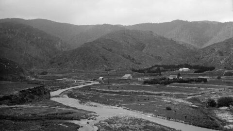
1880s view of the site where Richard Prouse Park in Wainuiomata is located. This view shows a number...
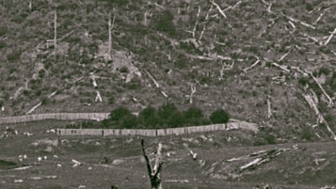
The fenced Sinclair Cemetery stands out in this photo with its perimeter of trees. At 5-7 Sunny Grove you...
WAINUIOMATA TOURS

Step into the wilderness of Wainuiomata and experience it for yourself. Learn more →.
WAINUIOMATA MUSEUM

Located in Wainuiomata Primary School, it is open 2pm-4pm every Sunday. Learn more →.
BUY ME A COFFEE
Support Wainuiomata.Net with a donation and help us continue to uncover local history, capture photos, drink coffee, and promote Wainuiomata.
Scan or click the code below:


DISCUSSION