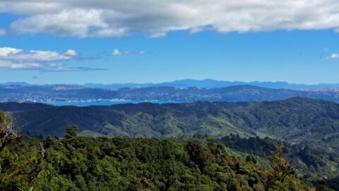
From the Whakanui Track, you can enjoy a distant view of Wellington and Wellington Harbour, with the South Island...
Wainuiomata: Photos
Photographic timeline of Wainuiomata
Documenting Wainuiomata with an ever growing collection of photos. This includes locations such as the town centre, suburbs, landscapes, coastline, rivers, and reserves.
Photo articles are dated by the age of the main photo or the main subject rather than when the article was written. This places the photos in a timeline. Some photos date back to the 1800s. We either have permission to show these old photos or they have no copyright. Modern photos on the site were taken by David Johnson unless otherwise specified.
Feel free to ask a question in the comments below about any photo displayed in this website.
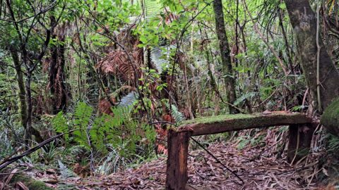
The aged bench is situated towards the conclusion of the Old Nikau Creek Trail. Beneath it lies a geocache...
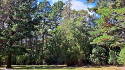
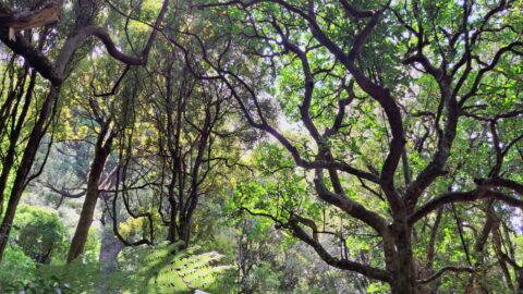
Exotic trees in Wainuiomata were introduced primarily to replace native trees that were logged in the mid to late...
Looking at Gums Loop Meadow located on Gums Loop Walk in the Wainuiomata Regional Park. The meadow was once...
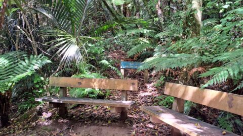
At the end of Nikau Creek Track are two wooden bench seats. The track is an easy 30 minute...
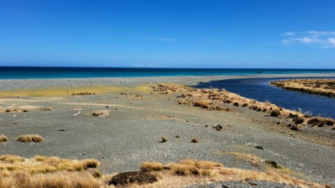
View of the Wainuiomata River as it flows into the south coast. This area is rugged and wind-swept, but...
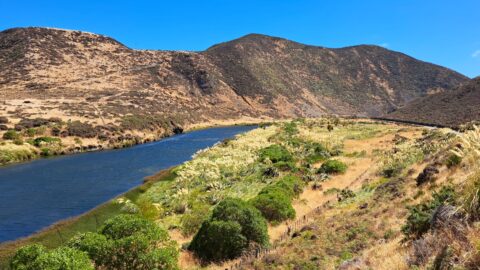
The lower reaches of Wainuiomata River as observed during summer. It traverses arid looking terrain in the month of...
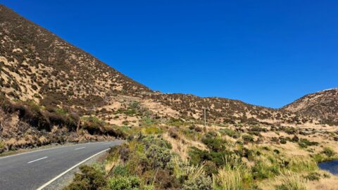
During the summer months, the southern section of Coast Road appears dry, presenting a stark contrast to the nearby...
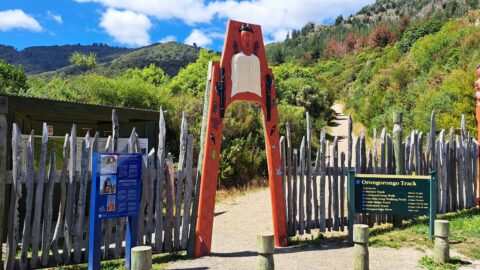
The Orongorongo Track entrance is quite elaborate compared to other walks. However, this entrance is also used for other...
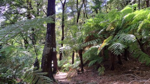
Walking through Remutaka Forest Park is a rewarding experience, offering some of the the region’s most diverse and scenic...
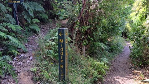
The start of the Middle Ridge Track also connects to the Orongorongo Track in Catchpool Valley, Wainuiomata.
Beech forests in Wainuiomata thrive in the hills and higher elevations, providing vital habitat for native birds.
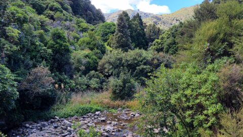
Looking at Catchpool Stream located in Catchpool Valley. The stream is located at the entrance to a number of...
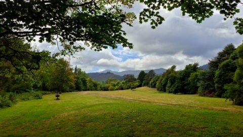
View of Bottom Field at Poole Crescent Reserve. The appellation 'Bottom Field' originates from its use by Wainuiomata Primary...
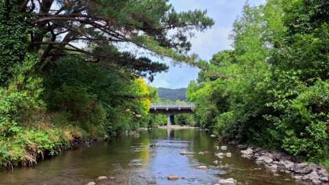
View of Main Street Bridge as seen from the Wainuiomata River at Poole Crescent Reserve. The bridge was once...
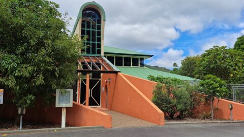
Looking at the side of the Wainuiomata Treatment Plant located near Morton Dam and the waterworks car park.
View from atop Morton Dam looking at what was once the area of stored water. This is what 36...
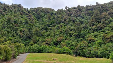
This area was deforested in the 1880s. This is what re-generated bush looks like some 140 years later. The...
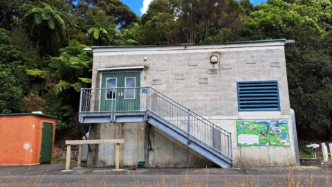
Water is passed through turbine generators housed in a dedicated building. Inspections of the generator are conducted no more...
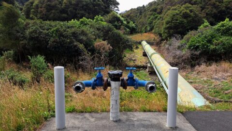
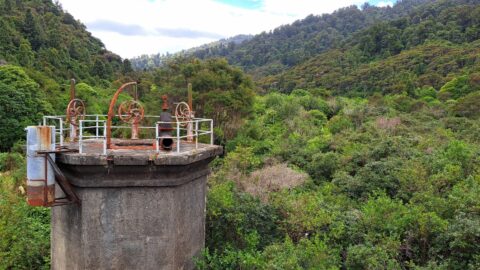
This water pipe is located in the restricted area of the waterworks, near Morton Dam. It transports water from...
WAINUIOMATA TOURS

Step into the wilderness of Wainuiomata and experience it for yourself. Learn more →.
WAINUIOMATA MUSEUM

Located in Wainuiomata Primary School, it is open 2pm-4pm every Sunday. Learn more →.
BUY ME A COFFEE
Support Wainuiomata.Net with a donation and help us continue to uncover local history, capture photos, drink coffee, and promote Wainuiomata.


DISCUSSION