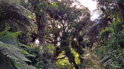
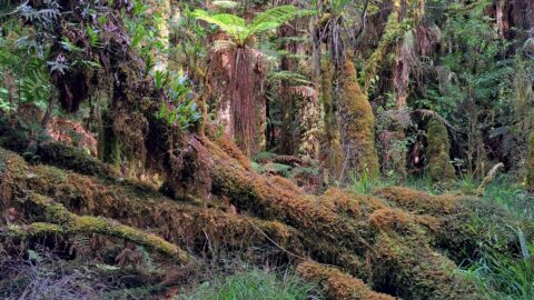
Podocarps once covered the Wainuiomata Valley. Today, they can still be found in the lower sections of hills and...
Wainuiomata: Photos
Photographic timeline of Wainuiomata
Documenting Wainuiomata with an ever growing collection of photos. This includes locations such as the town centre, suburbs, landscapes, coastline, rivers, and reserves.
Photo articles are dated by the age of the main photo or the main subject rather than when the article was written. This places the photos in a timeline. Some photos date back to the 1800s. We either have permission to show these old photos or they have no copyright. Modern photos on the site were taken by David Johnson unless otherwise specified.
Feel free to ask a question in the comments below about any photo displayed in this website.
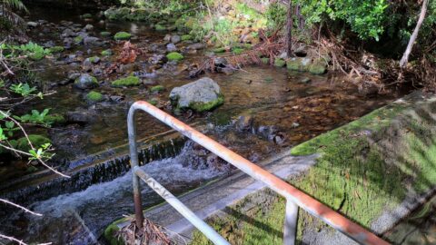
Two weirs in the Wainuiomata River have replaced Morton Dam in Wainuiomata. The image shows the smaller of the...
Top Pool was widely considered the best swimming hole in Wainuiomata until the council filled it with stones in...
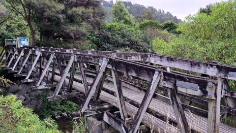
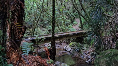
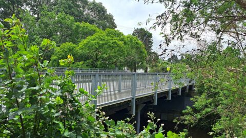
This footbridge connects Hine Road Recreational Reserve to Wainuiomata Regional Park. Nearby is Top Pool, a popular swimming hole.
The water catchment that supplied Wainuiomata with water was located in Skerretts Creek in the mid 1950s to early...
This small foot bridge is located on the Whakanui Track where it crosses Skerretts Creek above Sunny Grove.
A proposed sanctuary in Wainuiomata, akin to Zealandia, but on a larger scale, is currently being considered by the...
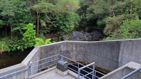
This is one of two weirs that collect water in the Wainuiomata River. Another three weirs exist in the...
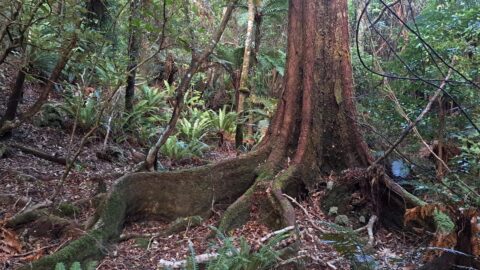
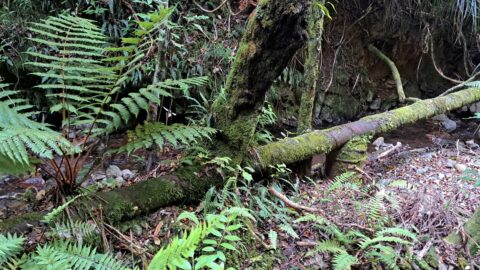
Example of a buttress root system that helps stabilise trees that grow in shallow soil. This giant is located...
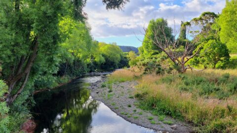
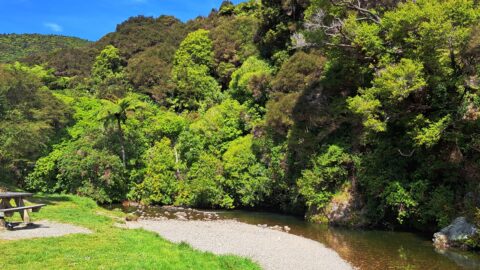
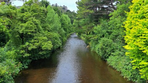
Scenic view of Wainuiomata River as seen from Poole Crescent Reserve. The reserve is a perfect location for a...
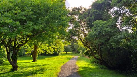
Walking through Poole Crescent Reserve in the Village direction at the Richard Prouse Park end. This walkway traces the...
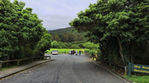
Looking at the entrance to the Hine Road car park and Hine Road Recreation Reserve. This is a great...
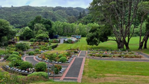
Photo of The Garden of Remembrance in Wainuiomata taken in the year 2023. This cemetery site is located in...
Looking at Wainuiomata River from the Main Road Bridge with entrance and track to Pool Crescent Reserve just visible...
Before the construction of the Main Road Bridge, there was a ford that allowed access across the Wainuiomata River....
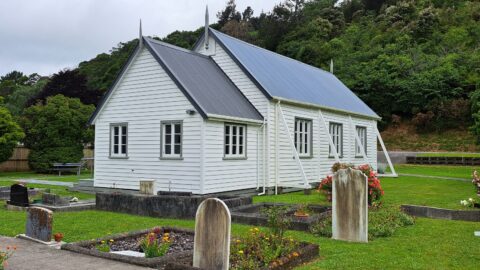
This Methodist Church in Wainuiomata stands as a historical building, mirroring the design of numerous early colonial churches in...
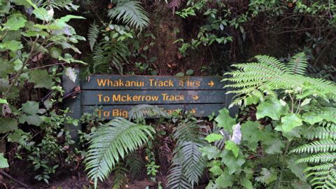
Most people walking on the Whakanui Track will start at the top of Sunny Grove. But the track use...
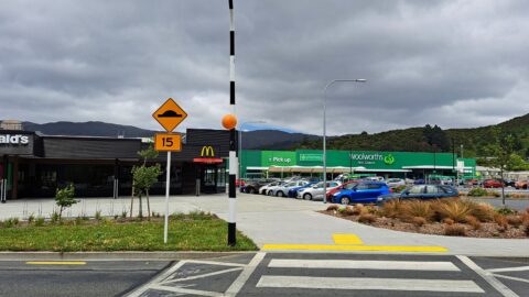
Looking at both McDonalds and Woolworths at The Strand in Wainuiomata. Woolworths is the largest supermarket in the suburb.
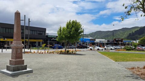
View of the lower end of Queen Street in Wainuiomata. Queen Street is dissected by The Strand which can...
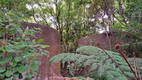
Two hidden tanks on the track to Crowther Trig. It is not currently known if these two tanks were...
WAINUIOMATA TOURS

Step into the wilderness of Wainuiomata and experience it for yourself. Learn more →.
WAINUIOMATA MUSEUM

Located in Wainuiomata Primary School, it is open 2pm-4pm every Sunday. Learn more →.
BUY ME A COFFEE
Support Wainuiomata.Net with a donation and help us continue to uncover local history, capture photos, drink coffee, and promote Wainuiomata.


DISCUSSION