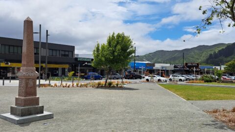
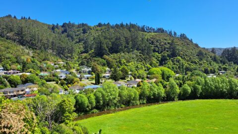
View of the lower end of Queen Street in Wainuiomata. Queen Street is dissected by The Strand which can...
Wainuiomata: Photos
Photographic timeline of Wainuiomata
Documenting Wainuiomata with an ever growing collection of photos. This includes locations such as the town centre, suburbs, landscapes, coastline, rivers, and reserves.
Photo articles are dated by the age of the main photo or the main subject rather than when the article was written. This places the photos in a timeline. Some photos date back to the 1800s. We either have permission to show these old photos or they have no copyright. Modern photos on the site were taken by David Johnson of Wainuiomata.Net unless otherwise specified.
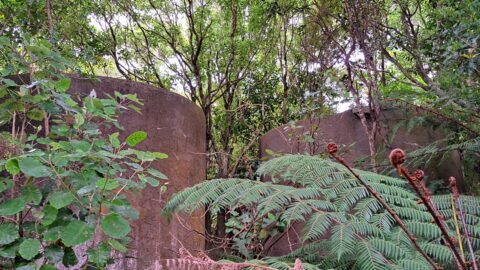
Two hidden tanks on the track to Crowther Trig. It is not currently known if these two tanks were...
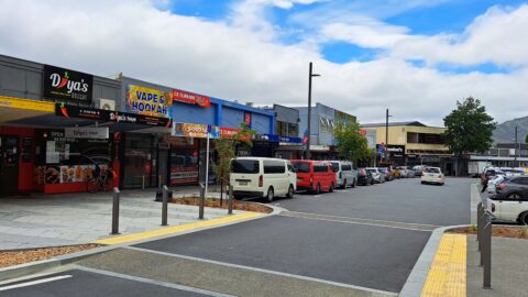
Wainuiomata's Queen Street serves as a primary hub for various shops and it houses the Community Centre and Public...
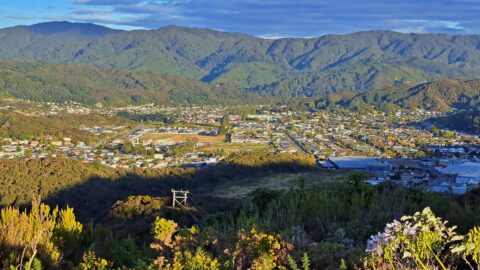
A timeline taken from the same lookout near the car park at the top of the Wainuiomata Hill. Click...
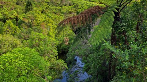
There is no track here, but trekking up Skerretts Creek involves a lot of rock hopping. Eventually it opens...
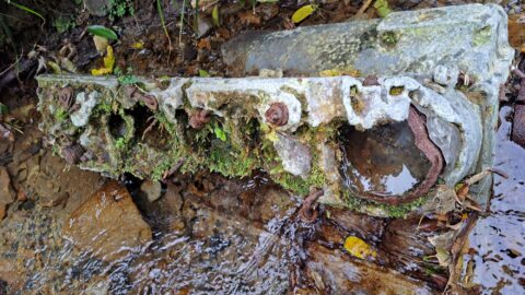
Looking at a V12 Allison Motor from a Curtiss P-40E Kittyhawk that crashed in the Wainuiomata hills in 1943.
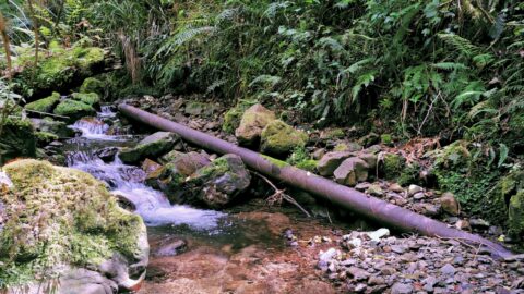
Skerretts Creek was the location for a water catchment in the 1950-60s. Water was piped out of the creek...
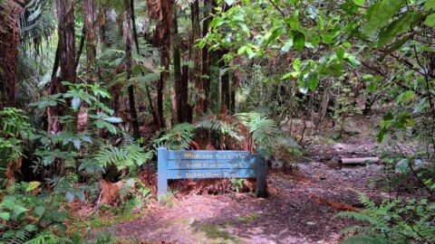
Looking at a sign on the Whakanui Track indicating the direction of the track as well as other tracks....
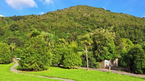
This photo shows the Wainuiomata River dividing the Wainuiomata Regional Park to the left and Hine Road Recreation Area...
Looking toward Hine Road with the eastern side of Richard Prouse Park in view.
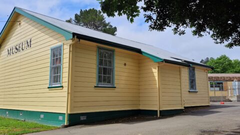
The Wainuiomata Historical Museum proudly houses a diverse collection of historical exhibits that vividly depict its rich heritage.
This is the site of Hugh Sinclair's old homestead 'Moness' in Wainuiomata, as seen in 2023. Photo shows a newer home...
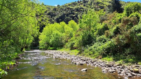
View of a section of Wainuiomata River that dissects Richard Prouse Park. The river is a popular place for...
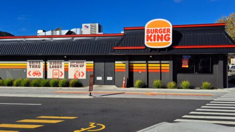
Burger King in Wainuiomata opened in 2023. It consists of a typical drive through and also has a lobby...
Rock Pool is situated in Richard Prouse Park, near the driveway entrance from Hine Road. It gets its name...
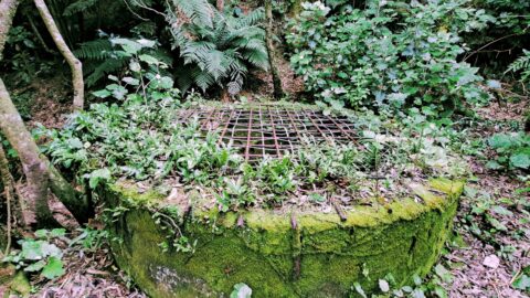
Image depicting the concrete well captured in 2023. Initially built during 1881-1882, the well now remains concealed.
View of the small settlement associated with the water catchment area in Wainuiomata. In the past, there were more...
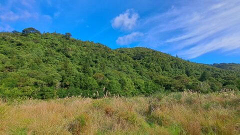
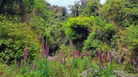
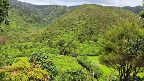
Typical view of the hills in Reservoir Valley with a field of toetoe in the foreground. Wainuiomata River runs...
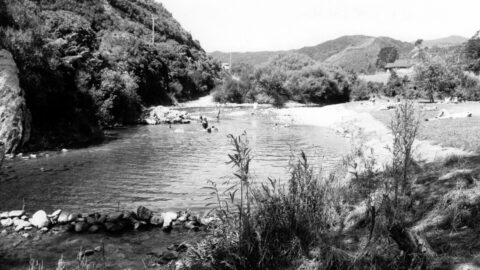
Ultimate Pool is located upstream from Top Pool. It is arguably the best pool for swimming in the Wainuiomata...
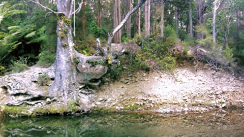
This part of Wainuiomata River is close to the historic lower dam. Once the water has flowed over the...
WAINUIOMATA TOURS

Step into the wilderness of Wainuiomata and experience it for yourself. Learn more →.
WAINUIOMATA MUSEUM

Located in Wainuiomata Primary School, it is open 2pm-4pm every Sunday. Learn more →.
BUY ME A COFFEE
Support Wainuiomata.Net with a donation and help us continue to uncover local history, capture photos, drink coffee, and promote Wainuiomata.
Scan or click the code below:


DISCUSSION