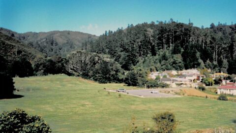
The caretaker’s house in the Orongorongo Valley served Wellington’s early water supply system and remained in use until the...
Wainuiomata: Photos
Photographic timeline of Wainuiomata
Documenting Wainuiomata with an ever growing collection of photos. This includes locations such as the town centre, suburbs, landscapes, coastline, rivers, and reserves.
Photo articles are dated by the age of the main photo or the main subject rather than when the article was written. This places the photos in a timeline. Some photos date back to the 1800s. We either have permission to show these old photos or they have no copyright. Modern photos on the site were taken by David Johnson of Wainuiomata.Net unless otherwise specified.
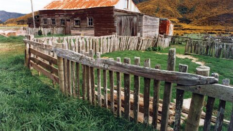
"Cobb's Barn" in Wainuiomata was a well-known landmark on the Cobb family's Coast Road farm, located near today's Wainuiomata...
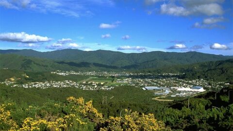
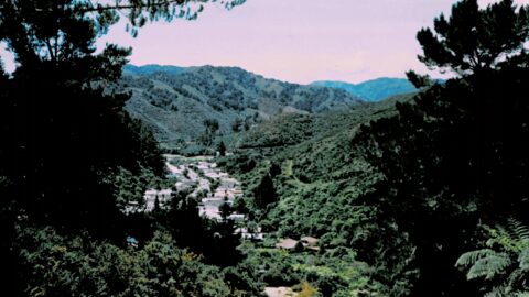
Looking down upon Wainuiomata in approximately the year 1990 as seen from the top of the Wainuiomata Hill.
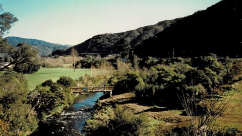
View of an under construction Top Pool Bridge with Hine Road Recreation Area in view. The bridge connects the...
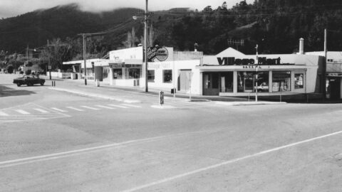
In 1989, numerous shops thrived within The Village, creating a lively hub of activity. Today, The Village stands at...
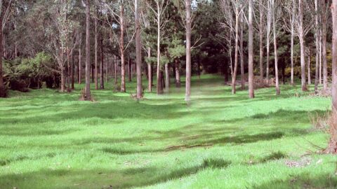
Pictured is Gums Loop in 1989. The grass was greener in that year as the trees were younger and...
Pictured is Hine Road Recreation Area in 1989. You can clearly see the old maintenance road above Reservoir Road.
A view from the year 1989, looking at the tunnel entrance to the concrete well in Wainuiomata with Reservoir...
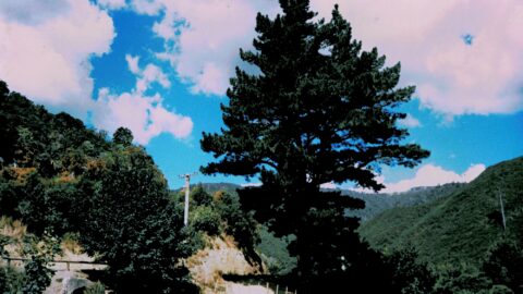
Pictured is a view that opens up from the McKerrow Track, circa 1989. Looking out toward Wellington with the...
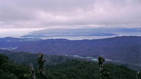
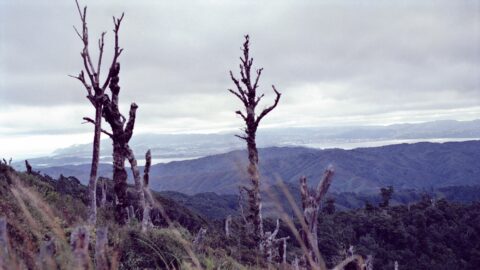
Pictured is a view toward Wellington from the Whakanui Track in 1989. In view is the valley where Coast...
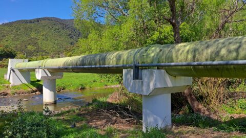
In 1988, a new water pipeline known as the green pipe was constructed, running alongside the existing pipelines.
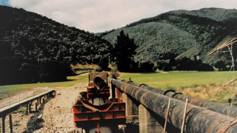
In 1988 at Richard Prouse Park, a new water pipe was constructed next to older pipes that ran across...
Gazing down on Sunny Grove from the Mount Crowther Track in 1988, the firebreak and track behind the odd-numbered...
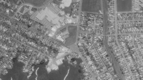
Aerial photos showing the first intersection upon entering Wainuiomata, where Main Road meets Fitzherbert Road.
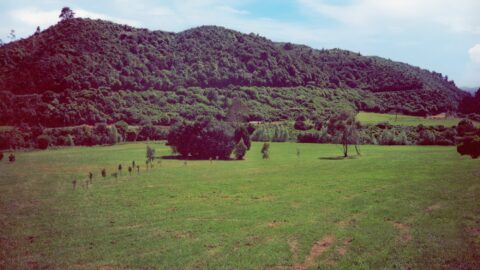
Looking down on the Hine Road Recreation Area in 1987, one can see the absence of the Wainuiomata Garden...
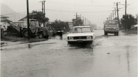
Photograph showing a car pushing through floodwaters along Wise Street in Wainuiomata, creating waves as it moves.
Looking at Wainuiomata River in flood with Main Road Bridge and the Rotary Park entrance in the background. Date:...
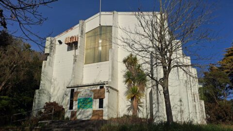
St John’s Anglican Church is situated on Dick’s Hill, just behind The Village in Wainuiomata. Its exact address is...
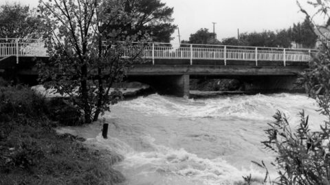
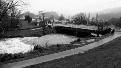
A swollen Wainuiomata River flowing under Main Road Bridge with Wainuiomata Primary School just in view. Date: 21st May,1981.
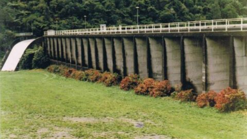
Photos of Morton Dam, circa 1980. In view is the dam, spillway, and a walkway that went through the...
WAINUIOMATA TOURS

Step into the wilderness of Wainuiomata and experience it for yourself. Learn more →.
WAINUIOMATA MUSEUM

Located in Wainuiomata Primary School, it is open 2pm-4pm every Sunday. Learn more →.
BUY ME A COFFEE
Support Wainuiomata.Net with a donation and help us continue to uncover local history, capture photos, drink coffee, and promote Wainuiomata.
Scan or click the code below:


DISCUSSION